
This stretch of the British coastline borders the entire western side of the county of Cumbria. Stretching from Arnside in the south to Bowness-on-Solway in the north, it is over 200km (120 miles) in length [1]. The coast runs alongside a very beautiful part of the United Kingdom, encountering several estuaries, sandy beaches, woodland areas and the Lake District National Park. There are, however, several port towns along the coast; although these are quite dispersed, they are towns which were once renown for industrial activity, although a small pocket of this still exists today.
The Cumbrian coastline is being into two broad sections: the first being Silverdale to Ravenglass, and the second being Ravenglass to Bowness-on-Solway. I have done this mainly because there are subtle changes in landscape features that distinguish two sections.
Section One: Silverdale to Ravenglass
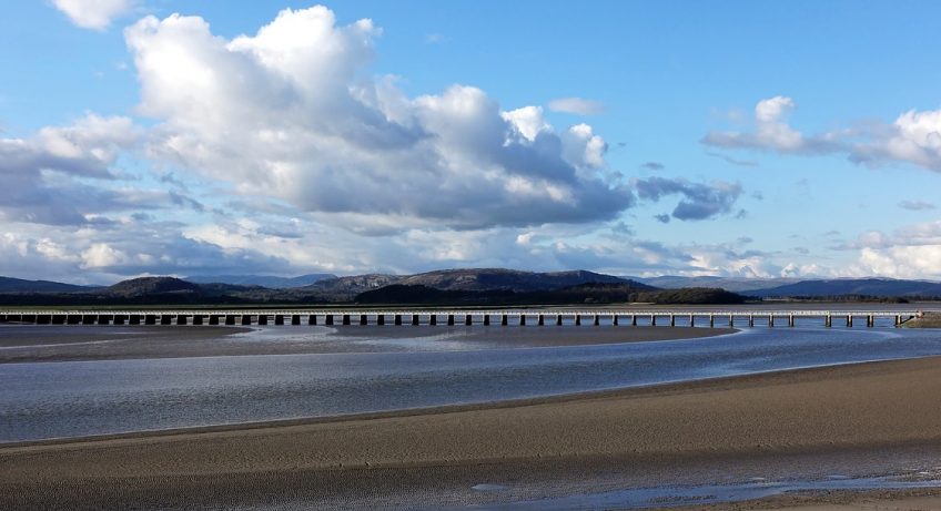
This section winds its way around the northern edge of Morecambe Bay, and is intersected by several tidal estuaries and the port of Barrow-in-Furness. Starting just south of Arnside, the coastline borders Morecambe Bay. This is a rather hazardous area of the shoreline; when the tide moves out, tidal sandy flats can extend for up to 3km in length, and people are often caught out by either quicksand or the tide moving in rather quickly. The coastline winds its way around the Arnside & Silverdale Area of Natural Beauty, a wild area of hilly woodland which is notable for its wildlife [2] and limestone rock formations. Geologically speaking, this part of the Cumbrian coastline is interesting, due to the presence of limestone here. The Arnside and Silverdale section is characterised by low limestone cliffs, behind which we have the presence of limestone pavement, and a series of small cave systems due to the weathering of the limestone [3]. This type of geomorphology is not unique to the United Kingdom, but it is interesting to see it next to the coastline in such a nice part of Britain.
Moving westwards from Arnside, the coastline encounters several sandy estuaries, which are fed by rivers flowing from the mountainous Lake District. Of these, it is notable that the River Kent estuary has a tidal bore – in other words, a wave of water that flows up the channel when the tide moves in. This occurs due to the channel narrowing, and the surge of the tide meeting resistance from the sands and small channels, which forces a small wave to move up the inlet [4]. The other estuaries along the south and south-western side of the coastline are the River Leven, the River Duddon and the River Esk. Bordered by hills and green fields, these inlets only add to the great and wild landscape of this area.
The coastline also encounters port villages and towns. Arnside is a small seaside village that contains a sailing club and a country market [5]. Grange-over-Sands is a small town of 4,000 people, which became a popular holiday destination in the 1850s, and still contains various hotels and holiday lettings to this day [6]. However, the largest town on the entirety of the Cumbrian coastline is located to the west of these place – Barrow-in-Furness. This is a large industrial town that has been a major shipbuilding hub for the last 150 years [7]. Today it contains a large indoor shipbuilding facility, one of the largest of its kind in Europe. This goes to show that, while this is a rather picturesque part of the British coastline, there are parts of it which are rather industrial. Unlike many other port towns, Barrow-in-Furness has been successful in maintaining some of its original industry – in this case, shipbuilding – which is important to the economy of the local area.
Moving north from here, the coastline reverts back to a more rural setting. The section up to Ravenglass is far more rural, and is now within the Lake District National Park. Although the coastline here is characterised by low (and sometimes non-existent) cliffs, the large hills of the Lake District are very prominent from here.
Section Two: Ravenglass to Bowness-on-Solway
I mentioned that the section between Ravenglass and Bowness-on-Solway can be distinguished from the other part of the Cumbrian coastline. This is true – the estuaries and woodlands to the south of Ravenglass become notably absent in this section. North of the River Esk, which runs just south of Ravenglass, there is a series of sand dunes that stretches up towards Seascale. There is also a significant amount of flat land next to the coast, especially between Ravenglass and Nethertown, and between Workington and Bowness-on-Solway. This is due to a lack of hills in this area directly adjacent to the sea; most of this coastline is bordered by flat land, with the large summits of the Lake District between 5 and 10 kilometres (8 and 16 miles) to the east. However, one stretch of coastline forms an exception to this: 6 kilometres (4 miles) of cliffs between Saint Bees and Whitehaven. This section includes Saint Bees Head, a red sandstone headland that juts out into the sea, forming a rather rugged section of the Cumbrian coast [8]. This section of the coast contains a clifftop path that offers spectacular views of the sea. A Nature Reserve is also located on the headland.
This stretch of the coastline also includes several port towns; two of which are Whitehaven and Workington. These are notable as they were once renown for industrial activity in the 18th, 19th and 20th Centuries; however, such activity has since declined, and today these towns are popular tourist destinations. Whitehaven is a town that developed due to local coal and iron ore mining, and was rather prosperous as a result. It is also noticeable that, on the 23rd April 1778, Whitehaven was the last place in Britain to be attacked by American naval forces. Today, however, Whitehaven serves as a tourist destination, with numerous hotels and holiday lettings available [9].
The Cumbrian coastline ends at the village of Bowness-on-Solway. This is because it has reached the River Eden estuary, which not only marks the northern end of the Cumbrian coastline, but also forms the border of England and Scotland for this part of Britain. The coastline here is rather flat, with a complete lack of cliffs; instead we have farmland and intermittent woodland. However, this area also contains the Solway Coast Area of Natural Beauty. This shows that, like Arndale towards the south of the county, this part of Cumbria is also an important area for wildlife, but with a much flatter landscape.
References:
[2] https://www.arnsidesilverdaleaonb.org.uk/
[4] https://www.arnsidesilverdaleaonb.org.uk/discover/things-to-see-do/explore-villages-aonb/arnside/
[5] http://arnsidevillage.co.uk/blog/
[6] http://www.grange-over-sands.com/
[7] https://www.visitcumbria.com/sl/barrow-in-furness/
[8] https://www.visitcumbria.com/wc/st-bees/
[9] https://www.visitcumbria.com/wc/whitehaven/
Photo by Andrew Martin