
This article covers a stretch of coastline between the Ceredigion/Pembrokeshire border and the River Mawddach estuary at Barmouth Bay. Therefore, the coast running alongside the entire county of Ceredigion, as well as a section of southern Gwynedd, is covered here. Consisting of rugged cliffs and headlands interspersed with sandy beaches, seaside towns and estuaries, this rather scenic and rural coastline borders the Irish Sea, along the central section of western Wales.
The River Teifi estuary marks the border between the counties of Pembrokeshire and Ceredigion. At the head of the estuary sits the small and historical town of Cardigan – with its 900-year-old castle, old and rustic bridge, colourfully painted buildings and many independent shops, Cardigan is a rather vibrant town [1]. Several other small towns with similar characteristics exist along this stretch of coastline.
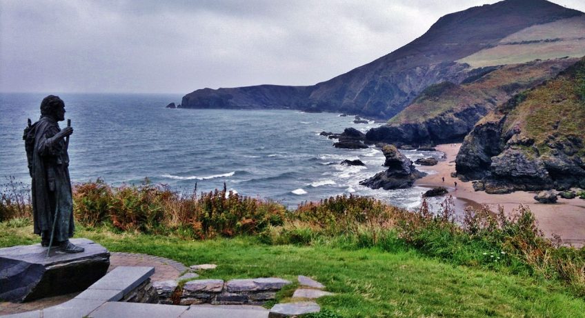
North-eastwards of Cardigan and the River Teifi, the coast resumes its usual characteristics that are common in this section of Wales – rugged, rocky and lined with cliffs. Numerous coves are hemmed in between small gaps in the cliffs, and Traeth y Mwnt is one of them. Located 5km (3 miles) to the north of Cardigan, Traeth y Mwnt is a scenic sandy cove that is rather sheltered by cliffs on either side. Various other scenic and remote coves exist along the coastline, including at Cwmtydu, located at the mouth of a stream valley around 15km (9 miles) north-eastwards along the coast from here.
Moving eastwards from Traeth y Mwnt, the coast wriggles around craggy coastal cliffs to the coastal village of Aberporth. Used today as a crab and lobster fishing port, the picturesque village overlooks two sandy beaches, and at low tide rockpools are exposed below the cliff faces that flank each side of the beaches. This area is also rich in sea wildlife – bottlenose dolphins are frequently seen from the shoreline, and porpoise species are occasionally spotted [2]. Despite the high frequency of rocks at the base of the cliff, beaches are fairly common within this part of Ceredigion, and Traeth Penbryn beach located just to the east of Aberporth is an example of this. At 2.5km (1.5 miles) long, this sandy beach is rather popular with tourists.
The cliffs between Traeth Penbryn beach and the seaside town of New Quay are significantly taller and rugged than the cliff faces around Aberporth. To the north-east of the seaside village of Llangrannog, a towering headland protrudes outwards into the Irish Sea, with the cliffs reaching a height of 150 metres (500 feet) in places. The remains of an Iron Age hillfort, known as Pen Dinas Lochtyn, sit atop the headland. A coastal path on top of the cliffs provides fantastic views across the Irish Sea, as well as the coastline on either side [3].
The towering cliffs continue north-eastwards, only decreasing in height at the town of New Quay, a beautiful seaside village that contains cottages, pubs and restaurants and a sandy beach that arches around New Quay Bay [4]. Between New Quay and Aberystwyth, the cliffs are not as towering, but remain a dominant feature alongside the coast. However, some pockets of low-lying land border the Irish Sea, including at the holiday town of Aberaeron, where a harbour filled with sailing boats sits in front of beautifully-painted cottages.
The largest town along this stretch of coastline is Aberystwyth. Famed for being both a seaside and a university town, it serves as a rather important centre for much of western Wales. The town centre consists of many restaurants, cafes, cottages and independent shops, all located within mostly old and scenic buildings. To the south of Afon Rheidol, the small river that runs through the town, Aberystwyth Harbour adds to the tranquillity of the area, with its yachts and sailing boats. A 1.5 km (1 mile) long Victorian promenade lines the seafront at Aberystwyth, with rather grand buildings overlooking the sandy beach.
A short pier also juts out into the bay. Built in the 13th Century, the remains of Aberystwyth Castle stand just to the west of the promenade, overlooking the Irish Sea. Throughout the 14th and early 15th Centuries, the castle changed hands many times between Wales and England, as both nations warred with each other. Another tourist attraction in the town is Aberystwyth Electric Cliff Railway. Opened in 1896, this is the longest railway of its type in Britain, and it stretches up Constitution Hill to the north of the town, from which great views of Aberystwyth and the Irish Sea can be seen from the clifftops. The largest Camera Obscura in the world sits atop Constitution Hill, from which 2500 square km (1000 square miles) of land can be observed with an incredibly remarkable level of clarity [5].
About 8 km (5 miles) to the north of Aberystwyth, the cliffs give way to a large area of low-lying land. The seaside village of Borth straddles the coastline, with a sandy beach called Borth Sands that stretches 6 km (3.5 miles) northwards from the village. The beautiful River Dovey estuary meets the Irish Sea just to the north; from Borth, wonderful views can be seen of the steep and towering hills on the northern side of the estuary [6]. A sand dune system, the largest in Ceredigion, sits just to the south of where the River Dovey meets the sea, providing a wonderful habitat for many bird species.
Crossing the Dovey estuary, one leaves Ceredigion and enters both the county of Gwynedd and Snowdonia National Park. Passing the quaint seaside village of Aberdovey, the coast is lined by a long sandy beach that extends to the north of the holiday town of Tywyn [7]. Carrying on northwards, steep hills directly border the coastline; although cliffs intermittently border the shoreline here, the coast is also bordered by a seaside railway that overlooks the coastline. This railway line connects the towns of Aberdovey and Barmouth with the rest of the British railway network. As the coast winds its way away around craggy rocks, it reaches Barmouth Bay, where the River Mawddach estuary meets the Irish Sea. A beautiful wide and sandy estuary, the mouth is bordered by the town of Barmouth to the north, and Barmouth Bridge – a long railway bridge – crosses the estuary. To the north, the rest of Gwynedd stretches out into north-western Wales – this is covered in another article [8].
References
[1] https://www.visitwales.com/attraction/castle/cardigan-castle-gardens-1409795
[2] https://www.cardigan-bay.com/aberporth-cardigan-bay/
[3] https://ancientmonuments.uk/130926-pen-dinas-lochtyn-llangrannog#.X6cOy2j7SUk
[4] https://www.newquay-westwales.co.uk/
[5] https://www.visitwales.com/destinations/mid-wales/ceredigion-cardigan-bay/insiders-guide-aberystwyth
[6] https://www.visitmidwales.co.uk/Machynlleth-Dyfi-Valley-Coast/details/?dms=3&venue=1124365
[7] https://www.visitmidwales.co.uk/Tywyn-Tywyn/details/?dms=3&venue=1023165
[8] https://www.visitmidwales.co.uk/Dolgellau-Mawddach-Estuary/details/?dms=3&venue=1012044
Image Cardigan Bay by Mark Foley