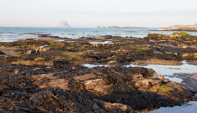
Stretching from the England/Scotland border to the head of the Firth of Forth estuary, this section of coastline stretches around the rugged North Sea coastline, passing rocky cliffs, quiet bays and seaside towns. It also runs alongside the bustling Port of Leith, and makes up the border of the southern side of the Firth of Forth estuary.
England/Scotland Border to Cockburnspath
The most southerly section of coastline on the eastern side of Scotland, the coastal landscape is characterised by towering and rugged cliffs that contain many headlands, with craggy rock stacks standing upright along the shore line.
The most impressive headland along this coastal section is arguably Saint Abb’s Head – located 5.5 km (3.5 miles) north-west of the port town of Eyemouth, Saint Abb’s Head towers above the waves of the North Sea, giving impressive views of the cliffs on either side, the visible diagonal-shaped rock folds diving sharply into the sea [1]. An impressive seabird colony also inhabits this beauty spot, with incredibly large numbers of guillemots, kittiwakes and razorbills calling Saint Abb’s Head their home. Another headland is Telegraph Hill – located several miles to the north of Saint Abb’s Head, this towers over 150 metres (500 feet) above the North Sea.
Bays and coves are also found along the coastline here, including Coldingham Bay, Pease Bay and Starney Bay. Each of these bays is rather small and sheltered, being tightly hemmed in at either end by tall cliff faces. However, they are not always beach-free – Coldingham Bay, for example, contains a kilometre (5/8 mile) of sand arching around the rocky inlet. As well as being an ideal destination for paddling and swimming, rocks flag either end of the beach, and rockpools emerge during low tide [2].

By Mick Knapton – Self-photographed, Public Domain, https://commons.wikimedia.org/w/index.php?curid=4569493
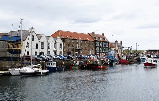
Apart from the small and quaint fishing village of Saint Abbs, the only other settlement directly bordering the coast is the small town of Eyemouth. A fishing village since the 13th Century, Eyemouth contains an old harbour that is still used for fishing today, as well as a town centre containing twisting, narrow streets. A number of Bed and Breakfast hotels, pubs and restaurants also exist in the town [3].
Cockburnspath to Port of Leith
Although pockets of rocky ruggedness remain along this coastal stretch, particularly close to the towns of Dunbar and North Berwick, wide and sandy bays lie along the coastline. The largest of these are Belhaven Bay, Gullane Bay, Aberlady Bay and Gosford Bay. For example, Belhaven Bay contains a wide sandy beach, and is suitable for paddling, swimming and surfing.
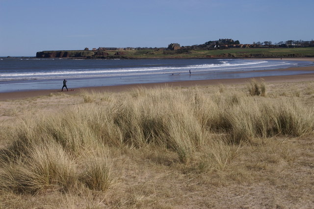
It is part of the John Muir Country Park, a coastal park and beauty spot, from which views across both the North Sea and the Firth of Forth can be seen [4]. Another large bay along this coastal stretch is Aberlady Bay – consisting of a huge area of tidal sandflats, this bay has been designated as a nature reserve, and comprises a complete set of habitats stretching from the low tidal mark up to the coast, and includes the salt marshes and sand dunes that border the shoreline. Tens of thousands of pink-footed geese roost here every autumn, while wheatear, whitethroat and blackcap bird species nest in the nature reserve [5].
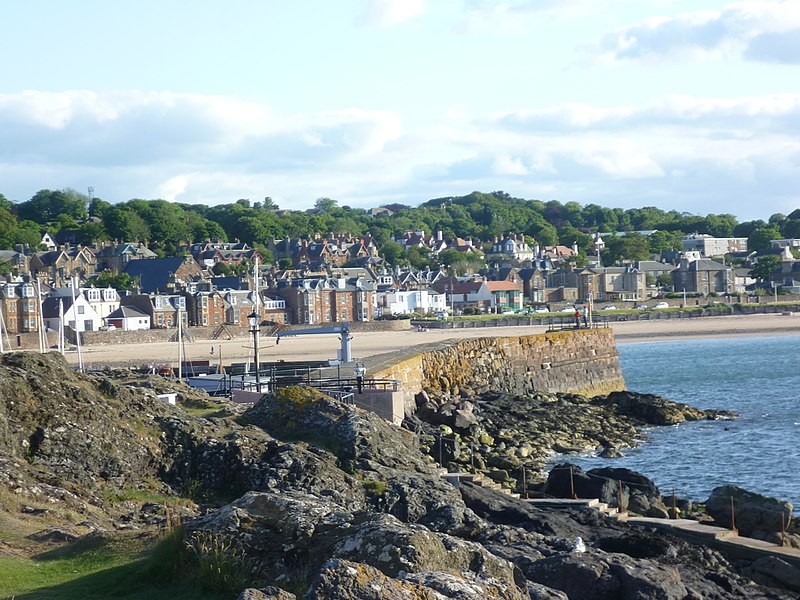
A number of seaside towns border the coastline, gradually increasing in frequency towards both Edinburgh and the Port of Leith in the east. Located to the east of Belhaven Bay, Dunbar marks the boundary that divides the North Sea to the east from the Firth of Forth to the west. A beautiful port town, with many cottages overlooking the quaint harbour, Dunbar contains a ruined 950-year-old castle that served as one of Scotland’s most important fortresses [6]. North Berwick is another picturesque seaside town; with its rustic seafront and two sandy beaches, quaint buildings and a wide range of shops, restaurants and hotels make up a rather pleasant destination for visitors [7].
Moving towards the Edinburgh area, one passes the seaside towns of Port Seaton, Cockenzie, Prestonpans and Musselburgh. Portobello, a seaside suburb of the Scottish capital city of Edinburgh, contains a long and sandy beach that is bordered by an extensive promenade, and grand Georgian and Victorian-era houses.
Port of Leith to Kincardine
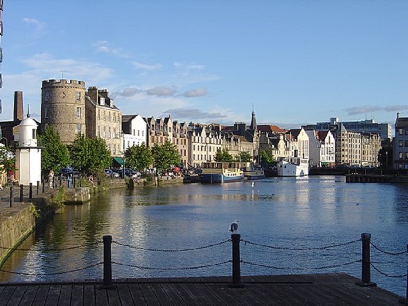
This coastal stretch includes pockets of industry, port towns and grand bridges interspersed between a more natural landscape of woodland and coastline ruggedness. The Port of Leith is the largest of these industrial areas – located 3.5 km (2 miles) north of Edinburgh’s city centre, this port handles the delivery of many types of cargo into Scotland [8], with many warehouses lining the large dockland area.
By en:User:Zaian – Transferred from en.wikipedia, Public Domain, https://commons.wikimedia.org/w/index.php?curid=4515125
Large and picturesque buildings border the river – appropriately named the Water of Leith – that runs through the centre of the town of Leith, itself a hub of lively pubs, restaurants and cultural diversity [9]. Further pockets of industry exist at South Queensferry, Bo’ness and Grangemouth, with the latter containing a vast oil refinery located in the upper reaches of the estuary.
Andrew Shiva / Wikipedia, CC BY-SA 4.0, https://commons.wikimedia.org/w/index.php?curid=51291330
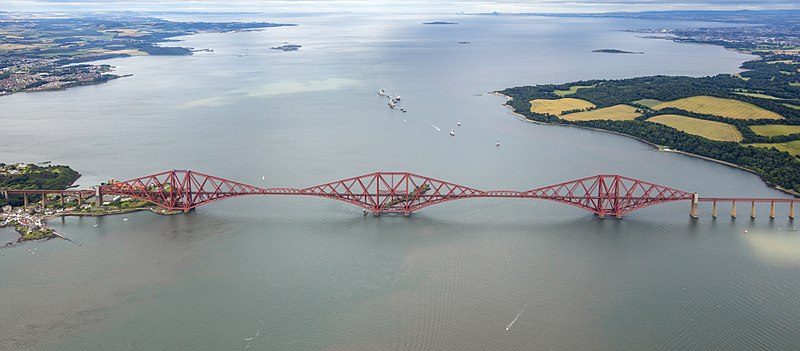
The beautiful town of South Queensferry, with its stone-clad buildings, sits on the southern shore of the Forth estuary. However, it is also known for being adjacent to three vast bridges that cross the estuary here. The first of these – the Forth Bridge – is a railway crossing that connected Edinburgh, with the towns to the north of the wide estuary. Opened in 1890, this massive red-painted iron bridge is a symbol of Scotland. However, two more grand bridges also pass Grangemouth – the Forth Road Bridge, a dual carriageway opened in 1964, and the Queensferry Bridge, which opened in 2017 to carry the M90 motorway across the estuary.
Despite the presence of industry and seaside towns, the southern banks of the Forth estuary also contain their fare share of nature. The estate of Dalmeny House, a splendid Gothic revival mansion, contains coastal woodland that borders the estuary. The coastline between South Queensferry and Bo’ness is also lined with deciduous woodland that flows down the rolling hillside to the shoreline. West of Grangemouth, as the Forth estuary increasingly narrows past the town of Kincardine, up towards the head of the estuary near Alloa, it is bordered with rural farmland, making good use of the fertile soil. The large expanse of flat land bordering this section of the estuary provides a great view of the surrounding area, including of the large Ochil Hills that loom to the north.
References
[1] https://www.nts.org.uk/visit/places/st-abbs-head
[2] https://www.visitscotland.com/info/towns-villages/coldingham-bay-p315511
[3] https://www.visitscotland.com/info/towns-villages/eyemouth-p242461
[4] https://www.meadowhead.co.uk/parks/belhaven-bay/
[5] https://www.eastlothian.gov.uk/info/210569/countryside_and_wildlife/12080/countryside_sites/2
[6] https://www.visitscotland.com/info/towns-villages/dunbar-p241151
[7] https://www.visitscotland.com/info/towns-villages/north-berwick-p240511
[8] https://www.forthports.co.uk/our-ports/leith-edinburgh/
[9] https://www.visitscotland.com/info/towns-villages/leith-p918421

