
Brighton, Eastbourne and Hastings
This section of south England coastline stretches from Brighton through to the seaside village of Camber. It includes seaside resorts such as Brighton, Eastbourne and Hastings, as well as the iconic sections of the British coastline, including the Seven Sisters Cliffs and historical ‘1066 Country’. This coastline borders the English Channel, and is very popular with visitors.
By Wolfgang Glock – Own work, CC BY 3.0, https://commons.wikimedia.org/w/index.php?curid=4490145
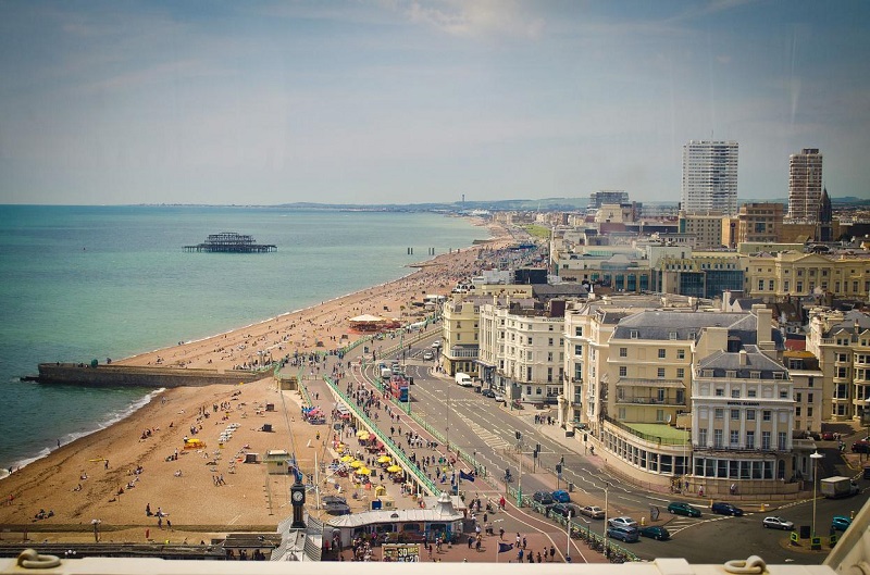
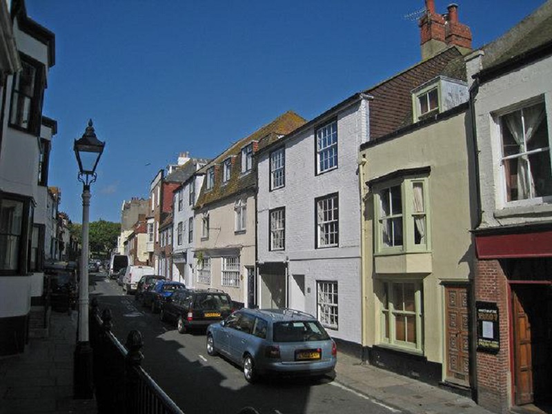
At the westernmost part of this coastline is the famous seaside resort of Brighton. This is a rather large town that contains many tourist attractions. Brighton has been renowned as a popular resort town since the 18th Century, not only due to the relatively warm English Channel sea, but also because of its proximity to London – as London has grown over the previous decades and centuries, so has Brighton.
By Garry Knight – Flickr: Brighton June 2012 – 17, CC BY-SA 2.0, https://commons.wikimedia.org/w/index.php?curid=21515266
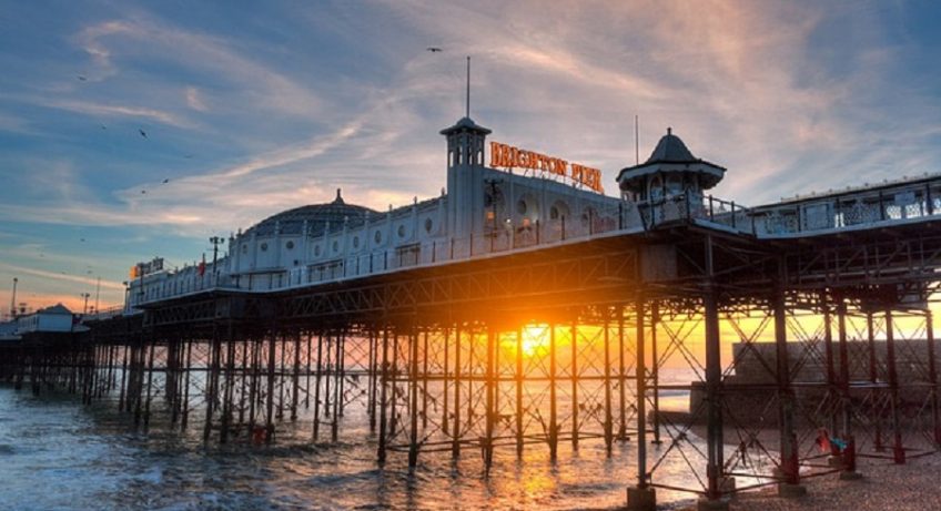
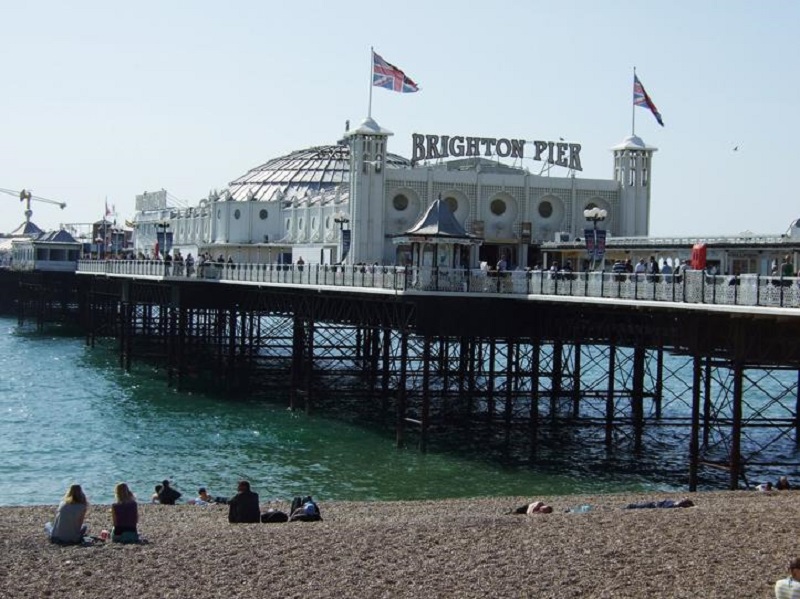
The town itself is well-known for having many tourist attractions and its vibrant nightlife. First of all, the renowned pier contains amusement arcades and a large funfair at the end of the pier. Brighton also has a rather extensive and vibrant seafront, with highlights including an aquarium, a Victorian promenade and a long pebble peach.
By Jenni Ahonen – Own work, CC BY-SA 4.0, https://commons.wikimedia.org/w/index.php?curid=3127215
The beach also contains Volk’s Electric Railway – opened in 1883, this is a 1.6 km (1 mile) long miniature railway located east of the pier [1]. However, the most recent attraction of note is the British Airways i360 Viewing Tower – opened in 2016, this is a 160 metre (450 foot) high tower, from which you can see great views of Brighton, Hove and the surrounding area [2].
South Downs
East of the town, cliffs begin to appear as the coastline starts to intercept the South Downs. This is a large row of chalk hills that starts at Eastbourne in the east and finishes at Winchester in the west. East of Brighton, the coastline is dominated by these cliffs, which have several residential seaside towns on top of them. These include Rottingdean, Saltdean and Peacehaven, and are well-protected by sea defences to prevent much coastal erosion. East of Peacehaven, the cliffs climb further before being interrupted by the mouth of the River Ouse, at the small port town of Newhaven.
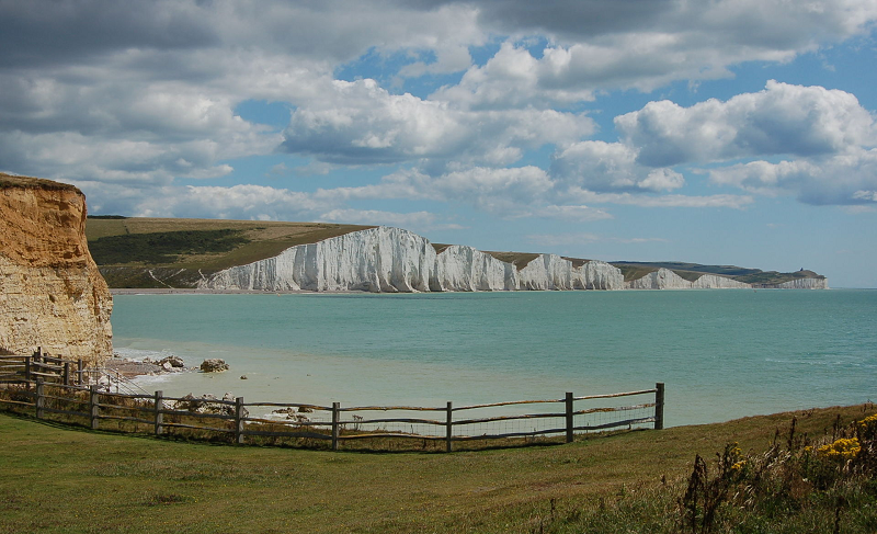
The section of coastline between the seaside town of Seaford and the resort town of Eastbourne, however, contains some rather iconic chalk cliffs. Known as the Seven Sisters, they are a very picturesque sight, and consist of a distinctive white colour. A small valley between two of the cliff faces is known as Birling Gap – this contains a visitor centre, a viewpoint from which the cliffs can be seen and safe access to the shoreline.
The quaint Belle Tout lighthouse sits on top of the cliffs near here – now used as a guesthouse, this was moved a few metres from the coastline due to impending erosion of the cliffs [3]. At the most eastwards point of the Seven Sisters cliffs is Beachy Head – at over 150 metres (500 feet) tall, this marks the highest point along these cliffs [4]. This is a very popular viewing spot that offers many views of Eastbourne to the east and beyond.
Eastbourne
To the east of the chalk South Downs escarpment lies the seaside resort of Eastbourne. Like many British resort towns, this is home to a pier, a picturesque promenade and various hotels on the seafront. The land between Eastbourne and Bexhill is, however. The complete antithesis of the cliffs to the west – they are dominated by flat land bordering onto the shore with no cliffs.
There is a large area of marshland here – known as the Pevensey Levels, this is a 3,500-hectare (8,600-acre) nature reserve and Site of Special Scientific Interest that boasts a wide range of aquatic flora and fauna. For example, bird species found in these marshes include reed warblers, redshanks and cuckoos, whereas flowering-rush and greater spearwort can be found in great numbers here [5].
Hastings
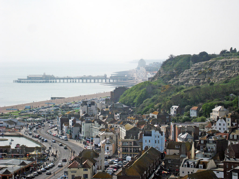
The seaside town of Hastings exists to the east of these levels. Nestled south and westwards of another series of hills, this town is popular in the summer with tourists. Hastings is notable that, amongst the usual attractions typical of a British seaside town, it also contains two funicular railways and an almost thousand-year-old castle. Known as Hastings Castle, this is a set of ruins consisting of stone fortress remains, that was built just after the Norman Conquest, between 1066 and 1069 [6].
This part of the United Kingdom is very significant in terms of the Norman Conquest – it is at the historic town of Battle 8 km (5 miles) inland that the Battle of Hastings was fought in 1066, hence the colloquial name for this part of Britain, which is ‘1066 Country’. Located close to the castle is an area known as Hastings Old Town – this consists of many old and quaint buildings, including pubs and small shops, all nestled within a small valley.
By Oast House Archive, CC BY-SA 2.0, https://commons.wikimedia.org/w/index.php?curid=14569923
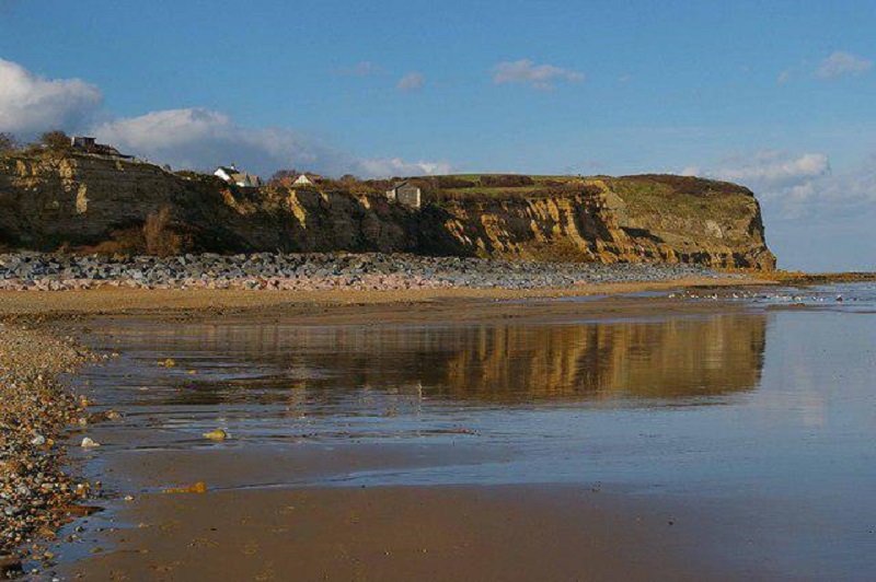
Directly east of Hastings Old Town is another set of cliffs; however, unlike the cliffs between Brighton and Eastbourne, these mainly consist of a different sedimentary rock type – yellow sandstone. These cliffs mark the eastern extent of a range of sandstone hills that runs through south-east England, starting from Horsham to the west and ending here.
Unlike the distinctive white chalk of the Seven Sisters, these cliffs have a rather yellowish hue to them. These cliffs are very picturesque, and are marked by coastal woodlands and small valleys that run down to the shoreline. The village of Fairlight Cove sits above these cliffs; it is therefore no surprise that this village is often threatened by cliff erosion, which occurs on a fairly frequent basis, despite the construction of small-scale sea defences on the shoreline.
By Glyn Baker, CC BY-SA 2.0, https://commons.wikimedia.org/w/index.php?curid=13400602
Rye
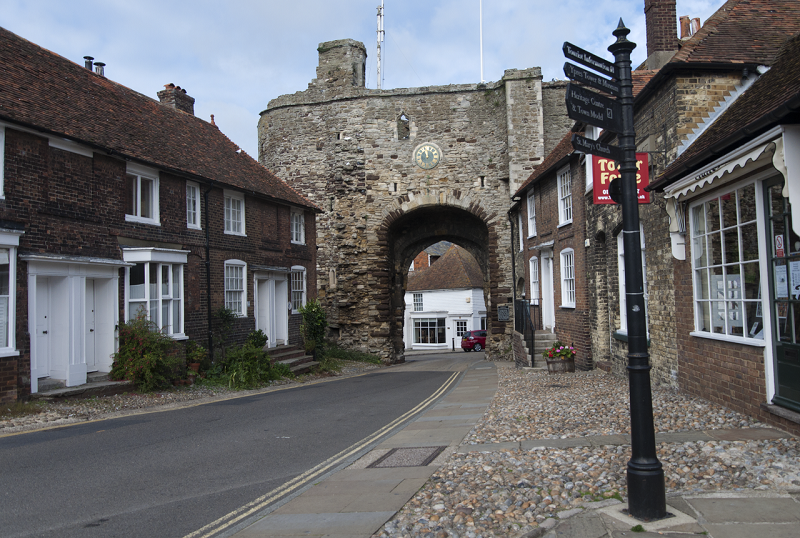
A couple of kilometres (about 1 mile) east of Fairlight Cove, the coast once again returns to rather flat terrain, with the adjacent marshy land being only slightly above sea level. After passing the popular holiday village of Winchelsea Beach, with its pebbly shoreline and Nature Reserve, the coastline is briefly interrupted by the River Rother flowing into the English Channel. This river is interesting as it passes the small Medieval town of Rye that is located around 3 km (2 miles) inland.
By Paul Hermans – Own work, CC BY-SA 3.0, https://commons.wikimedia.org/w/index.php?curid=17051091
Although today it is separated from the sea by marshland, it was once a sea port located on the far end of a coastal bay. In terms of history, Rye was part of Normandy during the early half of the 13th Century, although even after the port was returned to the English Crown in 1248, the French invaded the port in 1377. More recently, in the 18th Century, Rye was a key smuggling centre, with contraband goods being stored in a network of cellars and secret tunnels underneath the historic town [7]. East of the River Rother is one final part of East Sussex – the holiday village of Camber Sands.
By Segaboyno2010 – Own work, Public Domain, https://commons.wikimedia.org/w/index.php?curid=11429469
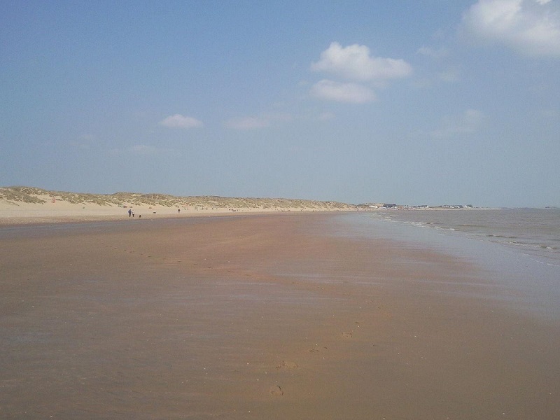
Camber Sands
With a sandy beach, dunes, camping facilities and holiday homes, Camber Sands is a popular tourist destination on the south England coast. Just east of this village is the East Sussex and Kent border.
References
[1] http://volkselectricrailway.co.uk/#
[2] https://britishairwaysi360.com/about/faqs/
[3] https://www.belletout.co.uk/
[4] https://www.beachyhead.org/
[5] https://sussexwildlifetrust.org.uk/visit/pevensey-marshes
[6] https://www.visit1066country.com/things-to-do/hastings-castle-and-1066-story-p44433
[7] https://www.visit1066country.com/destinations/rye/history