Table of Contents
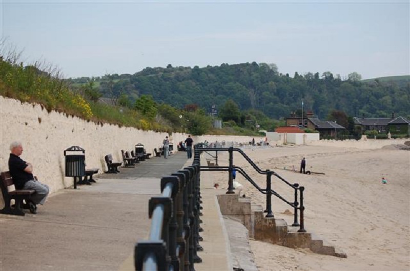
The Blue Flag is a prestigious award that is given to beaches and marinas around the world that meet a series of stringent criteria relating to beach cleanliness, high-water quality, and the presence of environmental education programmes. The award scheme is operated and administered by the Foundation for Environmental Education (FEE), whose mission statement involves promoting and participating in environmental marine-related education, implementing environmental management systems, environmental monitoring, and the promotion of sustainable tourism.
The FEE assesses beaches and marinas based on four criteria – environmental, education, safety and accessibility – and give an award to any beach or marina that meets these criteria to a high standard. Coastal areas that are given a Blue Flag award have to ensure that high standards are maintained, and are assessed by the FEE every year. As of 2019, there are 128 beaches in the UK that have been awarded such a distinction – 71 of these are in England, with 44 located in Wales, and a further 5 in Scotland.
15 Best Blue Flag Beaches in England
Out of the 71 Blue Flag beaches in England, these are the 15 that I feel are the most interesting and scenic in the country.
West Wittering, West Sussex
Quietly tucked away on the southern coast of England, the beach at West Wittering is marked by a vast swathe of white sand that slides down from a row of sand dunes into the sea. Making up one of the last remaining natural stretches of coastline in West Sussex, small beach huts line part of the beach, giving this beauty spot a rather traditional feel. Despite its relative remoteness, facilities include toilets and a couple of cafes that sell refreshments.
How to find it:
Located just to south of the village that is also named West Wittering, the beach is served by a large car park that charges a small entry and parking fee. Co-ordinates: 50.775547, -0.907859.
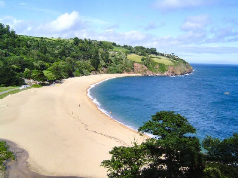
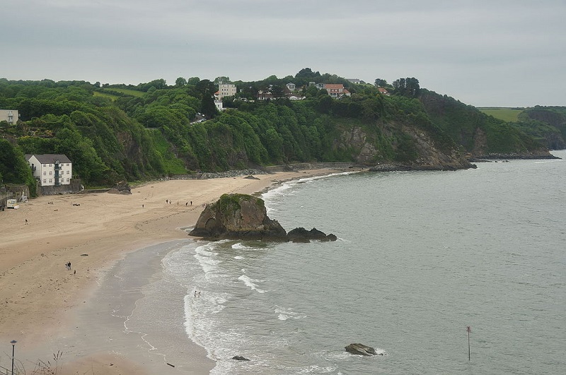
Blackpool Sands, Dartmouth, Devon
Located in south west England, Blackpool Sands beach is nestled within a beautiful and tranquil landscape, where woodland sweeps down from the adjoining hillside to the shoreline, and cliffs flank the bay on either side. A mainly shingle beach, Blackpool Sands also contains unusually clear water, hence its Blue Flag status.
How to find it:
The A379 runs alongside the bay. A large car park is located adjacent to the beach. Co-ordinates: 50.318824, -3.610891.
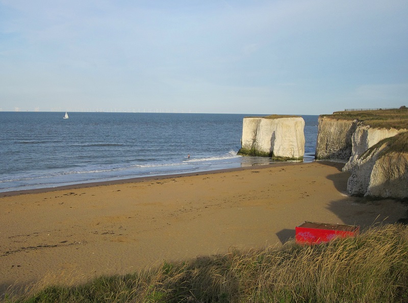
Botany Bay, Kent
Botany Bay is regarded as one of Kent’s best kept secrets. With its distinctively white chalk cliffs bordering the sandy coastline, and several chalk stacks rising from the waves, it is no wonder that this is popularly regarded for its impressive scenery. Located on the north-eastern point of the Isle of Thanet peninsula between the towns of Margate and Broadstairs, fossils can often be found here.
How to find it:
Parking spaces are lined along Palm Bay Avenue, although try to park as east as possible. Since a residential area borders the beach, parking without a permit is rather restricted in the surrounding roads. For a fee of £10 per day, parking is allowed at the Captain Digby restaurant. Beach co-ordinates: 51.389060, 1.435054.
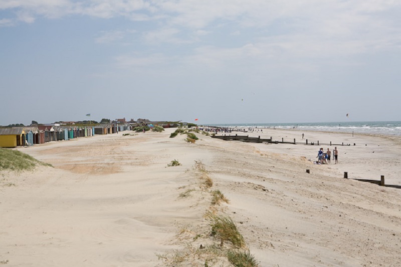
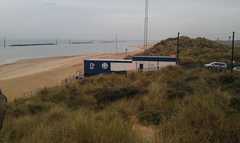
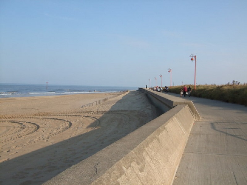
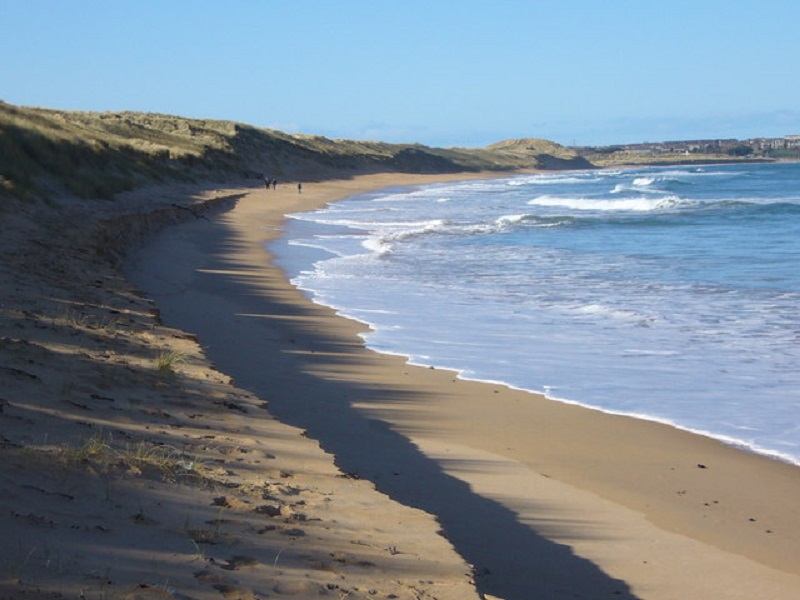
Sea Palling, Norfolk
Located around 30 km north-east of Norwich, the beaches that neighbour the quaint seaside village of Sea Palling consist of large expanses of white sand that stretches down from sand dunes into the waves of the North Sea. A peaceful and tranquil area situated far from any busy seaside towns, the beaches in this area are definitely well worth a visit.
How to find it:
A large car park (named Clink Road Long Stay) is located on Clink Lane, just to the west of the village of Sea Palling – the shore is easily accessible from here. Co-ordinates: 52.790755, 1.601682.
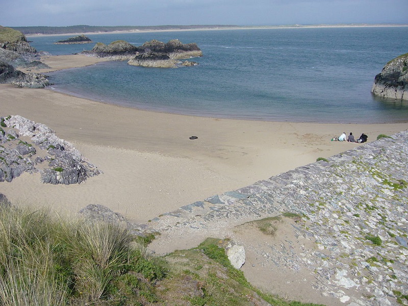
Trevone Bay Beach, Cornwall
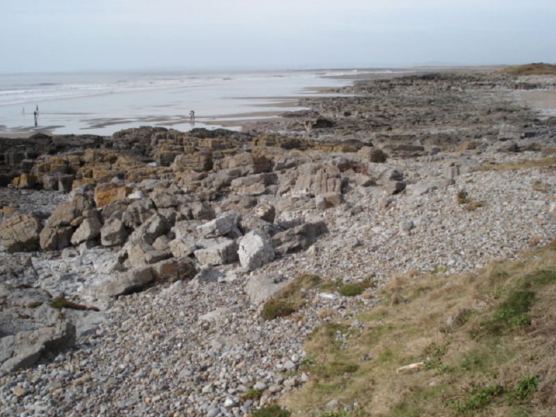
Trevone Bay consists of a beautiful stretch of golden sand that is nestled between two rocky ledges on the northern coast of Cornwall near Padstow. A designated Site of Special Scientific Interest (SSSI), amazing rock formations line both sides of the bay, upon which many tidal rock-pools can be found, teeming with marine life. A semi-natural swimming pool and large blow-hole formation are two notable attractions around Trevone Bay.
How to find it:
A car park is located next to the head of the bay, on the northern end of Trevone village. Co-ordinates: 50.545608, -4.977768.
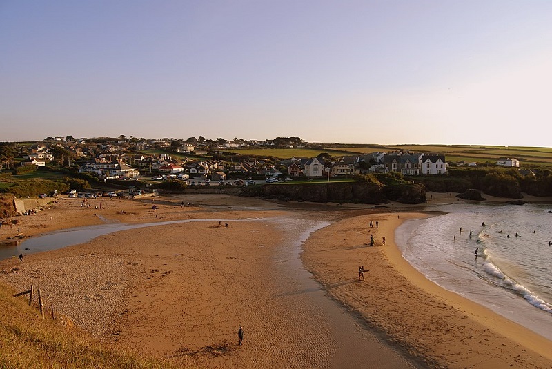
By Evans1551 at English Wikipedia – Transferred from en.wikipedia to Commons., Public Domain,
Mablethorpe Beach, Lincolnshire
Bordering the small seaside town of Mablethorpe, this beach consists of a large swath of golden sand that expands from the seafront and into the waves of the North Sea. North of the town, the beach is backed by dunes covered in grass and shrubs. This beach is also a popular habitat for seals, particularly during November and December.
How to find it:
Queens Park, located just south of the town centre, contains two car parks. Sea View car park lies to the north of the town. Co-ordinates: 53.343299, 0.264985.
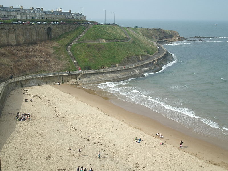
King Edward’s Bay, Tyne and Wear
Situated along the east of the seaside town of Tynemouth, King Edward’s Bay is a slice of golden sand positioned in a sheltered cove. It is surrounded by cliffs on all sides, and lies between the 13th Century ruins of Tynemouth Priory and Castle to the south, and the rugged rocks of Sharpness Point to the north. Riley’s Fish Stack – a twee seafood restaurant – rests at the base of the cliffs.
How to find it:
Parking can be found along Sea Banks and Percy Gardens, two streets just to the north of King Edward’s Bay’s sandy section. Co-ordinates: 55.019037, -1.420568.
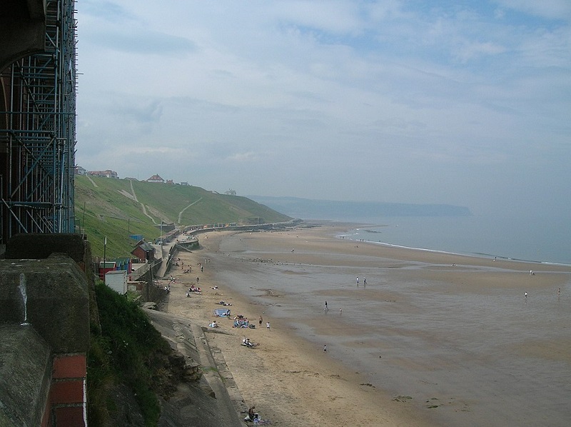
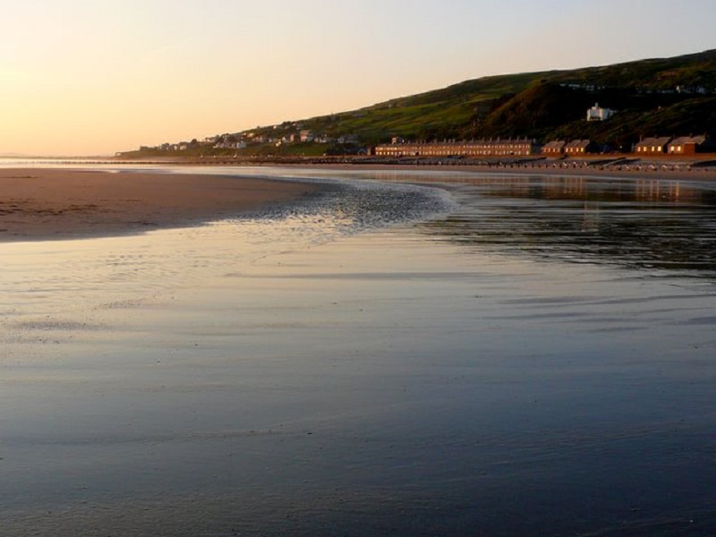
Whitby Beach, North Yorkshire
Facing the North Sea, and located close to the scenic town of Whitby, this sandy beach is lined by a series of rugged cliffs. Views from the beach are rather spectacular, with views of Whitby Abbey on the hilltop to the east, and the cliffs extending for many miles to the north-west. A line of beach huts line part of the beach.
How to find it:
North Terrace Car park, located on top of the cliffs, offers parking. Street parking is also possible on some of the roads in the vicinity. Co-ordinates: 54.491538, -0.621694.
By tormentor4555, CC BY-SA 3.0, https://commons.wikimedia.org/w/index.php?curid=53433226
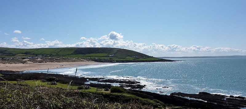
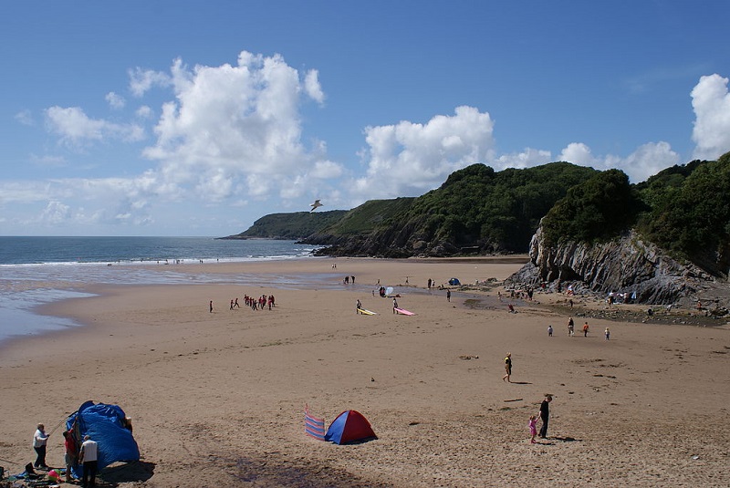
Croyde Beach, Devon
A beach that is popular with surfers, Croyde Beach is renowned for its large expanse of sand that is flanked by rocks on both sides. With a row of sand dunes backing the lovely beach, this is a quintessentially English beach that attracts tourists from far and wide.
How to find it:
Croyde Beach Car Park, located on the northern side of the bay, is located on Moor Lane. Alternatively, Down End Car Park is situated to the south of the beach, on the B3231. Co-ordinates: 51.131473, -4.238471.
By Becks – Croyde Bay, CC BY 2.0, https://commons.wikimedia.org/w/index.php?curid=25739883
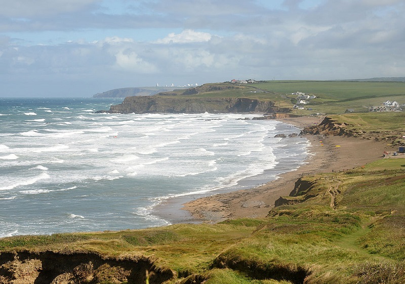
Widemouth Bay, Cornwall
With a vast expanse of golden sand, and patches of low-lying rocks stretching out to sea, the beach at Widemouth Bay is located within a rather scenic setting. With many exposed rock pools at low tide, and a row of sand dunes lining the shore, it is no wonder that this is a popular destination for tourists, from families having picnics on the beach through to surfers taking advantage of the waves coming in from the Atlantic Ocean.
How to find it:
There are two main car parks – named ‘Widemouth Bay’ and ‘Widemouth Beach’, these are located on Marine Drive, which runs alongside the bay. The A39 road runs along the coastline, around a mile (2 km) inland. Co-ordinates: 50.793036, -4.557189.
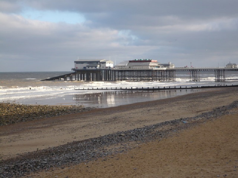
Cromer, Norfolk
Bordering the resort town of Cromer, it is no surprise that this beach has been awarded a Blue Flag. Boasting pristine sands, tall cliffs and a late Victorian pier jutting out from a popular holiday destination, the beach is definitely one to visit if you are after both a lovely beach and an adjacent picturesque seaside town.
How to find it:
Meadow, Cadogan Road and Runton Road car parks are located just to the south and west of the town centre, with the latter located above the cliffs. A popular seaside resort town, both the A148 and A149 roads enter Cromer. Co-ordinates: 52.933045, 1.299824.
Gyllyngvase Beach, Cornwall
Located on the southern side of the port town of Falmouth, this beach consists of a fine crescent of clean, white sand, with waves from the turquoise-coloured bay lapping the shore. Rock flats stretch from the shoreline out into the bay, with much of these being only visible at low tide. Despite its close proximity to Falmouth, the beach feels like it is in a sleepy, quiet village. The Gylly Beach Café overlooks the bay.
How to find it:
A car park is located just behind the bay, and limited street parking is also available. The A39 passes around 200 metres to the north of the bay. Co-ordinates: 50.144253, -5.068618.
By Tim Green from Bradford – Gyllyngvase Beach, CC BY 2.0, https://commons.wikimedia.org/w/index.php?curid=51783869
Seaburn, Tyne and Wear
With its long stretch of golden sand, the beach at the seaside resort town of Seaburn is backed by a patch of luscious grass on its northern end, and by the town’s promenade at its southern edge. The White Lighthouse looks out over the North Sea at the most southern point of the beach. There are plenty of amenities here, with a wide choice of restaurants and cafes along the seafront.
How to find it:
A car park is located on Lowry Road (not the Morrison’s car park), as well as street parking on Whitburn Road (the A183). Co-ordinates: 54.936616, -1.367576.
Carbis Bay, Cornwall
Tucked away alongside the seaside town of the same name, Cardis Bay is a delightful beach flanked by rocky headlands on both sides. With a lovely spread of white sand that is backed by homes, a restaurant and a large hotel amongst a woodland of broadleaved and evergreen trees, Carbis Bay is a beach that you would truly not want to miss.
How to find it:
Limited parking is available in the valley just behind the beach; street parking is, unfortunately, also fairly limited. Co-ordinates: 50.198675, -5.465499.
Carbis Bay Beach Takver from Australia, CC BY-SA 2.0, via Wikimedia Commons
.jpg)
Dawlish Warren, Devon
Built on a spit of sand that extends eastwards from the town of the same name into the mouth of the River Exe estuary, the beach at Dawlish Warren consists of a long extent of golden sand backed by a row of grassy sand dunes. This is a rather quiet and relaxing beach.
How to find it:
Parking is available just to the east of the beach, located on the western side of the village that is also named Dawlish Warren. To find the village, turn off from the A379 at Shutterton. Co-ordinates: 50.600204, -3.437640.
Nilfanion, CC BY-SA 4.0, via Wikimedia Commons
.jpg)
10 Best Blue Flag Beaches in Wales
Of the 44 Blue Flag beaches in Wales, these are the 10 which I feel are the most interesting and attractive in the country.
Llanddwyn Bay, Anglesey
The beautiful sandy beach at Llanddwyn Bay is located within an incredibly scenic part of Wales, with views of Snowdonia and the Llyn Peninsula visible from the shoreline. The coast itself is backed by an extensive sand dune system and a 2,000-acre conifer forest. A small island named ‘Ynys Llanddwyn’ makes up the western side of the bay, upon which church ruins and a lighthouse are located amongst a wild and rocky terrain.
How to find it:
Llanddwyn Bay is located on the southern side of Anglesey. Parking is available just to the north of the bay – since it is located within Newborough Warren Nature Reserve, a small entry fee (£3 per car) has to be paid on entry. 53.144522, -4.385640.
The original uploader was Nabokov at English Wikipedia., CC BY-SA 3.0, via Wikimedia Commons
Caswell Bay, Gower Peninsula
Caswell Bay rests among the beautifully rugged coastline along the south-eastern edge of the Gower peninsula. Consisting of a wide expanse of golden sand that stretches out from the coastline into the sea, with a small, crystal-clear stream running through the centre, the beach is also surrounded by rocks on both sides.
How to find it:
Caswell Bay car park is located just behind the bay, just off of the B4593. Co-ordinates: 51.569911, -4.031402.
Lukeas09, CC BY-SA 3.0, via Wikimedia Commons
Llangrannog Beach, Ceredigion
Nestled within craggy cliffs, and located at the mouth of a beautiful, wooded valley, Llangrannog Beach consists of a cove lined by a small and sandy beach. Backed by Llangrannog village, when one looks down on the beach and village from either of the cliffs that flank the beach, it resembles a place from a picture postcard.
How to find it:
Parking is allowed with the village of Llangrannog – however, if this is not possible, a large car park sits on top of the hill overlooking the village, on the B334. It is a roughly 10-minute walk from the car park to the beach. Co-ordinates: 52.160136, -4.471257.
William M. Connolley at English Wikipedia, CC BY-SA 3.0, via Wikimedia Commons
Cefn Sidan, Carmarthenshire
The first beach in Wales to receive a Blue Flag award, Cefn Sidan stretches 13 km (8 miles) along the north-eastern side of Carmarthen Bay. At low tide, an impressively vast area of flat sand is exposed, which is ideal for activities such as kite flying and bathing. Since it is located a considerable distance away from any towns and villages, and is backed by a system of sand dunes and a large conifer forest, Cefn Sidan is the ideal place for a quiet and relaxing day at the sea.
How to find it:
There are several car parks located behind the eastern section of the beach; since these are within Pembrey Country Park, a small entrance fee is required to park here. The road to the country park is signposted, and leaves the A484 at the village of Pembrey. Co-ordinates: 51.677900, -4.324291.
Traeth Abermaw Beach, Barmouth, Gwynedd
Resting alongside the beautiful seaside town of Barmouth, the white and sandy beach at Gwynedd stretches out over a wide area, offering great views of the hills and cliffs to the south, and of the Cambrian Mountains to the east. Located within the Snowdonia National Park, the beach is popular with visitors, but due to its large size, almost never feels crowded.
How to find it:
A car park is located on Barmouth promenade. The A496 runs through the town. Co-ordinates: 52.720269, -4.056880.
Tenby North Beach, Pembrokeshire
Sheltered amongst the picturesque town of Tenby, this is a beautiful sandy beach that expands even further out into the bay during times of low tide. On the southern side of the beach is Tenby harbour – once a vital part of Tenby’s functioning as a fishing village, it is now mainly used for leisure activities. The northern side is lined with luscious, wooded cliffs. On a rocky headland making up the bay’s southern boundary, Tenby Castle looks out over the sandy beach and clear blue sea.
How to find it:
Being a small town with narrow streets, parking is limited in central Tenby, but North Beach car park is close to the northern part of the bay. Rectory car park also is located about a 5-minute walk away from the bay’s southern section. Co-ordinates: 51.674618, -4.701189.
By Nilfanion, CC BY-SA 4.0, via Wikimedia Commons
.jpg)
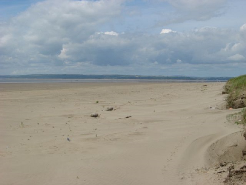
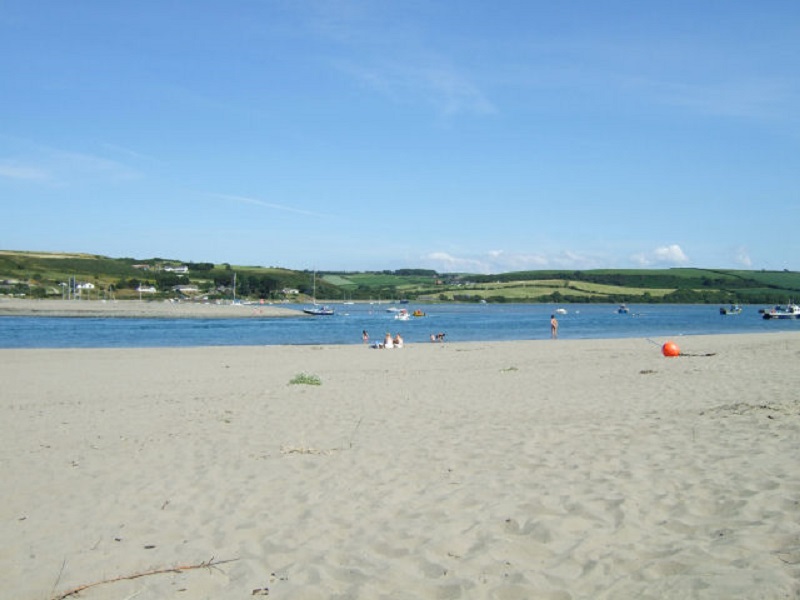
Poppit Sands, Pembrokeshire
Located at the mouth of the River Teifi estuary, Poppit Sands is a sandy beach located in a peaceful and tranquil setting. Like many beaches, although sand is present at high tide, it is when the tide goes out that the full extent of the beach is revealed – a wide area of sand flats. It is backed by a row of sand dunes vegetated with grass and shrub species.
How to find it:
A car park is located just behind the beach – the B4546 links the car park with the A487 just to the south of Cardigan. Co-ordinates: 52.1055787, -4.695417.
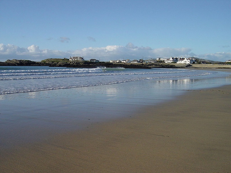
Trearddur Bay, Anglesey
With a great expanse of golden sand arching around a rocky bay, Treaddur Bay is a scenic place to visit and relax due to its location within a rather laidback seaside village. The bay is penned in by low, rocky cliffs on both sides, with some of the rocks only becoming visible during low tide.
How to find it:
A car park is located adjacent to the beach, on the B4545, which links to the A55 North Wales Expressway just to the south of Holyhead. Co-ordinates: 53.278685, -4.616727.
Rest Bay, Porthcawl
A wide and sandy beach on the southern Welsh coast, Rest Bay is very popular with surfers due to the high waves that blow in from the Atlantic Ocean and up the Bristol Channel. Although much of the sand is only visible outside of high tide, rugged rocky outcrops located along the shoreline are visible at all times. On the southern edge of the bay, these are particularly large, and make up a section of low cliffs.
How to find it:
A car park is located behind the beach, on a lane that turns off of Mallard Way. The A4106 road connects Porthcawl to the wider road network. Co-ordinates: 51.489735, -3.728726.
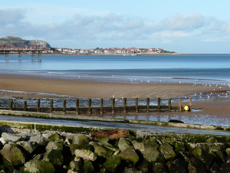
Rhos-on-Sea/Colwyn Bay Beach, Conwy
This 5 km (3 mile) long beach curves around Colwyn Bay, past both the town of the same name and the seaside town of Rhos-on-Sea. With a beach of shingle and sand, and many boats bobbing up-and-down in Rhos’ harbour, which marks the north-western limit to the beach, this is a rather scenic place to visit. Sand is particularly found towards the central part of the bay,
How to find it:
A road runs along the promenade along the entirety of the bay, along which street parking can be found. There is also a car park named ‘Porth Eirias’. The A55 North Wales Expressway runs close to the beach. Co-ordinates: 53.2985146, -3.727449.
All Blue Flag Beaches in Scotland
As of 2019, there are only five beaches in Scotland that retain a Blue Flag award.
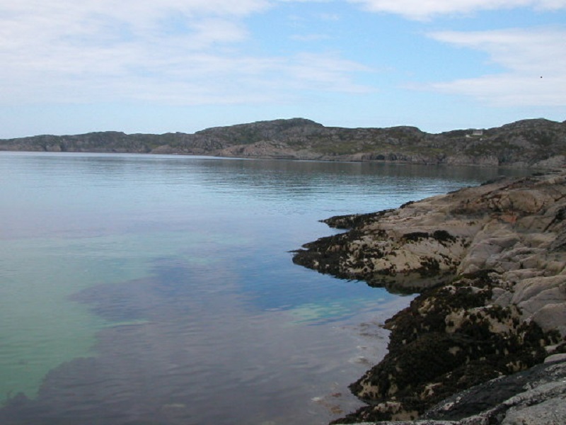
Achmelvich Bay, Lochinver
Nestled in between rocks on either side, the beautiful white sands of Achmelvich Bay are a beautiful sight, tucked in within some rather amazing scenery. Granite outcrops overlook the bay, with its clean turquoise-coloured waters and tidal rockpools only improving the natural quality of the bay even further.
How to find it:
The beach car park is located at the end of a single-track road, which turns off from the B869 at Achmelvich. Co-ordinates: 58.170015, -5.305746.
Elie Woodhaven (also known as Ruby Bay), Fife
Overlooking the outer reaches of the Firth of Forth to its south, Elie Woodhaven is a particular hotspot for wildlife. Due to its eclectic nature of golden sandflats and rock formations, the bay provides various habitats for many species – in particular, tidal rockpools within Ruby Bay contain periwinkles, dog whelks and sea anemones. Lady’s Tower overlooks the bay – this white, quaint building was built in 1770 for its use as a bathing house.
How to find it:
Parking is available next to the bay, which itself is located to the south of the village of Elie. The A917 runs through the village. Co-ordinates: 56.186714, -2.812224.
Waters of Philorth Beach, Fraserburgh, Aberdeenshire
Making up the eastern section of Fraserburgh Bay, this is a peaceful sandy beach backed by a large dune system and a nature reserve. A stream named the Water of Philorth – which gives its name to the beach – flows into the eastern side of Fraserburgh Bay, attracting a variety of bird species, including waders.
How to find it:
A car park is located behind the sand dunes, close to the Water of Philorth – it is at the end of a small lane which runs off from the B9033. Co-ordinates: 57.675654, -1.965655.
Silver Sands Beach, Aberdour, Fife
Overlooking Silversands Bay, itself a wide inlet on the northern coast of the Firth of Forth, this beach is characterised by an expanse of light-yellow sand. Bordered by a small headland to the south, and tree-covered slopes to the north, this is a peaceful jewel that contrasts with the port town of Burntisland, located around 2.5 km (4 miles) to the east of Silver Sands Beach.
How to find it:
Parking is located behind, or close to, the beach. Hawkcraig Road links the beach with the A921 at the village of Aberdour. Co-ordinates: 56.053873, -3.286333.
Burntisland Beach, Fife
Located just to the east of the port town of the same name, Burntisland Beach consists of an expanse of sand mixed in with pebbles. Despite its fairly close proximity to the dockyards at Burntisland, the beach has maintained a high standard of cleanliness, and is popular with visitors. Amenities such as food and other refreshments can be found close by, in the town of Burntisland.
How to find it:
Links Place, and other car parks, are located close to the beach. The A921 road runs through Burntisland. Co-ordinates: 56.061792, -3.224043.