
This coastal section stretches from the port town of Gretna, around the ear-shaped Rhins peninsula, and along the rest of the south-west Scottish coast, towards the England/Scotland border at the village of Gretna. Many wide bays and tidal inlets are located along the coast here, which is rather rural and wild, typically consisting of outstanding natural beauty. Although long sandy beaches exist here, sometimes evolving into sand flats (particularly in the River Eden estuary), large expanses of tall and rugged cliffs are also located along the shoreline.
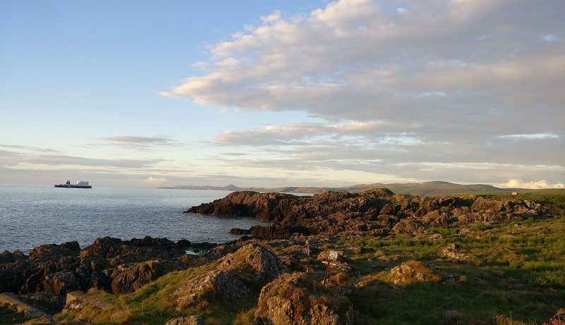
The Rhins of Galloway is a hammerhead-shaped peninsula located on the far southwestern edge of Scotland. It is connected to the mainland by a relatively small section of land on its eastern side. At 45 km (28 miles) in length, The Rhins is rather hilly, and consists of rugged cliffs on its northern, western and southern edges. With the Milleur Point and Corsewall Point headlands on its northern side, and the rocky Mull of Galloway promontory on its southern end, this is a dramatic section of coastline. The shoreline is particularly impressive to both the north and the south of Portpatrick, a picturesque seaside village on the western edge, with a small and enclosed harbour. To the north of the village, large cliffs wind their way around small bays and coves, including the small, sandy bay of Port Mora. To the south, the landscape is incredibly similar.
To the east of the Mull of Galloway, the vast 30 km (20 mile) wide Luce Bay expands across to the Machars peninsula. At the head of Luce Bay, a large sandy beach named Luce Sands stetches across the entire northern side of the bay, backed by a large system of sand dunes named Torrs Warren. However, due to the use of this bay, and its northern beach, as a Ministry of Defence testing area, public access to the beach is often rather limited, apart from a small section on both the western and eastern sides. Along the eastern side of the bay, the craggy shoreline re-emerges, with large cliffs and headlands characterising the costal landscape – these include the Mull of Sinniness and Barsalloch Point. However, a couple of small bays are dotted along the coast, including Monreith Bay.
By Rosser1954 – Own work, CC BY-SA 4.0, https://commons.wikimedia.org/w/index.php?curid=74064083
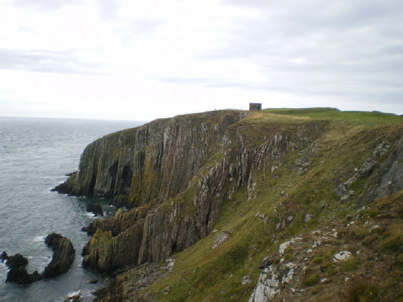
Both the eastern extent of the mouth of Luce Bay, as well as the tip of the Machars peninsula, are marked by Burrow Head, a dramatic headland with rock layers pointing more or less vertically downwards [1]. A village named The Isle of Whithorn sits on the rocky shoreline around 3 km (2 miles) to the north-east of Burrow Head – its white-painted buildings looking out across a small bay [2].
To the north, the stony shoreline continues northwards up the western side of Wigtown Bay – with a relatively flat marshy coastline, the bay consists of large tidal mud and sand flats. It is therefore no surprise that this part of the bay is a designated nature reserve, and is popular with many bird species [3]. The town of Wigtown overlooks the bay; it is renowned for its annual book festival, with a large number of independent bookshops located in the town. It is a rather peaceful and tranquil town [4].
On the eastern side of the bay, the shoreline borders steep hills, with cliffs near the Ravenshall Point and Ringdoo Point headlands. However, the large Fleet Bay also exists on this side, with its large sand flats that are exposed during low tide. Along the section of coastline between Fleet Bay and the large Kirkcudbright Bay, the landforms, rock crags and coves tend to be oriented in a south-south-west to north-north-east pattern – these are shaped by the flow of ice sheets during the last Ice Age, which peaked at around 20,000 years ago. Kirkcudbright Bay extends inland to the lively fishing port of the same name. As well as its fishing trade, the beautiful town of Kirkcudbright is also known for being a centre for creative artists over the past few centuries, including painters and craftworkers [5].
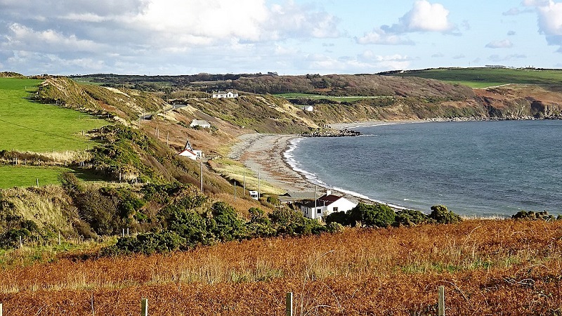
To the east of Kirkcudbright Bay, the coastline continues on its rugged way, entering the mouth of the Solway Firth – a large inlet that separates Scotland from England. Like the rest of the coastline, rocky cliffs and bays dominate the incredibly rural landscape. Auchencairn Bay and Rough Firth extend northwards inland – these are large tidal and salt flats, that are interspersed with small rocky peninsulas and islands, contributing even further to the natural beauty of the area. The small picturesque village of Rockcliffe overlooks the bay, with its sandy beach flanked by rocky outcrops [6].
Moving eastwards along the Solway Firth, the coastline gradually becomes less rocky and more gently sloping as the inlet narrows. Vast expanses of sand are exposed during low tide, and although some rocky outcrops flank sections of the coast, such as at Southerness Point, the shoreline generally consists of marshland. Caerlaverock nature reserve occupies a large section of sandflats, known as the Blackshaw Bank, towards the upper reaches of the Solway Firth, as well as a large area of marshland bordering the coastline [7]. East of here, the inlet narrows further, and close to the coastal village of Powfoot, the Solway Firth becomes the estuary of the River Eden.
With a large catchment area including the hills and mountains directly to the north, the Pennines to the east and the Lake District to the south, the Eden estuary is fed by two rivers – the Eden and the Esk. The River Esk marks the border between Scotland and England – however, just to the east of the small town of Gretna, the boundary makes a sharp northward turn. Therefore, this marks the eastwards extent of the Scottish coastline. Fittingly, the Scottish border town of Gretna is located just to the north of the River Esk – famous not only for being the first settlement that travellers from England pass, Greta is also renowned for its blacksmiths’ forgery, where, during the 18th and 19th Centuries, runaway English couples would marry at the age of 16 [8].
References
[1] https://www.walkhighlands.co.uk/galloway/burrow-head.shtml
[2] https://www.visitscotland.com/info/towns-villages/whithorn-and-the-isle-of-whithorn-p239301
[3] https://www.visitsouthwestscotland.com/attractions/wigtown-bay-local-nature-reserve/
[4] https://www.visitscotland.com/info/towns-villages/wigtown-p239291
[5] https://www.kirkcudbright.town/
[6] https://www.visitscotland.com/info/towns-villages/rockcliffe-beach-p314891
[8] https://www.visitscotland.com/info/towns-villages/gretna-and-gretna-green-p244351