There are currently 1114 locations in this directory
Abbotsbury, Dorset
Abbotsbury is an incredibly picturesque Dorset village, nestled in a valley around a mile from the sea. Lovely stone-built cottages line the streets that run through Abbotsbury, and a few cafes and a pub are located here. The famous Dorset writer Thomas Hardy set much of his work in the county – various film adaptations of his books have included Abbotsbury. The village is associated with a great deal of history, including the remains of an abbey founded in 1044, and the 14th century St Catherine’s Chapel, which sits on a hill overlooking the surrounding landscape. Abbotsbury is also surrounded by pleasant scenery – a subtropical garden is situated just outside of the village, and a wide range of exotic plant and tree species grow here. It is also located on Chesil Beach, and at the western end of a 13 km (8 mile) long tidal lagoon named The Fleet.
Aberaeron, Ceredigion
With a population of less than 1,500, the town of Aberaeron feels a lot more like a large village, with a small network of streets flanked by terraced 19th Century buildings. Aberaeron is well-known for its picturesque townhouses, which are painted in a variety of pretty colours, and overlook a large harbour filled with small boats. It is a popular tourist destination, with a small selection of restaurants, cafes, pubs and shops located here. The Harbourmaster Hotel, painted in a nice purple-blue colour, overlooks the harbour and the sea. A few independent craft shops are also located here, many of which are situated in a craft centre on the southern part of Aberaeron. The village is surrounded by pleasant scenery, with a sandy and pebbly beach located adjacent, and cliffs situated to the south-west.
Aberarth, Ceredigion
Aberarth is a rather pretty village nestled at the mouth of a river valley, on the banks of the Afon Arth, just before it flows into the sea. Traditional stone-built cottages Afon Arth make up much of the village, which are interspersed by narrow streets that wind around the houses. The Wales Coast Path runs through Aberarth, and links the village with a pleasant stony beach.
Abercastle, Pembrokeshire
Abercastle is a small and picturesque hamlet that is located at the head of a sheltered rocky cove. A few stone-built cottages make up much of the hamlet, and a patch of sand makes up the shore during low tide. The Pembrokeshire Coast Path runs through Abercastle and above the cliffs on either side of the hamlet, meandering around numerous rugged inlets and past several small rocky islands. Careg Sampson, a 5,000-year-old Neolithic burial chamber, is located just to the west of the hamlet, and is accessible via a footpath.
Abercorn, Lothian
The hamlet of Abercorn is located within a beautiful natural landscape, surrounded by lush woodlands and large fields, and placed just to the south of the Forth estuary. It is also situated within the Hopetoun Estate, close to an incredibly grand stately home named Hopetoun House. The hamlet is made up of a few houses and a stone church, parts of which were built in the 12th Century. A footpath winds down from the hamlet to the edge of the firth, where a network of paths provides great opportunities for walking through the coastal woodland. This can include following the shore to the village of Blackness, 3 km (2 miles) to the west.
Aberdaron, Gwynedd
Aberdaron is a pretty village that is located close to the tip of the Llyn Peninsula. A collection of traditional stone-built cottages makes up much of the village, along with several cafes, a restaurant and a hotel situated next to the shore. Aberdaron is surrounded by some pleasant scenery – it is nestled at the foot of a small valley, with a stream running through the village. A long sandy beach borders the village, providing views across Aberdaron Bay.
Aberdeen, Aberdeenshire
The port city of Aberdeen is located in north-eastern Scotland, around 150 km (90 miles) to the north of Edinburgh. It is a rather bustling city that attracts many visitors – Aberdeen is a large commercial centre, and has a great deal of history associated with it, including its well-regarded university. With a population of around 200,000, it is the third most populous city in Scotland.
Large areas of industrial docklands border the mouth of the River Dee. They are a relic of Aberdeen’s once-roaring fishing and shipbuilding industries, which have declined over the past few decades. However, the North Sea oil industry, and the ferry terminal, manage to keep the docklands alive today. At the mouth of the Dee, on the northern side of the river, stands Footdee, a small neighbourhood that sits at the end of Aberdeen’s Harbour. It consists of quaint townhouses and cottages that were constructed in the 19th Century to house Aberdeen’s fishing community, and is well-worth walking around to see what traditional life was like for those living on the coast.
A long sandy beach borders Aberdeen, stretching from Footdee in the south up towards the River Don. This is backed by as well an extensive esplanade – a large road flanked by large patches of coastal greenery, and a large golf course. Attractions for tourists include Codona’s Amusement Park, with its large array of funfair rides and arcade machines, and a series of adjacent cafes, restaurants and takeaway food venues. An Art Deco building named the Star Ballroom is also located on the esplanade, and regularly hosts events such as music concerts.
Aberdeen is home to two universities, the oldest of which was formed in 1495. Appropriately named the University of Aberdeen, it is placed in a beautiful part of the city, with cobbled streets and buildings made of granite stone that look like they are from a picture postcard. The main university buildings are incredibly grand, with the beautiful Elphinstone Hall and King’s College Chapel forming the centrepiece of the campus.
Aberdeen is a rather bustling city, with a large shopping centre, and a wide range of cafes, restaurants and pubs to choose from. It is also home to a large Maritime Museum, a glass-fronted building that is located on a street named Shiprow, and showcases the city’s maritime heritage. An art gallery, a grand 19th century building, is also placed in the city. The Aberdeen Science Centre, situated on Constitution Street, houses a collection of interactive science exhibits and workshops.
Looking out onto the North Sea, Aberdeen is one of the larger coastal towns in Scotland. Despite its industrial dockland parts around the mouth of the River Dee, Aberdeen has some rather scenic coastal features. One of these is Footdee, a small neighbourhood that sits at the end of Aberdeen’s Harbour – it consists of quaint townhouses and cottages that were constructed in the 19th Century to house Aberdeen’s fishing community. A long sandy beach borders Aberdeen, as well as an extensive esplanade that links Footdee in the south with the mouth of the River Don in the north. Attractions for tourists include Codona’s Amusement Park, with its large array of funfair rides and arcade machines, and a series of adjacent cafes, restaurants and takeaway food venues. Other attractions include the Star Ballroom, an Art Deco building that hosts events such as music concerts.
Aberdesach, Gwynedd
Aberdesach is a small hamlet located close to the start of the Llyn Peninsula. A few bungalows make up the settlement, which is bordered by a beach of large pebbles. The beach provides amazing views of the coastal peaks that border the northern side of the Llyn Peninsula, including the Yr Eifl mountains. A car park is situated next to the beach.
Aberdour, Fife
The charming village of Aberdour is renowned for its 13th-Century castle, the remains of which are located just next to the village centre. A collection of stone-clad cottages and townhouses make up much of Aberdour, with many flanking either side of the main road that runs through the village. Aberdour is located within some rather pleasant natural scenery, with the scenic bays and headlands that border the Firth of Forth to the south. Patches of woodland and heathland are located on Hawkcraig Point, which provides great views across the Forth. Two beaches flank the headland – Black Sands and Silver Sands. More here.
Aberdyfi, Gwynedd
Aberdyfi is a picturesque village placed on the northern side of the River Dovey (Afon Dyfi) estuary, built up against the steep slopes of south-western Snowdonia. A row of beautiful pastel-coloured townhouses lines the waterfront, facing the estuary, whereas cottages and independent shops flank Aberdyfi’s streets, adding to its 18th Century charm. Numerous guest houses and bed and breakfasts are located in the village. A long beach extends from the west of the village, stretching back to Tywyn and beyond – a row of sand dunes also borders the shore, along which runs the Wales Coast Path. A network of footpaths crosses the hills behind the village, providing amazing views of the Dovey estuary, and the surrounding landscape.
Abereiddy, Pembrokeshire
Located on the northern side of the St Davids Peninsula, Abereiddy is a small hamlet that includes a pleasant sandy beach that is flanked by rugged shores and cliffs. A handful of rustic stone-built cottages make up much of the hamlet. A disused slate quarry, nicknamed the Blue Lagoon due to minerals in the rock which have turned the water turquoise, is located to the north of Abereiddy. A rocky promontory extends out into the sea, providing excellent 360-degree views of the surrounding coastal landscape.
Aberffraw, Anglesey
The village of Aberffraw is located at the head of a small estuary, just north of where the Afon Ffraw flows into the open sea. It is a fairly quiet village made up of small terraced cottages, along with a general store, Post Office and country pub. It is located on the western side of the river – by contrast, the eastern side consists of a large system of sand dunes named Tywyn Aberffraw, which is a designated nature reserve. A footpath connects the village with a sandy beach that borders the sea.
Abergele and Pensarn, Conwy
The connected towns of Abergele and Pensarn are situated on the north coast of Wales. Abergele is a traditional small market town, with its high street placed around a kilometre from the Irish Sea. It has a parade of shops, including an assortment of cafes, restaurants and pubs. The 15th Century-built Gwrych Castle sits on a hillslope to the west of the town, overlooking the coast. Pensarn is situated directly along the shore – it is a quiet seaside town, with a small amusement arcade and several cafes along the seafront and in the town centre. A beach of shingle and sand stretches next to Pensarn, and brushes up along the northern side of Abergele. The views from the beach are impressive, with large hills to the south and west of the town, including the Little Orme peninsula in the distance.
Aberlady, Lothian
Aberlady is a small village situated around 22 km (14 miles) to the east of central Edinburgh. A pretty, tree-lined high street runs through the centre of the village, flanked by picturesque cottages and townhouses. The Old Aberlady Inn is also placed here, serving as a restaurant, a pub and a hotel. A large estuarine inlet separates the village from the Firth of Forth to the north. Luffness Castle – a grand stately home – lies less than a mile to the east of Aberlady.
Aberporth, Ceredigion
Aberporth is a charming village that is located in north-western Ceredigion, placed at the head of an idyllic bay. Although the bay is flanked with wild and rugged coastlines on both sides, it is filled with a large patch of fine golden sand, a Blue Flag award-winning beach that is popular with visitors. The village itself is a pretty collection of cottages and bungalows, which are interspersed by patches of lush greenery. A pub and restaurant, which is appropriately named The Ship Bar and Grill, is located on the seafront. A few cafes, shops and a wide range of guest houses and holiday cottages can be found in Aberporth.
Abersoch, Gwynedd
Located on the southern side of the Llyn Peninsula, Abersoch is a bustling village that is popular with visitors during the holiday season, who are attracted to its surrounding sandy beaches and beautiful scenery. A series of shops, including independent stores, are located in the centre of the village, along with a few pubs, restaurants and cafes. Borth Fawr, a lovely beach of smooth sand, is placed next to the village, and is host to both a sailing and a yacht club. Many guest houses and holiday lettings are available in Abersoch, and several camping and caravan sites are dotted just outside of the village.
Aberystwyth, Ceredigion
Aberystwyth is a town that is probably most famous for its university, regarded as one of the most prestigious educational institutions in Wales. It is also a rather popular holiday destination – located on the coast of west Wales, it includes a promenade that curves around a large bay, and a town filled with three or four-storey townhouses, independent shops, and other amenities that one would commonly find in a seaside town. These include the White Horse Hotel, made up of both a traditional guest house and a pub/restaurant. A great deal of history can be found in the town, such as the ruins of Aberystwyth Castle, which date back to the late 13th Century. A sandy beach curves around the bay, flanked by a large promenade and a row of beautifully-painted townhouses. The town is rich with tourist attractions – as well as a small pier and amusement arcade, a funicular cliff railway runs from the bay to the top of Constitution Hill, which overlooks the town. Spectacular views of the surrounding area are provided from the top of the hill – a camera obscura is also located here. More here.
Achiltibuie and Polglass
Like nearby Polbain, the linear conjoined villages of Achilitibuie and Polglass also face the Summer Isles, a small archipelago perched just off from the mainland. Despite its small size, this is the largest settlement for miles around, and so therefore contains a primary school, café and a Post Office amongst its cottages and bungalows. More here.
Achintraid., Highland
The hamlet of Achintraid is located at the head of Loch Kishorn, overlooking the spectacular mountains of the Applecross Peninsula, the towering peaks interspersed with large glacially-carved U-shaped valleys. A row of cottages makes up Achintraid, which curves around a small bay that is flanked by a pebbly shore. It is a quiet and serene place, with scenic woodland covering the hillslopes down to the water’s edge.
Achmelvich, Highland
Like Clachtoll, Achmelvich is also renowned for its lovely beach – a beautiful Blue Flag Award-winning arc of sand flanked by outcrops of granite. Although Achmelvich is a small hamlet, it is popular with visitors, and a campsite, youth hostel and a selection of holiday homes are located in and around the settlement.
Aignish, Lewis, Outer Hebrides
The small village of Aignish lies on the Eye Peninsula, next to the narrow strip of land that links it with the rest of Lewis. Consisting of a collection of cottages, a row of low cliffs separates the village from a small strip of sand and rocks that makes up the beach below. The natural landscape of the area is rather pleasant, with large patches of grassland surrounding the village. The coast of Lewis can be seen across the bay, meandering around headlands and inlets.
Aird of Sleat (or ‘Aird’), Isle of Skye
The Isle of Skye’s most southerly settlement, the Aird of Sleat is a small hamlet on the Sleat Peninsula. It is placed on the side of a coastal hill, close to the Point of Sleat, the island’s southernmost tip. Located amongst some rather wild scenery, the hamlet sits perched above the waves below, offering impressive views of the Sleat Peninsula, the Isle of Eigg out to sea, and the Scottish Mainland to the south east. Aside from a handful of cottages, the hamlet is also home to Aird Old Church Gallery, an art studio and shop located at the end of the country lane which runs through the settlement. A foot-only track provides an ideal hiking trail, connecting the hamlet to the Point of Sleat headland.
Aird Uig, Lewis, Outer Hebrides
The small village of Aird Uig is located on the western side of Lewis, with a nearby coastal landscape that is dominated by large cliffs and narrow inlets. Looking to the north-west from the lane that runs through the village, one can see the cliffs towering over a collection of rock stacks, and the islands of Seanna Chnoc and Bearasaigh in the distance. The cliffs contain a number of caves, although these can be submerged during high tide. The village was once home to a radar site operated by the Royal Air Force and NATO, located on Gallan Head just to the north of Aird Uig.
Aith, Mainland Island, Shetland Islands
Aith is a small village placed at the head of a large inlet named Aith Voe. Despite its small size, it includes a couple of schools, a leisure centre, a general store and a Post Office, due to it being the largest settlement in what is a rather remote area. The village has managed to keep a small fishing industry going, and thus a marina is located along the shore, which is filled with both fishing and pleasure boats.
Aldingham, Cumbria
Aldingham is a village on the southern coast of Cumbria, facing onto Morecambe Bay. It is a rather serene village, surrounded by trees and bordered by a shingle beach. Despite its small size, with only several cottages located here, a large church forms part of the village – St. Cuthbert’s, part of which dates back to the 12th Century. A grand manor house, built in the Gothic style, is situated in the centre of Aldingham, and is used today as a nursing home.
Allonby, Cumbria
Placed on the remote northwest coast of Cumbria, the seaside village of Allonby is bordered by a lengthy sandy beach, and is made up of a collection of terraced cottages and other buildings. The beach provides views across the Solway Firth, with the mountains of southwestern Scotland clearly visible when the weather is pleasant. A few caravan parks border the village, often filling with holidaymakers during the summer months. A fish and chip shop named The Codfather is located in Allonby, along with a hotel, restaurant and bar named The Ship Hotel.
Alness, Ross and Cromarty
The small town of Alness can be found close to the northern shore of the Cromarty Firth. A charming town of stone-built cottages and townhouses, a high street runs through Alness, flanked by a range of shops and a couple of cafes. The Station Hotel, a pretty restaurant, bar and hotel, is situated near the eastern end of the high street. Alness is known for its whisky-producing Dalmore Distillery, which is placed on the banks of the Cromarty Firth, and is open to visitors. The views across the firth are rather beautiful, with the slopes of the Scottish Highlands to the north, and the rolling hills of the Black Isle peninsula to the south.
Alnmouth, Northumberland
Once a port, the village of Alnmouth boomed as a holiday resort during the Victorian era. A collection of grand stone-built townhouses runs along the seafront, adding to the village’s charm. The high street, which runs up from the beach, forms the centrepiece of Alnmouth, and is flanked by traditional stone-built townhouses, shops and several traditional pubs and inns. The village is located within one of Northumberland’s Areas of Outstanding Natural Beauty, and unsurprisingly, the scenery surrounding Alnmouth is incredibly tranquil and scenic. The western side of the village provides great views across the estuary of the River Aln, whereas a beautiful sandy beach borders the sea on Alnmouth’s south-eastern side. Also, the woodland and grassland of nearby Alnmouth Common provide great opportunities for walking.
Altandhu, Ross and Cromarty,
The small hamlet of Altandhu overlooks a small bay, flanked by a rocky coast and an island named Isle Ristol, which is used as a nature reserve. Despite Althandu’s small size, a camping and campervan site is located in the hamlet. A traditional bar and restaurant named the Am Fuaran Bar is rather cosy inside, and includes an outside seating area that looks out onto the rocky bay.
Am Baile, Eriskay, Outer Hebrides
The village of Am Baile is the largest settlement on the small isle of Eriskay. Spread out along the island’s north-western corner, the village is placed on a lovely grassy slope that glides down gently to a beautiful beach of white-coloured sand. When the sun is out, the white hue of the sand just beneath the waves gives a water a beautiful turquoise colour, one which would be expected in the Mediterranean. A small rocky cove is located next to a part of the village named ‘Haun’. Am Baile itself is home to a pub, a post office, and several cottages which are used as holiday lettings.
Amble, Northumberland
Situated on the southern side of the mouth of the River Coquet, Amble is a small fishing village filled with terraced seaside cottages and a few seafood restaurants, amongst other features. Even to this day, the village retains some of its industrial heritage, with several small warehouses lining part of the seafront. However, the town is currently going through a bit of a regeneration – a small marina is located just to the west of the village centre, and is overlooked by a series of modern apartments. Amble Harbour Village also contains a series of modern and wooden retail ‘pods’ – built in the last 10 years, with the aim of attracting visitors. The sandy Little Shore beach borders the east of Amble and faces onto the North Sea – it is bordered by a series of pastel-coloured beach huts. With an annual puffin festival, Amble is a seaside village with a great amount of character.
Amlwch Port, Anglesey
Amlwch Port is a coastal village on the northern side of Anglesey. As its name suggests, it grew in size as it formed the port of the town of Amlwch, mainly due to its narrow inlet that acts as a harbour. A range of boats, including some fishing craft, still use the port today. Both the village and its larger town have a great industrial heritage – during the 18th and 19th Centuries, a deep copper mine extracted many tons of the metal. A visitor centre features exhibitions about its once-roaring copper industry. The village centre includes a few streets lined with terraced cottages, including a few takeaway food options and a pub named The Liverpool Arms.
Amroth, Pembrokeshire
The small village of Amroth is located in south-eastern Pembrokeshire, close to its border with Carmarthenshire. It is a rather picturesque village, with a row of cottages painted in pastel colours that face onto the beach, and a cosy stone-clad pub named the Amroth Arms. It is surrounded by some lovely scenery, with wooded coastal slopes that reach down to the shore, and a pleasant sandy beach. When the tide is very low, large numbers of tree stumps emerge from the waves – these are the remains of a petrified forest that has been dated back to around 5,000 ago, when the sea level was a little lower than it is today.
Anderby Creek, Lincolnshire
The small hamlet of Anderby Creek is rather popular with visitors, attracted to the pleasant natural landscape of the area. A long expanse of sand, bordered by a lush row of shrub-covered dunes, borders the hamlet. However, the coast is rather peaceful here compared to locations to the south. More here.
Angle, Pembrokeshire
The small village of Angle is located near the southern side of the Milford Haven Waterway, on the western edge of Angle Bay. It is a quiet village that is mostly made up of cottages and bungalows, along with a country pub named the Hibernia Inn. A 19th Century fort and battery is located to the north of the village, on top of a cliff that overlooks the Milford Haven Waterway – today, it is open as a museum. The shore of Angle Bay consists of mudflats – however, a fine sandy shore is located to the west of the village, at West Angle Beach.
Anstruther, Fife
Anstruther is a traditional Scottish coastal town that has a long history of being a fishing port. It is the largest community on the East Neuk of Fife, a section of the Firth of Forth’s coastline where it meets the North Sea. A row of quaint townhouses overlooks the seafront and the harbour opposite, whereas the town centre is filled with old stone buildings that flag twisting narrow streets. These include many picturesque cottages, independent shops, and a range of bed-and-breakfast style hotels and guesthouses. Although Anstruther’s fishing industry unfortunately dwindled during the 20th Century, the town is home to the Scottish Fisheries Museum, which showcases its fishing heritage. A large range of traditional fish-and-chip shop takeaways and restaurants can be found in the town, particularly along the sea front.
Anthorn, Cumbria
The small village of Anthorn lies on the northern bank of the River Wampool estuary, within an environment of extensive marshland, tidal sands and large mudflats. Anthorn owes much of its existence to a Naval air station which closed in 1958 – however, the village has remained during the decades since. It is split into two parts – an older row of cottages that flanks the estuary, and a 20th-Century housing estate that was constructed to serve the air station.
Applecross
Located on the western side of the peninsula of the same name, the village of Applecross (or Shore Street as it is known locally) is popular with visitors, despite its small size. The landscape and tranquillity of the surrounding area, including mountains, coastal woodland and the large Inner Sound to its west, attract people to this corner of Scotland, particularly during the summer months. The village is located on the side of a sandy bay, with a Heritage Centre, a 15th-Century chapel and a lovely walled garden located nearby. The Applecross Inn – a small pub and hotel – overlooks the shore, with a campsite placed next to the village.
Appledore, Devon
Appledore is a charming seaside village that sits on the side of the Torridge Estuary, directly opposite from Instow. It is a village of narrow streets that wind their way around quaint cottages, running down a hillslope to a large quayside. The waterfront is flanked by a series of colourful townhouses that face onto the Torridge. Appledore is renowned for its rich maritime history – it is built on fishing and boat building, and still clings onto these industries today. The North Devon Maritime Museum is located in the village, showcasing the heritage of the village and its surrounding area. Appledore is also home to a craft shop, several cafes, fish-and-chip shops and a few pubs. The Seagate bar and hotel is situated on the sea front, facing onto the estuary.
Arbroath, Angus
Like many towns on the eastern coast of Scotland, Angus has a rich heritage of being a fishing port. The town’s most famous product, the Arbroath Smokie, is line-caught smoke-cured haddock that is produced by several family-run smokehouses found around Arbroath Harbour. Unfortunately, the fishing industry has declined here over the past few decades; today, a marina sits within Arbroath Harbour. The old town centre hugs the coastline for around 600 metres/660 yards to the east, filled with traditional stone-built townhouses and cottages. A few pubs and cafes are dotted close to the shoreline, such as the Old Brewhouse. A large patch of green grass lines the shoreline to the west of the town; here, the Signal Tower Museum can be found. This showcases history relating to the Bell Rock Lighthouse, which stands next to the shore, and was constructed more than 200 years ago.
Ardaneaskan
Ardaneaskan is a rather remote Scottish village surrounded by woodland and rocky shores. Located at the end of a quiet country lane, it overlooks Loch Carron, with the grand peak of Càrn a’ Bhealaich Mhòir and the lovely coastal woodland towards Duncraig Castle placed just across the water. Ardaneaskan itself is a small village of mainly cottages, with a few bed and breakfast-style guesthouses located here.
Ardentinny, Argyll
The small and remote village of Ardentinny is placed on the western shore of Loch Long, tucked away at the foot of the steep wooded slopes that border the coastal fjord. The village is surrounded by amazing scenery, with fir and spruce-covered slopes that slope down to the shore and the hills of the Rosneath Peninsula opposite. A rocky shore borders the village, with Finart Bay – an inlet bordered by an arch of pebbles – located just to the north. The conifer forests that flank the steep slopes are part of Argyll Forest Park, which includes a wide variety of footpaths and trails that run up, down and along the hillslopes – some of these start at Ardentinny. A caravan site named Glenfinart Park is situated just outside the village, in the middle of a wide valley.
Ardersier, Highland
The village of Ardersier lies on the eastern side of the inner section of the Moray Firth. Filled with many cottages, it is popular with visitors due to its lovely scenery. The wide firth provides great views of the Black Isle – a peninsula covered in rolling hills – on the other side, and of the Scottish Highlands to the west. A beach filled with sand passes the village. Ardersier is also famous for Fort George – a large 18th-Century fortress – that is still used as an army barracks today.
Ardfern, Argyll and Bute
The village of Ardfern is placed on the south-eastern side of the Craignish Peninsula. It is a rather pretty village, not just for its white-washed and stone-clad buildings, but also for the tree-lined main road that runs through the settlement. The Galley of Lorne Inn, a traditional pub and hotel, overlooks the rocky shore, with great views provided from the beer garden. A store and post office are also located in the village, and a marina named the Ardfern Yacht Centre is placed along the eastern shore of Ardfern.
Ardminish, Isle of Gigha, Argyll and Bute
The only village on the Isle of Gigha, Ardminish is located on the eastern side of the island. It is made up of a few cottages, a post office and a small church. A short country lane links the village with the island’s ferry terminal, placed at the head of a sandy bay. A seafood restaurant named The Boathouse overlooks the shore. Achamore House, a grand stately home that has been converted into a lovely hotel, is situated to the south of the village, surrounded by a lush woodland. The Achamore Gardens, a well-managed collection of many tree and flower species, can be found within the grounds of the house.
Ardrishaig , Argyll and Bute
The large village of Ardrishaig is placed on the western side of Loch Gilp, a mere stone’s throw away from the town of Lochgilphead. The eastern end of the Crinan Canal meets the coast at Ardrishaig, with sailing boats moored away from the open sea. It is a vibrant village, with two cafes, a post office and a convenience store located here. The Grey Gull Inn hotel and restaurant, a grand white-painted building, overlooks the loch and its rocky shore.
Ardroil, Lewis, Outer Hebrides
Ardroil is a rather scattered village that mostly consists of cottages and a few farmhouses, all sprinkled around the Tràigh Uige bay. It is placed within a rather wild landscape, with rolling grass-covered hills surrounding the settlement, and the grey-coloured hills of Lewis’ interior visible in the near distance. During low tide, the bay retreats to reveal a large stretch of white-hued sand; named Ardroil Beach, it is backed by a row of sand dunes, adding to the area’s beauty. As well as a local museum, a community-run shop and the Uig Sands restaurant, a camping area overlooks the shore.
Ardrossan and Saltcoats, Ayrshire
The conjoined towns of Ardrossan and Saltcoats flank either side of South Bay, on the coast of Ayrshire. Ardrossan contains a large marina that is filled mainly with sailboats – the town has undergone some degree of regeneration in recent years, with modern apartments flanking its sides. The town provides ferries to the Isle of Arran, which is visible from the seafront, and the Kintyre Peninsula. South Bay is flanked by a long beach of golden sand, a slice of greenery and low-lying residential homes. The Lauriston hotel is also located here. Saltcoats is a more traditional town, filled with various townhouses, shops and chain stores, and several cafes. Around 1 km/0.6 miles to the west of Saltcoats, Stevenson Beach and sand dunes line the shoreline, providing great views across the Firth of Clyde.
Arduaine, Argyll and Bute
The hamlet of Arduaine is located on the Argyll mainland, overlooking the scenic Asknish Bay, an idyllic section of coastal woodland that flanks a series of large hills. Although it is placed directly on the A816 road, it is a rather quiet hamlet that is made up of a series of cottages. The Loch Melfort Hotel overlooks the bay, providing great views of the coastal landscape. The Arduaine Garden is located next to the hamlet; it is a colourful botanic garden rich with many different plant species, some of which are rather exotic in nature.
Ardvasar, Isle of Skye
The small village of Ardvasar is tucked away on the southern side of the Sleat Peninsula, just to the south-west of Armadale, a separate village in its own right. Surrounded by woodland and within easy reach of the rocky shore, the village is placed in a rather scenic area. The Ardvasar Hotel, which also includes a restaurant and bar, occupies a traditional white-painted building close to the coast. A few bed and breakfast-style guest houses are also situated in the village.
Ardwell, Dumfries and Galloway
The small village of Ardwell is placed on the eastern side of the Rhinns of Galloway, overlooking the vast open waters of Luce Bay. The village is bordered by a pebbly and sandy beach, which offers great views across the bay – the rolling hills of the Machars Peninsula to the east can be seen poking above the horizon. A couple of rows of cottages make up much of the village, a couple of which are available as holiday lettings. A camping and caravanning site borders the shore.
Arinagour,Iisland of Coll
The small village of Arinagour is the main settlement on the island of Coll. It serves as the isle’s port, with ferry services to Oban on the Scottish Mainland, and the neighbouring island of Tiree. Arinagour is placed on the western side of Loch Eatharna, a small rocky inlet on the southern edge of Coll. It is a quiet village, chiefly made up of a line of cosy terraced cottages that face the stony shore. A café, post office and a general store can be found here, as well as the Coll Hotel. A remote settlement, Arinagour – along with the rest of Coll – is great for those who are after a quiet getaway.
Arisaig, Highland
Placed at the head of Loch nan Ceall, the village of Arisaig is made up of a row of traditional cottages that overlook a beautiful rocky bay surrounded by swathes of woodland. Although it is located close to the A830 road, it is a rather quiet place that includes a Post Office, a pub, restaurant and hotel named The Old Library Lodge, and a bunkhouse. Arisaig makes an ideal base for exploring the surrounding coast, with its rocky shores and patches of white-hued sand. More here.
Armadale, Isle of Skye
Located only half a mile to the north-east of Ardvasar, the small village of Armadale is well-known for its ferry terminal, which directly links Skye with Mallaig on the Scottish Mainland. Like Ardvasar, it is surrounded by lush woodland, but is also flanked by a couple of small bays. With trees brushing against the rocky shore, splashes of sand that appear during low tide, and views of the Scottish Highlands to the east, the landscape in and around the village is rather scenic. Armadale Castle, a former seat of Clan Donald, is located just to the north of the village, and is surrounded by beautiful gardens. A general store, post office, and a clothing and gift shop can also be found in Armadale.
Armadale, West Lothian
Located next to a lovely bay of the same name, Armadale is a hamlet made up of a few cottages and farmhouses. As with much of Scotland’s coast, the scenery around Armadale is amazing, with great views of the large cliffs and rolling hills of the region provided from the hamlet. A sandy beach is located just to the east of Armadale, and rocky coves are situated just to the north of the hamlet.
Arnol, Lewis, Outer Hebrides
Although much of the village of Arnol is located around half a mile from the coast, the sea is within easy reach, with a small track connecting the coast with the village. Like much of coastal north-western Lewis, Arnol is surrounded by large plains interspersed by small lochs. This includes Loch Arnol, a lagoon that is build up behind the pebbly shore. The Blackhouse Museum, a traditional style of home that consists of a stone wall and a thatched roof, is located in the village. Blackhouses are part of the local area’s heritage, and the museum showcases how people traditionally lived and farmed the land up until the 20th Century.
Arnside, Cumbria
Arnside is a picturesque coastal village in south-eastern Cumbria. It grew in the 19th Century as a holiday resort, and includes a large parade of Victorian-built townhouses and independent shops. The village overlooks the outer reaches of the River Kent estuary, just before it enters Morecambe Bay – the peaks of the Lake District are visible in the distance on the other side, behind the rolling hills of southern Cumbria. Arnside is located next to a series of limestone hills, including the 159 metre (521 foot) high Arnside Knott, placed just to the south of the village. The surrounding landscape is great for walks and hikes, with a network of footpaths and tracks that run through woodlands, over hilly terrain and along the coast of Morecambe Bay.
Arrochar, Argyll
Placed near the head of Loch Long, and within the Loch Lomond and the Trossachs National Park, the village of Arrochar is well-known for its spectacular surrounding scenery. A series of rugged mountains known as the Arrochar Alps tower more than 800 metres (2,600 feet) high above the loch – their close proximity to the village means that Arrochar is a popular gathering place for mountaineers. Many of the surrounding slopes are covered in dense coniferous woodland, such as the nearby Ardgartan Forest, which are crossed by various footpaths and trails. The village itself is quite lively, with a couple of pubs, a general store, a fish-and-chip shop and a great range of guest houses and holiday lettings to choose from. Arrochar is located on the A83, and close to the A82 and a railway station, meaning that it is relatively easy to travel to.
Ascog, Isle of Bute
Ascog is a linear village on the eastern side of Bute, around 2 km (1¼ miles) to the south-east of the small town of Rothesay. It is a rather quiet and idyllic village, flanked by coastal woodland that glides down a hillslope to the pebbly shore. A series of residential homes, including a series of Victorian-built villas, face onto the Firth of Clyde, with the hills of Ayrshire on the other side of the water. Ascog Hall (a large manor house) is located in the village – it is situated next to a large Victorian fernery, where a selection of tropical fern and plant species are placed within a glasshouse.
Askam and Ireleth, Cumbria
Askam and Ireleth are two villages that have merged to form a larger settlement, which is located on the western edge of the Duddon Sands inlet. It is a mostly residential place, with a small high street flanked by townhouses and a parade of shops, and many other houses and bungalows. Several country lanes and footpaths connect the settlement to the edge of Duddon Sands, providing great views across the channel towards Black Combe, a 600 metre (1,968 foot) high peak on the other side, behind Haverigg and Millom. A footpath also borders the channel, following the coastline.
Atherington, West Sussex
Atherington is a small hamlet on the edge of the West Sussex coast, sandwiched between Middleton-on-Sea and Littlehampton. Made up of several cottages, it is mainly known for its nearby shore, named Climping Beach, which is a fine stretch of pebbles. Its rural location means that the beach is rather pleasant and unspoilt, and can be quite popular with visitors during holiday season. A beach café is placed by the shore.
Atwick, East Riding of Yorkshire
Located just to the north of Hornsea, and close to the North Sea coast, Atwick is a pleasant village, with old cottages huddled around a village green. The Black Horse serves as Atwick’s only pub, and overlooks the green. The coast is located around 0.5 km (550 yards) to the east – as is typical along this stretch of the East Riding of Yorkshire, a long sandy beach makes up the shore, bordered by a low clay cliff. More here.
Auchmithie, Angus
The small village of Auchmithie is located around 5 km (3 miles) to the town of Arbroath. The village is mainly made up of traditional single-storey cottages perched above a row of sandstone cliffs. A path connects the village with both the stony shore, which arches around a bay flanked by rocky promontories, and a derelict harbour that was once a thriving fishing port. The shoreline provides impressive views of the cliff formations.
Auldhame, Lothian
Although the hamlet of Auldhame consists mainly of a row of cottages and a farmstead, it is known for being close to both Seacliff and Oxroad Bay. Seacliff Bay has a lovely sandy beach that nests within a rather wild landscape, with luscious woodlands bordering the shore, and a series of rocky inlets, including Oxroad Bay, located just to the west. Tantallon Castle – a ruined 14th-Century fortress – sits above the crashing waves, on top of the rocks.
Aultbea, Ross and Cromarty
The pretty village of Aultbea is located within a tranquil landscape. Positioned on the side of Loch Ewe, the settlement curves around a large rocky bay, providing great views of the coastal hills that follow the shoreline to the south of the village. The peaks of the Scottish Highlands can be seen in the distance, with their great peaks visible from here. An area popular with visitors, there is a range of holiday homes in and around the village.
Aust, Gloucestershire
The small village of Aust is placed a short distance from the edge of the Severn estuary, next to the M48 Motorway and Severn Road Bridge. Built in 1966, the bridge was the first road crossing to traverse the Severn estuary, replacing a long-ceased car ferry. Aust is a great example of a contrast between the old and the new; it is a lovely village made up of old cottages and a cosy country pub, yet a modern-day service station is located just a stone’s throw away. A rocky shore borders the edge of the Severn Estuary, placed underneath a cliff made up of bands of red mudstone, black shale and cream-hued limestone. On the top of the cliffs, a lookout point at the service station provides great views across the estuary, and of the giant road bridge.
Avoch, Highland
Located on the western side of the inner section of the Moray Firth, the village of Avoch is a rather pleasant collection of stone-built cottages and townhouses that overlook the firth. The splendid Station Hotel is located in the village. A large marina mainly filled with pleasure boats lies by the village’s eastern end, although some fishing boats still dock here – fishing remains a significant contributor to Avoch’s economy
Ayr, Ayrshire
Away from the warehouses and dock that line the mouth of the River Ayr, the coastline bordering the town of Ayr is rather pleasant. With a 3 km/2-mile-long sandy beach bordering the town, it is little surprise that Ayr grew in popularity as a resort town for holidaymakers during the middle of the 19th Century. Today, it retains much of its Victorian character, with a wide stretch of pristine greenery flanking the esplanade, and a stone-built town tall (Ayr County Buildings) which faces the seafront. It is a vibrant town, with an adventure play park and other amenities in the Ayr Pavilion, and various pubs, cafes and traditional hotels located in and around the town. Ayr is also famous across Scotland, if not internationally, for being the birthplace of poet Robert Burns. Widely regarded as the national poet of Scotland, Burns grew up the suburb of Alloway, around 3km/2 miles to the south of the town centre.
Bacton, Norfolk
Bacton is a scattered village, which includes a small coastal area named Keswick, made up of a collection of houses, a couple of hotels, and a pub named the Poachers Pocket. A long sandy beach passes the village, which expands in width significantly during low tide. A small row of sand dunes is found to the north-west of the settlement. More info here.
Badachro
The small village of Badachro sits at the head of a small inlet. It is located within an incredibly scenic landscape, with coastal woodland rolling down from the hills to the water’s edge, the towering peaks of the Highlands to the north, and a general sense of serenity. The village is quite popular with visitors, attracted to the area by its idyllic charm – the local landscape is great for coastal walks. The village itself consists of a few cottages and bungalows, with holiday rentals located in the area.
Badcaul
The small village of Badnaul is located on the southern side of Little Loch Broom, a separate inlet located to the south of a more well-known Loch Broom. Placed on the A832, it is a quiet village that provides a magnificent view of the Scottish Highlands, their craggy peaks towering above the loch. It is made up of a cluster of homes and cottages; the Northern Lights Camping and Caravanning Park is situated just outside from the village.
Balemartine, Isle of Tiree
The small village of Balemartine is placed on the edge of the south-eastern part of Tiree. It is a small collection of cottages and farmhouses that lies within walking distance of Sorobaidh Bay, which is curved by an arch of smooth white-hued sand. Although cliffs are absent along this part of Tiree’s coast, the coastline is quite rugged, with outcrops of rock visible along the shore. Around 2 km (1.2 miles) to the south of Balemartine is the Skerryvore Lighthouse Museum, showcasing how Scotland’s tallest lighthouse – which is placed on a reef of rocks around 18 km (11 miles) to the south of Tiree – was built and is currently maintained. An old harbour is located next to the museum.
Balfour, Shapsinay, Orkney Islands
The island of Shapinsay’s only ferry link to the Orkney Mainland docks at the village of Balfour, located on the southern side of the isle. Here, a row of stone-built cottages flanks the main road through the village, looking out onto a large rocky bay. Balfour Castle – a grand stately home built in the 1780s – lies just to the west of the village. It currently operates as a hotel.
Balintore & Shandwick, Highland
The village of Balintore merges with the smaller village of Shandwick to create a conjoined settlement. A pleasant sandy bay borders Shandwick, bordered by a small row of grass-covered dunes. Balintore is home to a stone-walled harbour, and a high street flanked by rows of terraced cottages. A bronze statue of a mermaid – named The Mermaid of the North – sits on top of a boulder, on the rocky shoreline that stretches between Balintore and nearby Hilton. This is a rather quiet place, surrounded by a great amount of beautiful countryside and coastal landscapes, which are both ideal for walks.
Balivanich, Benbecula, Outer Hebrides
The village of Balivanich serves as the main centre of not only the island of Benbecula, but also of North and South Uist, and various other surrounding isles. Therefore, despite its small size, it is home to a few shops (including a small supermarket), a couple of takeaway food outlets, a small hospital and a post office. Benbecula Airport, which serves much of the southern Outer Hebrides, is placed next to the village. A lovely beach of white-coloured sand is located around 1.6km (1 mile) to the south of Balivanich; it is backed by sand dunes and flanked by a couple of rocky promontories, which adds to the scenic landscape.
Ballachulish, Highland
Placed around 3 km (2 miles) to the south-east of North Ballachulish, the larger village simply named Ballachulish is placed on the southern side of Loch Leven. It is a quiet village that is surrounded by stunning mountains, the lower slopes of which are covered in wild forests. A restaurant and bar named The Laroch is located in the village, as well as a visitor centre. A small promontory named the Ballachulish Peninsula stretches out for a few hundred yards into the loch, offering some amazing photo opportunities. The Isles of Glencoe – a rather modern and pleasant-looking hotel – is placed next to the shore.
Ballantrae, Ayrshire
Ballantrae is a rather pleasant village, with a long beach that provides great views of the coastal hills to the south, and of Ailsa Craig, which can be seen to the north. A series of cottages looks out onto the sea, with a selection of small traditional hotels and bed-and-breakfasts located here. The Ballantrae Festival of Food & Drink takes place in the village every June, along with a farmers’ market every second Sunday of the month between April and October. The hills of Ayrshire and Dumfries and Galloway flank the southern and western sides of the village, and provide a great rural landscape for walking and hiking.
Balmacara, Highland
Balmacara is a small and scattered village; placed around 4 km (2.5 miles) to the east of the Kyle of Lochalsh, it is placed on the northern banks of a large coastal fjord named Loch Alsh. Much of the village is made up of small fishing cottages, sheltered by a large slope covered with lush coastal woodland. An arch of sand curves around a small rocky bay, adding to the lovely scenery of the area. Another part of the village lies a few hundred yards inland, and takes the form of a Highland crofting estate, where traditional cottages are located. A visitor centre is placed here, which includes information about the heritage of the village.
Balmedie, Aberdeenshire
The large village of Balmedie has a rather suburban feel to it, with mainly relatively modern houses lining many of its streets and cul-de-sacs. The village is located close to a very scenic coastal landscape, which includes an extensive sandy beach, a large 23 km (14 mile) long sand dune system, and Balmedie Country Park, a lovely area of grassland and woodland. The area provides many great walking opportunities. More here.
Balmerino, Fife
The small village of Balmerino is famous for its 13th-Century Cistercian abbey – although it has been a ruin for the past 400 years or so, it attracts many visitors and tourists to the site. A few traditional houses make up the village, which overlooks the waters of the Tay Estuary. Its rural location means that Balmerino is an ideal starting point for walks through the surrounding landscape.
Bamburgh, Northumberland
The traditional and picturesque village of Bamburgh sits in the shadow of Bamburgh Castle, an 11th Century fortress built on top of a rugged volcanic outcrop. It was restored and partly rebuilt during the late 19th Century, and is open to the public, who can walk around its giant walls and through the grand rooms of its interior. Bamburgh itself is also rather impressive, with its terraced stone-built cottages centred on a village green covered with trees. The Castle Inn pub is located in the village centre. A lovely beach of yellow sand, and a line of sand dunes, are situated just to the north-east of Bamburgh, on the other side of the castle. More info here.
Banff, Aberdeenshire
Located on the north coast of Aberdeenshire, Banff sits on the western side of Banff Bay, facing the town of Macduff across the Deveron Estuary. The town centre is filled with many Georgian-era buildings, including large stone-built and nicely-painted townhouses, including Banff Castle, an old 18th-Century mansion house built on the side of a Medieval castle. Banff Castle is used today as a community arts centre, whereas Banff Museum – showcasing a collection of Banff silver – is also located in the town. A harbour sits on the northern edge of Banff, filled with small boats, whereas a quayside follows the coastline from the town and around a small headland to Boyndie Bay, located to the west of the town. Here, a row of quaint fishing cottages faces directly onto the rocky shoreline. More here.
Bangor, Gwynedd
Bangor is a small seaside and university town located on the coast of North Wales. It is surrounded by incredible scenery, with the giant peaks of Snowdonia to the south-east, and the rugged island of Anglesey to the west, separated from the mainland by the swirling currents of the Menai Strait. Bangor University is perched on top of a hill, overlooking the town – its grand Arts Building, opened in 1911, is a very prominent part of the town’s skyline. The town centre of Bangor is filled with a mixture of chain stores and independent shops, traditional pubs and eating venues. Bangor Promenade lies along the north-eastern side of the town, whereas Penrhyn Castle, a manor house built in the early 19th Century to resemble a Norman fortress, lies to the east of the town. However, a trip to Bangor is not complete without walking along its pier. Stretching out halfway across the Menai Strait, the pier provides spectacular views of the surrounding natural landscape, including the wooded slopes of Anglesey, the mountains of Snowdonia, and the cliffs and headlands of the North Wales coast to the east. More here.
Bantham, Devon
The small village of Bantham can be found perched on the southern side of the River Avon, one of many rivers in the United Kingdom to carry that name. The village is famous for its sandy shore, aptly named Bantham Beach, which is located just to the west. Flanked by sand dunes, it is a lovely beach of golden sand, and is popular with swimmers and surfers. Bantham itself is made up of a few cottages, and a small hotel and pub named The Sloop Inn.
Bardsea, Cumbria
Much of the small village of Barsea is a pleasant collection of cottages that line a narrow, twisting street. A cosy pub named The Ship Inn is located in the village. A sandy beach is placed to the south-east of Bardsea, providing great views across Morecambe Bay.
Barmouth, Gwynedd
The small seaside town of Barmouth is situated along the coast of north-west Wales. Overshadowed by a large hillslope, the town attracts many visitors due to its impressive sandy beach and spectacular surrounding scenery. A parade of Victorian-era townhouses overlooks the beach and promenade, with many stone-clad buildings making up Barmouth. A small amusement arcade and funfair are lined along the seafront, with pubs, cafes and takeaway food shops dotted around the town. The view from the beach and promenade is spectacular – to the south, large hillslopes and cliffs stretch out into the distance. Barmouth is within the south-westerly tip of the Snowdonia National Park – this is no surprise, as the natural landscape of the area is incredible. The estuary of the River Mawddach borders the town, forming a large valley that is flanked by wooded hills and rocky peaks. A bridge carrying a railway and a footpath stretches across the estuary, providing great views of the surrounding area. More here.
Barmston, East Riding of Yorkshire
The village of Barnston is located just a stone’s throw away from the North Sea. It is a rather small village, with many of its cottages and homes flanking Sands Lane, which runs through Barmston. It is a fairly popular destination for holidaymakers, with a large caravan parks between the village and the coast. Unfortunately, access to the beach is quite difficult due to a row of low cliffs. More here.
Barrow-in-Furness, Cumbria
Barrow-in-Furness is a large town that is located near the far south-western tip of Cumbria. A town built on industry, it remains an industrial centre even to this day, with shipbuilding a large contributor to Barrow’s economy. Parts of the town are rather pretty, with a grand red sandstone-built town hall – its impressive clock tower forms part of Barrow’s skyline. Parades of beautiful Victorian-built shops and townhouses form much of the town centre, including around Ramsden Square.
Barrow is a bustling town, with a shopping area, and a collection of cafes, restaurants and pubs located in and around the town centre. The Dock Museum, which showcases exhibits relating to the town’s industrial heritage, is situated on North Road. Walney Channel, a large tidal water channel, separates the main part of the town from Walney Island, which faces onto the Irish Sea. The western part of Barrow spreads out onto the island, and is linked to the rest of the town via a bridge. On the other side of Barrow, just outside of the town, are the remains of a Medieval abbey – the site is open to the public.
Barry, South Glamorgan
Barry sits on the coast of South Wales, around 11 km south-west of Cardiff, the country’s capital. Barry is a rather vibrant town, with a small town centre, and a large tourist-focused peninsula named Barry Island, which faces onto the Bristol Channel. Barry Island is bordered by a large swathe of sand that is backed by a promenade. A number of ice cream parlours, cafes and takeaway food outlets are located on the seafront, as is a large funfair named Barry Island Pleasure Park. Barry’s town centre is rather Victorian in style, with a parade of townhouses and shops on Broad Street, the main road that runs through the town. To the east of the town centre is Barry Waterfront – a series of modern apartments that overlook a large harbour. The coast to the west of Barry is rather interesting, with a series of rugged cliffs bordering the shore. This area is great for walking, with patches of woodland and open grassland along the clifftops.
Barton on Sea, Hampshire
Barton-on-Sea is a pleasant suburban-style village located in the far south-western corner of Hampshire. It is perched on top of a row of cliffs, with a footpath leading down to the pebbly and sandy shore below. The seafront provides wide views across Christchurch Bay, with the Isle of Wight – and its iconic Needles rock stacks – visible to the east. The beach is also a great place for finding fossils. A café and a seafood restaurant are placed on top of the cliff, with a selection of takeaway food shops and a pub located inland. Barton on Sea separates the town of New Milton from the sea – this is also a pleasant place to visit, and is home to shops, cafes and a few places to buy food.
Barton-upon-Humber, Lincolnshire
Placed on the southern bank of the Humber estuary, Barton-upon-Humber is a pleasant market town that includes a high street, and a network of streets flanked by terraced cottages. In the town centre, many of the buildings are Georgian in age, with traditional pubs and inns dating back to the 18th century located here. Barton is surrounded by a slice of northern Lincolnshire’s beautiful countryside, with open fields to its east, south and west, and large patches of marshland to its north. Open as a country park, the marshland connects to the Humber estuary, a large water channel that divides Lincolnshire from Kingston-Upon-Hull and the East Riding of Yorkshire. The bank of the estuary provides great open views across the channel, with the towering Humber Suspension Bridge located just to the west. A state-of-the-art visitor centre is located here, dedicated to the marshland and its rich wildlife. More here.
Bayble, Lewis, Outer Hebrides
The village of Bayble is divided into two smaller villages, named ‘Upper’ and ‘Lower’ Bayble. It overlooks a rocky bay named Bàgh Phabail, and is surrounded by many acres of rolling moorland. Although this part of the Isle of Lewis is not very high in altitude, the coastal landscape close to the village is rather rocky, with headlands flanking both sides of the bay. A country lane connects Bayble to a small sandy beach, with a jetty making up the village’s harbour.
Baycliff, Cumbria
A collection of traditional stone-built cottages makes up the village of Baycliff, which is located a quick walk away from the coast of Morecambe Bay. It includes a village green, a farm shop and a pub named The Farmers Baycliff, along with The Fishermans Arms Hotel, which overlooks onto the bay. A footpath links Baycliff with the pebbly shore, which gives away to miles of sandflats during low tide.
Bayhead, North Uist, Outer Hebrides
As is common on the western side of North Uist, which is where Bayhead is located, the landscape surrounding the hamlet consists of flat, grassy plains that are regularly interspersed by tidal lagoons and inlets. Bayhead sits at the head of one of these inlets, named Ceann a’ Bhàigh, which regularly exposes large patches of sand during low tide. The hamlet is home to a shop and post office, as well as the Tractor Shed, a bunkhouse which also offers camping pods to stay in.
Bayherivagh, Barra, Outer Hebrides
Situated on the north-eastern side of the island of Barra, the hamlet of Bayherivagh is made up of a few bungalows and cottages. It overlooks a slice of Barra’s rugged coast, with a small tidal inlet bordering the hamlet. A few places to stay, including the Heathbank Hotel, are scattered in and around Bayherivagh.
Beadnell and Benthall, Northumberland
The small conjoined villages of Beadnell and Benthall sit on a low headland that makes up the northern edge of Beadnell Bay. A lovely beach made of cream-coloured sand curves around the bay and brushes up against the settlement. A small harbour also makes up part of the coast, backed by a series of stone-built lime kilns dating back to 1789. Although there are no cliffs bordering the shore here, the coastline is rather scenic. The eastern side of the villages overlooks a rugged selection of headlands and inlets flanked by wild rocks, many of which are exposed during low tide.
Beaulieu, Hampshire
The picturesque village of Beaulieu is located in the New Forest, between the towns of Lymington and Hythe. Packed with history, and a selection of beautiful buildings, Beaulieu is definitely a place to explore when visiting the New Forest. Old and charming cottages line its streets, along with the lovely Montagu Arms hotel, and a traditional village pub named Monty’s Inn. Placed on the Beaulieu River, the village sits next to a lovely pond named Mill Dam, which is overlooked by Palace House, a stunning Victorian manor that is open to the public. The ruins of a 13th century monastery are also located next to the village, along with a lovely Victorian flower garden. The famous National Motor Museum is also located at Beaulieu, and boasts a collection of over 280 vehicles, from the earliest motor cars through to the vehicles of the past few decades.
Beaumaris, Anglesey
The small town of Beaumaris sits on the northern edge of the Menai Strait. Despite being a town, its small size makes it feel more like a large village, with a network of streets flanked by charming cottages and townhouses, and many quaint independent shops. A splendid seafront, also flanked by a terrace of townhouses, provides excellent views across the Menai Strait, with the peaks of Snowdonia visible in the distance. A pier extends its way into the strait, another viewing platform. The town is famous for Beaumaris Castle, a great fortress that was started by Edward I at the end of the 12th Century – although its walls were completed, parts of the castle have never been finished, including its moat, which curves around half of the fortress. Beaumaris Castle is open to the public. Other places of interest include Beaumaris Gaol, a Victorian prison, and the large St Mary’s and St Nicholas’s Church.
Bebington, Merseyside
A stone’s throw away from the banks of the River Mersey lies the town of Bebington, a charming suburban settlement. It is home to a small high street, a leafy stretch of parkland named Mayer Park, and a couple of restaurants and cafes. A 2015 study found that Bebington’s postcode area (CH63) is the most desirable in England for places of work, good schools and high employment. It is located next to Port Sunlight, a planned village and suburb that was built by the Lever Brothers, two industrialists, in the late 19th century. It consists of beautiful Arts and Crafts-style cottages, which are flanked by lovely gardens and tree-lined streets. Bebington is close to the banks of the Mersey estuary, where a coastal path runs along the channel at Shorefields Cliffs and Port Sunlight River Park.
Beer, Devon
The charming village of Beer is located on the western edge of Seaton Bay, in southeast Devon. It is placed at the head of a stony cove, where a pebble beach provides great views of the tall cliffs, which tower above both ends of the shore. Beer is placed within the Jurassic Coast, a UNESCO-designated world heritage site, and is surrounded by dramatic scenery. A wide range of footpaths, including the South West Coast Path, link the village to the surrounding countryside, providing a wide range of great walking and hiking opportunities. Beer itself is comprised of many stone-built cottages and townhouses, along a cluster of quaint cafes, restaurants and a couple of pubs. An arts and pottery shop, and a heritage centre, are also situated in the village.
Beesands, Devon
The small village of Beesands is located on the edge of Start Bay, a scenic inlet on the south coast of Devon. A pleasant beach of sand and shingle passes the village, with a row of gentle rolling hills located to its west, and a small lagoon named Widdicombe Ley to its north. This is a rather quiet part of South Devon, and is ideal for tranquil walks along the coast and through the countryside. Beesands is home to a cosy pub named The Cricket Inn, and a beach café, both of which can be found on the seafront.
Bembridge, Isle of Wight
Situated on the easternmost tip of the Isle of Wight, Bembridge is a charming village with a laidback atmosphere. A rather large village, it is home to a pleasant harbour, and is flanked by three beaches. Bembridge Harbour is located to the west of the village, and is frequented by sailboats, yachts and many houseboats. A sailing club, a café, and a nautical-themed pub and hotel named the Pilot Boat can be found within easy reach of the harbour. In fact, the village centre is placed not far from here, on top of a gentle hillslope. It includes an old church, a few shops, and another pub. The three beaches that surround the village are named Lane End, the Ledge and Bembridge Beach – each provides a great sliver of golden sand, and outcrops of rock that are exposed during low tide. At Lane End beach, a pier connects the seafront with a lifeboat station, a timber building that was constructed in 2010. A coastal footpath follows the coastline around the village, providing great views across the sea.
Bempton
Bempton is a civil parish and village located in the East Riding of Yorkshire, England, near the North Yorkshire border. It sits along the North Sea coastline and is positioned in close proximity to Flamborough Head, roughly 4 miles (6.4 km) to the north of Bridlington. The village is situated on the B1229 road between Speeton and Flamborough and benefits from transport links via Bempton railway station. This station is serviced by the Yorkshire Coast Line, a railway line connecting Hull to Scarborough.
Benderloch, Argyll and Bute
Benderloch is a small village that is located near the head of Ardmucknish Bay, in the shadow of Beinn Lora, a 308 metre (1,010 foot) high coastal hill that is covered in lush woodland. A sandy beach is situated next to the village, bordered by pockets of dunes. Therefore, a number of scenic walks are available through the forest to the summit of Beinn Lora, and along the coastline. Understandably, it is a popular destination for tourists, with a few caravan parks located in the vicinity. The village itself is home to a post office, a general store, a café and a petrol station.
Benllech, Anglesey
Benllech is a large village on the north-eastern side of the island. It is known for its pleasant beach – a strip of sand that is flanked by coastal woodland on its south-eastern side, and by a coastal road on the other. The village is popular with holidaymakers during the summer months, with a great selection of guest houses and holiday lettings in and around Benllech, and a large caravan park next to the village. Several restaurants and takeaway food outlets are located in the centre of the village, and a pub named The Benllech.
Bernisdale, Isle of Skye
The hamlet of Bernisdale is a long settlement, sandwiched in between large healthlands and the waters of Loch Snizort Beag. Being on a small hill, the hamlet provides impressive views of the mountains to the east, with The Storr being the most prominent.
Berriedale, Highland
The small village of Berriedale sits at the confluence of two rivers, which meet before reaching the sea a few hundred yards away. It is situated within a rather wild landscape, with two large and wooded river valleys, and a great section of rugged coastline just to its east. A collection of large cottages and a Post Office make up much of the village, with further buildings looking out onto the North Sea. The scenic A9 road passes through Berriedale, diving into the valley from the south, and then steeply climbing its northern side.
Berrow, Somerset
Located just to the south of Brean, the village of Berrow is a rather suburban-type settlement, with a collection of houses and bungalows that are located within easy reach of Bridgwater Bay. A golf course and a row of sand dunes separate the village from the shore, which is a lovely beach of golden sand. Like neighbouring Brean, the coast at Berrow provides great views across the Bristol Channel, with the Quantock Hills and the highlands of Exmoor visible in the distance to the west. Two rocky islands – Steep Holm and Flat Holm – can be seen in the Bristol Channel, to the north-west of Berrow.
Berwick-upon-Tweed, Northumberland
Situated in the north-eastern corner of Northumberland, the town of Berwick-upon-Tweed is rich in history, and has a lovely traditional character to it. Its location close to the border between England and Scotland, and at the mouth of the River Tweed, means that Berwick was at the centre of conflict for centuries, switching many times between English and Scottish control from the 10th century to the late 1600s.
The town centre is surrounded by a 16th century wall, with a large stone arch welcoming visitors into central Berwick at almost every entrance. The wall is a popular tourist attraction, and includes ramparts such as Meg’s Mount and King’s Mount, and look-out points such as Coxon Tower, which overlooks the mouth of the River Tweed. The Berwick Barracks, a striking 18th century building, is located within the town walls – once used by the military, it is open today as a museum.
A charming town, much of Berwick’s character is due to its centuries old buildings, many of which were constructed in the 17th and 18th centuries. Many townhouses, shops, cafes, pubs and restaurants are located in Berwick, flanking the numerous streets that wind their way through the town centre. A striking 18th century guildhall is placed on Marygate, the town’s main high street. A range of hotels, bed-and-breakfasts and holiday rentals are available in Berwick.
Bettyhill, Sutherland
The village of Bettyhill overlooks the impressive waters of Torrisdale Bay, which is surrounded by large coastal hills and a lovely sandy beach. Infact, the village is spoilt for choice when it comes to beaches – Farr Beach is located on the other side of Bettyhill. The local area provides great walking opportunities, with footpaths and country lanes in the area, allowing people to take in the area’s tranquil scenery. One of the lanes takes people down to Port Swingo, a secluded cove just to the north of the village. A few cottages, a general store, the large Bettyhill Hotel, a general store and a petrol station make up much of the village.
Bexhill, East Sussex
Bexhill-on-Sea is a seaside town located on the East Sussex coast in south-east England. Unlike Bournemouth and Brighton to the west, and Hastings to the east, Bexhill is a much more laid-back resort town. It is filled with many independent shops, cafes and numerous guest houses, all of which attract many visitors each year. Its 3-kilometre-long and mainly shingle beach is backed by a long row of apartments that face the English Channel. The 1930s-built De La Warr Pavilion is a great focal point along the town’s promenade – it is here that Bob Marley performed his first ever gig in the UK. The pavilion is located directly behind the King George V Colonnade, which provides a row of gift shops and a café. The town is also recognised as the birthplace of British Motor Racing, where the first race was held on the seafront in 1902.
Bigbury-on-Sea, Devon
The village of Bigbury-on-Sea is perched on the side of a coastal hillslope, a collection of houses that overlooks a fine beach of golden sand and a tidal island. A sandy cove is located just to the north of the village, flanked by cliffs and outcrops of rock, whereas a lovely stretch of sand is also placed to the south and east of Bigbury. Burgh Island, a rocky isle that is only reachable during low tide, is within a stone’s throw from the village, and is home to a pleasant hotel. The top of Burgh Island provides a spectacular 360-degree panorama of the surrounding coastal landscape.
Bigton, Mainland Island, Shetland Islands
Bigton is surrounded by Shetland’s wild scenery, with large moor-covered hills overlooking the village. It is made up of a collection of houses, as well as a community-run shop. A gentle slope runs down from the village to the rocky shore, where a bay separates the mainland from St Ninian’s Isle. This small island is connected to the mainland by the largest tombolo in the UK – a tombolo being a bar of sand or shingle that links an island with a much larger landmass. The runs of a chapel on the island have been found to contain Pictish objects, which were buried underneath part of it.
Birkenhead, Merseyside
Located on the northeast corner of the Wirral peninsula, the large town of Birkenhead is placed on the side of the Mersey estuary, where it faces onto the large city of Liverpool on the other side. A town built on a great industrial heritage, it still clings onto parts of its industry, with an active dockland area that is used for shipbuilding, transporting cargo and manufacturing. However, a couple of museums are also located on the town’s waterfront, including a U-boat exhibition and a replica of an early Victorian submarine. The Medieval ruins of Birkenhead Priory is also placed next to the docklands, with an unusual juxtaposition between the 11th century monastery and the large Cammell Laird shipbuilding site next door.
The town centre also contains a slice of history, with the beautiful Hamilton Square – a lovely park surrounded by Georgian townhouses – being a particular highlight. It is a bustling town, with a selection of shops, cafes and restaurants located in Birkenhead. The much larger Birkenhead Park is located to the west of the centre, and features a network of paths that wind their way past lakes and through patches of woodland.
Birling Gap, East Sussex
Despite a short row of cottages and a National Trust visitor centre making up much of Birling Gap, the hamlet sees many visitors and holidaymakers each year. Its location between the iconic Seven Sisters cliffs to the west, and the Beach Head promontory to its east, mean that large numbers of people pass through the hamlet, either on walks along the coastline, or down the short staircase to the pebble beach below. Impressive views of the Seven Sisters, which stretch majestically into the distance to the west, are provided from Birling Gap.
Birsay, Orkney Mainland, Orkney Islands
Birsay is a small village located near the north-western tip of the Orkney Mainland. The ruins of the ‘Earl’s Palace’ – a ruined 16th Century castle – lies in the village, and is open to the public all year round. St. Magnus Church is also placed in the village, surrounded by a small churchyard. Birsay is placed at the head of a large bay, which is flanked by Marwick Head to the south, and by Brough Head, a rocky tidal island, to the north.
Black Crofts and Achnacairn, Argyll and Bute
The neighbouring villages of Black Crofts and Achnacairn are placed on the northern banks of Loch Etive, merging to form a scattered settlement. The views from the settlement are rather scenic, with a nearside shoreline that is flanked by trees, the rolling hills on the other side of the loch, and the Falls of Lora – a turbulent water channel that connects Loch Etive with the open sea – to the west. Connel Bridge can be seen crossing the Falls of Lora – built in 1903, it originally acted as a railway bridge, but today carries the A828 road from one side to the other.
Blackdog, Aberdeenshire
A collection of semi-detached suburban houses makes up much of Blackdog, a small village located around 8 km (5 miles) to the north of Central Aberdeen. A wide sandy beach lies just to the east of the village, bordered by a row of sand dunes and a swathe of grass-covered fields.
Blackhall Rocks, County Durham
Blackhall Rocks is a small village located less than a mile from the coast, separated by grassy fields. It is mainly filled with semi-detached houses and bungalows, giving it a rather suburban feel. A row of cliffs borders the coast, with a small rocky headland located just to the east of the village. Access down to the shingle beach is rather easy, due to the presence of a well-maintained footpath.
Blackness, Lothian
The small village of Blackness is placed on the southern side of the Forth estuary, made up of a collection of cottages and townhouses. A charming nautical-themed pub and restaurant named The Lobster Pot is located in the centre of the village. Blackness Castle – a 15th-Century fortress – sits on a promontory to the east of the bay. It is shaped like a ship, with long and narrow walls that surround a fortress tower in the centre.
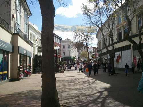
Blackpool, Lancashire
One of the UK’s most popular seaside towns, Blackpool is packed with a huge variety of attractions stretched out for several km along the north-west English coastline. The town gained popularity as a major holiday resort during the second half of the 19th Century – therefore, Blackpool has a distinctly Victorian-era feel to it. Many large guest houses, restaurants, cafes, bars and other venues make up much of the town centre. Major attractions within the town include numerous arcades, the large Pleasure Beach amusement park, Blackpool Zoo, three pleasure piers and the 158-metre-high Blackpool Tower. The town also includes the longest surviving tramway in Great Britain, and its annual Illuminations – an 8-kilometre-long light show along the promenade that typically runs from late August to early November each year. Blackpool is also bordered by a sandy beach that extends for more than 10km along its shoreline.
Blackwaterfoot, Isle of Arran
Blackwaterfoot is a small village located on the western side of Arran. With views across the sea to the distant Mull of Kintyre, the village offers some great coastal scenery. Sandy beaches stretch from the village to Drumadoon Point, a promontory located just under a mile to the west, upon which sits the largest Iron Age fort on the island. Blackwaterfoot itself is rather pleasant, with a number of cottages facing onto the sea, and the large Kinloch Hotel forming the centrepiece of the village.
Blakeney, Norfolk
Blakeney is a village of narrow streets and alleyways, twisting around flint-clad cottages, townhouses and independent shops, carrying a rather rustic charm. A small seafront overlooks a series of large marshlands crossed by the estuary of the River Glaven, which are used as a nature reserve. The Blakeney Hotel – an ornate flint-built hotel and restaurant – stands on the seafront. A boat trip from the village takes people around the marshes, which include a large seal colony managed by the National Trust.
Blue Anchor, Somerset
The small village of Blue Anchor is placed on the coast of western Somerset, where it overlooks the vast open waters of the Bristol Channel. A beach mostly comprised of shingle borders the village, providing great views across to North Hill, which is located on the other side of Minehead. The West Somerset Railway, a heritage railway that uses both steam and diesel locomotives, has a station at Blue Anchor. The village is also known for its large holiday park, which is placed next to the beach.
Blyth, Northumberland
Blyth is a coastal town situated in the southeast corner of Northumberland, where the River Blyth flows into the North Sea. Much of the town grew in the 18th and 19th centuries due to its booming industry, which has largely declined over the past few decades – however, its port still thrives to this day, and a number of warehouses are lined up along the side of the river. Blyth is a bustling town, with a range of shops, cafes, a few restaurants and a number of pubs to choose from – the town has regularly held a market since the 1700s, and today takes place on Market Square. Although an industrial quay flanks the town centre, its southern suburbs could not be more different – they are bordered by a lovely beach of golden sand, with a large patch of grass dividing the town from the North Sea. A bandstand and a café are located on the grass, along with a World War Two battery, which is open as a museum during the summer months.
Bo’ness, Stirling and Falkirk
On the southern side of the Firth of Forth estuary, around 7 km (4 miles) to the east of Grangemouth, lies the coastal town of Bo’ness. It has a small town centre filled with townhouses, and a collection of shops, cafes, an Indian restaurant and a pub, all of which is placed just a stone’s throw away from the edge of the firth. A large linear park separates the town from the shore, along with a couple of disused docks – a remnant of the town’s industrial past. A footpath follows the coast, providing a pleasant walking opportunity along the side of the estuary, and views across to Fife on the other side.
Bo’ness has a Roman connection, with the Antoine Wall – constructed during the 2nd century AD – reaching the Forth just to the east of the town. Although its course is well-documented, hardly any visible traces exist in Bo'ness. However, the Kinneil Estate, located to the west of the town, includes the partly excavated remains of a Roman Fort, along with a museum and an 18th century manor house. Other attractions in the town include the Museum of Scottish Railways and the Bo’ness Motor Museum.
Boddam, Aberdeenshire
Boddam lies around 4 km (2.5. miles) to the south of Peterhead. It is a pleasant seaside village, filled with traditional stone-built cottages that border a web of streets. Buchan Ness Lighthouse sits on a small headland, one of the most easterly parts of the Scottish Mainland, warning vessels of danger from the sharp rocks below. Like much of coastal Aberdeenshire, the coast is very rugged, with small rocky inlets divided by steep promontories. Although the cliffs around Boddam are not very high, their steepness makes climbing down to the shoreline rather dangerous outside of any proper footpaths. More here.
Boddin, Angus
The hamlet of Boddin lies close to Boddin Point, a small rocky headland that forms the northern side of Lunan Bay. The remains of a large 18th-Century limekiln stand at its seaward end, albeit at serious threat from coastal erosion. Although parking is limited in the area, it is worth visiting due to the wild, rugged coastline – although the cliffs are relatively low, rather impressive rocky landscapes cling to the shoreline. These include Elephant Rock, a natural arch that resembles the animal it is named after.
Bodinnick, Cornwall
Tucked away in a valley on the side of the River Fowey, the small village of Bodinnick stretches down to the water’s edge. It is located opposite the northern tip of Fowey, where a quay provides ferry services between the town and Bodinnick. It is a village of old cottages, many of which cling to the hillside, overlooking the waters of the river. The Old Ferry Inn, which has stood in the village for over 400 years, serves a range of local beers and tasty pub food.
Bognor Regis, West Sussex
Bognor Regis is a relatively quiet seaside town that is situated on the West Sussex coast, bordering the English Channel. Like many small English resort towns, it is filled with the usual shops and hotels that you would expect from a town of this size, including a small arcade, a high street, and several restaurants along the promenade. Despite being a pebble beach, golden sand flats and a series of rocks (named the ‘Bognor Rocks’) are exposed at low tide. The town also includes a pier, which is famously known for its annual ‘Birdman of Bognor’ content, where members of the public jump from the pier using home-made hang gliders and human-powered aircraft, and compete for distance travelled before hitting the sea. Hotham Park is located to the north-east of the town centre, and contains a miniature railway and a boating lake. In addition, a large Butlin’s holiday resort is situated along the coast, just to the east of Bognor.
Bolton-le-Sands, Lancashire
The large village of Bolton-le-Sands is located in the north-west of Lancashire, 6.5 km (4 miles) to the north of the historical city of Lancaster. However, history can also be found at Bolton-le-Sands, with its Holy Trinity church that dates back to around 1500, and the village centre which is made up of old townhouses and cottages. The Lancaster Canal, built in the late 18th Century, runs through the village – its towpath provides a quiet and relaxing walk down to Lancaster and beyond. A few places to stay can be found in the village, including the Royal Hotel, which is situated on the side of the A6 road. A couple of country lanes link Bolton-le-Sands with the edge of Morecambe Bay, which is located close to the village.
Bonchurch, Isle of Wight
Located just to the east of Ventnor, Bonchurch is a pretty village on the south side of the Isle of Wight. It lies on a coastal slope named the Undercliff, where it is sheltered beneath St Boniface Down, and brushes up against the shore. A pond forms the centrepiece of the village, flanked by a row of lovely stone-built cottages and a quaint café. Bonchurch also includes a church which dates back to the 11th century, and a sheltered cove named Monks Bay. The village is overlooked by St Boniface Down, the highest point on the island, at 241 metres (791 feet) high. Footpaths link the village with the summit, which provides amazing views of the English Channel, and across rest of the island, and on to Portsmouth.
Bootle, Merseyside
Known for its industrial docklands, the town of Bootle is located around 4 km (2.5 miles) to the north of central Liverpool, on the eastern edge of where the Mersey flows into the North Sea. The expansion of Liverpool means that Bootle is essentially a suburb of the larger port city, but began as a separate village in its own right before industrial expansion began during the 1700s. It grew rapidly as an industrial centre during the 18th and 19th centuries, with docks strewn along the side of the town – however, its industry unfortunately declined during the second half of the 20th century. Some of its docks and warehouses have managed to survive, however, with the state-of-the-art Liverpool2 freight terminal opened near the town in 2016. Away from the dockland areas, Bootle has a mainly suburban feel to it, with residential homes, a couple of recreation grounds, the pleasant Derby Park, and a shopping centre.
Borth-y-Gest, Gwynedd
Borth-y-Gest is a picturesque village made up of traditional seaside cottages that crowd around a cove, facing onto the estuary of the Afon Glaslyn. A small promenade provides great views across the estuary, with the peaks of Snowdonia looming on the other side. Some of the cottages are painted in nice, bright colours, which adds even further to the village’s charm. A bistro and a couple of cafes are located in the village, along with several holiday cottages.
Borth, Ceredigion
At 2.3 km (1.4 miles) long, Borth is a fairly long village that extends along the coast of north-western Ceredigion. Much of it consists of a single street flanked by bungalows, terraced cottages, several cafes and restaurants, and a pub named The Sands. It is bordered by a large sand and pebble beach that runs down from Ynyslas towards the cliffs at Upper Borth. During low tide, it reveals an ancient submerged forest, where tree stumps have been preserved by the peat. The beach, along with Borth’s surrounding landscape, make the village attractive to visitors, with a few caravan parks and numerous holiday lettings located in and around the settlement. The southern part of the village is named Upper Borth – here, a row of cliffs divides the village from the shore, providing great views of the coast of west Wales.
Borve and Ruisgarry, Berneray, Outer Hebrides
Two small conjoined villages named Borve and Ruisgarry form the largest settlement on the island of Berneray, a small isle placed just to the north of North Uist. Made up of a collection of cottages and small bungalows, much of the settlement curves around Loch a’ Bhàigh, a rocky bay flanked by a harbour on its western side. Displays of the island’s heritage are shown at the Nurse’s Cottage, which is run by the Berneray Historical Society.
Boscastle, Cornwall
Boscastle is a charming Cornish harbour village of stone cottages and townhouses, which slope down from the top of a hill to the head of a tight rocky cove. A couple of breakwaters make up its harbour, which shelter a narrow inlet from the waves of the Atlantic. Once a busy port during the 19th Century, it is mainly used today for fishing and pleasure boating. The harbour area is perhaps the most beautiful part of the village, with centuries-old buildings that line the slopes of a valley, and overlook the harbour itself. A collection of shops, restaurants and a range of holiday cottages are located in Boscastle – however, the village is also famous for its Museum of Witchcraft and Magic, which has been described as the largest collection of such objects in the world. More info here.
Bosham, West Sussex
Located on the side of a tidal inlet, Bosham is a charming coastal village located 5.5 km (3.5 miles) to the west of Chichester. A row of old brick-built cottages faces directly onto the shore, divided from it by a narrow street. The tide often comes in right up to the side of the cottages, which are protected from the waves by a brick seawall. A café and a traditional pub named The Anchor Bleu are placed close to the shore, with an arts and crafts centre also located in the village. An old church is situated in Bosham, surrounded by a churchyard. Evidence shows that the area upon which the village stands was inhabited by the Romans. According to the legend, Bosham is where King Canute commanded the tide to go back out, and of course, failed in his attempt.
Bossington, Somerset
Situated around a mile to the north-east of Porlock, Bossington is a small village that is nestled beneath the side of a large hill. It is made up of cosy cottages, along with a beautiful thatched café named Kitnors. Bossington Hill overlooks the village – it forms part of the Hornicote Estate, which is owned by the National Trust, and is known for its lush ancient oak woodland that flanks its south-western slope. The top of the hill provides amazing views of the surrounding landscape, with the moorland of Exmoor to the south, the coastal woodland of northwest Somerset to the west, and the open expanse of the Bristol Channel to the north. Located close to the eastern end of Porlock Bay, the village is in easy reach of a cosy pebble beach. More info here.
Botallack, Cornwall
Located near the westernmost tip of Cornwall, the small village of Botallack is located on a hill above the towering Atlantic cliffs. Placed in the heart of the Cornish Mining World Heritage Site, a large disused tin mine is located just to the north of the village; its engine houses are located between Botallack and the cliff edge, a couple of which cling to the base of the cliffs, just a few feet above the Atlantic. The coastal landscape is very dramatic, with rugged coves and rocky headlands that rise up from the waves. Botallack itself is a small village of granite-built cottages and a cosy pub named The Queen’s Arms.
Boulby, North Yorkshire
Consisting of a row of houses and several farmhouses, the hamlet of Boulby provides impressive views across the North Yorkshire countryside, with the surrounding rolling hills, and the grey cliffs meandering along the coast. At around 200 metres (660 feet), the cliffs to the north-west of Boulby are some of the highest in England. Despite its rural setting, the area was once the site of alum mines, with mining taking place along the cliff. However, this industrial practice is long gone, leaving behind a wild coastal landscape. More here.
Bouldnor, Isle of Wight
Bouldnor is a hamlet that is situated on the northern coast of the Isle of Wight, just to the east of the small town of Yarmouth. Much of the hamlet is made up of large houses and villas that take advantage of the sea view – however, a viewing place is perched just above the shore, providing a great vista across the Solent. Bouldnor Forest is located next to the hamlet- it is a large woodland that contains a network of footpaths and a disused World War II battery. A submerged prehistoric settlement site is located just offshore from Bouldnor, and is estimated to be around 8,000 years old.
Boulmer, Northumberland
The quiet fishing village of Boulmer is made up of a series of cottages, stretched out in a line overlooking the coast. A sandy beach borders the village, with lengthy outcrops of rock exposed during low tide. A pub, restaurant and hotel named the Fishing Boat Inn sits along the shoreline, with a lovely terrace that provides great views of the sea.
Bournemouth. Dorset
Situated on the Dorset coastline, the seaside town of Bournemouth is a popular destination for visitors from many parts of Great Britain, and also functions as a university town. It is famous for its long and light-yellow sandy beach that stretches from Boscombe in the east across to Sandbanks in the south-west, and is backed by a promenade upon which sits a row of intermittent beach huts. A low but steep cliff also borders the coastline, which is frequently traversed by small valleys (known locally as chines) which connect the beach to the town behind it. The beach’s main focus is at Bournemouth Pier, upon which sits a restaurant and other attractions. An aquarium named the Oceanarium is also located just to the east of the pier. Bournemouth town centre itself is rather bustling, and is packed with numerous shops, hotels, bars and nightclubs, and is also known for its Lower Gardens – a scenic park located in the middle of the town.
Photo: GBC
Bowmore, Isle of Islay
Founded in 1768, the village of Bowmore was the first settlement in Scotland to be laid out in a grid pattern. Several streets meet each other at right angles, lined by distinctive white-washed cottages and a small range of shops. It is a charming village that is accompanied by a harbour, the circular Kilarrow Church and, of course, Bowmore whiskey distillery, which offers guided tours. A range of hotels, guesthouses and holiday lettings are available in the village.
Bowness-on-Solway, Cumbria
Bowness-on-Solway lies on the southern side of the Solway Firth, the large channel of water that separates southwest Scotland from northwest England. Despite being a rather small village, it is well-known for being the western terminus of Hadrian’s Wall Path, along-distance walking trail that stretches for 135 km (84 miles) from here to Wallsend, near Newcastle-upon-Tyne. Although the wall does not exist here, its course would have met the Solway Firth at the eastern end of where the village stands. Bowness-on-Solway is a small village of cottages, with a 12th-Century church, a café and the Kings Arms Inn located here.
Bradwell Waterside, Essex
Situated on the northern side of Essex’s Dengie peninsula, Bradwell Waterside is home to a small collection of houses, as well as a pleasant country pub named the Green Man. A large and scenic tidal inlet, an estuary served by the River Blackwater, runs to the north of the hamlet. Despite its small size, Bradwell Waterside is quite popular with visitors and holidaymakers – Bradwell Marina, regularly filled with yachts and other pleasure boats, sits next to the hamlet. A caravan park is also located here.
Brae of Achnahaird
Brae of Achnahaird is a small hamlet situated just to the west of a pleasant sandy beach backed by a small dune system. The area surrounding Brae is rather untouched, with a vast expanse of beautiful natural scnery. A coastline of wild cliffs and headlands stretches to the north of the village, along the north-eastern side of the large Rubha Na Còigeach headland. A series of rugged mountain peaks can be seen in the distance to the south-west of the village, looming over the horizon.
Brae, Mainland Island, Shetland Islands
The village of Brae sits at the head of two large inlets – or voes as they are locally referred to. These are Busta Voe, located to the south of the village, and Sullom Voe, which is placed to the north. It is a village of cottages, more modern homes and other amenities including shops, a leisure centre and a pub named the Mid Brae Inn.
Brancaster, Norfolk
Brancaster is a rather charming North Norfolk village, made up of quaint terraced cottages and townhouses. The village is known for its festivals, including a Christmas Market and the summer Outdoor and Wildlife festival. Brancaster also boasts a great deal of hotels, guesthouses and places to buy locally-caught seafood. A glorious beach of golden sand lies around 1.2 km (0.7 miles) to the north, backed by a row of sand dunes – when the sea recedes during low tide, a vast extent of unspoilt sand flats is exposed, and is ideal for kite surfing.
Branscombe, Devon
Branscombe is a lovely village that is surrounded by some rather picturesque scenery. Located just a stone’s throw away from the shore, it is nestled in a quiet valley flanked by steep slopes and patches of lush woodland. A cluster of cottages make up the village, including the quaint Masons Arms Inn, and an old thatched forge that is open as a museum. A country lane and a footpath follow the valley down to the beach, a decent patch of shingle that is surrounded by towering cliffs. This part of South Devon’s coastline is part of the Jurassic Coast, which runs from Exmouth to Swanage, and is recognised for its archaeological and geological importance.
Braystones, Cumbria
Popular with visitors, particularly during the summer months, Braystones is a small village located in rural Cumbria, just to the west of the Lake District National Park. Although the main village of Braystones is separated from the coast, a large caravan site links the settlement to the pebble shore. Its rural location means that it is great for quiet walks along the coast, and within the surrounding rural countryside. Its west-facing location means that the village often sees great sunsets.
Brean, Somerset
The long village of Brean stretches along a 3 km (2 mile) section of Bridgwater Bay, flanked by a beach of fine golden sand, and a row of sand dunes that helps to protect the village from the Bristol Channel. Although a number of cottages and bungalows make up part of the village, much of Brean is comprised of holiday parks. A large number of caravans are rented out during the holiday season, with people attracted to the sandy beach, along with the scenic Quantock Hills, which are located not far from here. Brean Down, a rocky coastal hill that juts out into the Bristol Channel, is situated to the north of the village.
Bridgend, Isle of Islay
Bridgend is a rather scattered village that is made up of various cottages, the Bridgend Hotel and a couple of shops. However, it is also home to Islay House, a grand white-painted stately home that stands three storeys high above the surrounding landscape. Placed at the head of Loch Indaal, the scenery around the village is rather beautiful, with pockets of dense woodland interspersed with large green fields. A marshland divides the village from the loch, located next to a great expanse of sand that appears during low tide.
Bridlington, North Yorkshire
Bridlington is a small and traditional seaside town that looks out onto the North Sea, with views of the Flamborough Head promontory to its north. Two long and golden sandy beaches border both its northern and southern sides, separated by a small harbour filled with fishing boats. One of the town’s most renowned features is the Old Town, which is characterised by its charming and quintessentially British feel. Narrow streets and alleyways twist around historical buildings, many of which date back to the Medieval era. As well as numerous traditional pubs, hotels and independent shops, the Priory Church – dating back to 1113 AD – can also be found here. Two large festivals are also held in the Old Town each year – one in summer and one in the winter. Bridlington also has more modern features as well, such as the Bridlington Spa, an Edwardian-era theatre venue which stages variety shows and other forms of light entertainment.
Brighstone, Isle of Wight
Brighstone is a charming village located in the south-western part of the Isle of Wight. It includes a twee village centre, where a cluster of old cottages, a thatched village store, and a cosy pub named The Three Bishops, face onto the main road that runs through Brighstone. A medieval church, a tea room and a youth hostel are also located in the village, along with an 18th century cottage and sculpture garden. Brighstone lies less than a mile away from the coast – a beach of golden sand and pebbles that is sheltered by a row of cliffs. Different types of fossils, including dinosaur fragments, are often found on the beach.
Brightlingsea, Essex
Placed at the mouth of Brightlingsea Creek, a tidal estuary that meets the mouth of the River Colne, Brightlingsea is a small coastal town in north-eastern Essex. Unlike the hustle and bustle of Clacton-on-Sea (located 9 km (5.5 miles) to its east), Brightlingsea is a more laidback seaside town, with a quiet promenade lined with beach huts, a beach of golden sand, and a grade II listed tower placed just above the shore. The promenade stretches westwards from the town, flanked by the estuary on one side and a nature reserve on the other. A rather village-like town centre forms the centrepiece of Brightlingsea, with a small village green and flower garden, a couple of parades of shops, and a selection of cafes and pubs. A new pleasure marina flanked by modern sea-facing apartments makes up the waterfront, and is located to the south of the town centre. The Brightlingsea Museum, a local heritage museum, is situated in the town, on Station Road.
Brighton, East Sussex
Brighton is a popular and highly-regarded seaside resort town that is located on the south coast of England. Forming part of the city of Brighton and Hove, Brighton is a huge tourist hub, and a great cultural and entertainment centre. It grew in popularity during the late 18th and 19th centuries as a holiday resort, particularly for affluent people from London. Many of its buildings reflecting this, with grand Georgian-era villas and townhouses that face onto the seafront, and flank a web of streets that stretch inland. Over the past 200 years, the town has become popular with many people, and is home to a wide range of different attractions.
Brighton Pier is perhaps the most known of its attractions. Stretching out into the sea, it is home to a large amusement arcade, a fine seafood restaurant and a bustling fun fair placed at the end. A range of attractions are spread out along the seafront, including a Sea Life aquarium, a large 162 metre (531 foot) high viewing tower, and a mile-long miniature railway named the Volks Electric Railway, which runs from the aquarium towards Brighton Marina. Many gift shops, cafes and food stands can be found on the promenade, which face onto Brighton’s large shingle beach.
Away from the seafront, the splendid Royal Pavilion is located in the centre of Brighton – it was constructed by King George IV to resemble the grand architectural styles seen in India, and was used as a former royal residence. The beautiful Pavilion Gardens surround the Pavilion, whereas a museum and art gallery, built in a similar style, is situated next to the gardens.
Brighton is also home to a wide range of shops, cafes, restaurants and bars. The Lanes, the oldest part of Brighton, is located just behind the seafront – having existed as a fishing village before the late 18th century, it is a network of streets and twisting alleyways that is home to many old pubs, trendy bars, restaurants that specialise in many cuisines, and a range of quaint independent shops. The North Laines area is placed even further from the seafront, close to the railway station – it is a more bohemian part of Brighton, containing record stores, vintage clothing shops and hipster-style pubs and cafes.
Brighton Marina is situated just outside of Brighton, at the far eastern end of the seafront. As well as being home to many sailboats, it includes a range of restaurants, a bowling alley, a cinema and a shopping centre.
Brims, Hoy, Orkney Islands
The hamlet of Brims lies at the southern tip of Hoy, with rugged cliffs on one side and the Aith Hope inlet on the other. The Longhope Lifeboat Museum is located on the edge of the shore, bordering Brims; it is home to the famous Thomas McClunn lifeboat, which saved 308 lives during her service. The shoreline along Aith Hope provides an impressive panorama of the coastline around the bay, as well as the hills of Hoy to the north.
Brinian, Rousay, Orkney Islands
The village of Brinian is located on the southern side of the island of Rousay. It provides the only ferry link to the Orkney Mainland, and is made up of a series of residential homes, bungalows and older cottages. A large area of moorland, which makes up a significant proportion of the island, lies just to the north of the village, covering the summit of Knitchen Hill.
Brixham, Devon
Clustered around a working fishing harbour, the town of Brixham is situated on the South Devon coast, on the southern side of a large bay named Torbay. The town spreads out from the harbour on its western, southern and eastern sides, stretching their way up the hillsides which overlook the bay. Brixham is filled with narrow streets that twist their way around many small shops, fishing cottages and pastel-coloured town houses. Despite being one of the UK’s busiest fishing ports, the town has a rather quiet and relaxed feel to it. Brixham is a hub for artists to showcase their work, with several art galleries dotted around the town centre – an annual arts and craft market is also held next to the harbour every Saturday between Easter and the end of October. Various festivals are also held in the town every year, including Brixham Pirate Festival and a family friendly festival named BrixFest.
Broad Haven, Pembrokeshire
Placed on the edge of a lovely beach of golden sand, the village of Broad Haven attracts many visitors, particularly during the summer months. Owing to its west-facing orientation, the beach is popular with surfers. Geologically speaking, Broad Haven is interesting for its coastal landscape, with a rock stack and a couple of natural arches located just to the north of the beach. The village itself includes a bar, an inn, an Italian restaurant and a convenience store. A range of holiday cottages and a youth hostel are also located here. A small promenade runs along the edge of the shore, providing great views out to sea, with the tall cliffs of south-west Pembrokeshire meandering away into the distance. The St Davids Peninsula can also be seen on the horizon.
Broadford and Harrapool, Isle of Skye
Two villages merge at the head of Broadford Bay to form a larger settlement, the second-largest on the Isle of Skye. It is placed within the shadow of Beinn na Caillich, a 732 metre (2,401 foot) high mountain, and next to a large woodland that provides pleasant walking opportunities along the coast. The settlement includes a Co-op supermarket, a few pubs and restaurants, and a large number of guest houses and holiday rental cottages. The Dunollie Hotel is located towards the Broadford end of the settlement, whereas a Youth Hostel is situated just to the north. The location of Broadford and Harrapool on the A87 road and fairly close to the nearest train station (Kyle of Lochalsh) mean that it is well-situated as a base for tourists, who can explore the rest of the island from here.
Broadstairs, Kent
Located at the eastern tip of the county of Kent, Broadstairs is a quintessentially English seaside town that became a popular resort during the 19th Century. It has a rather quaint town centre that is filled with many shops that maintain a Victorian-era feel to them, each of them run independently and handed down through many generations of the same family. The town was a holiday spot of famous English author Charles Dickens, who often visited Broadstairs – the town boasts a museum dedicated to the author, as well as the Charles Dickens pub and restaurant, which overlooks the seafront. Broadstairs is also no stranger to annual festivals – a three-day food festival is held in the town every autumn, along with a Charles Dickens-themed festival in June and a folk week in August. The town also overlooks Viking Bay – a stunning arc of golden sand that curves around a large cove.
Brodick, Isle of Arran
Located on the eastern side of the Isle of Arran, the village of Brodick is the largest settlement on the island. Placed on the edge of a large bay, Brodick overlooks the Firth of Clyde, along with great views of Arran’s jagged peaks to the north-west, and sweeping coastal forest to the north. It a charming village, with a row of traditional stone-built buildings placed along the waterfront, many of which are used as independent shops or guest houses. A fine sandy beach borders the village, next to a slice of greenery. A ferry service runs from Brodick to Ardrossan on the Scottish mainland.
Brogaig, Isle of Skye
The small coastal village of Brogaig arches around the head of Staffin Bay, never directly adjacent to its shore, but well within its reach. Like many settlements on the Isle of Skye, it is a sprinkling of cottages and farmhouses interspersed with patches of lush green grass used chiefly for sheep grazing. A shop, a post office, and a range of holiday cottages form part of the village. A country lane connects the eastern side of Brogaig with the rocky shore that makes up much of the beach. This provides great views of the towering cliffs to the north, and a small island named Eilean Flodigarry. The lane also links to An Corran Beach, tucked in beneath a sheer cliff.
Brook, Isle of Wight
The small village of Brook is located on the south-western side of the Isle of Wight. It lies in close proximity to a splash of golden sand, which is sheltered from the land above by a row of cliffs. Although countryside covers large parts of the island, this part of Wight is particularly rural, meaning that is one of the quieter beaches on the isle. However, it attracts swimmers and kite surfers, and is of particular interest to fossil hunters – as well as dinosaur footprints and other ancient fragments, a fossilised forest of large tree stumps appears from the beneath the waves at Hanover Point, a small headland that is close to the village. Brook itself consists of a few cottages and larger houses – a Victorian church sits to the north of the village, and is known for its beautiful stained-glass windows.
Brora, Highland
The charming and historical village of Brora is located around 60 km (36 miles) to the north of Inverness. Like many villages in Scotland, it is packed full of traditional stone-built cottages, with the quaint Sutherland Inn – a hotel, pub and restaurant – placed on the A9 road which runs through the centre of Brora. The peaks and moors of the Scottish Highlands are located only a few miles to the west of the village, whereas a lovely stretch of golden sand borders the coastline next to Brora. Although it is quite a popular destination during the summer months, Brora is a rather quiet and tranquil place for much of the year.
Brough, Caithness
Whereas Scarfskerry is the British mainland’s most northerly settlement, Brough is the its most northerly village. It is, however, a rather small village – between 50 and 60 people live in its single-storey cottages and bungalows. A small country lane winds down the coastal cliff into a cove flanked by rocks, where a small slipway extends into the water. The village is located a few miles to the south-east of Dunnet Head, a large and scenic headland that makes up mainland Britain’s most northerly point
Broughty Ferry, Angus
Broughty Ferry is a pleasant seaside town that is located on the northern side of the River Tay Estuary. Historically, the town played a part in the area’s fishing and whaling industry, and a row of fishing cottages flanks the seafront, baked by a neighbourhood filled with many old cottages and townhouses. Broughty Castle forms the centrepiece of the town’s seafront, a stunning late 15th-Century fort that was rebuilt in the 19th Century as part of the area’s defences. Today, both a museum of the area’s heritage and an art gallery are located in the building. A long sandy beach and an esplanade flank the eastern side of Broughty Ferry, backed by stone-clad houses, some rather modern apartments and a pristine nature reserve. The town can be rather vibrant, particularly during the summer months, with a great deal of pubs, places to eat and independent shops located in the town centre.
Bruichladdich, Isle of Islay
The small hamlet of Bruichladdich is well-known for its distillery, and the brand of whisky that shares its name. The distillery is open to the public; a visitor centre is located inside part of the building. Like many of Islay’s settlements, the hamlet itself is made up of white-washed cottages, many of which look out onto the waters of Loch Indaal.
Buckhaven, Fife
Sandwiched between East Wemyss and Methil, Buckhaven is a pleasant town on the northern side of the Firth of Forth. A collection of stone-built townhouses, a general store, a pub and a café make up much of the town centre, which is within easy reach of the coast. A building housing a library and local heritage museum is located in the town centre. A narrow park separates the town from the shore, providing sweeping views across the water – the hills of Lothian are visible on the other side on clear days. The Wemyss Caves, which hold Britain’s largest concentration of Pictish carvings, are located at the village of East Wemyss, around a mile to the south-west of Buckhaven. The Fife Coastal Path links the town with the caves, and makes for a pleasurable walk along the coast of southern Fife.
Buckie, Moray
Despite its small size, the burgh town of Buckie is rather bustling, with a large harbour and marina, and a compact town centre. Although its fishing industry has declined over the last 100 years, it is still a fishing hub, with many trawlers operating from the harbour. The town centre, with its traditional stone-built cottages, townhouses and other buildings, sits on top of a small hill that overlooks the seafront. Buckie’s shoreline is generally rugged – a small street or footpath follows the shore as it winds its way around small headlands and bays. Fishing cottages line the coastline, as does Buckpool Harbour Park, with its neat flower garden. A large golf course – Buckpool Golf Club – is situated just to the west of Buckie, perched on top of a low hill, where it overlooks the sea.
Buckler’s Hard, Hampshire
Placed on the side of the Beaulieu River, Buckler’s Hard is a lovely 18th century shipbuilding village. Much of the village consists of two rows of beautiful terraced cottages, which have been unaltered since they were built, and retain their original Georgian style. A maritime museum is located at Buckler’s Hard, along with a hotel aptly named The Master Builder’s. The village looks out onto the Beaulieu River, a beautiful estuary that is surrounded by the quiet and tranquil woodland of the New Forest. A marina is placed on the banks of the river. The Solent Way, a long-distance path, links the village with Beaulieu, which is located around 3 km (2 miles) to the northwest.
Bucks Mills, Devon
Nestled within a wooded valley, Bucks Mills is a small village made up of charming cottages, which straddle a narrow lane that runs to the edge of a cliff. Cars are prohibited from driving through the village to the shore, meaning that it is a quiet and serene place. A rocky beach sits below the cliffs, strewn with pebbles and larger rocks. A waterfall tumbles down to the shoreline, adding to the wild natural landscape.
Bude, Cornwall
Situated in the most northerly extent of the county of Cornwall, Bude is a small seaside town facing the Atlantic Ocean. It is a rather relaxed town, with a great choice of local amenities, and a large sandy beach that stretches far out into Sir Thomas’s Pit bay during low tide. There is a great range of hotels, guest houses and restaurants in the town, including ‘The Barge’ – a tearoom located on a barge moored on Bude Canal, and ‘The Carriers Inn’, a more traditional style of pub and restaurant. Pubs and independent shops are also commonplace, many of which are family-run businesses. Summerleaze Beach borders the town to the its west – it is filled with beautiful golden sand, and also includes Bude Sea Pool, a semi-natural swimming pool that is topped up by the tide every day.
Budleigh Salterton, Devon
The south-east Devon seaside town of Budleigh Salterton is one of many seaside towns that is located on the world-famous Jurassic Coast, close to its most westerly extent. It is a rather unspoilt and scenic town with a rich historic heritage. Many of its buildings are cottages, townhouses and independent shops, and are painted in nice colours, adding to the town’s charm. Restaurants, pubs and fish and chip shops are also found in Budleigh. Two museums are located in the town – Brook Art Gallery and Fairlynch Museum & Arts Centre. The natural landscape in and around Budleigh is incredibly scenic – a 3 km-long pebble beach borders the southern side of the town and its surroundings. Furthermore, the town is bookended on both its east and western sides by distinctively orange-coloured sandstone cliffs, and taking scenic walks along the clifftops is highly recommended.
Bull Bay, Anglesey
The most northerly village in Wales, Bull Bay is located on the western side of the bay with which it shares a name. A rugged coastal landscape passes the village, which includes rocky shores, low cliffs and a series of narrow inlets. The village itself is made up of a few cottages, with a couple of large guest houses located here. The Isle of Anglesey Coastal Paths runs through the village and along the clifftops to the north of the village. More here.
Bunnahabhain, Isle of Islay
The hamlet of Bunnahabain is located on the side of a rocky bay on the eastern coast of Islay. It owes its existence to a large whisky distillery, a large warehouse-type building placed next to the shore. It is a rather remote settlement that is surrounded by acres of heathland, which attracts a rich variety of wildlife.
Burghead, Moray
Burghead is a small town that sits on the north-eastern side of Burghead Bay, located on a rocky headland. It is a pleasant town, filled with many stone-built cottages – unusually for Scotland, the streets are arranged on a grid system. Like many towns in the area, Burghead once had a large fishing industry that has reduced considerably over the past few decades – however, its small harbour is still used by some fishing trawlers as well as recreational sailboats. A rocky shoreline divides the northern side of Burghead from the North Sea. However, on the southern side, the landscape is much different – a 10 km/6-mile-long sandy beach curves around Burghead Bay, backed by a row of sand dunes that only add to the impressive landscape. Roseisle Forest – a vast forest of pine trees – borders much of the beach, providing a great area for walkers.
Burnham Norton, Norfolk
Burnham Norton is located in North Norfolk off the A148 and is a small village north of larger village Burnham Market. There are no shops or pubs in the village, and it is a very peaceful place, offering wildlife and nature and a perfect road to Norton Beach. The tide sometimes allows safe passage to Scolt Head Island and its scenic views.
Burnham Overy Staithe, Norfolk
The village of Burnham Overy Staithe sits along the estuarine reaches of the River Burn, opposite a large patch of North Norfolk marshland. Fishing boats sit along the waterfront, backed by an old boathouse. The village has a quiet charm to it, with a tree-lined road running through it, flanked by cottages and a country pub named The Hero.
Burnham-on-Sea, Somerset
Burnham-on-Sea is a seaside town situated at the mouth of the River Parrett, facing the Bristol Channel. It is known for its large sandy beach around which much of the town curves around, with its southern end beginning at Burnham’s town centre, whereas the northern end reaches the start of a long row of sand dunes. It is famous for having Britain’s shortest pier – built on concrete stilts from 1911 to 1914, it is an impressive Edwardian-era pavilion that is attached to the promenade on one end. It is used today as an amusement arcade. Burnham contains many buildings which date back to the 18th and 19th Centuries, especially along the promenade, including numerous townhouses and one hotel – the Royal Clarence Hotel – which dates back to 1796. Other hotels, guest houses, bars and restaurants can also be found in Burnham-on-Sea.
Burnmouth, Scottish Borders
Located close to the Scotland-England border, Burnmouth is the first Scottish village passed by travellers on both the East Coast railway line, and the A1 road. The village consists of a relatively newer collection of houses above the cliffs, and a couple of rows of houses that stretch along the foreshore. With an operational harbour, Burnmouth remains a working fishing village to this day. Views from the foreshore provide great views of the towering cliffs, as they meander off into the distance.
Burntisland, Fife
Burntisland has a mix of different areas along its seafront, ranging from warehouses and industrial docks, a large area of coastal greenery, and a sandy beach. A small sailing club exists among the docks – apart from this, all leisure activities are located on the eastern side of the town. Here, a large green open space lies next to the coast, which is occupied by a large funfair during the summer months. The town centre is filled with old townhouses, and there is a wide selection of shops, restaurants and pubs to choose from in the town. The golden sand of Burntisland Beach curves around a small bay to the east of the town. Incredible views across the Firth of Forth are provided, with the port of Leith, the city of Edinburgh and the Pentland Hills, visible on the other side of the estuary.
Burravoe, Yell, Shetland Islands
The small village of Burravoe lies in the south-eastern corner of the island of Yell, on the edge of a coastal inlet named Burra Voe. The village was built here due to its sheltered location, and consists of a number of pretty white-painted buildings, including the oldest, which dates from the 17th Century and is used as the Old Haa Museum. A small marina borders the rocky shore.
Burray Village, Burray, Orkney Islands
Burray Village is the only village on the island of Burray. It is placed on the southern side of the island, and overlooks Water Sound, a large coastal inlet. A collection of cottages and bungalows make up the village, as does the Sands Hotel, which also contains a bar and a restaurant.
Burry Port, Carmarthenshire
Placed at the junction of the Loughor estuary and Camarthen Bay, Burry Port is a small and charming seaside town that is known for its lovely sandy beaches. The main town is divided from the shore by a linear park, a patch of greenery and sand dunes that adds to the pleasant coastal landscape. Burry Port Harbour – a pleasure marina – is situated just to the south of the town, and is often filled with sailboats and small yachts. It is famous for being the place where Amelia Earhart landed after her flight across the Atlantic back in 1928 – a monument to the record-breaking aviator is located in the town, on Stepney Road. A breakwater stretches out into the estuary, upon which stands a small lighthouse, providing a lovely vista across the channel. The rolling hills of the Gower Peninsula are visible on the other side.
Burton Bradstock, Dorset
The charming Dorset village of Burton Bradstock is located just a stone’s throw away from the coast. Stone-built cottages make up much of the village centre, with a country pub named The Three Horseshoes, a Post Office, and a church that was restored in 1897 in the Arts and Crafts style. A country lane and a couple of footpaths link to village to Hive Beach, a stretch of sand and pebbles. The northern end of the beach is flanked by limestone cliffs with a yellow hue to them – they glow a lovely gold colour in the sunlight. The village borders Dorset’s Jurassic Coast, with fossils often being exposed in the cliff face after rock falls. A beach café and a seaside restaurant are placed next to the shore.
Burton Ferry, Pembrokeshire
Burton Ferry is a small and elongated village that runs along the northern side of the Daugleddau estuary. Much of the village is a collection of cottages and larger homes, many of which overlook the water. A short waterfront runs along the side of the estuary, providing great views of the A477 Cleddau Bridge, a road crossing that runs through the western side of the village. A pub named the Jolly Sailor is located on the waterfront, with a beer garden next to the shore.
Burwick, South Ronaldsway, Orkney Islands
A small collection of farmhouses and a church makes up much of Burwick, a small village close to the southern tip of the Orkney island of South Ronaldsay. It is most known for its summer-only passenger ferry crossing, which links the isle with John o’ Groats.
Cadgwith Cove, Cornwall
As the name suggests, the small village of Cadgwith Cove is placed at the head of a beautiful rocky cove, a sheltered and idyllic inlet on the eastern side of the Lizard peninsula. It is a traditional fishing village, with a collection of lovely thatched cottages, and a few fishing boats resting on the pebble beach. The South West Coast Path winds its way through the village, and on top of the cliffs on either side, providing amazing views of the wild coastal landscape.
Caernarfon, Gwynedd
Caernarvon is a small and charming seaside town in north-western Wales. It is famous for its 13th Century castle, an impressive fortress that overlooks the western end of the Menai Strait. It is open to the public, and attracts tens of thousands of visitors per year. Caernarvon’s town centre – which itself is comprised of many centuries-old buildings – is enclosed by a large Medieval castle wall. A wide selection of traditional pubs, cafes and shops can be found in the town, as well as numerous guest houses. A seafront extends from the walled town along the coast of the Menai Strait, providing impressive views of the surrounding landscape, with the island of Anglesey visible straight ahead. A marina filled with yachts and sailboats lies to the north-east of the town, overlooked by a café and a modern restaurant. Galeri Caernarfon – a music venue and performing arts centre – is located along the waterfront. More here.
Cairndow, Argyll and Bute
The coastal hamlet of Cairngow sits close to the head of Loch Fyne, on the western edge of the Cowal Peninsula. It is a quiet settlement, with a row of cottages that border the loch, providing scenic views of the mountains on the other side. The Cairndow Stagecoach Inn, a hotel and restaurant, is located here. The Ardkinglas Woodland Garden, an arboretum that contains a range of large conifers, and a network of quiet woodland paths, is placed to the south of Cairndow.
Cairnryan, Dumfries and Galloway
The village of Cairnryan sits on the eastern shore of Loch Ryan, around 8 km (5 miles) to the north of Stranraer. It is well-known for its two ferry terminals that link Scotland with Northern Ireland. However, the rest of the village is a pretty settlement of terraced cottages lined up along the coastline. A bed and breakfast and a couple of holiday lettings are located in Cairnryan.
Caister-on-Sea, Norfolk
Great Yarmouth. One of the most easterly points of the United Kingdom, Caister overlooks the North Sea, and is a rather laidback seaside town that is popular with holiday-makers. The shoreline is made up of a long sandy beach that is bordered by a long row of grass-covered sand dunes. Holiday parks are rather commonplace in Caister – however, the town centre contains amenities such as pubs, restaurants and shops. This includes the grade II listed pub named the ‘Never Turn Back’ – built in the Art Deco style in 1957, it is named as a memorial to commemorate the nine lifeboatmen who lost their lives in the Caister lifeboat disaster in 1901. However, the town also contains some Roman history, with the partially excavated remains of a Roman fort dating back to 200AD.
California, Norfolk
California village is located North from Great Yarmouth off the A47 and has a population of around 900 inhabitants. It is home to a magnificent sandy beach below wonderful cliffs which makes it a very popular destination for holidays as it there are several holiday parks & resorts in the village. It was supposedly given the name California in 1848 after people found gold coins on the beach.
Callanish, Lewis, Outer Hebrides
The small village of Callanish is located on the western side of Lewis. It is well-known for its Neolithic monument – a group of ancient standing stones, which were erected around 5,000 years ago, making them older than Stonehenge. A visitor centre is located next to the monument, and the public are allowed to walk right up to the stones. Various other ancient stone circles, dating from the same era as the main standing stones, are scattered within a few miles of Callanish. The village itself is a collection of small cottages and farmhouses.
Calshot, Hampshire
Located in the south-eastern corner of the New Forest National Park, Calshot is a small village that is by the Solent to the south, and the Southampton Water estuary to the east. Much of the village is a collection of small cottages, with a row of beach huts flanking the Solent side of Calshot. A spit of land extends eastwards from the village, which divides the Solent from the estuary – a fortress constructed by Henry VII is located at the end of the spit, along with an indoor activities centre that includes climbing and ski slope facilities. A shingle beach provides great views across the Solent, with the Isle of Wight visible on the horizon.
Camascross and Isleornsay, Isle of Skye
The two hamlets of Camascross and Isleornsay merge to form one larger settlement, a small village placed on the side of the Sleat Peninsula, overlooking the Sound of Sleat. It is a quiet settlement, surrounded by patches of woodland and rolling hills, along with a rocky shoreline that meanders around small headlands and inlets. A bay flanks Isleornsay – during low tide, patches of sand appear amongst the rocks, forming a small beach. The Hotel Eilean Iarmain borders the shoreline, with great views of an island also named Isle Ornsay, located just off from the coast. A selection of bed and breakfasts and holiday cottages can be found in and around the village.
Camastianavaig, Isle of Skye
The hamlet of Camastianavaig is placed in a wooded valley, at the head of a small bay with a rocky shore. It is overshadowed by Ben Tianavaig, a roughly 400 metre (1,200 foot) high rugged coastal peak. The scene from the shoreline is rather impressive, with the grassy slope to the left contrasting with coastal woodlands on the right, and the mountains of Raasay and the island of Scalpay right ahead of you.
Camber, East Sussex
The small village of Camber is renowned for its large sandy beach and tall sand dunes, both of which are popular with visitors and holidaymakers. Divided from the shore by a row of large sand dunes, the village has a rather pleasant seaside feel to it – an assortment of cottages and weatherboard houses make up most of its buildings. A handful of shops and pubs, such as the Camber Castle, are located in the village centre. Two holiday parks and an array of caravan sites are located in and around Camber.
Campbeltown, Argyll and Bute
At the head of a well-sheltered bay sits Campbeltown, the largest settlement on the Kintyre Peninsula. The quayside provides great sweeping views across the bay, which is appropriately named Campbeltown Loch – large hillslopes rise from the water’s edge on both sides, with the rugged cliffs of Davaar Island near the mouth of the bay. The town’s location, along with its vehicle ferry connection to Ardrossan in Ayrshire (which runs between March and October), means that Campbeltown is an ideal base from which to explore the wild and beautiful Kintyre Peninsula.
The town itself is rather charming and scenic, with traditional stone-built townhouses that flank its streets – a collection of shops, cafes and restaurants are located here, along with a range of hotels, including the Royal Hotel on the quayside. Campbeltown is famous for its whisky production – three distilleries remain in the town, and are open to the public and provide guided tours. A heritage centre is also located here, along with an Edwardian picture house, and the Linda McCartney Memorial Garden, which can be found on Shore Street.
Canvey Island, Essex
The town of Canvey Island is located in southern Essex, on an island of the same name, which is separated from the mainland by a small creek. Placed on the edge of the Thames Estuary, it is a mainly suburban-style town of family homes and bungalows, with a cluster of shops that make up much of the town centre. Most of the town was constructed in the 20th century, with many people moving here from London in the 1950s, 60s and 70s. Several holiday parks are located in and around the town, with a family-friendly fun park and amusement arcade on its southern side, next to the Thames – a few restaurants and cafes are also located here. A large sea wall shelters the town, much of which is just above sea level, from the estuary. Thorney Bay Beach, an arc of golden sand, is situated near the fun park.
Carbis Bay, Cornwall
Located next door to St Ives, Carbis Bay is a lovely village that slopes down a coastal hill to a fine sandy beach. It is an affluent village, with large houses and bungalows that face onto the crystal-clear waters of St Ives Bay. The beach of north-east facing, meaning that it rarely sees any surf, and therefore is more suitable for casual swimmers. The Carbis Bay Hotel and Estate, a luxurious hotel, is placed next to the beach – it is used for functions, and famously hosted the 2021 G7 summit.
Carbost, Isle of Skye
Carbost is the largest settlement on Minginish Peninsula, located on the western side of Skye. The village flanks the shore of Loch Harport, and is known for its Talisker whiskey distillery, which is accompanied by a visitor centre. A pub and restaurant named The Old Inn is placed along the shore of the loch, and sits adjacent to the Waterfront Bunkhouse. A couple of shops, a post office and a doctor’s surgery are also located in the village. Carbost provides great views of the coastal hills on the other side of the loch, and is surrounded by rural landscapes that provide ideal places for walking and hiking.
Cardiff, Vale of Glamorgan
The capital city of Wales, Cardiff is widely regarded as the country’s main commercial and political centre. It is the base for the Senedd, the Welsh Parliament, and is also home to a wide range of shops and entertainment venues, as well as a large and developing business district. A large arts complex named the Wales Millennium Centre, along with an internationally-known sports arena known as the Principality Stadium, are also situated in the city.
Cardiff’s city centre is located around 2 km (1.2 miles) from the edge of Cardiff Bay. Despite the large number of shops, restaurants, bars and other modern buildings, the city centre is shaped by centuries of history, with archaeological findings dating back to the Iron Age. Cardiff Castle, a large Medieval fortress that was shaped into a mansion during the Victorian era, is located just to the north of the city centre. Furthermore, the Cardiff Docks, situated to the south of the centre, grew rapidly during the 18th Century, exporting coal mined beneath much of South Wales to other parts of the world. Much of the dockland area has been redeveloped over the past 30 years, with many new apartments built along the banks of Cardiff Bay and the River Taff.
Cardiff is also famous for its university, which attracts students from across the United Kingdom, as well as internationally. It is located next to Bute Park, a pleasant city park that flanks the River Taff, and includes a network of footpaths. Other parks are located in other parts of the city, including Hamadryad Park, which lines the River Taff as it flows into Cardiff Bay. A footpath runs along Cardiff Bay Barrage, a large dam that maintains a constant high-water level in Cardiff Bay, providing sweeping views of the city to the north, and across the Bristol Channel to the south. More here.
Cardigan, Ceredigion
Located near the end of the estuary of the Afon Teifi, Cardigan is a pretty market town that is crammed with charming townhouses and other buildings that flank a network of narrow, winding streets. A high street runs through the town, lined with quaint shops and a few cafes. An old bridge crosses the Teifi, which is overlooked by Cardigan Castle, a 12th Century-built fortress that is open to the public, and holds music events during the summer on its castle lawn. The town’s waterfront area is particularly pretty, with a selection of restaurants and a pub housed in a series of cosy townhouses, placed on the side of the estuary.
Cardross, Argyll
Cardross is located on the northern side of the Clyde estuary, where the River Clyde flows into the Firth of Clyde. Its fairly close proximity to Glasgow means that it has become a bit of a commuter village over the past few decades, but maintains its village-like charm, with a high street flanked by shops and townhouses. A street links the village centre to the side of the estuary, providing views across the Clyde to Port Glasgow on the other side. Nearby attractions include Geilston Garden, with its lovely walled garden that is maintained by the National Trust for Scotland, and Cardross Golf Club.
Carinish, North Uist, Outer Hebrides
The hamlet of Carinish is located on the south-western side of North Uist. Although it is a rather quiet hamlet of cottages that flank the A865, it is well-known for the remains of a temple, which is located close Carinish. Named the Teampull na Trianaid (Church of the Holy Trinity), it was founded in the 13th Century; the ruins were restored in the 19th Century, and the site is open to visitors.
Carlyon Bay, Cornwall
The village of Carlyon Bay sits on top of a row of cliffs, close to the village of Charlestown and the town of St Austell, the latter of which is located around a mile inland. The village provides great views across St Austell Bay, which the grand Carlyon Bay Hotel perched on top of the cliffs. A scenic beach of lovely sand stretches to the east of the village, backed by a row of meandering cliffs. During the summer, two pop-up beach restaurants are situated on the shore.
Carnoustie, Angus
The small town of Carnousite sits on the coast of Angus, around 16 km/10 miles to the east of the centre of Dundee. The town is known internationally for its large championship golf course, which has held the Open Championship on eight occasions. The course lies directly to the south-west of the town, bordering the scenic waters of Carnoustie Bay. The rest of the sea front is lined by a rather sandy beach, which continues along the coastline all the way to Arbroath. The town itself is a rather relaxed place, and includes a high street flanked by shops and cafes, and quiet residential areas, some of which overlook the beach. Carnoustie is popular with holidaymakers – a selection of guesthouses is on offer, many of which are located in Victorian-built villas and townhouses.
Carradale, Argyll
Like much of the Kintyre Peninsula, the village of Carradale is surrounded by amazing landscapes and a great deal of tranquillity. Located many miles away from the nearest town, it is a village of cottages and houses that overlook Kilbrannan Sound, with a road that sweeps down to a small fishing harbour that is still working today. The waterfront provides views of the rocky peaks of Arran across the sound, and the beautiful wooded slopes of eastern Kintyre, which stretch out into the distance. A golf club is located next to the village.
Carrick Castle, Argyll
The small village of Carrick Castle takes its name from a fortress that stands on the side of Loch Goil. Located within Argyll Forest Park, it is a quiet village that is surrounded by a series of rugged mountains, but surprisingly is only flanked by woodland to its south. A series of cottages makes up much of the village, with an unusually-placed three-storey-high tenement that was built to provide accommodation for tourists. The fortress named Carrick Castle was constructed in the 15th Century by Clan Lamont, and was used as a hunting lodge by James IV – it is placed on a small rocky promontory that overlooks the fjord.
Carsethorn, Dumfries and Galloway
The small village of Carsethorn is located on the side of the Solway Firth, facing eastwards towards Carse Sands and Blackshaw Bank, vast sandflats that emerge during low tide. It is a small and pretty settlement of white-painted and stone-clad cottages, all of which face onto the firth – a couple of guest houses and a pub named The Steamboat Inn are also located here. However, Carsethorn was not always a sleepy village – during the 18th and early 19th Centuries, boats regularly sailed to Liverpool, the Isle of Man and Ireland, with many travellers leaving Scotland for the New World via Carsethorn.
Carsluith, Dumfries and Galloway
Carsluith is a rather elongated village located on the northern edge of Wigtown Bay, bordered by sandy and rocky shoreline on one side, and by the hills of southern Galloway on the other. Its attractions include Carsluith Castle, the ruins of a 16th-Century tower house, and Galloway Smokehouse, which produces finely-smoked salmon, along with other species of fish, and different varieties of smoked cheese.
Castlebay, Barra, Outer Hebrides
Barra’s largest village, Castlebay lies on the southern side of the island, placed at the head of a large rocky bay. It is surrounded by a rather impressive coastal landscape, with hills that slope down to the pebbly shore, and the peaks of the islands of Vatersay and Sandray located in the distance. As the village’s name suggests, a 16th-Century fortress named Kisimul Castle is placed on a rock in the bay. It is a charming village, with stone-clad cottages, small townhouses and various shops located here. A selection of bed and breakfast-style guesthouses and holiday lettings are situated in and around Castlebay. A recreational marina and a ferry terminal are located along the waterfront, providing services to other islands and the Scottish Mainland.
Castletown, Highland
Castletown is one of the larger-sized villages in the local area. It lies to the south-west of Castletown Beach, a beautiful curve of sand that merges into Dunnet Beach. The village contains a number of terraced cottages, bungalows, a handful of shops, and the stone-built Castletown Hotel. Harbour Road connects the village to the coast, where a heritage centre can be found, displaying information about the village’s once-thriving quarrying industry, and about the area’s social, economic and archaeological history. The landscape around the area is rather tranquil and serene.
Catterline, Aberdeenshire
Catterline sits on top of a row of low cliffs, overlooking a picturesque rocky bay that shares its name with the village. A small stone-built quay juts out into the bay, built in 1810 to protect boats that were moored there. A number of cottages make up the village, as well as a traditional pub named The Creel Inn. Catterline is situated amongst some beautiful rural scenery, with opportunities for walks along the coast and through the countryside.
Cayton Bay, North Yorkshire
Perched above the coastal hillslopes of North Yorkshire, Cayton Bay is a small hamlet, made up of a row of houses and several holiday parks. It takes its name from both the bay of the same name, and the larger village of Cayton, which lies just to its south. The Cleveland Way coastal footpath winds its way along the coastal landscape, whereas a cobbled lane provides access from the hamlet to a pleasant sandy beach. The shore provides great views of the rugged cliffs that tower over the coast More here.
Cellardyke, Fife
Although the village has, over time, merged with the port town of Anstruther, it remains a settlement in its own right. It has a separate harbour, bordered by a quayside and a row of charming cottages and townhouses. The harbour waterfront provides impressive views across the Firth of Forth, which at this point, is approaching its boundary with the North Sea. A traditional pub named The Haven Bar and Restaurant overlooks the harbour.
Cemaes, Anglesey
The village of Cemaes is surrounded by a nice slice of Anglesey’s natural scenery – a large sandy bay borders the village, along with a rockier beach, and a series of rugged cliffs. A charming high street makes up the centre of Cemaes, bordered by a series of cottages, townhouses and a few shops on either side. The Stag Inn, a cosy-looking pub, is located at the end of the high street. A harbour is placed next to the village, filled with many small boats.
Chale, Isle of Wight
The village of Chale is situated on the Isle of Wight, close to St Catherine’s Point, a large headland that forms the island’s southernmost tip. It is a collection of cottages and farmhouses, with a pub and hotel named the Wight Mouse Inn, and an old church, located in the village centre. It is surrounded by dramatic geology, with a row of towering cliffs that separates the village from the shore below, and the large St Catherine’s Hill, which looms to the east of Chale. The top of the hill provides amazing views across the English Channel, and along the south-west coast of the Isle of Wight. Blackgang Chine, the oldest amusement park in the United Kingdom, is situated close to the village – opened in the 1840s, it includes many funfair rides and life-size animatronic dinosaurs.
Chapel St. Leonards, Lincolnshire
Chapel St. Leonards is a large village situated on the Lincolnshire coast, separated from the North Sea by a wide sandy beach and a row of dunes. Compared to many English villages, much of it is relatively modern, with much of it built in the 20th Century. It is a popular holiday destination, with many caravan sites located in the vicinity. The North Sea Observatory, a state-of-the-art visitor centre, is placed around 1.6 km (1 mile) to the north of the village centre. More here.
Charlestown, Cornwall
Located on the outskirts of St Austell, Charlestown is a picturesque village that arches around a historic harbour. Built at the end of the 18th century, the harbour has remained in pristine condition ever since – its Georgian character means that it is often used as a location in film and TV programmes, including Poldark, Hornblower and Doctor Who. It is therefore popular with visitors, with old sailing ships often moored here, and a shipwreck treasure museum located close to the harbour. The village is filled with buildings from the same era, with old pubs, restaurants and cosy holiday cottages situated here. Charlestown Beach is located next to the village, its pebble shore sheltered by meandering cliffs. Duporth Beach and Porthpean Beach can also be found just to the south-west of Charlestown, along the South West Coast Path.
Charlestown, Fife
Built in the 1750s, Charlestown was famous for producing large amounts of lime – during the late 18th Century, this made the village one of Scotland’s most important industrial centres. Today, its trade has disappeared, but a series of limekilns from that era exist to this day, built into a grand stone wall at the base of a row of cliffs. It is a rather peaceful village, positioned with a great deal of greenery – being located on the northern side of the Forth, it is surrounded by coastal woodland. A series of terraced cottages surround a large village green in the centre of Charlestown.
Charmouth, Dorset
The village of Charmouth is located on the coast of Dorset, less than two miles away from Lyme Regis. A lovely beach of sand and shingle divides the village from the sea, which itself is flanked by two huge cliff faces at both of its ends – however, the shore is easily accessible via a country lane, which reaches the sea through a large valley. Charmouth is located in the heart of the world-famous Jurassic Coast, with fossils frequently being found on the beach. Fossil displays are featured at the local heritage centre, which is placed next to the shore. The centre of the village is marked by a high street, where a few cafes, restaurants, a pub and a general store are located.
Chickerell, Dorset
Chickerell is a small town located close to Dorset’s coast. The centre of the village has a village-like feel to it, with a cluster of traditional stone-built cottages and an old church, parts of which date back to the 13th century. A couple of pubs can be found in the town. A country lane and a network of footpaths link Chickerell with the nearby coast – this part of Dorset’s shore is included within the large Jurassic Coast World Heritage Site. Here, a long tidal lagoon named The Fleet passes to the south of Chickerell, which is separated from the open sea by Chesil Beach. Bennett’s Water Gardens, a pretty garden that is home to ponds, a wide range of water lilies and a lovely Japanese-style bridge, is situated just to the south of the town.
Christchurch. Dorset
The town of Christchurch is located in the county of Dorset, just upstream of Christchurch Harbour, a natural harbour formed by a sand bar separating it from the Solent. The town is situated on a tidal section of the River Stour, where the main river is also met by the River Avon. Christchurch is a suburban Dorset town, with close links to nearby Bournemouth. It contains a great deal of history, including Christchurch Priory and the Castle Ruins, both of which were built in the 11th Century, the Red House Museum and Gardens, containing a collection of local history. Due to its very close proximity to the harbour (and the open sea), Christchurch is a popular destination for recreational sailing, with a large sailing club located on the northern banks of the estuary. During the summer, passenger ferries also link Christchurch with the village of Mudeford, on the north-eastern side of Christchurch Harbour.
Church Bay, Anglesey
Church Bay is a small hamlet on the western coast of Anglesey. Although much of it is made up of a few cottages, the hamlet is quite popular with holidaymakers due to its campsite. A local heritage centre showcasing traditional life on the island, as well as a seafood restaurant and a separate café are also situated in Church Bay. A country lane connects the hamlet with the shore of the bay itself – an arch of sand and pebbles sheltered by a row of cliffs.
Clachan na Luib, North Uist, Outer Hebrides
The tiny hamlet of Clachan na Luib is placed at the head of a small tidal inlet. As well as a collection of cottages, the hamlet includes the renowned Hebridean Smokehouse, which is well-known for its delicious smoked salmon and shellfish.
Clachtoll
A few cottages and bungalows make up the small village of Clachtoll, a scattered and remote settlement on the coast of northwest Scotland. A campsite is located next to the village, with a selection of holiday rentals available in the vicinity. Located on the B869, it is rather accessible, and attracts a great deal of visitors during the summer months, who are drawn to the area’s spectacular landscape. Headlands, rolling hills and small inland lochs surround the village, providing great walking and hiking opportunities. However, Clachtoll’s greatest feature has to be its beautiful beach – a sliver of white sand flanked by two rocky headlands.
Clacton-on-Sea, Essex
Situated on the north-east Essex coast, Clacton-on-Sea is a rather bustling seaside resort town. It boasts several attractions, as well as numerous cafes, bars, restaurants and other amenities. Clacton Pier – awarded Pier of the Year 2020 by the National Piers Society – is filled with funfair rides, ten pin bowling and a large amusement arcade among many other attractions. A large fun park named ‘The Pavilion’ is also situated on the promenade. The seafront also includes Armstrong’s Bar, a large modern-styled pub and restaurant, and other bars are also located in the vicinity. The town is also famous for its two-day annual air show that occurs towards the end of August. A sandy beach makes up most of Clacton’s coastline – it stretches for several km, from the village of Jaywick in the west to Holland Haven country park on the eastern outskirts of the town.
Cleadale, Island of Eigg
Placed on the north-western side of Eigg, the small village of Cleadale is surrounded by rather dramatic scenery. Most striking is a large cliff face which towers above the settlement, dwarfing the small cottages that make up Cleadale. However, the pleasant Bay of Laig, with its beach of smooth sand, is located next to the village. A SPAR shop, Eigg’s only general store, is located to the south of Cleadale, roughly in the centre of the island.
Cleethorpes, Lincolnshire
Situated on the southern side of the vast Humber estuary in eastern England, Cleethorpes is a traditional seaside resort town that became popular with tourists in the 19th Century. Its seafront is marked by a large promenade that spans the length of the town, bordered by a long stretch of golden sand. A small funfair rests on the sandy beach during holiday periods, and a short pleasure pier extends from the promenade out onto the tidal sand flats, upon which sits a seafood restaurant named ‘Papas’. Other attractions can be found on the southern outskirts of the town, including a large boating lake and a light tourist railway. However, the town is also known for being located on the Greenwich Meridien line, which is marked on the coastal footpath just to the south of the boating lake. More info here.
Clevedon, Somerset
Clevedon is a seaside resort town that is located on the outer reaches of the Severn Estuary, around 15 km to the west of the city of Bristol. Filled with many beautiful Victorian-built town houses and cottages that surround a rather scenic rocky bay, Clevedon is the sort of seaside resort that one would find on a postcard. The town consists of various small independent family-run shops and businesses, as well as traditional pubs, cafes and hotels. However, Clevedon is also famous for its 300-metre-long pier – with its quirky entrance built to resemble a Medieval castle’s turret, the 19th Century jetty provides spectacular views of the town, the rocky Somerset coastline, and across the Severn Estuary to South Wales. It is therefore no surprise that Clevedon Pier was awarded the 2021 Pier of the Year Award by the National Piers Society. It was first built as part of a paddle-steamer that ran from Clevedon to Wales and Devon, and although it has not run for many decades, the pier is popular with visitors.
Cleveleys, Lancashire
Located on the Fylde coast around 6km to the north of Blackpool, Cleveleys is a rather relaxed suburban seaside town. Victoria Road makes up the centre of the town – running from the sea on its western end, across to eastern Cleveleys, this is the main shopping street. Numerous shops – from well-known chain stores to independent businesses – line either side. Like at Blackpool, the beach is rather sandy and expansive, although patches of pebbles make up part of the shoreline. The beach is backed by an extensive recently-refurbished promenade, which is designed in the mid-20th Century Streamline Moderne style. Steps lead down from the seawall directly onto the beach. Patches of greenery also border the coastline, such as at Anchorsholme Park on the southern side of the town, and Jubilee Gardens in northern Cleveleys.
Cley next the Sea, Norfolk
Like Salthouse to the east, Cley is also separated from the shoreline by a large marshland named the Cley Marshes, a system of lagoons and reedbeds that form part of a nature reserve. In the village, narrow streets wind their way around twee cottages and small townhouses – often either flint-clad or painted in light colours. A few independent shops are found here, including tea rooms, a smokehouse, and a pottery shop named ‘Made in Cley’, with its products made on site. A large and famous 18th Century windmill stands on the edge of the village.
Cliff End, East Sussex
As suggested by its name, the village of Cliff End lies to the north of a line of tall sandstone cliffs that start at Hastings, and reach their north-eastern terminus here. Large houses built around a couple of leafy cul-de-sacs make up much of Cliff End, with a row of dwellings bordering the shoreline along a part of the village known as Pett Level. A large shingle beach stretches along the sea, providing great views of the cliffs to the south-west.
Cliffsend, Kent
Situated around 3 km (2 miles) to the west of Ramsgate, the village of Cliffsend lies on the southern edge of the Thanet peninsula, looking out over the fine waters of Pegwell Bay. A few tourist attractions are located in the village, most notably a replica Viking ship that overlooks the sea. Cliffsend is located in a rural area, meaning that it is surrounded by green woodland, including a small strip of coastal marshland that is used as a nature reserve, and Pegwell Bay Country Park, which lies to the south. The concrete remnants of a disused hovercraft port also border the sea.
Clovelly, Devon
The small harbour village of Clovelly is famous for its beautiful cottages, lovely harbour and great scenery. Placed on the coast of northwest Devon, Clovelly consists of a narrow, cobbled street that stretches down a hillslope to the water’s edge, where a centuries-old harbour wall keeps small fishing boats safe from the waves. The street is flanked by traditional fishing cottages, adding a special charm to Clovelly that is not seen in many other villages. The village has been in private ownership since the Elizabethan times, meaning that only few alterations have been made to Clovelly during the past hundreds of years. The village is home to a couple of cosy pubs and inns – a pottery shop is located on the hill above the village, whereas a traditional fisherman’s cottage, which is open as museum, can be found just off from the main street. More info here.
Clynder, Argyll
Located on the eastern side of the Rosneath Peninsula, the village of Clynder overlooks the waters of Gare Loch, with views across the inlet to a range of large hills. It consists mostly of Victorian-built houses and villas, and is surrounded by patches of woodland. A stony shore runs along the length of the village.
Cockenzie and Port Seton, East Lothian
The conjoined towns of Cockenzie and Port Seton are located on the southern side of the Firth of Forth, around 15 miles/9 km to the east of central Edinburgh. The settlement mainly consists of terraced cottages and small townhouses, with an older section close to the seafront; this is particularly the case along High Street, which runs perpendicular to the shore. Two harbours are situated along the coast – one at the Cockenzie end and another at Port Seton. The latter is larger and houses fishing boats, many of which are still used today. As is the case with many seaside towns in Scotland, pubs, cafes, shops and a handful of bed-and-breakfast hotels can be found in the town. Cockenzie House and Garden lies in the west of the town – built as a mansion house in the 17th Century, it houses a tearoom, craft workshops and art studios. It is surrounded by a beautiful and well-managed flower garden.
Cockwood, Devon
Cockwood is a quiet rural village on the western side of the River Exe estuary. Apart from the river, it is surrounded by countryside, with a few footpaths and county lanes in and around the village. Cockwood lies on the banks of a harbour, much of which is divided from the estuary by a coastal railway line. It is a village of stone-built cottages, with two cosy pubs also located here, named The Anchor Inn and The Ship Inn.
Colbost, Isle of Skye
The hamlet of Colbost is placed on the western side of Loch Dunvegan. It is a scattered settlement that includes Colbost Folk Museum, a traditional croft house showcasing what typical life was like on Skye before the Highland Clearances. A number of other farmhouses and cottages make up much of the village, some of which have been converted into holiday lettings. An award-winning restaurant named The Three Chimneys is located in Colbost; virtually all of its meals are made from locally-sourced ingredients.
Colintraive, Argyll
The small village of Colintraive is located on the north-eastern bank of the Kyles of Bute, facing the scenic wooded slopes of the Isle of Bute. It is a rather quiet village, surrounded by the steep coastal hills of the Cowal Peninsula, with a series of cottages and a traditional hotel situated in Colintraive. The village is known for its ferry crossing – one of two vehicle ferry routes that links the island with the mainland, and is by far the shortest.
Collieston, Aberdeenshire
The former fishing village of Collieston is placed around a small bay flanked by two rocky headlands. A sliver of golden sand makes up the village’s beach, which is bordered by a low quay. The village itself mainly consists of single-storey cottages and bungalows, and is built on the hillside overlooking the bay. A viewpoint on the northern headland provides great views of the wild coastline, with its rocky outcrops and rugged shore – just to the south of Collieston, the gentle dunes and sandy beaches to the south give way to sections of cliffs, which extend almost continuously to Peterhead.
Colwyn Bay, Conwy
The popular seaside resort town of Colwyn Bay is situated on the north coast of Wales, nestled beautifully amongst the hills of the region. Much of its town centre was built in the 19th Century, as holidaymaking in the area exploded in popularity, largely caused by the construction of the railway that separates the town from the Irish Sea. A large expanse of golden sand curves around the bay, with the modern Porth Eirias development along its eastern side – this is a recently-built community centre and bistro that features a large viewing platform on its roof. Part of the town is rather exquisite, with large Victorian red-brick houses and villas lining wide streets. The town centre itself is also rather quaint, and is filled with many shops, restaurants and cafes. Many traditional hotels are dotted around the town.
Combe Martin, Devon (North Side)
Situated at the north-western tip of the Exmoor National Park, the village of Combe Martin is noted for its length – it runs for around 3 km (2 miles) along the bottom of a valley, parts of it consisting of just a single street. The northern tip of the village ends at the head of a rocky cove, overlooked to its north by Lester Point, a rugged promontory. This part of the village is particularly pretty, with centuries-old cottages and townhouses that overlook the cove, along with a guest house named the Focsle Inn. A selection of stores is located here, along with a couple of traditional pubs and Devon-style tearooms. Newberry Beach, an idyllic hidden cove, is located to the west of the village, flanked by rocks and a pebble shore. The South West Coast Path meanders its way along the coastline on both sides of the village, providing some incredible viewpoints for walkers and hikers.
Connah’s Quay, Clwyd
Placed near the tip of the Dee estuary, Connah’s Quay is a mainly suburban town, with family homes lining most of its streets. A high street runs through the middle, lined by brick-built townhouses, and a small collection of shops, a couple of pubs, and an Indian restaurant. Dock road links the centre of the town with the edge of the Dee, where a large quayside provides views across the water – Connah’s Quay is surrounded by pockets of industry, with the Tata Steelworks visible on the other side. However, woodland and open parkland is located to the east of the town, flanking the side of the estuary, and a lovely country park stretches southwards from the town, complete with a network of footpaths. The ruins of Ewloe Castle, built in the Medieval times, are located in the country park.
Connel, Argyll and Bute
Positioned at the mouth of Loch Etive, this village is split into North Connel and Connel by the turbulent Falls of Lora, a water channel which becomes a series of rapids during the advancing and receding of the tide. A series of rocks just below the water surface forms impressive white-crested turbulent waves four times a day. The main part of the village – simply named Connel – is located on the southern side. It includes the Falls of Lora Hotel, a grand stone-clad building that overlooks the water, and the Oyster Inn, a more modern pub, restaurant and hotel. North Connel is placed on the opposite side of the water, and is the location of Oban Airport, a landing strip that offers local flight connections. A road bridge links Connel and North Connel.
Constantine Bay, Cornwall
The village of Constantine Bay is famous for its beautiful beach, an arc of lovely golden sand that curves around the head of a bay. Considered to be one of Cornwall’s best surfing beaches, it is flanked by patches of rocky outcrops, which contain plenty of rockpools. The village itself is fairly quiet, with a collection of houses and a general store. Treyarnon Bay is located to the south of the village – a small and more sheltered cove, it includes a beach store and a youth hostel.
Conwy, Clwyd
North Wales is renowned for its history, with numerous Medieval castles dotted around the region, along with towns filled with centuries-old buildings, and a range of other historical artefacts. Conwy is a great example of a traditional North Welsh town – placed on the western side of the Conwy estuary, it is a stunning collection of centuries-old townhouses and other buildings. The town centre is enclosed within a Medieval town wall, with stone archways at road entrances, and large turrets at regular intervals. Conwy Castle overlooks the town centre – perched on top of a small hill, it is a striking 13th-century fortress that greets visitors as they enter Conwy from the east.
Popular with tourists, the town has a great number of cafes, restaurants and pubs on offer, each with their own quaint charm. Conwy is also home to a number of independent shops – from boutiques through to gift shops. A range of hotels and bed-and-breakfasts are scattered in and around the town, including the grand Castle Hotel, which is located on the high street. Conwy is also flanked by a quay, which runs along the side of the estuary – it provides beautiful views of the rolling hills on the other side, with Conwy Castle to the southeast. The quay is also notable for another attraction – the smallest house in Great Britain, a miniscule two-room cottage that is built up against the town wall.
Corpach, Highland
Corpach is a rather large village, placed at the far northern end of Loch Linnhe, around 3 km (2 miles) to the north of Fort William. It is located in the heart of the Scottish Highlands, providing spectacular views of the mountains that flank the loch, including Ben Nevis – the tallest mountain in the United Kingdom, peaking at 1,344 metres (4,409 feet) above sea level. A coastal footpath runs along the shore from Corpach to Fort William via Caol. Although Corpach’s range of shops and restaurants is not as wide as in neighbouring Fort William, a number of places to stay are located here, including the Corpach Hotel and Restaurant, and the Smiddy Bunkhouse & Blacksmiths Hostel. The Treasures of the Earth, a family-run gemstone, crystal and fossil museum, is located along the main road that runs through the village.
Corran, Highland
The former fishing village of Corran sits on a promontory on the western side of Loch Linnhe. It is a scattered settlement, made up of a small main area and another part named Clovullin, each separated and surrounded by patches of woodland. Small cottages make up much of the village, although a hotel, a store and a café are also located here. The main part of Corran faces northwards up Loch Linnhe, providing one of Scotland’s most amazing views of the Highland mountains. A short vehicle ferry links both sides of the loch here, crossing the Corran Narrows, where the promontory has forced the loch to narrow significantly.
Corrie, Isle of Arran
The pretty village of Corrie is located along a scenic coastal road that runs along the eastern side of Arran. Made up of a long row of cottages, Corrie is placed within some rather nice scenery – it is flanked by coastal hillslopes and woodland on one side, and by a rugged shore on the other. From the road, one can look across the Firth of Clyde to the uplands of Ayrshire on the Scottish mainland. A range of bed and breakfasts and holiday lettings are available in the village
Corton, Suffolk
Situated in the most north-easterly part of Suffolk, the village of Corton is a popular destination for holidaymakers, with several holiday villages and caravan parks located in and around the settlement. A long sandy beach stretches past the village, backed by a row of cliffs that reach up to 20 metres (60 feet) above the shore.
Cove and Kilcreggan, Argyll
The two villages of Cove and Kilcreggan stretch around the south-western tip of the Rosneath Peninsula, merging to form one extensive settlement that clings to the shore. A row of mainly Victorian-era houses and villas flanks the coastal road as it curves around the peninsula, providing great views down the Firth of Clyde, with the Cowal Peninsula to the west, and the hills of Inverclyde to the south. The 19th-Century built Knockderry Castle (a stately home) and the Knockderry Country House Hotel, are located to the north of the settlement. Kilcreggan is the larger of the two, with a jetty that provides a passenger ferry service to Gourock, and a parade of shops that includes a general store, a bank and a pharmacy. Much of the settlement was built using stone, as is traditional across this region of Scotland.
Cove Bay, Aberdeenshire
Although Cove Bay has expanded over the past 40 years due to the construction of suburban-style housing, the village retains some of its old character. Located close to the rugged shoreline, it is filled with traditional single-storey cottages built on the hillside. A footpath connects Cove Bay to a lovely coastal inlet, where the North Sea laps up against the rocky shore. Large slanted folds in the cliff face are visible opposite the small quayside.
Cove, Scottish Borders
The small village of Cove is mostly made up of a row of houses, perched up high above the cliffs. A road runs along the top, providing superb views across a large bay and along the wild coastline. A small path runs down to Cove Harbour, where two stone breakwaters create a sheltered area away from the waves. It is a rather tranquil area, with a couple of cottages sheltered below a steep hillslope. An impressive outcrop of red sandstone is also visible along the back of the harbour.
Covehithe, Suffolk
A small hamlet made of a handful of cottages and a farm, one of Covehithe’s main features is the remains of a large Medieval church – St Andrew’s – with a smaller 17th Century church built within it. This is a very rural area, surrounded by a tranquil landscape. The sands of Covehithe Beach, situated 700 metres (800 yards) to the south of the settlement, is accessible via a footpath. This part of the British coastline sees the highest rates of erosion per year, and it is estimated that the hamlet will be completely eroded away in 100 years’ time. The main thoroughfare through the hamlet – Mill Lane – ends at the cliff edge around 250 metres (250 yards) to the east of the village, and is unsafe to travel on.
Coverack, Cornwall
Coverack is a beautiful fishing village of old cottages that arch around part of a large cove, centring on an old harbour that has kept the village alive for centuries. A café, a Post Office and an old church are located in Coverack. The village provides great views across Coverack Cove, including the scenic coastal hillslope that slides down to the water’s edge. The beach is rather rocky, but some patches of sand are also placed along the shore.
Cowes, Isle of Wight
Cowes is a small seaside town that is situated on the northern side of the Isle of Wight. It is situated on the western side of the tip of the Medina Estuary, the largest river on the Isle of Wight, directly opposite East Cowes. A town popular with sailors and recreational yachting, it is well-known for hosting the oldest and biggest regatta in the world every summer, and contains a great deal of history. The town is filled with various warehouses, as well as many townhouses, shops and restaurants, many of which date back to at least the 19th Century. Cowes is proud of its maritime heritage, containing both a Maritime Museum and the Sir Max Aitken Museum, each of which is packed with artefacts relating to the town’s nautical and industrial history. Northwood House, a large stately manor house, is located in the town – it was a venue for lavish parties during the 19th Century, with Queen Victoria’s children often visiting Northwood House during her reign.
Crackington Haven, Cornwall
The hamlet of Crackington Haven is nestled within a coastal valley, overlooking the head of a large rocky cove that is flanked by cliffs. Although pebbles are strewn across the upper part of the beach, a sliver of golden sand emerges at low tide. Crackington Haven is located within an Area of Outstanding Natural Beauty, which is not surprising considering the wild coastal scenery that surrounds the hamlet. Crackington Haven may be a small hamlet, but includes a combined pub and inn, a couple of cafés and several holiday cottages.
Craighouse, Island of Jura
The only village on the island of Jura, Craighouse is placed on the corner of a sheltered rocky bay. Surrounded by patches of woodland, coastal hills, and within view of Corra Bheinn, a rocky mountain peak, the village is a rather idyllic place to visit. The Jura Hotel overlooks the bay, with a few small rocky islands out to sea, and the hills of northern Kintyre in the distance. Craighouse is also known for its distillery, a large building that produces Jura single malt scotch whiskey.
Craigmore, Isle of Bute
Although Craigmore could be described as a suburb of Rothesay, it is also a coastal village in its own right. Built up around Bogany Point, a small peninsula that makes up the eastern side of Rothesay Beach, Craigmore is a pleasant village of Victorian stone-built houses and villas that face onto the Firth of Clyde. A fine strip of grass makes up the small promenade that borders the village, dividing it from the pebbly shore and the waves of the firth.
Crail, Fife
The pretty historic fishing village of Crail is located near the eastern tip of the East Neuk of Fife, where the Forth estuary meets the open sea. Narrow streets bordered by beautiful cottages and terraced houses run down to the harbour, which itself is incredibly charming. A handful of places to buy food can be found in Crail, including those selling locally-caught fish. The Fife Coastal Path winds along the rugged shoreline, providing great views of the natural marine landscape. More info here.
Cramond, Lothian
The coastal village of Cromond lies 7.5 km (4.5 miles) to the north-west of central Edinburgh. Located within a rather impressive natural landscape, it is a rather quiet village, filled with stone-built cottages and suburban-style houses. It is flanked by the River Almond, which meanders along a wooded valley to the west of the village, and the Forth estuary, which lies to the north. Cramond contains a great deal of history, including the site of a Roman Fort, a 17th-Century church, and a waterfront bordered by late-18th Century townhouses. The waterfront provides superb views across the Forth, with the luscious coastal woodlands to the west, and the peaks of central Scotland across the estuary. A couple of art galleries can be found in the village: the Cramond Gallery and the Littlegatehouse Gallery.
Crantock, Cornwall
Located close to the estuary of the River Gannel, Crantock is a pretty Cornish village, with a small village green, a general store and a couple of cosy pubs situated here. A short country lane links the village to its main beach, a lovely stretch of golden sand that lines the southern side of the Gannel. The shore is backed by a large row of sand dunes, which add to the great coastal landscape. During low tide, the beach extends westwards to West Pentire, a small hamlet that also provides parking facilities, a bistro and another pub. Here, a row of rugged cliffs separates the land from the shore.
Craobh Haven, Argyll and Bute
Constructed in 1983, Craobh Haven is a purpose-built village, a collection of terraced cottages placed next to a pleasure marina. Despite being relatively modern buildings, the cottages were built in a style that replicates a traditional style, with colourfully-painted walls and either orange-tiled or grey-slated roofs. The marina opposite is popular with visitors, and is filled with yachts and sailboats. A village store is located here, along with a pub and restaurant named The Lord of the Isles.
Craster, Northumberland
The fishing port of Craster is perhaps best known for its kippers, a delicacy popular with many, including (reputedly) the British Royal Family. The village itself is incredibly scenic, with rows of lovely terraced cottages, and a stone-built pub named The Anchor that overlooks a small harbour. An art gallery – the Mick Oxley Gallery is located in the village, and is open every day. Rugged rocks make up the coastline both north and south of the harbour, and are spliced by pockets of golden sand. More info here.
Crawton, Aberdeenshire
The coastal hamlet of Crawton is placed within a rather beautiful and wild natural landscape. It overlooks a large inlet, where 25 metre (80 foot) high cliff faces drop vertically into the sea. The Crawton Waterfall tumbles into the sea on the northern side of the inlet, where the Crawton Burn reaches the cliff edge.
Creetown, Dumfries and Galloway
Despite its official status as a town, the settlement of Creetown has a population of 750, meaning that it feels much more like a village. Located close to the estuary of the River Cree, it is a rather picturesque settlement, with a high street that is flanked by traditional terraced cottages and townhouses. Local attractions include the Creetown Gem Rock Museum, a collection of many different gemstones and crystals, and the Barholm Arts and Crafts Shop. A petrol station, general store, a few guest houses and holiday lettings, and a small caravan park are all located in and around the settlement. Creetown is sandwiched between marshland and the River Cree to its west, and by the wooded slopes of Knockleans Hill to its east.
Cremyll, Cornwall
The small village of Cremyll can be found on the northern side of the Rame peninsula, where it looks out across the Plymouth Sound. The port city of Plymouth is located on the other side, around half a mile away, and is reachable directly from Cremyll via a passenger ferry. Cremyll itself is a pretty village, made up of several cottages and a pub and hotel named the Edgcumbe Arms. Mount Edgcumbe Country Park, which covers the grounds of a 16th century manor house, is situated to the south of Cremyll, and includes paths that wind their way past large trees, exotic plant species and flower gardens.
Cresswell, Northumberland
Like much of the Northumberland coast, the small village of Cresswell sits in a rather rural setting, with the coast directly to the north and east, and green fields to the south and west. A series of traditional stone-built cottages make up the village, and a well-preserved Pele Tower, built as a fortress during the late Medieval era, is located just to the south of Creswell. The shore is made of rocks, many of are exposed during low tide, forming rock pools teeming with wildlife. However, a long beach of sand – backed by a lengthy dune system – is placed to the north of the village, which curves around Druridge Bay.
Criccieth, Gwynedd
Although Criccieth is a small town, its rather compact size makes it feel more like a large village. It is a very picturesque settlement, with grand Victorian buildings that face onto the sea, including a row of large townhouses and a plush villa that forms the Caerwylan Hotel. Two pleasant sandy beaches line Criccieth, split in the middle by a rocky promontory, upon which lies the ruins of a 13th Century castle. The settlement itself includes a range of shops, along with a couple of pubs and a choice of takeaways and restaurants. Various guest houses, bed and breakfasts and holiday lettings are also located in Criccieth.
Crinan, Argyll and Bute
Located on the western coast of Knapdale, a region of western Scotland within Argyll, the village of Crinan is surrounded by some rather idyllic scenery. The towering mountains of the Highlands may be absent here, but miles of beautiful woodland surround the village, sweeping down from the coastal hills to the rocky shore. A collection of fishing and sailing boats lie out in Crinan Harbour, a natural mooring place that requires no breakwaters. The village is placed at the western end of Crinan Canal, a 14 km (9 mile) long water channel that was built to avoid the lengthy journey around the Kintyre Peninsula, which extends for almost 90 km (55 miles) to the south. As well as a collection of mostly traditional white-washed cottages, the large Crinan Hotel overlooks the sea.
Crofty, Gower Peninsula
Like Pen-clawdd just to its east, the village of Crofty overlooks the Loughor estuary, separated by a large saltmarsh that attracts a range of wildlife. Much of the village is made up of cottages and a number of bungalows, giving it a suburban feel. A small Post Office and traditional country pub named The Crofty can be found on Forge Road, which winds its way through the village. Cockles are commonly harvested on the mudflats next to the village.
Cromarty, Highland
Cromarty is situated near the northern tip of the Black Isle peninsula, overlooking the relatively narrow entrance of the Cromarty Firth. It is a charming town, with several picturesque streets lined with traditional townhouses, a handful of independent shops and a lovely harbour. The Cromarty Arts Trust, an arts centre, adds further character. The town is surrounded by water on its eastern, northern and western sides, with a small lighthouse placed alongside Cromarty’s shoreline. The eastern shore provides great views of the entrance to the firth, a narrow gap between two large hills – the Sutors of Cromarty and North Sutor – which connects the firth with the open waters of the North Sea.
Cromarty, Ross and Cromarty
Cromer, Norfolk
Located on the north coast of Norfolk, Cromer is a traditional Victorian-era seaside town, with a town centre filled with narrow streets that twist their way around shops and large townhouses, a large pier and flanked by cliffs on both sides. The pier is built in a typical Victorian style, and includes an end-of-pier theatre, the last in the UK to still hold variety shows, which run every summer and winter. In Cromer’s town centre, the large 50-metre-high Saint Peter and Saint Paul church tower is unmissable – the 14th-Century church is famous for its large stained-glass windows that depict Cromer’s lifeboat crew, commemorating them for their bravery and service. The town is also filled with a wide range of restaurants, many of which serve the famous Cromer crab. In fact, the town is rather proud of its maritime heritage, hosting a carnival every summer, as well as the annual Crab & Lobster Festival each May.
Cromore, Lewis, Outer Hebrides
Cromore is a small coastal village that sits on a rocky peninsula, placed at the mouth of Loch Eireasort. It is surrounded by rolling hills covered in rocky outcrops, which adds to an already impressive coastal landscape.
Crosby, Merseyside
Located around 9 km (6 miles) to the north of central Liverpool, Crosby is a seaside town with a fairly quiet and suburban feel to it. Tree-lined avenues and residential streets make up much of the town, which grew in popularity as a resort during the late 19th and early 20th centuries. Crosby is known for its lovely beach of golden sand, which is backed by a row of sand dunes and expands outwards into the Irish Sea during low tide. The beach is famous for its art installation – Another Place – which was created by Antony Gormley, and features 100 life-sized cast-iron figures scattered along the shore, staring out to sea. Along with the dunes, a coastal park also separates part of the town from the beach, which includes a large marine lake and a visitor centre. The centre of Crosby is rather village-like, with a couple of high streets, one of which is placed next to a church and a patch of greenery named Alexandra Park. A selection of cafes, restaurants and a couple of pubs are also located in the town.
Crossapol, Isle of Tiree
Located on the southern side of the island, the small village of Crossapol overlooks Hynish Bay, an idyllic bay that is bordered by a long stretch of lovely white-coloured sand. As well as a post office, an art studio (BauenArt) that holds exhibitions and a café, the village is home to Tiree Airport, a small landing strip that connects the island with the mainland.
Crossbost, Lewis, Outer Hebrides
The village of Crossbost overlooks the Barkin Isles, a series of small and rocky islands placed at the head of Loch Liurboist. It is a rather elongated settlement made up of cottages, bungalows and a few farmhouses. Despite its rather remote location, it is located around 9km (5.5 miles) to the south of Storonoway, the largest settlement and only town on the island of Lewis.
Crovie, Aberdeenshire
Consisting of a row of cottages, the small village of Crovie is built on a ledge between Crovie Bay and a row of steep cliffs. A very narrow quay between the cottages and the sea makes using cars (or any other motor vehicle) in the village pretty much impossible. Crovie provides some amazing views across Gamrie Bay, with the towering grey cliffs meandering their way into the distance. Being a west-facing village, the setting sun provides some great sunsets, before it is blocked by the cliffs on the other side of the bay.
Croyde, Devon
Like Woolacombe to the north, Croyde is also a haven for surfers, many of whom are brought to the west-facing coastal village each year. Sandwiched between two rocky headlands, Croyde is placed at the head of a beach of golden sand that is backed by a row of sand dunes. The village itself includes a couple of surf shops, along with an ice cream parlour, a nice café, restaurant and bar named the Blue Groove, and two cosy pubs. A few holiday parks, with caravan and camping facilities, are located in and around the village.
Cruden Bay, Aberdeenshire
The large village of Cruden Bay is popular with visitors, mainly due to its surrounding natural landscape. It is home to the only lengthy extent of sand between the Sands of Forvie and Peterhead; it is a rather pleasant beach, marked by wide golden sands and a dune system. The village itself is rather pretty, with stone-built cottages and houses, as well as the Kilmarnock Arms Hotel and a pub named The Fairway. A part of the village named Port Errol stretches along the northern side of the bay, linking the main village with a harbour. The ruins of Slains Castle, located just to the east of Cruden Bay, stand on top of the cliffs, overlooking the rocks and crashing waves below. The building forms one of the inspirations for Bram Stoker’s Dracula.
Cullen, Moray
The large village of Cullen sits in the north-eastern corner of Moray, at the end of a rather pleasant bay. It is a rather charming village, with a large square forming its centrepiece, flanked by stone-built townhouses. A disused railway line runs through the village, with its well-preserved arches found both in the centre of Cullen, and as part of an impressive viaduct to the west of the village. A harbour and an area of the village named Seatown – with its single-storey cottages – are located along the quayside.
Cullipool, Luing, Argyll and Bute
The largest village on the island of Luing, Cullipool owes its existence to the once-roaring slate industry that flourished in this part of Scotland during the 18th and 19th Centuries. Placed beneath a series of low cliffs where the slate was previously quarried out, Cullipool is a rather quiet village of white-painted cottages. It faces onto the Firth of Lorn, with the coastal peaks of Mull visible on the other side. The towering cliffs at Malcolm’s Point are located on the horizon to the east.
Culross, Fife
Built in the 17th and 18th Centuries, Culross is a beautiful village of cottages and townhouses with painted walls and red-tiled roofs. Cobbled streets twist their way through the village, which is located on the northern side of the Forth Estuary. Owned by the National Trust of Scotland, Culross Palace forms the centrepiece of the village, a quirky ochre-coloured stately home that is surrounded by a lovely garden. A 13th-Century former Cistercian abbey is placed just outside of the village.
Cummingstown, Moray
Despite its name, Cummingstown is a small village, sandwiched between the town of Burghead and the larger village of Hopeman. Much of Cummingstown consists of two rows of cottages that flank a main road – the B9040 – which runs through the village. The beach adjacent to the village is rather interesting, with a large rocky promontory that juts out into the sea. A series of small caves flank the rocky shore.
Cwm-yr-Eglwys, Pembrokeshire
The hamlet of Cwm-yr-Eglwys is nestled along the rocky coast of northern Pembrokeshire, at the head of a small cove. The hamlet is surrounded by some lovely scenery, with large wooded hillslopes bordering Cwm-yr-Eglwys. This includes a headland named Dinas Island, which is permanently attached to the mainland, and provides great walking opportunities. The hamlet itself is rather pretty, with a small collection of cottages and the remains of an old church.
Dalchalm, Highland
The small village of Dalchalm lies a mile to the north of Brora. The village is made up of a row of houses – however, a beautiful beach of golden sand, which also passes Brora, runs past Dalchalm as well.
Dale, Pembrokeshire
The pretty village of Dale is located on the southern side of Marloes Peninsula, nestled in a valley around 3 km (2 miles) to the north of St Ann’s Head. A few cottages overlook the sea, facing onto the scenic cliffs and coastal hills that make up the southern side of Pembrokeshire. Dale is a quiet village, with a pub, a local heritage centre and a handmade crafts and jewellery store located here. The Pembrokeshire Coast Path passes through the village, linking Dale up with the surrounding coastal landscape, which includes patches of lush woodland that extends down to the shore, and a series of rugged cliffs.
Dartmouth, Devon
Dartmouth is a small seaside town that is situated on the River Dart, just north of where it meets the open seas of the English Channel. It is set within the scenic South Devon countryside, with open green fields and luscious woodland flowing down the slopes of the Dart valley to the river’s edge. Dartmouth is rather historical, filled with many narrow streets and alleys that wind their way through the town. A large number of Dartmouth’s buildings are Medieval or Tudor in age, such as Saint Saviour’s Church, which dates back to 1335. This also includes many of the buildings that are situated close to the sea front, and overlook the harbour, including the Royal Castle Hotel, built in 1639. Markets are frequently held within the town, particularly during the summer months. Partly due to being located on a large flooded valley, Dartmouth is also a popular sailing and yachting hub, with many boats moored onto jetties on either side of the river.
Dawlish Warren, Devon
Located around 2.5 km (1.5 miles) to the north-east of Dawlish, the village of Dawlish Warren is famous for its large beach, and extensive shore of pleasant sand that reaches up to the mouth of the River Exe. Backed by a row of sand dunes and a nature reserve, the beach is a rather nice part of South Devon’s coast. It is ideal for families, with an amusement arcade, a small fun fair and a restaurant located close to the beach. The Silly Goose pub, and a couple of fish and chip shops, are situated in the village centre. A series of large holiday parks surround Dawlish Warren, making this a rather bustling place during holiday season.
Dawlish, Devon
Situated on the South Devon coast around 15 km to the south of Exeter, Dawlish is a traditional seaside town, filled with lightly-painted 18th-Century townhouses, that is centred on a wide village green known as The Lawn. A tree-lined stream named the Dawlish Water runs alongside the green and into the English Channel. Numerous independent shops and pubs are located in the town, including the South Devon Inn and the Dog House Inn. Dawlish is unusual in that it has a railway station directly adjacent to the seafront, with the South Devon Railway Line dividing the beach from the town. Widely considered to be one of the most scenic railway lines in the country, it runs along the coast from the cathedral city of Exeter to the market town of Newton Abbot. A sandy beach borders Dawlish, and around 2 km to the north of the town is Dawlish Warren – an impressive beach of sand and dunes.
Photo: GBC
Deal, Kent
Deal is a charming seaside resort town that is located on the east Kent coast, around 12 km to the south of Broadstairs, and 10 km to the north-east of Dover. It is the first town-sized seaside settlement to the north of the White Cliffs of Dover – on a clear day, France can be seen in the distant horizon. Its town centre includes a long brightly-painted terrace that overlooks the promenade – this includes townhouses, pubs, traditional hotels and shops, many of which date back to the 18th Century. The impressive Royal Hotel is also located directly on the seafront. Deal Castle is another highlight – this is a 16th-Century artillery fort used to protect against the threat of invasion. Like many seaside towns, Deal also has a pleasure pier that was built in 1954, and a long shingle beach.
Photo: GBC
Deganwy, Conwy
Although Deganwy is considered to be more of a town, its small size means that it feels much more like a village. Located on the eastern side of the estuary of the River Conwy, it offers some great views, with tree-covered hills on the other side of the inlet, the towering coastal peak of Penmaenbach to the west, and the Isle of Anglesey on the horizon. Many sea-facing townhouses, as well as a parade of mostly independent shops, are located in Deganwy. A sandy beach is located next to the village centre, whereas a large marina filled with yachts and sailboats is placed just to the south of Deganwy.
Dinas Dinlle, Gwynedd
The small village of Dinas Dinlle is placed on the coast of Gwynedd, between the Menai Strait and the Llyn Peninsula. A beach of large pebbles makes up much of the shore, providing impressive views of the towering Yr Eifl mountains, which loom above the sea to the south. With a large campsite and caravan park, and a couple of hotels, it is popular with holidaymakers during the summer months. The remains of an Iron Age hillfort are placed on a low hill to the south of the village.
Dingwall, Ross and Cromarty
Placed at the western tip of the Cromarty Firth, Dingwall is a charming market town of traditional stone-clad buildings, some of which are a few centuries old. A high street forms the centre of the town, flanked by a range of shops – both chain and independent stores – and a handful of cafes and restaurants. A large town hall, dating back to 1745, is placed on the high street, and includes a museum that features displays and artefacts about the town’s history. Ferry Road links the town with the edge of the firth, where a patch of quiet grassland provides great sweeping views of the channel, with rolling hills that slope down to the water’s edge, and the distant peaks of the Scottish Highlands visible to the north.
Dittisham, Devon
Placed on the southern side of the River Dart estuary, Dittisham is a relaxing village surrounded by the tranquil countryside of South Devon. Along with many old cottages, a hotel and pub named The Red Lion Inn can be found in the village centre. The eastern end of Dittisham brushes up against the estuary, with a jetty that provides passenger ferry services across the water, and a row of lovely cottages that face onto the river. The Ferry Boat Inn, an old tavern, can be found here. The village is an ideal base for walks along the estuary, which itself is a quiet drowned river valley flanked by wooded hillslopes, and through the rural landscape.
Dornie, Highland
The small village of Dornie is placed on the eastern side of the shore, where Loch Alsh, Loch Long and Loch Duich meet. It is a pleasant former fishing village, of traditional cottages placed neatly along the shore. However, Dornie is rather overshadowed by the dramatic scenery that surrounds the village, with grand Highland peaks that slope up majestically from the sides of the lochs. The village is also famous for Eilean Donan Castle, a reconstructed Medieval fortress that sits on a rock just to the south of Dornie. It is famous around the world, and is said to be the most photographed castle in Scotland.
Dornoch, Highland
Dornoch is a very picturesque town with a village-like charm to it. Scores of historical stone-built buildings lines many of its winding streets – many of these are townhouses and rows of terraced cottages. The town is famous for its former cathedral, which dates back to the 13th-Century, and a grand castle, which was built in around 1500, and is used today as a hotel. The local area is filled with great scenery, including a vast sandy beach to its east, which is flanked by a large system of sand dunes, and is within easy reach of the town.
Dover, Kent
Situated on Kent’s southeast coast, the town of Dover is well-known for its port, its rich history and its distinctive chalk cliffs. It is known as the ‘Gateway to England’ due to its major ferry port, which links Britain with both Calais and Dunkirk on the European Mainland, and is one of the world’s busiest maritime passenger ports. The town is also home to a cargo port, and a cluster of marinas. An esplanade is sandwiched between the ports, backed by large townhouses and apartments, and flanked in part by a shingle beach. Dover is a bustling town, with a high street lined with shops, and a range of cafes, restaurants and pubs situated in the town centre.
Dover is also famous for its history, with the 11th-century Dover Castle perched above the town on the clifftops – it is open to the public, showcasing its Medieval history and the important role it played as a defence during World War Two. In the town centre, the Dover Museum and Bronze Age Boat Gallery exhibits the town’s rich heritage, and the remains of a wooden boat thought to be around 3,000 years old. The world-famous White Cliffs of Dover are placed to the east of the town, with parking available next to the National Trust visitor centre. A footpath runs along the clifftops, providing great views across the English Channel – France is visible on the other side on the clearest days.
Downderry, Cornwall
The pretty village of Downderry stretches along the Cornish coast, flanked by coastal hills to the north and the English Channel to the south. Below a row of low cliffs, a beach of pebbles makes up much of the upper shore – however, the tide recedes to reveal large outcrops of rock that are interspersed with rockpools and patches of sand. As its name suggests, the Inn On The Shore pub and hotel includes a decked beer garden that overlooks the beach.
Downies, Aberdeenshire
Made up of a few cottages and bungalows, the village of Downies rests on top of the cliffs that overlook the North Sea. The eastern end of Downies Road, which runs through the village, provides amazing views of the coastal landscape to the north, with the rugged shore and grass-covered slopes winding their way into the distance.
Drinishader, Harris, Outer Hebrides
Drinishader is a hamlet that lies on the western side of Loch An Tairbeart, a vast coastal inlet that stretches from Tarbet all the way out to the open sea that divides Harris and the Isle of Skye. It is placed in a rather serene location, with coastal rolling hills that reach down to the water’s edge, and a few scattered islands situated in the loch. A hostel named ‘No. 5 Drinishader’ is located in the village, as well as a shop selling Harris Tweed and knitwear items, and an art gallery named the Ardbuidhe Cottage Gallery.
Drumbeg
The remote village of Drumbeg is located on a hill overlooking Eddrachillis Bay, a vast tidal inlet in northwest Scotland. A viewpoint and car park provides great views of the coastal landscape, with rocky hills that slope down to the water’s edge, along with a small archipelago. Since Drumbeg is located to the west of the Scottish Highlands, the surrounding area is made up of rolling hills covered in pockets of heathland, woodland, and a small lake named Loch Drumbeg. A selection of paths and tracks provide opportunities for walking and hiking within the beautiful landscape. A series of white-painted cottages, along with a hotel, make up the village.
Drummore, Dumfries and Galloway
The southernmost village in Scotland, Drummore is located on the eastern side of the Rhinns of Galloway. It is situated around 6 km (4 miles) to the north of the Mull of Galloway, the southern tip of the Rhinns Peninsula, and the southernmost point of Scotland. Drummore itself is a rather quiet and pleasant village – it is placed on the edge of sandy bay, and is bordered by a small harbour. A row of terraced cottages faces onto the shore, along with a traditional pub named the Ship Inn. Queen’s Hotel, a tourist information centre and a general store are also located in the village.
Druridge, Northumberland
A row of stone-built cottages makes up much of Druridge, a small hamlet located just inland from the North Sea. The extensive sandy beach that arches around Druridge Bay passes the village, bordered by a scenic sand dune system that is great for walking. The area surrounding Druridge is rather rural, adding to the peaceful tranquillity.
Dumbarton, West Dunbartonshire
The town of Dumbarton sits on the northern side of the Clyde Estuary, around 21 km/13 miles to the west of central Glasgow. It has a rich industrial heritage, with shipbuilding, glassmaking and whisky production once being key industries in the town, but these have largely declined in the past few decades. The River Leven flows into the Clyde at Dunbarton; small boats sit along its banks, with patches of grass and numerous trees lining the river. Levengrove Park – a large open space – borders the Clyde, providing great views of the hills on the southern side of the estuary. However, the seafront is dominated by a much larger feature – Dumbarton Rock. This is a large rocky hill, derived from a long-extinct volcano, which last erupted 300 million years ago. Medieval remnants of Dumbarton Castle sit on top of the hill, a prime location due to the steep sides making the summit virtually inaccessible.
Dunbar, East Lothian
The picturesque town of Dunbar sits on the coast of East Lothian, overlooking the North Sea. It is a rather historical town, packed with traditional stone-built cottages and townhouses that centre around a wide high street. A 16th Century harbour lies on the north-western side of the town, along with an old battery that was built in 1781. The ruins of a Medieval castle overlook the harbour. Dunbar is popular with visitors not only for its history, but also for its surrounding scenery – although the coastline to the north of the town is characterised by a series of low cliffs, a small beach borders its eastern side. To the west of Dunbar is a much longer sandy beach, which curves around Bellhaven Bay. The scenery here is much quieter and more tranquil, and is backed by John Muir Country Park, named after the influential naturalist who was born in the town.
Dunbeath, Highland
The quiet village of Dunbeath is located close to the mouth of Dunbeath Water, a small river that runs off from the large hills to the west. Part of the village lies close to Dunbeath Bay, with its arched pebble beach and grass-covered hillslope contributing to the pleasant natural landscape. Another section sits on a hill overlooking the river and the bay, and along with a collection of cottages and bungalows, is also home to a Post Office and general store. A local heritage museum can also be found in the village.
Dunbeg, Argyll and Bute
Located around 4 km (2.5 miles) to the north of Oban, Dunbeg is a village that overlooks Dunstaffnage Bay. The Scottish Association for Marine Science is based just outside the village, well-located as it is close to the wild coastal fjords, steep cliffs and shallow bays that surround much of western and north-western Scotland. The Ocean Explorer Centre is situated next door, and showcases a number of exhibits related to the sea and marine conservation. Dunstaffnage Castle, a fairly well-preserved 13th-Century fortress that was built by the Campbell Clan, is placed on a rocky headland that juts out into the sea.
Dundee, Angus
Scotland’s fourth-largest city, Dundee is located on the northern banks of the Tay estuary, in the south-western corner of Angus. With a population of around 150,000, it is a large commercial centre, and includes a dynamic waterfront area that is currently being regenerated, and a great deal of arts and culture-related attractions. In 2014, the United Nations recognised Dundee as the United Kingdom’s first UNESCO City of Design, due to its contributions to several fields, including medicine, comics and video games.
Once a roaring city of industry, like many places in Scotland, this has declined in the city over the past few decades. As a result, the waterfront area has undergone much regeneration in recent years, with modern-day apartments now standing where wharves once looked out over the Tay, and an events venue and a row of shops now flanking the main dock. A recent addition to the waterfront is the V&A Dundee, which opened in 2018 – the first branch of the V&A museum outside of London, it features a range of design-related displays and exhibitions. The RRS Discovery, the ship which carried explorers Robert Falcon Scott and Ernest Shackleton to the Antarctic, is also situated on the waterfront, along with a promenade that faces onto the Tay.
Dundee has a rather lively city centre, with a wide range of shops, cafes, bars and restaurants that flank its streets. Large buildings clad with stone, as is often the case in many of Scotland’s towns and cities, make up much of central Dundee – many of them are Victorian in age, owing to the city’s rapid growth during the 19th century. Dundee is rich in arts and culture, with a range of venues and attractions located in the city. Caird Hall, a large concert auditorium, overlooks the City Square – it includes a grand neo-classical façade made up of large columns. The McManus Art Gallery & Museum, a striking Victorian Gothic building, is also located in the city centre – it includes eight open galleries that showcase art, along with historical and environmental exhibitions that relate to the city and the surrounding area. A science centre and a contemporary art gallery and cinema are also situated in the city.
In addition, Dundee is home to a university, which is often ranked as one of the world’s top 300 universities, and within the top 30 in the United Kingdom – its main campus is located just to the west of the city centre. As expected, it is a popular university, with students travelling from the rest of the country, and even from other parts of the world, to study here.
Dungeness, Kent
A series of wooden houses and cabins makes up the small hamlet of Dungeness, which sits at the south-easterly tip of a vast shingle headland, which carries the same name. It is a rather interesting settlement, in large part due to the quirky and rustic nature of its small dwellings, many of which are placed along a small road and function as either rental cottages or guesthouses. Around 30 of its houses are made from old railway carriages. However, the hamlet also lies in the shadow of a nuclear power station, contributing to the unusual local landscape. The Old Lighthouse and the southernmost section of the Romney, Hythe and Dymchurch Railway lie within Dungeness.
Dunnet, Caithness
The quiet village of Dunnet is made up of a collection of cottages and bungalows, as well as the Northern Sands Hotel. It is located within a rather scenic area, with Dunnet Head to the north of the village, and the lovely golden sands of Dunnet Beach to the south. The beach curves around a large bay, bordered by a row of sand dunes. With such a beautiful natural landscape, the area is great for walking, with paths along the coast and on to Dunnet Head.
Dunoon, Argyll and Bute
Dunoon is a small resort town placed on the eastern side of the Cowal Peninsula, overlooking the Firth of Clyde. It sits amongst some rather beautiful scenery, with the forested hillslopes of the peninsula’s interior just to the west of the town, and the large hills of Inverclyde on the other side of the firth. Dunoon grew in popularity as a holiday destination during the 19th Century – therefore, many of its buildings are Victorian in age. This includes Dunoon Pier, with its Victorian timber-framed waiting room perched at the end. The remains of Dunoon Castle, first recorded in the 12th Century, sit atop a small hill – a manor house was built in the same area in the 1820s, and is now open as a museum. A number of Victorian villas, hotels and bed-and-breakfasts can be found in the town, particularly along the seafront. A road runs along the coast from Dunoon up towards the village of Hunters Quay, bordered by a rocky beach – this makes for a rather scenic drive, providing impressive views across the Clyde.
Dunstan Steads, Northumberland
Dunstan Steads is a small hamlet that consists of a row of stone cottages, and is located close to the Northumberland coast. The name Dunstan Steads is most commonly associated with the lovely beach that Curves around Embleton Bay. Located within a beautiful rural location, it is a beach of light-yellow sand, backed by a system of large sand dunes. The 14th-Century ruins of Dunstanburgh Castle rest on a headland along the south-eastern edge of the bay, and are visible from the beach and the dunes. Limited parking is available here, but there are no public toilets or shops here.
Dunure, Ayrshire
The small village of Dunure is a former fishing port located around 8 km (5 miles) to the south-west of Ayr. It is located on the wild coast of Ayrshire, where large cliffs rise from the sea, and jagged rock stacks are placed along the coastline. A square-sized harbour forms the centrepiece of the village’s waterfront, keeping boats safe from the crashing waves. Two rows of old terraced cottages flank the harbour and the pebbly shore, with a seafood restaurant named The Anchorage located in the village. Dunure Castle, a ruined fortress from the Medieval era, is placed on a small headland, looking out to sea.
Dunvegan, Isle of Skye
The village of Dunvegan is well-known for its historical connections. It is famous for Dunvegan Castle, the seat of the MacLeod Clan, which was first built in the 13th Century and has been added to several times since. Located almost 1.6 km (1 mile) to the north of Dunvegan, on a rock outcrop that overlooks Loch Dunvegan, both the castle and its walled gardens are open to the public. Large forests and rolling hillslopes border the village; the large flat-topped peak of Healabhal Mhòr is easily visible on the other side of the loch. As well as a handful of hotels, bed-and-breakfasts, and a few shops, Dunvegan is home to the Giant Angus MacAskill Museum, dedicated to the tallest Scotsman ever to have lived.
Dunwich, Suffolk
The small village of Dunwich is a rather picturesque settlement, with a row of twee townhouses lining St James’s Street, the main thoroughfare that runs through the village. It has a great history to it – during Medieval times it was a bustling international port, only to lose its prominence in the 13th Century when storm surges and coastal erosion washes much of the old town into the North Sea. A pub named The Ship is located in the village, owing to its heritage. An extensive shingle beach makes up most of the coastline. Dunwich is surrounded by a plethora of beautiful and wild countryside, including the expansive Dunwich Forest, and the National Trust-owned Dunwich Heath, both of which provide great walking and hiking opportunities. More info here.
Durness, Sutherland
The small village in Durness is located around 16 km (10 miles) from Cape Wrath, a famous headland that marks the most north-westerly point of the British Mainland. The natural landscape is incredible – for starters, the village has two beaches to choose from. These are Sango Sands, with its pristine sands punctuated by a series of black rock stacks, and Balnakeil Beach, which is backed by a large dune system. Rolling hills, coastal headlands and small lochs also make up much of the scenery that surrounds the village. Smoo Cave, carved out into the limestone by both stream and sea water, is situated just to the west of Durness. A craft village is also located at Balnakeil, a small hamlet next to Durness, which is home to a large range of local artists and craft businesses.
Dwygyfylchi, Conwy
The village of Dwygyfylchi is surrounded by some lovely scenery that forms the northernmost extent of Snowdonia National Park. It is flanked by a series of towering hills, including the 362 metre (1,187 foot) high Foel Lûs. Not only do the hills provide incredible views of the surround area, but they also include a large network of footpaths and trails, including the long-distance North Wales Path. The surrounding landscape is known for its large number of stone circles and hill forts, some of which date back to the Neolithic era – the remnants of a fort are located on Allt Wen, a hill to the east of the village. Dwygyfylchi itself is a quiet village, which includes numerous holiday lettings and a large golf course. A beach is accessible just to the north of the village, with a footbridge crossing the A55 road.
Dymchurch, Kent
The village of Dymchurch stretches for around 2.5 km (1.5 miles) along the coast, penned in by a pleasant beach of sand to its south-east, and by the Romney, Hythe and Dymchurch Railway to its north-west. Although 20th-Century built residential homes make up much of Dymchurch’s edges, a high street lined with old cottages and wooden-clad buildings runs through the village. A small funfair is located in Dymchurch, as is one of Kent’s many Martello Towers – a series of defensive coastal forts that were built during the 1800s.
Easdale, Easdale, Argyll and Bute
A small settlement covers much of the island of Easdale, sharing its name with the isle. Like Ellenabeich, it once formed the centre of the Scottish slate industry, and includes a collection of rustic white-washed cottages that once housed workers in the local mines. The once-roaring industry has since petered out, but a broad range of exhibitions about the island’s heritage, including slate mining, folk history and local geology, are on display here. A small hill is located in the centre of the isle, and provides a 360° panoramic view of the impressive surrounding coastal landscape.
Easington, East Riding of Yorkshire
Easington is a quiet and picturesque village, with a few narrow streets flanked with old terraced cottages, and the Grade I listed All Saints’ Church placed in the centre. A traditional pub called The White Horse is located in the village. Easington Beach – a shore of sand located below a low cliff – is located to the east of the village. The cliff along this stretch of the coastline, which borders a region known as Holderness, forms some of the fastest-eroding beach in the country. More here.
East Cowes, Isle of Wight
East Cowes is located on the northern side of the Isle of Wight, facing the larger town of Cowes. Both lie opposite each other at the mouth of the Medina Estuary. Although Cowes is generally the centre of both towns, which are linked by a regular ferry, East Cowes is also an interesting town. East Cowes Heritage Centre showcases the history of the town, including its role as a sailing and industrial hub. Even to this day, boatyards still line the coast of the Medina Estuary, and a GKN Aerospace testing plant is located here. The town is probably most famous for Osborne House – a large stately manor situated on the town’s outskirts that was a holiday home for Queen Victoria during her reign. The manor – and its large Victorian walled gardens – are open to the public.
East Haven, Angus
A collection of bungalows and cottages makes up the small village of East Haven. Many people visit the pleasant sandy beach that passes the village – large outcrops of rock are exposed during low tide.
East Portlemouth, Devon
The small village of East Portlemouth is perched on the side of the Kingsbridge estuary, where it overlooks the town of Salcombe. A passenger ferry connects the village with the town. A quiet village, East Portlemouth is flanked by a few idyllic beaches, each of which are hidden away by the wooded hillslope. The largest of these – Mill Bay – is easily accessible, and is a lovely splash of golden sand flanked by lush woodland.
East Prawle, Devon
The quiet village of East Prawle is located around a mile from Prawle Point, a large rugged promontory that marks Devon’s most southerly point. Perched on top of a large hill, East Prawle overlooks a lovely coastal landscape, with large rocky outcrops that make up the shore. A fairly gentle footpath links the village with the shore below – other tracks meander their way across the headland, including the South West Coast Path, which provide a selection of great walking opportunities. Amongst the stone-built cottages, a cosy country pub named The Pigs Nose Inn can be found facing onto the village green.
East Runton, Norfolk
The charming village of East Runton lies just 2 km (1.2 miles) to the west of Cromer. A collection of flint-built cottages – a common feature with North Norfolk settlements – flanks the high street that forms the centre of the village. A beautiful Blue Flag-certified beach, covered with a long line of golden sand, runs along the coastline.
East Tilbury, Essex
Straddling both sides of a single road, the small village of East Tilbury lies close to the Thames Estuary, in south-east Essex. Despite its fairly close proximity to industrial ports and docklands, many of which straddle the estuary, the village is rather rural and is surrounded by marshland. The village ends just short of the Thames, which is where Coalhouse Fort is located, an impressive 19th Century fortress. Built to defend London from possible invasion, the fort is located within a park that is great for walking and picnicking.
East Wemyss, Fife
The idyllic village of East Wemyss sits on the northern side of the Firth of Forth. It is a quiet village of traditional townhouses and cottages, surrounded by patches of woodland. A series of caves, famous for their Pictish symbols which are inscribed in its walls, are located along the coast, just to the east of the village. Archaeological excavations have also uncovered evidence of prehistoric and Medieval activity around and inside the caves.
East Wittering, West Sussex
Situated on the southern edge of Selsey Peninsula, East Wittering is a quiet seaside town that is mainly filled with low-lying bungalows and chalet-type houses. It is best known for its nearby beaches. As is common along this part of the south coast, East Wittering beach is mainly covered by shingle on its upper reaches, with a large expanse of sand being exposed during low tide. West Wittering beach is located on the town’s north-western side – a recipient of the Blue Flag Award – the sand at West Wittering is more extensive, even forming a low layer of sand dunes at the top of the shore. The coast along the southern side of Selsey Peninsula curves slightly around a natural bay known as Bracklesham Bay – due to a low beach gradient and a lack of obstacles, the entire beach is popular with surfers
Eastbourne, East Sussex
Eastbourne is a large seaside resort town that is situated on south-east England. Often cited as the sunniest place in the UK, Eastbourne is a popular destination for holidaymakers. It has a rather vibrant seafront, with a large parade of mostly Victorian-built hotels and various other buildings facing directly towards the sea. The promenade itself is also designed in the 19th Century style, and includes a large bandstand and a large fortress named the Eastbourne Redoubt – built in 1805, this is located at the promenade’s northern end. A large pleasure pier extrudes from the promenade close to the town centre – this also has a rather traditional British seaside resort feel to it, and includes a fish-and-chip shop, Victorian-styled tea rooms and a bar. Beachy Head is located directly to the west of the town – reaching 162 metres high, these are the tallest chalk cliffs in Great Britain. The top of the headland gives spectacular views of Eastbourne to the east, the East Sussex coastline to the west, and of the vast English Channel to the south.
Easter Skeld, Mainland Island, Shetland Islands
Easter Skeld sits at the head of Skelda Voe, a quiet inlet flanked by gentle hillslopes. The village consists of a collection of scattered houses and cottages, centred around a marina filled with pleasure boats. The area is rather quiet and serene, and is ideal for coastal walks.
Edinbane, Isle of Skye
Edinbane is a small village that sits at the head of Loch Greshornish. Surrounded by trees, larger patches of woodland and rolling hills covered in heather, it is placed in a rather scenic part of Skye. It is bypassed by a main road (the A850), meaning that the village centre is rather quiet. Two hotels – the Edinbane Inn and the Lodge Hotel – are based here, with the latter also hosting a restaurant. A pottery shop is also located in the village, where a wide range of pottery products are made on site and then sold.
Elgol, Isle of Skye
The village of Elgol is located close to the tip of the Straithard Pensinula, on the southern side of Skye. Placed at the end of the B8083 road, it is a remote village that climbs from the rocky shore up onto the hill above. Elgol is a fairly popular village as the waterfront provides some amazing views of the Cullin Hills. These ‘hills’ refer to mountain range on the southern side of Skye; their rugged, towering peaks can be seen rising majestically above the water. Boat trips run from the village, which take people much closer to the mountains. The coastal landscape surrounding Elgol is also great for walking.
Elie and Earlsferry, Fife
The large village of Elie and Earlsferry is the westernmost settlement on the East Neuk of Fife, a coastal region that borders the most northerly part of the Firth of Forth, and incorporates a number of scenic fishing towns and villages. Cottages, townhouses and narrow streets make up much of Elie and Earlsferry, which curves around a crystal-clear bay flanked by a lovely arc of sand. A collection of independent shops, cafes and even a couple of pubs are located towards the eastern side of the village. A couple of rocky promontories are situated nearby.
Ellenabeich, Seil, Argyll and Bute
Located on the island of Seil, Ellenabeich is a small village placed beneath a row of rocky cliffs. Terraced white-washed cottages make up much of Ellenabeich, once used to house those who worked in the nearby slate mine. A traditional pub, named the Oyster Bar, is located on the shore next to the village. A passenger ferry connects Ellenabeich with the small island of Easdale, which is separated from Seil by a narrow channel.
Ellesmere Port, Cheshire
Ellesmere Port is an industrial town in Cheshire, England. Ellesmere Port is located near Liverpool in the south of the Wirral Peninsula on the south bank of the mouth of the River Mersey.
Embo, Highland
The quiet village of Embo overlooks the sea, bordered by a lovely beach of sand, as well as a vast system of tall sand dunes – named Coul Links – which is located to its north. The lack of hills in the immediate vicinity provides grand, sweeping views of the Scottish Highlands to the north-west of Embo, and of the hilly coastline to the north. The village itself is a collection of terraced cottages, many of them single-storey, as is common around the Scottish coast.
Emsworth, Hampshire
The small town of Emsworth is placed at the head of Chichester Harbour, on the far eastern edge of Hampshire. It has a charming town centre, with a cluster of Georgian cottages and townhouses that border a network of narrow streets. A few cafes, restaurants and pubs are located in the town, including the flint-clad Lord Raglan pub – the Emsworth Museum is situated on North Street, and includes displays about the town’s heritage. Ponds flank either side of the town centre, and during low tide, the harbour drains to reveal large tidal mudflats. A yacht harbour is situated to the east of the town. Footpaths wind their way around the ponds and along the side of the shore, providing sweeping views across Chichester Harbour.
Eoropie, Lewis, Outer Hebrides
Eoropie is the most northerly village on the Isle of Lewis, and is surrounded by a selection of rather tranquil scenery. A lovely beach of white-coloured sand is placed just to the south of the village, flanked by cliffs on either side, and backed by a large series of sand dunes. The Butt of Lewis, the tip of a large rugged headland that marks Lewis’ most northern extent, is located around a mile to the north of the village. A country lane links the headland with the village.
Erbusaig
The small village of Erbusaig is located around 2.5 km (1.5 miles) to the north of the Kyle of Lochalsh. Perched at the mouth of a small valley, it is surrounded by coastal woodland and two rocky promontories. A railway line, linking Kyle of Lochalsh with the mainline to the east, curves between the village and the shore. The Tingle Creek Hotel is located in the village, as are a couple of holiday homes, alongside a series of cottages.
Evie, Orkney Mainland, Orkney Islands
The small village of Evie is situated close to the Sands of Evie – a rather pleasant beach of white sand that arches around a small bay. A country lane connects the beach to the village. The grand peaks of the island of Rousay can be seen across the large Eynhallow Sound, which separates the isle from the Orkney Mainland. The Broch of Gurness – the remains of an Iron Age dry-stone structure – lies just to the north-east of the bay.
Exbury, Hampshire
The quiet village of Exbury is situated in the New Forest, close to the Beaulieu River and The Solent. It is famous for Exbury House, a country manor that adjoins a beautiful garden of exotic tree and rhododendron species. The gardens are Grade II* listed, and are open to the public – a network of paths and a miniature steam railway winds its way through the gardens, offering great views of the lush scenery. The village itself is surrounded by woodlands and open fields, with a few footpaths and country lanes that link Exbury with the coast and the Beaulieu River.
Exmouth, Devon
Situated on the South Devon coast, on the eastern bank of the mouth of the Exe Estuary, Exmouth is a popular resort and port town. Like many 18th and 19th Century-built seaside towns, it has a promenade backed by rather traditional town houses, and a recreational marina that was once a rather bustling industrial port. An extensive sandy beach sweeps from the town centre all the way to Orcombe Point, a cliff headland located around 3 km to the east of the town. The headland is a great viewpoint, providing visitors with a wide and sweeping vista across to Dawlish, which is visible to the south-west. Orcombe Point also marks the most eastern extent of the Jurassic Coast, a world heritage coastline in southern England that is known globally for the high number of fossils that have been found here. Located to the north and east of the town, the Exe Estuary also gives idyllic views across the wide river channel.
Exton, Devon
Situated around 2.5 km (1.5 miles) to the southeast of Topsham, Exton is a small village perched on the banks of the Exe estuary. A lovely country pub named The Puffing Billy Inn is located in the village, just a stone’s throw away from the edge of the water. Exton is separated from the estuary by a railway line, with a station in the village. The Exe Estuary Trail, a high-quality footpath, follows the coast down to Lympstone and then on to Exmouth.
Eyemouth, Scottish Borders
Nestled along a sandy cove flanked by rocky headlands on either side, Eyemouth is a small town in south-eastern Scotland. It is a rather traditional and picturesque place, with narrow streets and wynds (a local name for an alleyway) that pass many rustic cottages and townhouses. Like almost all towns on the North Sea, fishing was once a large industry here, but has since declined significantly. Historically, smuggling was a large practice in Eyemouth; many smuggled goods were hidden in Gunsgreen House, a large Georgian manor that overlooks the town’s small harbour. It is now open as a museum, and two holiday apartments are available for rent in the manor. Tourism helps to keep the town afloat, with many hotels and bed-and-breakfasts located here. A selection of independent shops, pubs and food outlets can also be found in the town.
Eype, Dorset
Eype is a small village on the coast of Dorset, around a mile and a half away from the town of Bridport. It lies just above a shore of pebbles, in the heart of Dorset’s Jurassic Coast. The beach is a magnet for tourists during holiday season, but the long extent of the shore means that it rarely becomes crowded. It is flanked by tall cliffs on either side, which add to the area’s stunning natural landscape. The village itself is a cluster of traditional Dorset cottages, some of which are available as holiday lettings. The New Inn pub and hotel is located in Eype, and a caravan and camping park is placed next to the shore.
Eyre, Isle of Skye
The small hamlet of Eyre sits along the side of a small loch, one which branches from the much larger Loch Snizort Beag. Built on a hillslope, it overlooks both lochs, offering great views of the rolling hills which surround the hamlet. Eyre is made up of a collection of white-painted bungalows, some of which are available as holiday lettings.
Fairbourne, Gwynedd
Sheltered beneath the steep coastal slopes of Snowdonia, the village of Fairbourne is located on a strip of flat land flanked by Barmouth Bay to its west, and by the estuary of Afon Mawddach to its north. Like much of north-west Wales, the scenery surrounding the village is absolutely beautiful, with impressive views of the mountain peaks that flank the Mawddach estuary, and the coastal hills that slope down to the sea. Fairbourne itself is a rather pleasant resort village, which is bordered by a sandy beach, and includes a narrow-gauge railway that runs through the village and along the coast for over a mile.
Fairlie, Ayrshire
The large village of Fairlie is located on the coast of Ayrshire. It is a pretty village of stone-built cottages and tree-lined streets that is flanked by a fine beach of sand and pebbles. A row of tall townhouses is lined along the waterfront, which provides views across to Great Cumbrae Island. A variety of restaurants and independently-owned shops can be found in Fairlie, including a seafood restaurant and a craft shop. The Kelburn Castle, Country Park & Estate is placed just outside of the village; part of the building is decorated in graffiti-style artwork, and is surrounded by large grounds that provide great walking and hiking opportunities through a beautiful section of north-west Ayrshire’s countryside.
Fairlight Cove, East Sussex
Perched on top of a series of sandstone cliffs, Fairlight Cove is a large village with a rather suburban feel to it. Views from Fairlight Cove stretch across the English Channel, which is visible from the appropriately-named Channel Way. However, the village is a little too close to the cliff edge, and is unfortunately a regular victim to coastal erosion.
Falmouth, Cornwall
Falmouth is a seaside and port town that is located on the coast of southern Cornwall. It is located on the eastern side of the mouth of the River Fal, where rising sea levels after the last Ice Age flooded the valley, creating a vast channel of water named the Carrick Roads. Falmouth contains various parts – a town centre, a quayside area, and another part bordered by sandy beaches. The town centre is traditionally Cornish, with streets that wind their way around old townhouses, and past numerous shops and pubs. An art gallery is also located in the town. Just to the south of the town centre is the quayside, filled with small fishing trawlers. The Cornish branch of the National Maritime Museum is based here. Also, Pendennis Castle is located on a headland on the south-eastern tip of the town – this impressive fortress was built by Henry VIII to help protect the port. Around 600 metres directly south of the quay, one reaches Gyllyngvase Beach – located on a part of town facing directly onto the English Channel, this Blue Flag-certified beach is filled with beautiful white-coloured sand.
Fawley, Hampshire
The village of Fawley located close to Southampton Water, sandwiched between the New Forest National Park and Fawley Oil Refinery. It has a mostly suburban feel to it, but retains village pub and a series of cottages. A short country lane links the village with Ashlett, a tiny hamlet that faces onto Southampton Water – a large Georgian tidal mill faces onto a small marina, and a traditional pub named the Jolly Sailor is also located here.
Felixstowe Ferry, Suffolk
Located around 4 km (2.5 miles) to the north-east of the port town of Felixstowe, the small village of Felixstowe Ferry is a much smaller settlement. It sits on the western edge of the mouth of the River Deben, and mainly consists of a series of cottages scattered in a line, facing the point where the estuary meets the North Sea. A ferry takes foot passengers across the Deben to Bawdsey Manor on the other side, a country house which was used as an RAF base during the Cold War. A pub named the Ferry Inn is located in the village, as well as a couple of cafes and a seafood restaurant. The coast around the village, and alongside the Deben Estuary, provides very pleasant walks along the rural coastal landscape.
Photo: GBC
Felixstowe, Suffolk
Felixstowe is a small resort town located on Suffolk coast around 12 km to the south-east of Ipswich. Although it is often associated with the busy container port on its outskirts, the town itself could not be further away from it – Felixstowe is a rather quiet resort town, with guest houses, pubs, restaurants and a nice sandy beach. The town has many attractions that are commonly found in seaside towns – amusement arcades, a fun fair, and a pier. The beach stretches alongside the centre of Felixstowe, and up towards Old Felixstowe, a part of the town which has a more village-like feel to it. Here, numerous beach huts overlook the sandy beach, making the town feel even more like a traditional British seaside resort. Bawdsey Manor is located around 4 km to the north-east of central Felixstowe – it is a large stately home that was used by the Royal Air Force as a radar receiving and transmission base during the Cold War. It is now used as a summer holiday camp.
Photo: GBC
Feock, Cornwall
Feock is a pretty Cornish village placed at the head of the Carrick Roads inlet. An old church is situated at the centre of the village, reputed to be one of the last to conduct its services in the Cornish language. A few picturesque thatched cottages flank the main street that runs through the village. A short country lane links Feock to Loe Beach, a shingle shore that provides great views across the Carrick Roads. Trelissick House, a large stately home, is located around 2 km (1.2 miles) to the northeast of the village – the manor and its beautiful gardens are owned by the National Trust, and are open to the public.
Ferring, West Sussex
The large village of Ferring lies on the coast of West Sussex, sandwiched between the towns of Littlehampton and Worthing. Much of the village was built during the 20th century, and consists of many bungalows and family-sized homes that are within easy reach of the shore. A large beach of shingle flanks the southern side of Ferring, although a ribbon of sand is exposed during low tide. A row of wooden beach huts borders the beach along the western end of the village – a café is also located here.
Ferryside, Carmarthenshire
Named after a ferry crossing which once ran across the Towy estuary, Ferryside is a rather quiet village located in rural Carmarthenshire. Traditional cottages make up much of the village, many of which face onto the Towy. A waterfront provides great views across the estuary, and access to a patch of sand. A traditional pub named the White Lion is located in Ferryside, along with a village store and a bed and breakfast. The village also contains a railway station, providing train services to Swansea.
Filey, North Yorkshire
Filey is a quiet and relaxed North Yorkshire seaside town. Like many traditional Victorian-era resort towns, it has a promenade, with a terrace of homes and guest houses overlooking Filey Bay. These include Downcliffe House – a stone-clad building that is used as both a traditional hotel and a restaurant. A long beach of golden sand curves along the bay, from the Filey Brigg headland to the north, down past the town, and along to the Bempton Cliffs. During low tide, an expanse of sand flats is exposed, and makes for a great opportunity to walk along the beach before the tide comes back in. The sand provides great views, when looking south-eastwards towards Flamborough Head, and along the rest of the coastline. The Filey Brigg headland also provides great views of the town and across Filey Bay. More here.
Findhorn, Moray
The village of Findhorn is located in the middle of some incredibly tranquil natural scenery. It sits on the eastern edge of Findhorn Bay, a large tidal estuary that is mostly fed by the River Findhorn, which provides amazing views of the rolling hills of Moray to the north. A large sand dune system, along with a pleasant sandy beach, also border the village. Culbin Forest – a vast swathe of pine trees – is situated to the west of Findhorn, on the other side of the bay. The village itself is made up of stone-built cottages, with a good smattering of guesthouses and holiday homes located in Findhorn. A local heritage centre is also situated here.
Findochty, Moray
A large harbour filled with fishing craft and pleasure boats forms the centrepiece of Findochty, a seaside village with a traditional feel to it. A collection of old cottages run down a small hill and curve around the harbour, making up much of the village. Dolphins and porpoise are often seen in the sea just off of the Moray coast. Although the cliffs bordering the shoreline are generally quite low, they are rather rugged, with rock stacks and inlets found along the coast.
Findon, Aberdeenshire
Located only a short distance from the coast, Findon is a quiet village filled with old cottages and 20th-Century built bungalows. Like much of south-east Aberdeen, the coast is incredibly rugged, with rocky cliffs that wind around inlets and promontories. To the east of the village, a patch of heathland named Findon Moor separates it from the North Sea, and is home to a network of footpaths.
Finstown, Orkney Mainland, Orkney Islands
Finstown sits at the head of the bay of Firth, close to the centre of Orkney’s Mainland. It is a collection of small terraced cottages and bungalows, all located within a rather serene natural environment. A series of guest houses and holiday homes are located in Finstown, which is popular due to its central location, and because it is close to many of Orkney’s Neolithic heartland, including Maeshowe, the 5,400-year-old Stones of Stenness and the Ring of Brodgar.
Fishbourne, Isle of Wight
Fishbourne is a small village on the northern side of the Isle of Wight. It is known for its large ferry terminal, with frequent connections to Portsmouth. A lovely country pub named The Fishbourne, a café and a yacht club are located in the village. Quarr Abbey, a beautifully-designed monastery that is home to a group of Benedictine monks, is situated just to the east of the village – it is open to visitors, and includes a café and a farm shop.
Fishguard, Pembrokeshire
Situated on the northern coast of Pembrokeshire, Fishguard is a small coastal town that overlooks the Irish Sea. It is set within an incredibly scenic landscape, with lush and wooded valleys running down from the town to the rocky shoreline. A large tidal inlet lies in a valley next to the town, filled with many small fishing trawlers and sailboats that bob up and down on the waves. A quaint cluster of cottages line the head of the inlet, some of which are used today as guest houses. The town itself, situated above the cliffs, has a traditional charm – it is filled with numerous townhouses, cafes and a few taverns. Fishguard Bay sits to the north-west of the town. Its seafront provides great views of the large headlands and grey hills along the Welsh coastline, which stretch away into the distance. An aquarium is also located here.
Flamborough, East Riding of Yorkshire
The village of Flamborough is located around x km (y miles) to the north-east of Bridlington. It is placed in the heart of the headland which shares the same name, and is a rather pleasant settlement that is filled with terraced cottages, and centred on a village green. Although the main section of the village is not situated directly on the coast, two of its satellite settlements are. A row of houses is located close to the tip of Flamborough Head, offering great views of the coastal landscape. A large white-painted lighthouse stands over the crashing waves below. Another satellite village is located above North Landing, a sandy bay flanked by rugged cliffs. An easily navigable footpath takes people down the hillslope to the shore. More here.
Fleetwood, Lancashire
Located at the northern end of the Fylde coast, Fleetwood is a bustling Lancashire seaside town. Many of its buildings date back to the 1830s, when the town was redeveloped into a busy seaport, creating the traditional early-Victorian character that the town centre has today. It has a wide promenade that curves around the northern end of the Fylde Peninsula, facing Morecambe Bay on its northern side, and hooking round to border the mouth of the River Wyre on its eastern stretch. The beach on the northern side of the town is made up of shingle in its upper reaches, but sand is exposed during low tide. There is also a great deal of greenery on the sea front, including a small hill named The Mount, with a small pavilion sitting on the top. Fleetwood is also known for the Pharos Lighthouse – unusually for a fully-functioning lighthouse, it sits in the middle of a residential street. The south-east of the town borders the estuary of the River Wyre – once a large fishing hub, this area now contains retail units and a marina.
Flexbury, Cornwall
Located just to the north of Bude, Flexbury is a rather pleasant and laidback village, with townhouses that run towards the beach, a lovely patch of golden sand that is flanked by rocky outcrops. Being west-facing, Flexbury is a popular surfing destination, with many bed-and-breakfasts, hotels and holiday lettings available in the village. Two beach cafes and a pub named the Crooklets Inn are situated close to the shore.
Flimby, Cumbria
Located between Maryport and Workington, the village of Flimby is made up of terraced housing, surrounded by suburban-style houses. A mostly shingle beach borders the village, with patches of sand emerging when the tide goes out. Flimby Great Wood, a large woodland containing a network of footpaths, is located just to the east of the village.
Flint, Clwyd
The town is Flint is located in northeast Wales, bordering the edge of the Dee estuary. A high street runs through the centre of the town, flanked by a range of shops, along with a few takeaway food outlets, a couple of cafes, and a pub named the Ship Hotel. The town is within easy reach of the estuary – warehouses, woodland and a patch of open green space separates the two. The ruins of Flint Castle, started by Edward I in the 13th century, border the shore. Coastal woodland to the north of Flint is home to several footpaths, which link the town with the edge of the shore. This provides views across the Dee, with the Wirral visible on the other side.
Flushing, Cornwall
Flushing is a pretty village situated on the northern side of the Penryn River, opposite the port town of Falmouth. It is a village of terraced cottages placed on the side of a few winding streets, with two traditional pubs and a seafood restaurant located in Flushing. It is connected to Falmouth via a passenger ferry. A small and hidden rocky beach is located just to the east of the village, close to Trefusis Point – a patch of sand appears during low tide.
Folkestone, Kent
Folkestone is a seaside town located on Kent’s south-eastern coast, around 11 km to the west of Dover. It encompasses an old town centre, a harbour, and a large area of Victorian-built holiday homes. The town centre is perched on the hill, overlooking Folkestone Harbour – it is filled with cobbled streets that wind their way around traditional townhouses, and the Parish Church of Saint Mary and Saint Eanswythe. Folkestone Harbour is situated just to the south of the town centre – apart from a few fishing trawlers, industrial activity is absent from the area. One of the harbour’s breakwaters – Folkestone Harbour Arm – has been refurbished, and now includes a collection of cafes and bars. From here, spectacular views of the White Cliffs of Dover can be seen to the north-east. Lower Leas Coastal Park extends along the steep hillslope that separates the town from the sandy beach below – this is a long strip of deciduous woodland. Above the coastal park, many impressive Victorian villas overlook the English Channel, including the spectacular Grand Hotel.
Formby, Merseyside
The town of Formby is located close to the sea, separated from the beach by a large row of sand dunes. The town itself is a rather residential place, often functioning as part of Liverpool’s expanding commuter belt. It also has one main shopping area, with a row of shops with a few cafes and a Wetherspoons pub and restaurant. However, Formby is well-known for its large 10 km-long sandy beach, a popular destination for many holidaymakers. The beach is great for long walks along the coastline, with the sand not only shaping an attractive landscape, but also one that is relatively easy to walk on. Both Formby Beach – and its bordering dune system – are managed by the National Trust, who aim to preserve the natural quality of the site, which is rich in wildlife. The coast is constantly undergoing erosion, exposing human and animal footprints that were preserved in layers of mud up to 7,500 years ago. More info here.
Fort William, Scottish Highlands
Sitting on the eastern shore of Loch Linnhe, the town of Fort William is located within the heart of the Scottish Highlands. It is a popular tourist destination, who visit due to the incredible landscape in the area, made up of large mountains that sweep down to the shores of the loch. To the east of the town is Ben Nevis – at 1,345 metres/4,413 feet, this is the tallest peak in the United Kingdom, and often attracts mountain climbers and hill walkers. The town itself is the commercial centre of the region, and therefore contains a modest selection of chain stores and other shops – there are also pubs, restaurants and hotels here. In addition, the West Highland Museum and McCallum Art House are located in the town – the former showcases the region’s heritage, whereas the latter is a gallery that aims to promote contemporary artists and designers that have a link to the Highlands.
Fortrose, Highland
The small town of Fortrose is located around 3 km (2 miles) to the north-east of Avoch. It is surrounded by some rather pleasant scenery, which offers great views across the waters of the Moray Firth, the woodland that flanks the shore, and the hills on the other side of the firth. A small, quiet harbour lies on the banks of the town, home to a local sailing club. A high street flanked by shops and townhouses runs through the settlement. The 13th-Century remains of Fortrose Cathedral are located in the town, a very quick walk away from the high street.
Fortrose, Ross and Cromarty
Fortuneswell, Dorset
The charming village of Fortuneswell is placed on the northern edge of the Isle of Portland, an island that is connected to the mainland via Chesil Beach, as well as a short road bridge. It stretches down the side of a steep hill to the water’s edge, with the open sea of the English Channel to the west, and Portland Harbour to the north. Fortuneswell is home to Portland Castle, a 1540s fortress that looks out over the harbour, and the D-Day Centre, a museum commemorating a crucial part of World War II. The National Sailing Academy also borders Portland Harbour, which is one of the largest man-made harbours in the world, and hosted sailing events during the London 2012 Olympic Games. Fortuneswell is also home to several pubs, a few shops and a selection of cafes.
Foubister, Orkney Mainland, Orkney Islands
A small collection of bungalows and cottages makes up much of the hamlet of Foubister, which lies at the tip of the Bay of Suckquoy. The natural landscape surrounding the bay is very impressive, with green fields that glide down gracefully to the water’s edge. The beach of Sandi Sand is located around 3 km (2 miles) to the east of the hamlet – a great sandy arc that curves around another large bay.
Fowey, Cornwall
The attractive port town of Fowey is located on the western side of the River Fowey, just before it reaches the open sea. The mouth of the River Fowey is a flooded valley rather than estuary, with steep wooded slopes that drop down to the water’s edge, making for a lovely coastal landscape. Fowey is famous for being home to renowned author Daphne de Maurier, who set many of her novels in Cornwall. The town itself dates back to Medieval times, and is a beautiful assortment of narrow streets and alleyways that wind their way around townhouses built of brick and stone. Many family-run shops are dotted around the town centre, along with quaint cafes, old pubs and hotels. A museum and aquarium, open during the summer months, is located in the town hall, placed on the quayside. The quay provides great views across the river, with Polruan situated on the other side, directly to the south. A passenger ferry connects Fowey with Polruan.
Frampton on Severn, Gloucestershire
Frampton on Severn is a lovely village located within the Gloucestershire countryside, known for its extensive village green that is reputedly the longest in Britain. A number of cottages and other buildings, many of which are Tudor or Georgian in age, flank either side of the green, and include a couple of traditional country pubs. Cricket is often played at the northern tip of the village green, in front of the Bell Inn. As the village’s name suggests, it is only a stone’s throw away from the Severn estuary, accessible via the Severn Way, a long-distance foot path. However, the Gloucester and Sharpness Canal is located closer to Frampton, and includes a towpath that is great for both casual and long-distance walking.
Fraserburgh, Aberdeenshire
The port town of Fraserburgh sits at the north-east corner of Aberdeenshire. It stands out as a major fishing hub – whereas much of east Scotland’s fishing industry has declined over the past few decades, Fraserburgh retains its fishing industry, and includes the busiest shellfish port in Europe. The town itself has a traditional charm, with many stone-built buildings lining its streets, including Broad Street (the town’s main shopping area) and Saltoun Square. A large hotel, pub and restaurant named the Saltoun Inn overlooks the square – many other bars and places to stay are also located in the town. Kinnaird Head marks Fraserburgh’s most northerly edge; the first lighthouse in Scotland was built here, and is now part of a museum. Fraserburgh Bay lies to the east of the town; backed by a long sandy beach and a row of luscious grass-covered sand dunes, this adds to the scenic landscape of the area.
Freshwater and Totland, Isle of Wight
The twin villages of Freshwater and Totland are located close to the western tip of the Isle of Wight, stretching from Totland Bay on the island’s north-western coast, down to Freshwater Bay, which is on the southern coast. This area has a relaxed village-type feel to it, with independent shops, country pubs and a few restaurants sprinkled in and around the villages. A shingle beach makes up the shoreline around Freshwater Bay. A series of cave-like notches have been cut by wave action into the chalk cliffs on the eastern side of the bay, accessible only during low tide. Totland overlooks the bay of the same name – situated at the bottom of a small hillslope, the beach is rather calm and relaxed, flanked on both sides by wooded headlands. Around 3 km to the west is Alum Bay, with its cable car that brings people down the cliffs to the shoreline. The Needles rock stacks are located just to the west of Alum Bay.
Freshwater East, Pembrokeshire
Freshwater East is a village that is located on the side of a coastal hill, overlooking a beautiful sandy bay that is flanked by rocky cliffs on both sides. The beach, which is backed by a row of sand dunes, add to the great coastal landscape of the area. The village contains a pub named The Freshwater Inn and a café, along with several holiday cottages and a small holiday park filled with chalets. The Pembrokeshire Coast Path runs along the coast in either direction, winding along the top of the cliffs that make up much of south Pembrokeshire. Trewent Point, a rocky headland to the south of the village, provides great views of the surrounding coastline. More info here.
Frinton-on-Sea, Essex
Located just to the southwest of Walton-on-the-Naze, Frinton-on-Sea is a small seaside resort town that is ideal for a quiet holiday. A lovely beach of golden sand borders the town, sheltered from the streets and houses by a low coastal hillslope. Rows of beach huts run along the back of the shore, looking out into the sea, whereas a long patch of greenery separates the beach from the town. Frinton is a pleasant town of tree-lined avenues lined with suburban-style residential homes, and has a reputation for being a fairly exclusive holiday resort. A charming high street forms the centre of the town, lined with shops, a choice of cafes and restaurants, and a couple of pubs.
Frodsham, Cheshire
Frodsham is a market town and civil parish in the unitary authority of Cheshire West and Chester, in the traditional county of Cheshire, England. Frodhsam is about 5 km south of Runcorn, 26 km south of Liverpool and 45 km southwest of Manchester.
Furnace, Argyll and Bute
Despite being a small village, Furnace played a large part in shaping Scotland’s role in the Industrial Revolution. As indicated by its name, a large iron furnace once operated in the village, but has long since closed. A large granite quarry is located next to Furnace, and is still in operation today. However, it is also known for its beautiful surrounding scenery, with large forests and rugged hills surrounding the village. A couple of bed and breakfasts are located in Furnace, as well as a village store and a community-run bar.
Gairloch
Curving around a large bay that forms the north-western side of a large loch, the village of Gairloch is comprised of a few small settlements, made up of pleasant white-painted cottages, bungalows and various other buildings. It is located within the great landscape of Wester Ross, with coastal hills and large mountains in and around the village. A sandy beach makes up the shore bordering parts of the village, including the idyllic Gairloch Beach, which is flanked by luscious woodland and rocky hills. The hamlet of Charlestown makes up the southern part of the village; it includes Gairloch’s harbour, and is placed on the side of a sheltered inlet. It is overlooked by scenic tree-covered hillslopes. More info here.
Galmisdale, Island of Eigg
The hamlet of Galmisdale serves as a port for the rugged island of Eigg, the most easterly of the Small Isles. It is a rather quiet and remote settlement, although it attracts a fair number of visitors, particularly during the summer months. The hamlet curves around a small rocky bay, with a sandy beach that emerges during low tide. Galmisdale is home to the Earth Connections Eco Centre, which runs courses and holidays for people, allowing them to connect with nature and to learn practical environmental skills. Although accommodation is quite sparse here, a number of camping pods are available on the hillslope overlooking the bay.
Ganavan, Argyll and Bute
Much of Ganavan was built rather recently, with a series of swanky suburban houses and low-rise apartments that overlook a pleasant sandy beach. Its close proximity to the town of Oban means that it is quite popular with visitors. The surrounding coastal landscape is ideal for walking, with rolling hills covered in grass overlooking the sea. The Isle of Lismore is visible, with the towering peaks of Kingairloch and the Isle of Mull a fair distance away.
Gardenstown, Aberdeenshire
The picturesque fishing village of Gardenstown is built on the steep slopes that rise up from Gamrie Bay. The oldest part of the village hugs its harbour – once a part of Gardenstown’s fishing industry, today it is home to mostly pleasure boats. The village contains a small web of streets and alleyways, which are flanked by picturesque cottages that overlook the bay. The local scenery is stunning, with a series of steep and rocky cliffs contributing to the great coastal landscape.
Garelochhead, Argyll
Located around 10 km (6 miles) to the north-west of Helensburgh, Garelochhead is placed where the name suggests – at the head of Gare Loch. Although it is often regarded as a town, its small size means that the settlement feels much more like a large village – a collection of cottages and terraced houses surround a small high street that includes a pub named the Anchor Inn, a fish-and-chip shop, a post office and a SPAR convenience store. The B872 road runs from Garelochhead and down the eastern side of the inlet, providing great views across the loch to the wooded hills of the Rosneath Peninsula.
Garenin, Lewis, Outer Hebrides
The hamlet of Garenin is located in a rather pleasant and scenic area, with a wild rocky cove next to the settlement, and a great view of the rolling hills of Lewis, which spread out to the south. As well as a few cottages, the hamlet is home to a Blackhouse Village Museum, where visitors can see how people traditionally lived on the island, and the Garenin Art Gallery. A café and gift shop are also open at the village.
Garlieston, Dumfries and Galloway
Garlieston is a coastal village located on the eastern side of the Machars Peninsula. It is placed at the head of a sandy bay, flanked by stretches of rather pleasant coastal scenery on both sides – mountains are absent on the Machars, meaning that gentle hills covered in patches of coastal woodland slope down to the shoreline. The village itself is filled with many small cottages dating back to the 1780s. An old harbour is located next to the southern part of the village, flanked by both old cottages and a cluster of new townhouses. The Harbour Inn is located on Garlieston’s waterfront, and several holiday lettings are located here.
Garrabost, Lewis, Outer Hebrides
Garrabost is a small linear village that extends from the A866 – the main road running through the Eye Peninsula – to the coast. It is a rather quiet village, with rows of cottages and bungalows flanking a narrow country lane. Built on top of a row of rugged cliffs, the coast-facing end of the village offers great views across Broad Bay, with the coastline meandering towards the north on the other side.
Gillan, Cornwall
The coastal hamlet of Gillan is located close to where the Lizard peninsula meets the Helford River, a large flooded valley in south-western Cornwall. It is a rather quiet hamlet, with the peacefulness of the surrounding countryside adding to the serenity of the area. A couple of small rocky coves border the hamlet, interspersed by patches of rocks. The South West Coast Path winds its way through Gillan.
Girvan, South Ayrshire
The small town of Girvan sits on the coast of Ayrshire, overlooking the waters of the Firth of Clyde. It is placed within a rather scenic landscape, with a rocky shoreline flanking both sides of the town, and the hills of south-western Scotland within a stone’s throw away from Girvan’s centre. Although the town grew as a seaside resort in the 19th Century, it managed to retain its village-type feel, with quaint terraced cottages facing the Water of Girvan, a river which flows through the town. However, a promenade flanked with stone-built townhouses runs alongside the shore, providing great views of the hills to the south of the town, and across the firth. Ailsa Craig island can be seen straight ahead, around 16 km/10 miles out to sea. Girvan Beach forms the town’s shore – a great expanse of golden sand running from the town centre to the Horse Rocks, around 1.8 km/1.1 miles to the south. A range of bed-and-breakfast hotels are located in the town, as well as a selection of cafes, pubs and restaurants.
Glasson Dock, Lancashire
As the name of the village suggests, Glasson Dock is known for its large dock – once used by industrial barges, Glasson Waterside & Marina forms part of the area’s leisure industry, with many small yachts and sailboats moored here. The dock is directly linked to the Lancaster Canal. The village itself is a rather pleasant settlement, with grassy banks that overlook the dock, and a series of old townhouses facing onto the watercourse. The village also provides great views across the Lune Estuary.
Glenborrodale, Highland
The small village of Glenborrodale is a placed on the southern edge of the Ardnamurchan Peninsula. It is a collection of cottages, plus a large former stately home, that curves around a tight rocky bay. Surrounded by large oak woodlands, rocky shorelines and a nature reserve that is frequented by many bird species, it is fair to say that Glenborrodale is placed within a very scenic landscape. Glenborrodale Castle, a former stately home that is used today as a luxurious hotel, overlooks the wild coastline that passes the village.
Glencoe, Highland
Glencoe sits on the southern side of Loch Leven, at the mouth of the large valley with which it shares its name. The views along Loch Leven, as well as Glen Coe, are not only incredible, but reveal how glacial activity formed the valleys, with the distinctive ‘U’ shape of the sides. Glencoe is popular with visitors, and therefore includes a caravan and camping park nestled along the shore of Loch Leven, as well as a handful of bed-and-breakfasts and holiday lettings. Glencore Outdoor Centre and a folk museum, which showcases exhibitions about the heritage of the local area, are also placed in the village.
Glenelg, Highland
The small village of Glenelg is placed around the rocky shore of Glenelg Bay. Overlooked by the wild peaks of the Scottish Highlands, and surrounded by patches of lush woodland, it a village of mainly white-painted terraced cottages, with a cosy pub named The Glenelg Inn that provides a range of food and beverages. The Bernera Barracks, a set of ruined 18th-Century army barracks, are placed close to the village. A ferry connects Glenelg with the nearby Isle of Skye; although the ferry has been largely usurped by the road bridge, it is still frequented during the holiday season by visitors.
Glenuig, Highland
The small village of Glenuig is located at the head of a small bay, an inlet of the much larger Sound of Arisaig. Despite its rather small size, Glenuig is home to the Ardshealach Smokehouse, which produces a range of smoked salmon and other foods, and the Moidart History House, a small museum that showcases local history. A pub, restaurant and bed-and-breakfast named the Glenuig Inn is located in the village. The lovely remote scenery that surrounds Glenuig makes it a great base for exploring the local area, including the rugged hills of the Moidart Peninsula.
Golant, Cornwall
Perched on the side of the River Fowey, Golant is a rather quiet and idyllic village that is surrounded by woodland and the rolling hills of southern Cornwall. Lovely cottages, many of which are built of stone, make up the village, with a cosy pub named the Fishermans Arms located on Fore Street. A single-track railway divides Golant from the water’s edge, but the southern tip of Water Lane provides the best views across the river, with the lovely wooded slopes on the other side.
Goldcliff, Gwent
The small village of Goldcliff is located close to the shore, surrounded by the low-lying levels of south-east Wales. The Wales Coast Path links the small village to the shore of the Severn Estuary, where a grass-covered sea wall helps to prevent storm waves from flooding the landscape. It is a rather quiet village, with a series of cottages and a traditional country pub named The Farmers Arms. The village is known for its archaeological discoveries, including 8,000-year-old human footprints preserved in the laminated silts of the shore, eight Iron Age buildings just off the coast, and evidence of Roman activity.
Golspie, Highland
The village of Golspie is surrounded by some amazing natural scenery, with the rocky crags of Ben Bhraggie overlooking the village and the sea, and many miles of dense forests hugging the hillslopes. Golspie itself is a rather pleasant village, with stone-clad cottages, townhouses, shops and cafes. A beach of white sand borders the village. However, around 2 km (1.2 miles) to the north-east of Golspie is a grand stately home named Dunrobin Castle. Built in the 19th Century, Dunrobin Castle resembles the sort of castle one would typically find in Central Europe – it is bordered by large areas of woodland, and is fronted by a lovely country garden.
Goodwick, Pembrokeshire
With a population of just below 2,000, the small town of Goodwick feels much more like a large village. It is located on the western side of Fishguard Harbour, close to the port town of Fishguard. A ferry terminal is located just outside of Goodwick, one of two ferry routes that links Wales with Ireland. A quaint main street lined with terraced stone-built cottages makes up the centre of Goodwick, with a few shops and a pub named the Rose and Crown located here. A series of bed and breakfasts and holiday lettings can also be found here.
Gorleston-on-Sea, Norfolk
Situated on the east coast of the East Anglian peninsula, just south of the port and resort town of Great Yarmouth, Gorleston-on-Sea is a traditional and laidback British seaside resort town. The northern part of the town borders the estuary of the River Yare, whereas its southern half faces directly onto the North Sea. A wide sandy beach borders the southern part of the town, as does a promenade containing a long strip of green space. The town centre is located where the River Yare meets the North Sea, containing the Gorleston Pavilion – a grand, red-brick Edwardian theatre that regularly features performances, the Pier Hotel, various popular dining venues, and numerous traditional pubs. The northern part of Gorleston consists of warehouses and other light industrial units, all of which line the River Yare.
Gorran Haven, Cornwall
Gorran Haven is a beautiful village, with stone-built fishing cottages that flank narrow streets, and stretch down towards a sandy beach. The village is built around a cove – a sliver of sand that is bordered by rugged cliffs. A small harbour makes up the southern side of the cove. A few holiday homes and a hotel are located in the village, along with a fish and chip shop and a beach café.
Gosport, Hampshire
The town of Gosport is located in southern Hampshire, on the western side of Portsmouth Harbour. It overlooks the port city of Portsmouth, and like its larger neighbour, shares a great deal of naval history. Several pleasure marinas flank the town’s eastern shore, including the large Haslar Marina. It is here where the Royal Navy Submarine Museum is located, allowing visitors to take a tour on board a large submarine that survived World War II. The Museum of Naval Gunpowder is also situated in Gosport, in historic 18th century buildings that overlook the harbour. A Diving Museum, a collection of diving suits and equipment, is located just to the west of the town – it is housed in a former 19th century gun battery.
Gosport is a bustling town, with a centre filled with a range of shops, from chain stores to family-run businesses. A selection of pubs, cafes and restaurants can be found in the town centre and beyond. The Royal Clarence Marina is placed to the north of the town centre, and includes a quayside that overlooks the harbour, and several restaurants and cafes. A short passenger ferry links the town with Portsmouth.
Goswick, Northumberland
Made up of a row of cottages and a farmhouse, Goswick faces north-eastwards onto an area of marshland, with a patch of sand dunes in the distance. The sandy beach expands significantly during low tide, creating a vast section of golden sand flats. Unfortunately for such a peaceful and tranquil area, there is a lack of public parking, and there are no facilities available such as public toilets.
Gourdon, Aberdeenshire
Like much of Aberdeenshire’s coast, Gourdon has a lengthy maritime history. With a working harbour, the village still has a fishing industry, with a traditional quayside shop that sells locally-caught fish. Streets and alleyways wind their way past rows of terraced cottages and small townhouses. Gourdon is located within a rather scenic area, with steep coastal hillslopes and a rather rocky shoreline adding to the great natural landscape. A coastal path runs from both sides of the village.
Gourock, Inverclyde
The seaside town of Gourock sits on the northern edge of Scotland’s Inverclyde region, overlooking the Firth of Clyde. Its popularity grew massively in the 19th Century, when it became a popular destination for day-trippers from the growing city of Glasgow, located only 37 km/23 miles to the east of Gourock. It is a rather pleasant town, with many of its Victorian buildings constructed on the hillslopes overlooking the firth. Gourock gives impressive views across the Firth of Clyde, especially of the peaks of the Cowal Peninsula. Tower Hill Park, located above the town, provides a spectacular 360-degree panorama of the region. Back down to sea level, a promenade runs along the rocky shoreline, flanked by a row of holiday homes and villas, with many townhouses and bed-and-breakfasts found in the town centre. Furthermore, a recently-modernised outdoor swimming pool borders the shore. A ferry terminal, with services running across the Clyde to Dunoon and Kilcreggan, lies to the east of the town.
Grabhair, Lewis, Outer Hebrides
Grabhair is a small village placed at the head of Loch Odhairn. It is a collection of small cottages and bungalows, which are built on a hillslope that slides down to the loch. The landscape is rather scenic, with coastal hills flanking both sides of the water.
Grain, Kent
The small village of Grain sits on the north Kent coast, bordering the outer reaches of the Thames Estuary. Although much of the village is fairly modern, with many of its houses built in the 20th Century to serve a nearby oil refinery, it is surrounded by bits of interesting history. The church of St. James lies just outside of the village, parts of which date back to the 12th Century. The foundations of Grain Fort – an artillery fort built in the 1860s – lie between the village and the sea to its north-west. Grain Coastal Park – a pleasant stretch of luscious woodland – separates the village from the sea.
Grange-over-Sands, Cumbria
The charming town of Grange-over-Sands is situated in southern Cumbria, on the eastern edge of the Cartmel peninsula. The town is built on the side of a large coastal hill, overlooking where the River Kent flows out into Morecambe Bay. Although a large patch of marshland separates the town from the bay, Grange-over-Sands still makes for a rather decent coastal resort town. It grew rapidly as a holiday destination during the Victorian era, with many of its stone-clad townhouses and villas being built during this era. The town centre is rather village-like, with a collection of shops, a few cafes and restaurants, and a pub named The Keg & Kitchen located here. Grange-over-Sands is surrounded by beautiful natural landscapes, with the rolling hills of southern Cumbria bordering one side of the town, and the peaks of the Lake District not too far away. The town itself is also home to a slice of greenery, with a lovely ornamental lake and garden situated near the train station.
Grangemouth, Stirling and Falkirk
The town of Grangemouth is located on the banks of the Firth of Forth, around 3 km (2 miles) from the inland town of Falkirk. It is known for being a mainly industrial town, with a large oil refinery, a port (the busiest deep-water port in Scotland) and a cluster of warehouses located along the side of the firth. The town centre is a mixture of traditional stone-clad buildings and a more modern shopping centre, with a selection of stores and cafes situated here. A heritage museum is also located in the town centre, showcasing many artefacts relating to Grangemouth’s past, including old photographs. An outdoor wildlife centre, an urban green space that is home to many species of plants and animals, is also situated in the town.
Great Yarmouth, Norfolk
On the northern side of the River Yare is the seaside town of Great Yarmouth – facing onto the North Sea, it has a large sandy beach that borders much of the town. It has two Victorian-built pleasure piers – Wellington and Britannia Pier. The former is host to a large amusement arcade and a tenpin bowling alley, whereas a large funfair and a few bars are located on Britannia Pier. A large promenade lines the sandy beach, containing green areas, and attractions such as an aquarium and other funfair rides. Like Gorleston-on-Sea to the south, Lowestoft is filled with many residential terraces, as well as a large industrial area on the town’s southern tip. Many industrial warehouses line the Yare Estuary, which runs to the south and west of the town. However, the town centre is rather bustling, containing various shops and other amenities, as well as a maritime museum.
Greatstone, Kent
Like Lydd-on-Sea to its south, Greatstone is also made up of homes built during the middle of the 20th Century. A row of shops can be found here, as well as a nice pub and restaurant named the Jolly Fisherman. Greatstone Beach lines the village, which is filled with a glorious strip of golden sand, and is backed by a small row of grass-covered dunes.
Greenock, Renfrewshire
Placed on the southern edge of the Firth of Clyde, Greenock is a historic industrial town filled with stone-clad Victorian buildings, including many townhouses and the large Victoria Tower, and a regenerated waterfront next to the town centre. Although its industry has declined over the past few decades, a container terminal is located along Greenock’s quayside, along with a series of warehouses. Aside from this, the waterfront area is rather pleasant, with a lovely 19th-century custom house that overlooks the firth, located next to the glass-clad Beacon Arts Centre, a theatre and culture venue that opened in 2013. Greenock has retained large parts of its Victorian heritage, with a grand town hall, the aforementioned Victoria Tower, and rows of impressive townhouses and apartments that extend westwards from the town. The McLean Museum & Art Gallery is also located near the town centre. A shopping centre, a choice of takeaway options, cafes and a few pubs and bars are placed in and around central Greenock.
Grenitote, North Uist, Outer Hebrides
The hamlet of Grenitote is made up of a few scattered farmhouses and stone cottages, placed on the remote grassy landscape of the northern edge of North Uist. A short country lane links the hamlet with Tràigh Ear bay, which during low tide, exposes a vast patch of white-hued sand. With an assortment of sand dunes behind the bay, another beach at Tràigh Iar close to the hamlet, and scenic views across the sand flats, the natural landscape around the hamlet is rather impressive.
Grimsby, Lincolnshire
The port town of Grimsby is placed on the north-eastern side of Lincolnshire, where it overlooks the Humber estuary. The town is famous for its thriving fishing port – once the largest in the world, it remains one of the busiest fishing ports in the United Kingdom, and brings in large quantities of fish from the North Sea every day. A heritage centre, complete with exhibits about how Grimsby was built on its fishing industry, and a surviving 1950s trawler named the Ross Tiger, is located in the town. With a population of just under 90,000, Grimsby is a bustling town, with a shopping centre and a busy high street situated in its centre. A wide range of chain stores, and independent shops, are located here, along with a selection of restaurants, cafes and pubs. Grimsby is also home to patches of greenery, with the pretty People’s Park, a slice of grass, woodland and a large pond, placed to the south of the town centre. More here.
Grosebay, Harris, Outer Hebrides
The hamlet of Grosebay sits at the head of a scenic loch with which shares its name. As well as cottages and bungalows, the hamlet is home to a small shop that sells Harris Tweed-related clothing items.
Gulberwick, Mainland Island, Shetland Islands
Gulberwick is a village built on the side of a hill, overlooking the rocky bay of the same name. Due to its proximity to the port town of Lerwick, it has grown in recent years, and thus many of its houses are rather modern in appearance. A small sandy beach sits at the head of Gulber Wick bay, and is accessible via a small country lane.
Gullane, Lothian
Gullane is a rather pleasant village, located near the southern shore of the Firth of Forth. It is characterised by its large, stone-clad Victorian-era townhouses and villas, as well as a selection of suburban-style bungalows. Several appealing cafes and restaurants are located along Gullane’s high street, which runs through the village. A large area of grassy parkland gently slopes down from Gullane to the beach, providing great opportunities for walks along the coastline, and views across the firth. A sandy beach makes up the shoreline.
Gurnard, Isle of Wight
The seaside village of Gurnard is located on the northern coast of the Isle of Wight, a short distance to the west of Cowes. It is pleasant village, with a shingle beach that is flanked by a row of beach huts, and a cluster of houses and bungalows that face onto the Solent. Patches of lush woodland cover the coastal hillslopes, along with a couple of footpaths. The Portland Inn is located around half a mile from the shore.
Gwbert, Ceredigion
The small village of Gwbert is located in a scenic area – perched on the top of a cliff, it overlooks a pretty bay, where the Afon Teifi meets the North Sea, and the rocky coastal slopes of Cemaes Head on the other side. Its west-facing position means that the village often receives brilliant sunsets. A small footpath runs along the top of the cliffs to the north of Gwbert, where it meanders its way around inlets and coves. The village itself includes a selection of homes and bungalows, with the large Cliff Hotel overlooking the bay. Cardigan Island Farm Park, which includes a selection of farm animals, can be found close to the village.
Gweek, Cornwall
Nestled at the head of the Helford River, the village of Gweek is known for its boatyard, where pleasure craft is often harboured during the winter months. The Cornish Seal Sanctuary is also located in the village, which treats injured seals and seal pups, and is open as a wildlife centre. Gweek itself is a lovely village, with stone-built cottages, a Post Office and a pub named The Black Swan. The village is surrounded by rolling countryside, and the lush coastal woodlands that flank the Helford River.
Gwithian, Cornwall
Much of the small village of Gwithian is separated from the shore by sand dunes, part of the large Towans dune system that stretches along the eastern side of St Ives Bay. A lovely beach of golden sand stretches past the village, frequented by many surfers, swimmers and sunbathers. A couple of beach cafes are located next to the shore. Its popularity with holidaymakers means that two camping and caravan sites are placed in and around the village.
Halistra, Isle of Skye
Halistra is a small hamlet located on the western side of Skye’s Waternish Peninsula. It is made up of many croft-type farmhouses, as is often the case across much of the island and many other parts of Scotland. Halistra’s location means that it provides impressive views across the loch to Dunvegan Head, a 300 metre (1,000 foot) high promontory that drops almost vertically into the sea. A country lane links Halistra with the stony shore that borders Loch Dunvegan
Hallsands, Devon
Perched on the edge of a cliff, the small village of Hallsands is located in South Devon, just to the north of Start Point. Tragically, much of the original village was lost to the waves in 1917, during a winter storm that eroded away a large chunk of the cliffs – miraculously, no-one was injured, although many of the original cottages and a pub were lost to the sea. Today, all that is left is a series of cottages, many of which are available as holiday lettings. The village is located at the southern tip of Hall Sands, a small beach of sand and shingle. Its remote location means that this is a rather tranquil part of South Devon, and is ideal for walks along the coast and through the surrounding countryside.
Hamble-le-Rice, Hampshire
Hamble-le-Rice is a charming village that is located on the western side of the Hamble estuary. Picturesque cottages line its streets, along with a few quaint pubs, cafes and a small art gallery on the quayside. Thai and Italian cuisine, along with traditional and locally-produced pub food, is available in the village. Hamble-le-Rice is famous for its large marina, which is filled with many yachts and sailboats, and attracts many people from the rest of the UK (and even from around the world) to the village. Three sailing clubs are based here, as well as the headquarters of the Royal Yachting Association.
Hamnavoe, West Burra, Shetland Islands
The village of Hamnavoe sits on West Burra, a small island located just off from the coast of the Shetland Mainland. It is centred around a small harbour, placed at the head of a small rocky bay named Hamna Voe – its sheltered location, away from the waves of the Atlantic Ocean, allowed the village to grow into a popular fishing port. Although its fishing industry has since declined, a small number of fishing vessels still sit in the harbour alongside numerous pleasure boats. A collection of cottages surrounds the bay, along with a corner shop on the waterfront. The area is also ideal for coastal walks, with a wide range of great coastal scenery, including a lovely beach of white sand named the Sands of Meal.
Happisburgh, Norfolk
Pronounced ‘Hays-bruh’, the village of Happisburgh sits above a small cliff, overlooking the sandy beach below and the vast waters of the North Sea. It is a rather tranquil village, with picturesque flint-clad cottages and a 15th Century church making up much of the village. The oldest working lighthouse in East Anglia sits close to the coast, with its quaint red and white striped tower. Happisburgh is known for its archaeological importance – in 2010, flint tools discovered to be over 800,000 years old were unearthed here, making this the oldest known place occupied by humans in the United Kingdom.
Photo: GBC
Harlech, Gwynedd
Although Harlech contains a population of just under 1,500, Harlech is considered to be a small town – however, it feels much more like a village. It is well-known for its large and foreboding 13th Century castle, which was built by Edward I and sits on top of a large rocky outcrop. Harlech has a picturesque charm to it, with a narrow high street flanked by stone-built cottages, along with a few shops and a bar and restaurant. Much of Harlech is built on a hill, overlooking the vast open waters of Tremadoc Bay, with a number of streets linking the high street with a lovely sandy beach that borders the sea. One of these streets – named Ffordd Pen Llech – is recognised as the steepest signposted road in Britain, reaching a gradient of up to 40% in places. More here.
Harlosh, Isle of Skye
The hamlet of Harlosh is placed on a small promontory that juts out into Loch Bracadale. It is a collection of scattered cottages, some of which have been converted into holiday lettings and bed-and-breakfasts, focused around a small inlet named Camas Ban. Dùn Feorlig, the ruins of an Iron Age broch, are located just to the north-east of Harlosh.
Haroldswick, Unst, Shetland Islands
The village of Haroldswick derives its name from King Harald of Norway, whose fleet landed here in AD 875. Like many parts of the Shetland Islands, the village has a strong Viking connection – a replica of a traditional Viking-era longhouse and ship have been constructed just outside of Haroldswick. The Unst Heritage Centre is also located here. The village is surrounded by some rather impressive scenery, with a large inlet that is flanked by hillslopes that slide down to the shoreline. The Hill of Clibberswick is located to the east of the village, bordered by a row of towering, rugged cliffs that include headlands and rock stacks.
Harrington, Cumbria
The village of Harrington is located just to the south of Workington. It grew in the 18th and 19th Centuries, with shipbuilding becoming its main industry – however, this declined during the 20th Century. Today, Harrington is a fairly quiet village, with cottages, townhouses and shops filling the settlement. A harbour is located next to the village, separated by a breakwater – it is used today as a small marina.
Hartland Quay, Devon
The small hamlet of Hartland Quay is nestled at the bottom of a large coastal hillslope, around 3 km (2 miles) to the south of Hartland Point. Despite its small size, the hamlet is a magnet for visitors, many of whom are attracted to its rocky cove and fantastic scenery. A sandy, pebbly and boulder-strewn beach arches around a series of magnificent cliffs, their distinctive diagonal rock folds reaching from the shore up to the clifftops. A north-facing viewpoint provides amazing views of the rugged coastal landscape, with jagged headlands underlain with rocky outcrops stretching into the distance. The hamlet itself includes a cosy pub named The Wrecker’s Retreat, and the Hartland Quay Hotel.
Hartlepool, Durham
The coastal town of Hartlepool is located on the edge of County Durham. Once a roaring industrial town, a scenic waterfront, having gone much regeneration in recent years, forms part of its seafront. Today, its docks are filled by a large marina, overlooked by a row of cafes and restaurants. Hartlepool is keen to showcase its history, with a museum dedicated to the town’s heritage located on the quayside. A Royal Navy museum is placed next door, where a large warship from 1817 is moored, and is surrounded by a reconstructed 18th-century seaport. Hartlepool is also home to an art gallery, which is located away from the quayside, on Church Street.
A part of the town named The Headland is situated to the northeast of the town centre, on a promontory that juts out into the North Sea – here, a promenade follows the coastline, providing great views across to central Hartlepool and the steelworks of Teesside, with the hills of the North York Moors in the distance. Sandy beaches are located to the north of Hartlepool, at the aptly-named North Sands, and at Seaton Carew, a traditional seaside resort that forms part of the town, and lies to the south of central Hartlepool.
Harwich, Essex
Harwich is an attractive port town located in northeast Essex, on a promontory that divides the Stour estuary from the North Sea. A cluster of 18th and 19th century brick-built townhouses make up much of the town centre, straddling a web of narrow streets, with a large quayside that runs along its northern edge, providing great sweeping views across Harwich Harbour. Passenger ferries directly connect the town with both Shotley Gate and Felixstowe. The Electric Palace, built in 1911, is located in the town – it is the oldest unaltered purpose-built cinema in Britain. Harwich is also home to a local heritage museum, and an impressive early-19th century redoubt fort that is also open as a museum. Dovercourt, a scenic seaside resort, forms the southern part of the town, with a promenade that overlooks a lovely sandy beach. The centre of Dovercourt feels quite village-like, with a cluster of shops, a few cafes, and a couple of pubs and restaurants located here.
Hastings, East Sussex
Hastings is a large seaside town that is situated on the East Sussex coastline. The town has two main parts – a mainly 18th and 19th Century-built town centre, and a much older area named ‘Hastings Old Town’ that is located to the east. A row of impressive Victorian townhouses overlooks the seafront from the adjacent town of Saint Leonard’s through to the centre of Hastings itself. Here, a large wooden pier reaches out into the sea, providing great coastal views. Hastings Old Town is a twisting maze of narrow streets and alleyways that wind their way around many traditional centuries-old townhouses. It is great for wandering around and exploring the numerous picture-postcard streets and historical buildings. Hastings Old Town is overlooked by the 11th-Century ruins of Hastings Castle to its west. On its eastern side, you can either walk up the steep coastal hillside – or take the Edwardian funicular railway – to access Hastings Country Park, which provides fantastic views of Hastings, and across the vast open sea.
Haverigg, Cumbria
Haverigg is a quiet coastal village located in south-western Cumbria, around a mile away from the small town of Millom. A pub named the Rising Sun, a beach café and a hotel are located in the village, which is mostly made up of several streets lined with terraced houses. A lovely beach borders the southern side of Haverigg, backed by a large dune system covered in long, thick grass. A walk along the beach takes you to Haverigg Point, providing views out to sea in one direction, and of the peaks of the Lake District in the other.
Hayle, Cornwall
Hayle is a small seaside town located on the north Cornwall coast. Situated at the head of a tidal inlet named the Copperhouse Pool, Hayle has a twee village-like feel to it, with a stone-clad railway viaduct running through its centre, and a small outdoor swimming pool. The town is mainly known for its beautiful sandy beaches that lie to its north, making up the southern side of St. Ives Bay. The coastline is very impressive, giving wide and picturesque views across St. Ives Bay. Porthkidney and Hayle Beach are the closest to the town, and are great for their beautiful expanses of white sand set amongst a backdrop of sand dunes and a series of rocky cliff formations named The Bluff. The white sand continues along the eastern side of the bay for another 5 km, this time bordering the Towans – a large and wild sand dune system that is great for hiking.
Heacham, Norfolk
Heacham is a large village that is located around 3 km (2 miles) to the south of Hunstanton. A pleasant high street forms the centre of the village, flanked by many townhouses and independent shops. Heacham is a popular destination for holidaymakers, as evidenced by the large caravan parks that flank the outskirts of the village. Both Heacham Beach, which is rather sandy, and North Norfolk’s rural landscape, are a large draw for visitors. Being west-facing, glorious sunsets are often visible from the village.
Hele, Devon (North Side)
The small village of Hele is located in a lovely wooded valley just to the east of Ilfracombe, where it ends at the head of Hele Bay, a beautiful rocky cove with a shingle beach. During low tide, many rock pools emerge on the surface of a rocky outcrop, which borders the sides of the cove. Hele itself is home to a row of cottages, a pub, and a restaurant and café named the Snacking Kraken.
Helensburgh, Argyll and Bute
The lovely resort town of Helensburgh sits on the northern side of the Firth of Clyde, around 34 km/21 miles north-west of central Glasgow. It is filled with many wide tree-lined streets, flanked by beautiful buildings, ranging from Victorian-built townhouses through to large suburban homes. A range of pleasant parks and gardens can be found in and around the town, with Colquhoun Square forming the town’s centrepiece. A long promenade runs parallel to the shore, providing incredible views across the Firth of Clyde, with the hills of Inverclyde to the south. A terrace of townhouses, shops, traditional hotels and a selection of restaurants extends along the sea front; more amenities can be found within the town centre. Helensburgh is situated among some rather impressive landscape features, with Gare Loch and the Rosneath Peninsula to its west, and the giant peaks and waters of the Loch Lomond and the Trossachs National Park to its north.
Helford Passage, Cornwall
Helford Passage is a small village on the side of the Helford River. It is located directly opposite the main village of Helford, connected to it by a passenger ferry. It is a quiet village, with cottages that face onto the river, and a pub named the Ferry Boat Inn located on the quayside. The South West Coast Path runs to the east of the village, where it passes Trebah, Durban and Grebe beaches – these three hidden coves are strewn with rocks and pebbles, and are flanked by patches of lovely woodland. Glendurgan Gardens – an arboretum and botanic garden containing many exotic plant and tree species – is also located near the village.
Helford, Cornwall
Tucked away around a small, sleepy inlet, the village of Helford is located on the southern side of the Helford River, a large flooded valley that reaches into Cornwall’s interior. It is surrounded by a rather beautiful and serene landscape, with coastal woodland that flanks the shore, and sheltered creeks that can be reached via footpaths. The village itself is a collection of lovely country cottages that includes a general store and a thatched pub named the Shipwright Arms. A passenger ferry service links the village with Helford Passage on the other side of the river.
Helmsdale, Highland
Located at the mouth of the river which shares its name, the village of Helmsdale is a rather picturesque place. Its streets, many of which are arranged on a grid pattern, are flanked by rows of traditional cottages. The area is popular with tourists, and the village contains several inns and guesthouses. A harbour filled with both recreational sailboats and fishing craft is located in front of the village. Helmsdale lies in the shadow of Creag Bun-Ullidh, a large hill that towers to its north, and of the peaks of the north-east Scottish Highlands. The coast to the north-east of Helmsdale is incredibly wild and rugged – it is flanked by the A9 road, which provides some amazing scenery between Helmsdale and the other side of Berriedale.
Hemsby, Norfolk
Located on the eastern coast of East Anglia, Hemsby is a small town located around 5 km to the north of Caister-on-Sea. The town is popular with holidaymakers, who are attracted to the sandy beach that borders the entire town. The town itself is rather village-like, with a flint-walled church, a small parade of shops and several country pubs. Many of the attractions geared towards tourists are located in and around the many caravan and holiday parks that separate the village from the coast. These include numerous amusement arcades, restaurants, cafes and a small fun fair. As well as visiting the beach, walking along a section of the Norfolk Coastal Trail, on top of the sand dunes, allows you to take in a slice of the natural East Anglian landscape.
Herne Bay, Kent
Herne Bay is a traditional resort town that is located on the northern Kent coast. A long Victorian promenade borders the town, overlooked by many townhouses that were built during a similar era. As well as the long pebble beach that borders the coastline, the town includes numerous other attractions. A pier extends from the shoreline into the sea, hosting a couple of funfair rides, and numerous stalls selling food and beverages. As well as a series of amusement arcades a large traditional bandstand lies on the promenade, alongside an English country garden-type park. A grand clock tower overlooks the sea – despite being built in the 1830s, its architectural style resembles one used by the Romans. However, despite its attractions, Herne Bay is a fairly quiet seaside town, especially in the coastal suburb of Hampton, which lies to the west of the town.
Herston, South Ronaldsway, Orkney Islands
Herston is a small village overlooking Widewall Bay, on the western side of South Ronaldsay. It consists of a row of cottages, which have a great view across the clear water of the bay, and of the rolling countryside that surrounds it.
Hessle, East Riding of Yorkshire
The town of Hessle lies on the northern side of the Humber estuary, around 8 km (5 miles) to the west of Kingston-Upon-Hull. Despite its location on the edge of the Humber, Hessle feels more like a market town than a coastal port, with a charming high street and a square that form the town centre. Quaint townhouses, shops, a few restaurants and a pub named the Marquis of Gransby line the town’s streets, making Hessle a rather attractive town to visit. A short walk down a small hillslope links the town with the banks of the Humber – a footpath and a quiet street follow the shore, providing great sweeping views across the vast channel. The grand structure of the Humber Bridge looms to the west – when it opened in 1981, it was the longest single-span suspension bridge in the world, and peaks at a height of 155 metres (510 feet). More here.
Hest Bank, Lancashire
Hest Bank is a village that mainly consists of suburban-style housing, with bungalows and larger houses, along with a collection of shops and the cosy Hest Bank pub. Built next to the edge of Morecambe Bay, a long and sandy beach borders the village, which is easy accessed from the main road that runs through Hest Bank. Both the shoreline and the Lancaster Canal towpath provide great walking opportunities.
Heswall, Merseyside
Situated on the western side of the Wirral peninsula, Heswall is an attractive suburban-style town of family homes and bungalows, with a village-like town centre, and several streets that run down a hillslope to the edge of the Dee estuary. A range of shops, cafes and restaurants are located along the high street, and in other parts of the town. Much of Heswall is built on top of a hill, with views provided across the Dee at various points, with the peaks of North Wales visible on the other side. The town is surrounded by patches of open greenery, with the Dales, a nature reserve that is crossed by several footpaths, and a woodland named The Beacons. Heswall Beach is located at the bottom of the hillslope, and lines the edge of the Dee – away from much of the town, it is ideal for quiet walks along the shore.
Heybridge Basin, Essex
The coastal village of Heybridge Basin sits where the Chelmer & Blackwater Navigation canal meets the western end of the Blackwater Estuary. It is a rather pleasant village, with a terrace of traditional weatherboard cottages overlooking the canal, which is dammed by a small lock. Small pleasure boats often line the canal, which is popular with tourists. Two traditional pubs are located in the village – the Old Ship and the Jolly Sailor.
Heybrook Bay, Devon
The village of Heybrook Bay stretches down the side of a coastal hillslope, where it brushes up against a rocky cove. It is a fairly modern village, with homes and bungalows built during the past few decades. Wembury Point, a rugged headland surrounded by tidal rock flats, looms to the east of the village, adding to the area’s dramatic coastal scenery. The Eddystone Inn is built halfway up the hillslope; its beer garden provides great sweeping views towards Wembury Point, and out into the English Channel.
Heysham, Lancashire
The attractive seaside town of Heysham is located on the side of Morecambe Bay, close to the historic cathedral city of Lancaster and the resort town of Morecambe. It has a quieter feel to it than its surrounding settlements, with a charming village-like centre that is made up of stone-clad townhouses and cottages. Many of its older buildings date back a few centuries, although Heysham has a large suburban area that has been built since the 1930s. The Heysham Heritage Centre, a local history museum, can be found on Main Street, and is housed in a 17th century cottage and barn. A small café and a tea room are located close by.
Heysham is also surrounded by some lovely scenery, with Chapel Hill to the west of the town centre, a coastal hillock that provides fantastic views across Morecambe Bay – the peaks of the Lake District can be seen on the horizon. The hill takes its name from St Patrick’s Chapel, a now-ruined Medieval chapel that overlooks the shore – it is known for its row of stone-hewn graves, which are placed on the surface. To the north of Chapel Hill, the coastal landscape is less dramatic, with a more easily-accessible sandy shore making up the beach.
Highcliffe on Sea, Dorset
As the name suggests, Highcliffe on Sea is perched above a row of cliffs, where it looks out into the wide-open waters of Christchurch Bay. It is a mainly suburban settlement, with bungalows and family homes, and a high street flanked by shops, and a few cafes and restaurants. A few footpaths wind their way down the cliff to the beach, a pleasant shore made up of sand and pebbles. Looking out to sea, Ballard Down can be seen on the horizon to the west, whereas the Isle of Wight can be made out to the east. The iconic Needles rock stacks are easily visible on a clear day. A pretty wooded valley named Chewton Bunny runs from the beach and up along the side of Highcliffe. Also, a beautiful 19th century manor house is located on the other side of the suburb; named Highcliffe Castle, it is open to the public.
Higher Town, St. Martin’s, Isles of Scilly
The principal settlement on St. Martin’s, Higher Town is a small village located on the south-eastern side of the island. It is flanked by two splendid bays – Higher Town Bay to its south, and the larger Lawrence’s Bay to the west. Both are arched by lovely white-hued sand, with a great contrast between the sand and the dark rocky outcrop on the latter. The village itself is quite scattered, and includes a few cottages, a Post Office and general store, and a fish and chip shop located next to Higher Town Bay.
Hightown, Merseyside
Sandwiched between the towns of Formby and Crosby, the village of Hightown is made up of wide, tree-lined streets bordered by large 1930s-built suburban houses. It is a quiet village, with a railway station, and a pub and restaurant. As is common along this stretch of coastline, Hightown is bordered by a long strip of sand dunes, upon which a network of footpaths can be found. This includes the Sefton Coastal Footpath, which runs from Stockport to Crosby.
Hillswick, Mainland Island, Shetland Islands
Hillswick lies on the western side of Ura Firth, a large inlet in the north-western part of Shetland’s Mainland. It consists of a few scattered buildings, including cottages and farmhouses. The Magnus Bay Hotel, a large wood-clad guesthouse with 33 rooms, stands out from the other buildings, overlooking the rugged landscape surrounding the village. A small beach bordering another inlet – Sand Wick – is placed around 200 metres (220 yards) to the west of the village.
Hilton, Highland
The village of Hilton is situated immediately to the north of Balintore, and like its neighbour, is a rather quiet place, with bungalows and terraced cottages making up most of its buildings. A finely-carved Pictish stone slab, dating back to the 9th Century, was discovered just outside of Hilton. Although the original is held in the Museum of Scotland in Edinburgh, a replica is located on the hill overlooking the village. The remains of a 14th Century castle are also located nearby.
Holcombe, Devon
The village of Holcombe is located on the coast of South Devon, sandwiched between the towns of Teignmouth and Dawlish. It sits on a coastal hillslope, and is within easy reach of Holcombe Beach – a quiet stretch of sand flanked by a headland of red sandstone to the north. The village itself includes a pub named The Castle Inn, and the Salty Dog beach café.
Holkham, Norfolk
Holkham is a small village in North Norfolk off the A148 with a beautiful beach, but it has gained fame mainly from Holkham Hall, a gigantic Palladian mansion on a 3000 acres estate with many monuments, also featuring a fastuous marble hall and many symbols of grandeur. The beach also very popular destination and which is backed by pine woods to prevent erosion offers glorious sea views.
Holme-next-the-Sea, Norfolk
The village of Holme-next-the-Sea is a rather scattered settlement, made up of country cottages that straddle several country lanes, stretching from the A149 in the south up towards the beach on its northern side. The landscape is rather rural and wild here, with a large area of coastal grasslands and marshland bordering the village. The extensive sands at Holme Beach are rather wide, and stretch out into the North Sea during low tide. The beach is famous for its discovery of Seahenge, a Bronze Age timber circle, in 1998 – the timber posts were preserved and are on display at Lynn Museum in the Norfolk town of King’s Lynn.
Holmpton, East Riding of Yorkshire
The small village of Holmpton is located around 5 km (3 miles) south of Withernsea. Here, a collection of bungalows and small cottages line several country lanes, which wind their way through the countryside. The coast is located only a stone’s throw away from the village, but access onto the beach is rather poor to a line of unstable cliffs in the way. The village contains an underground nuclear bunker – built during the Cold War, the bunker is now open to the public as a museum.
Holy Island, Northumberland
Located on a small tidal island that shares the names Holy Island and Lindisfarne, the village of Holy Island is a popular tourist destination. This is no surprise as it is a wonderful village packed with picturesque stone-built cottages, a handful of independent businesses, including Holy Island Crafts, and Lindisfarne Scriptorium, which makes and sells religious-themed artwork. Lindisfarne Priory, located just to the south of the village, formed the origin of Christianity in England during the Medieval era – today, the priory is made up of ruins, which are open to the public. A mainly rocky shoreline surrounds the western, southern and south-eastern sides of the village.
Holyhead, Holy Island, Anglesey
The largest town on both the Isle of Anglesey and Holy Island, Holyhead is famous for its ferry service, with the busiest terminal that provides services between Great Britain and Ireland. Although the town is quite industrial, with docks and warehouses bordering the coast, there are also pleasant beaches along the coast, including at Porth-y-Felin, on the western part of Holyhead, and at Penrhos Beach to the east. The town also lies in the shadow of Holyhead Mountain, a craggy 220 metre (721 foot) high hill that provides some great natural scenery, and is ideal for walking and hiking. Holyhead is quite a busy town, with narrow streets lined with old townhouses and terraced cottages, and a range of shops, restaurants and pubs. A maritime museum is located on the coast to the north of the town, just off of Beach Road.
Holywell, Cornwall
Separated from the shore by a large patch of sand dunes, Holywell is a small village located around 6 km (3.5 miles) to the southwest of Newquay. Like much of Cornwall’s northern coast, it is bordered by a stunning beach of golden sand, that arches around Holywell Bay. It is popular with holidaymakers, especially with surfers and swimmers, with a camping and caravan park placed just outside from the village. The Treguth Inn, a thatched pub, and a bar and coffee house, can be found in the centre of Holywell. The South West Coast Path runs through the village, where it travels through the dunes and around Penhale Point, a promontory of rocky cliffs and deep coves.
Hope Cove, Devon
Hope Cove is a pretty coastal village, made up of a few cottages and a pub named the Hope and Anchor. As the name suggests, the village is placed on the edge of a rocky cove, with a patch of golden sand that is exposed during low tide. The sand makes the sea turn a lovely turquoise colour when the sun shines. The village provides great views of the rugged cliffs of Bolt Tail, a rugged headland that stretches out to the south of Hope Cove. Unsurprisingly, the village is popular with visitors during holiday season, with a few holiday cottages located in and around Hope Cove. A small art gallery is also located here.
Hopeman, Moray
Founded in 1805 to rehouse people displaced by the Highland Clearances, much of the village of Hopeman is made up of terraced cottages. It is arranged on a grid-style pattern, which is rare in Great Britain, but is quite common in some of Moray’s coastal settlements. A harbour filled with some fishing craft, but mainly pleasure boats, is located in front of the village. Two beaches of golden sand, peppered with rocky outcrops, flank the harbour, adding to the beautiful scenery of the area.
Hopton, Norfolk
The village of Hopton is very popular with holidaymakers, as evidenced by the abundance of caravan sites and holiday parks that surround much of the settlement. People are attracted to the golden sand that makes up the beaches running alongside Hopton. A small selection of amusement arcades and restaurants are located in the village centre.
Horden, County Durham
Like Blackhall Rocks just to the south, the village of Horden is also separated from the coast by a patch of grass and deciduous woodland. Up until the closure of its colliery in 1987, Horden was a town built on mining, and it is made up of many terraced houses. Cotsford Lane leads from the village to the shore, running down a small valley to the pebble beach. A sculpture of a Tern – a type of seabird – is perched up on a hill, looking out onto the North Sea.
Hornsea, East Riding of Yorkshire
Hornsea is a small seaside town situated on the East Riding of Yorkshire’s eastern coast. It has two main areas – a traditional village-like town centre, and a line of buildings that run along the promenade. The town centre is made up of various centuries-old buildings, each of them built in a style that is rather typical of a picturesque British village. As well as numerous independent shops to visit, there are several cafes, restaurants and pubs to choose from, including the Rose and Crown. The promenade is flanked by various buildings, including the Marine – a pub and traditional hotel that overlooks the North Sea. The beach is rather sandy in nature, although pebbles are frequently found here as well. Hall Garth Park is situated in the centre of Hornsea, and a large freshwater lake named Hornsea Mere is located just to the south-west of the town. More here.
Horton (Gower), Gower Peninsula
Placed at the eastern end of a lovely sandy beach, the small village of Horton is located only half a mile away from Port Eynon. It is a pretty village of cottages and large houses that stretch down a hill, looking out into a large bay. Horton is quieter and less bustling than Port Eynon, with a tranquil beach that is backed by sand dunes. A footpath – the Wales Coast Path – runs through Horton, and then meanders along the rugged and rocky coast of southern Gower.
Hoswick, Mainland Island, Shetland Islands
The village of Hoswick sits at the head of the bay of the same name, overlooking the grassy hillslopes that slide down to the water’s edge. The village includes a Visitor Centre, complete with a café, a gift shop and various exhibits showcasing local history and a collection of vintage radios. As well as the Orca Country Inn – a guest house and bar – a working knitwear factory named the Hoswick Woollen Mill is also located in the village.
Houton, Orkney Mainland, Orkney Islands
Located at the head of a small bay, the hamlet of Houton is made up of a few scattered cottages, bungalows and farmhouses. It is flanked by a headland named the Midland Ness to its east, and a small tidal island named the Holm of Houton lies at the front of the bay. The hamlet is sheltered by the Hill of Midland, with peaks to its north. Ferry services linking the Orkney Mainland with a few other Orkney Islands run from here.
Hove, East Sussex
The seaside resort of Hove is located on the south coast of England, historically within East Sussex. Hove is a rather upmarket district that makes up the city of Brighton and Hove. A grand terrace of Georgian townhouses and apartments faces onto the promenade, with a network of tree-lined avenues and large streets that stretch away from the coast, also flanked by early-19th century terraces. Church Road runs through the centre of Hove from east to west – this is where many of the district’s cafes, bars, pubs and fine restaurants can be found, along with Hove Museum and Art Gallery, which is housed in a splendid late-Victorian villa. Chain stores and a collection of independent shops line the sides of George Street, which connects with Church Road. A large promenade separates many of Hove’s buildings from a shingle beach – a long stretch of grass named Hove Lawns runs along the seafront.
Howmore, South Uist, Outer Hebrides
The small village of Howmore lies close to South Uist’s eastern coast. It stretches from the A865 road towards the coast, straddling a country lane that winds through a patch of grassland. A couple of traditional cottages, built with large stones and thatched roofs, are placed along the lane; although they are privately owned, they add to the village’s rustic feel. Howmore is home to a number of ruined churches and chapels; a small youth hostel is also located here. A sandy beach makes up the shore next to the village.
Hoylake, Merseyside
The small seaside town of Hoylake is located on the northern coast of the Wirral Peninsula in the north-west of England. Bordered by Meols to the east, and West Kirby to the south-west, Hoylake is a rather quiet and relaxed seaside town, with a small promenade running along the coastline. The town is rather residential, acting partly as a leafy commuter town for people working in nearby Liverpool. Hoylake has a small shopping street that is filled with various chain stores and independent shops, as well as a few pubs and restaurants. The town is also famous for being home to the Royal Liverpool Golf Club, world-renowned for being on the toughest golf course sin the world. This part of the Wirral is great for taking long walks along the sandy beach – during low tide, the sea recedes, leaving behind a vast expanse of sand flats. However, do take precautions as the tide can come back in with an alarming pace.
Hugh Town, St. Mary’s, Isles of Scilly
The largest settlement on the Isles of Scilly, Hugh Town is a charming hive of stone-built terraces, pubs, cafes and independent shops, many of which line the town’s narrow streets. Despite its small size, Hugh Town is rather welcoming to visitors, with a wide range of holiday lettings and a few hotels placed in and around the town. It is also home to the Isles of Scilly Museum, and an art gallery that is situated on Silver Street. Hugh Town is also blessed with having two sandy shores – Town Beach curves past the northern side of the town, and includes a harbour, whereas Porthcressa Beach arches its way along the town’s southern edge, and is the more relaxing of the two. A rocky headland reaches out to the west of Hugh Town, upon which sits the walls and castle of a 16th-century garrison. Named Star Castle, the central fortress is open today as a hotel.
Hunmanby Gap, North Yorkshire
Set within a wonderful landscape, the hamlet of Hunmanby Gap is mainly made up of a small community of fairly modern bungalows. To the north of them sits a car park – many visitors are attracted to the area for the amazing clifftop landscape, with Flamborough Head far to the south-east, the Filey Brigg headland to the north, and views across Filey Bay out to the vast waters of the North Sea. A footpath takes people down to the sandy beach below the cliffs.
Hunstanton, Norfolk
Hunstanton is a rather impressive Victorian seaside resort town, located on the north-west Norfolk coast, facing onto the Wash. It is a rather relaxed town, with a village feel to it – its town centre is made up of twee townhouses that face onto a village green, overlooking the sea. These include the elegant Golden Lion hotel, built in 1846, and a heritage centre. Many independent shops and tea rooms line the Cliff Parade, which runs parallel to the seafront. The southern half of the town is bordered by a generally sandy beach, which is overlooked by a small funfair. However, the coast becomes rockier the further north you travel, with a line of cliffs bordering the shoreline next to Hunstanton’s northern parts. These cliffs are famous for their distinctive stripy colours, with a white-coloured layer of chalk sitting above dark-red sandstone. To the north of the cliffs, the sand returns – this time with a scenic row of sand dunes.
Hunters Quay, Argyll
Hunters Quay is an idyllic suburban village located just to the north of Dunoon. It grew as a holiday resort in the late Victorian era, with visitors attracted to the lovely scenery that surrounds the village – as well as some rather amazing views across the Firth of Clyde, a series of coastal hills are also placed to the west of Hunters Quay. A series of beautiful Victorian domes and villas overlook the firth, including the impressive Royal Marine Hotel, which was built in 1890 in a Tudor Revival style. A large holiday camp filled with caravans and chalets, named Hunters Quay Holiday Village, is located next to the village. A vehicle ferry links the village to Gourock across the firth.
Hythe, Hampshire
Located on the western side of Southampton Water, the Hampshire town of Hythe boasts a selection of pubs, cafes and restaurants, along with a pleasant shopping street. The promenade provides views across the estuary to the Southampton suburbs of Woolston and Weston – a passenger ferry links Hythe with the port of Southampton, which is located around 3 km (2 miles) to the north. A pier connects the town to the ferry terminal – due to its length, a miniature railway runs along the pier, and remains the oldest continuously-operating public pier train in the world. A large marina village, which is filled with modern houses that are flanked by channels of water, is placed next to the town.
Hythe, Kent
Situated on the south-east Kent coast, Hythe is a small and rather laidback seaside town that includes a Victorian promenade, many independent shops and provides great views across the English Channel. A pebble beach borders the entire town, with various townhouses, and the large Hythe Imperial Hotel, all overlooking the seafront. Various parks and green spaces link the promenade with the centre of the town, which itself is a collection of traditional village-type cottages, townhouses and old pubs, many of which are more than 150 years old. Hythe forms the eastern end of the 45 km-long Royal Military Canal, which links the town with the market town of Rye – this is bordered by car-free tracks that are great for hiking and cycling through part of the stunning Kent countryside. Furthermore, the town forms the northern terminus of the Romney, Hythe and Dymchurch heritage railway, which connects Hythe with the small coastal village of Dungeness.
Ilfracombe, Devon
Ilfracombe is an historic harbour town that is situated on the coast of North Devon, bordering the Bristol Channel. It is made up of many beautiful pastel-coloured townhouses that sprawl their way up large hillslopes that overlook the harbour. The oldest street in the town is Fore Street, which winds its way up the hill, closely flanked by tightly-packed buildings on either side, many of which are 14th and 15th Century in age. This includes the George and Dragon pub, which opened in around 1360 and is still running today. Various other pubs, cafes and restaurants are also located here. Many three-storey terraced buildings overlook the harbour, which is filled with numerous yachts and trawlers. The adjacent coastline is incredibly dramatic, with large rugged cliffs rising up from the shoreline. Wildersmouth Beach is located along the town’s coastal edge – this is a large cove that is filled with numerous rocks, and is flanked by large cliffs on both sides. Capstone Hill – also situated along Ilfracombe’s coastline – provides great 360-degree views of the town, and of the incredible rugged seascape along the North Devon coast.
Innellan, Argyll
Innellan is a large linear village that stretches along the eastern side of the Cowal Peninsula, overlooking the Firth of Clyde and the hills of Inverclyde on the other side. It is a pleasant village bordered by wooded slopes, with a line of cottages, a few townhouses and a couple of pubs facing onto the rocky shore. It grew as a popular resort in the Victorian era, with many of its cottages and semi-detached houses being built in the 19th Century.
Instow, Devon
The village of Instow is located on the eastern side of the Torridge Estuary, just before it merges with the River Taw, and flows as one short channel to the open sea. It is a rather pleasant seaside village, with pretty townhouses that face onto the estuary. Several stores are located in the village, selling local produce, as well as a café and a choice of three pubs. Instow is made even prettier by its lovely beach of sand that stretches along the coast, part of which is backed by a row of sand dunes. The Tarka Trail, a scenic long-distance footpath and cycle route, runs through the village, along the course of a long-abandoned railway line. Both the platform and signal box, which were once part of Instow railway station, remain despite the railway’s closure.
Inver, Highland
The small village of Inver is situated on the southern side of Inver Bay, an inlet on the Dornoch Firth. A quiet village, it is mostly made up of a collection of bungalows; a small pub named The Inver Inn is also located here. The foothills of the Scottish Highlands can be seen to the north and west of the village.
Inveralligin, Highland
Like Lower Diabaig, Inveralligin is another remote hamlet that clings to the side of a steep hill, although much of it is built along the shore of Upper Loch Torridon. It is backed by Tom na Gruagaich – a towering 922 metre (3,024 foot) high peak – with a spectacular view of many other Highland mountains, which dominate the landscape on the other side of the loch. It is a rather quiet settlement, with a row of cottages that curves around a small pebbly bay.
Inverallochy and Cairnbulg, Aberdeenshire
The conjoined villages of Inverallochy and Cairnbulg lie at the tip of Cairnbulg Point, a headland that protrudes into the North Sea. The area has a rich fishing heritage, and although many of the people living here today do not work in the fishing trade, rows of 19th Century-built single-storey cottages remain to this day. Inverallochy forms the centre of both villages, and contains a handful of shops, including a Post Office. A rocky beach borders the settlement, with rockpools exposed during low tide.
Inveraray, Argyll and Bute
The former royal burgh of Inveraray sits on the north-western banks of Loch Fyne, with fine views of the mountains of Argyll across the water. Although it is considered to be a town, its compact centre and small population of around 600 means that it feels rather village-like. Established in 1745 by the Duke of Argyll, it is an incredibly picturesque settlement, with a neoclassical church, a jail and a courthouse which are open as a museum, and a stone-built bell tower. A collection of pretty white-painted terraced cottages and townhouses make up Inveraray, with independent shops and a range of hotels located in and around the settlement. However, a visit would be incomplete without visiting Inveraray Castle – a glorious and turreted stately home which forms the main seat of Clan Campbell. Both the home and its beautiful gardens are open to visitors.
Inverarish, Isle of Raasay
Despite being the largest settlement on the Isle of Raasay, Inverarish is a rather small village located on the south-western part of the island. A short row of traditional white-washed terraced cottages, along with a collection of bungalows, makes up much of the village, although a shop is also located here. Raasay Gallery, which showcases a range of different paintings, is also located here. The village is flanked by large patches of woodland, adding a great deal of greenery to the area.
Inverbervie, Aberdeenshire
Resting on the shores of Bervie Bay, the small town of Inverbervie is located in south-eastern Aberdeenshire. It is a quiet town that is surrounded by rural countryside, rocky cliffs and coastal hillslopes. A pebble beach makes up much of the town’s shore, with outcrops of rugged rocks placed to the south of the bay. A coastal footpath links the town with the village of Gourdon, making for a scenic coastal walk on top of the cliffs. A high street makes up the town centre, flanked by stone-clad cottages, townhouses, and a range of shops. The Crown Hotel is placed on the high street, and a lovely mansion named Hallgreen Castle – which is also used as a hotel – overlooks Bervie Bay. The A92 road runs through the town, crossing the Bervie Water – a babbling stream flanked by steep slopes – via a beautifully-designed bridge.
Inverboyndie, Aberdeenshire
A collection of fairly modern bungalows makes up much of Inverboyndie, a hamlet located around 2 km (1.2 miles) to the west of Banff. It is situated next to a pleasant sandy beach that borders Boyndie Bay, one of few stretches of sand on the northern Aberdeenshire coast.
Invergordon, Ross and Cromarty
The small port town of Invergordon lies on the western side of the Cromarty Firth. With a busy port and oil rig repairing facility, it is known as an industrial town, but retains a traditional charm, with a wide high street flanked by stone-built townhouses. A cluster of shops, cafes and restaurants can be found in the town centre, with Indian and Chinese food available here, along with a traditional fish and chip shop. The Invergordon Museum, which features a range of displays about the town’s history, including what living in the town was like during the First and Second World War, is located in the town. A road runs along the coast, providing great views across the Cromarty Firth – the hills of the Black Ness peninsula rise on the other side, with a large gap where the firth connects with the North Sea. A beach of sand makes up the shore that borders the north-eastern part of the town.
Invergowrie, Perth & Kinross
The large village of Invergowrie is located on the northern side of the Firth of Tay. Despite its close proximity to the city of Dundee, Invergowrie is a rather quiet village with a pleasant, suburban feel to it. A decent swathe of natural scenery surrounds Invergowrie, including pockets of coastal woodland, rural farmland and a nature reserve filled with paths, trees and wildflowers named Riverside Nature Park.
Inverie, Highland
Despite being a rather small village, Inverie is the largest settlement in mainland Britain that is not connected to the road network. Access to the village is only possible by a ferry from Mallaig, or a 27 km (17 mile) long hike over rough and mountainous terrain. Understandably, Inverie is a rather quiet village of small cottages, placed in a line along the shore of Loch Nevis. The surrounding scenery is spectacular, with the towering peaks of the Knoydart Peninsula flanking the coast, interspersed with patches of wild woodland. The rugged coast of North Morar is visible on the other side of the loch.
Inverkeithing, Fife
The small port town of Invergordon lies on the western side of the Cromarty Firth. With a busy port and oil rig repairing facility, it is known as an industrial town, but retains a traditional charm, with a wide high street flanked by stone-built townhouses. A cluster of shops, cafes and restaurants can be found in the town centre, with Indian and Chinese food available here, along with a traditional fish and chip shop. The Invergordon Museum, which features a range of displays about the town’s history, including what living in the town was like during the First and Second World War, is located in the town. A road runs along the coast, providing great views across the Cromarty Firth – the hills of the Black Ness peninsula rise on the other side, with a large gap where the firth connects with the North Sea. A beach of sand makes up the shore that borders the north-eastern part of the town.
Inverkip, Inverclyde
Inverkip is a large village situated on the western edge of Inverclyde. It consists of two areas: an old village centred on a main street, and a large marina flanked by modern apartments. Although much of the village is made up of suburban-style residential homes, the centre is rather charming, with a high street flanked by traditional cottages and a few shops. A couple of hotels are located near the village centre. The marina is placed just to the north of the village – it is rather popular for pleasure sailing, with many yachts and sailboats moored here. Many modern homes and apartments overlook the marina. Inverkip is also rather pleasant for its surrounding scenery, with woodland and rolling hills flanking the village, and great views across the Firth of Clyde.
Inverlussa, Island of Jura
The tiny hamlet of Inverlussa is located at the head of Lussa Bay, a lovely inlet that is flanked by coastal woodland, rocky shores, and includes a small sandy beach next to the hamlet. A few cottages make up much of Inverlussa, tucked away against a wooded hillslope. The hamlets of Lussagiven and Ardlussa are located nearby; the latter is also placed next to lush woodland, and links to a small rocky cove.
Inverneill, Argyll and Bute
The quiet hamlet of Inverneill is located around 6.5 km (4 miles) to the south of Lochgilphead, with Kilbrannan Sound to its east, and the hills and forests of Knapdale to the west. Made up of a few cottages and detached houses, it sits on the side of a rocky shore, bordered by patches of coastal woodland. A bunkhouse is located in the hamlet, making it an ideal base from which to walk and hike the surrounding landscape.
Irvine, Ayrshire
Equidistant from both Stevenson and Troon, the town of Irvine is located a stone’s throw away from Ayrshire’s coastline, near the lovely sandy shores of Irvine Bay. A varied town, it includes a high street and shopping centre, an old quayside area, and a scenic beach park. The town centre is home to a range of cafes, food outlets, a pub named The Carrick, and Rivergate Shopping Centre. The estuaries of the River Irvine and River Garnock meet to the west of the town – here, a quayside flanked by old buildings lines one side of the water. This part of Irvine is particularly attractive, with rows of painted cottages and stone-clad townhouses. One of the branches of the Scottish Maritime Museum is located here, within an old shipyard building, and a small arts centre faces onto the quay. Irvine Beach Park separates the town from the bay, and includes a boating lake and a row of grass-covered sand dunes that offer great views across the Firth of Clyde. A beach of fine golden sand makes up the shore.
Isle of Whithorn, Dumfries and Galloway
One of the most southerly settlements in Scotland, the Isle of Whithorn is a picturesque village that lies around 3 km (2 miles) to the north-east of Burrow Head, the tip of the Machars Peninsula. Despite its name, the village is placed completely on the Scottish mainland. It is clustered around a small rocky bay, and includes a harbour, along with rows of old, white-painted cottages that face onto the shore. The ruins of St Ninian’s Chapel, which was built in the 13th Century, are located just outside of the village.
John o’ Groats, Caithness
John o’ Groats is located only a mile and a half (2.5 km) away from Duncansby Head, the most north-easterly tip of mainland Britain. It often forms either the starting line or the destination point for challenges or charity events that involve travelling from John o’ Groats to Lands End in Cornwall, the longest possible trip in Great Britain without having to cross any of its surrounding seas. The village itself has two parts – a row of bungalows that straddles the A99 road, and a tourist area that overlooks the sea. The latter includes the famous signpost, with directions to a variety of international destinations, and a visitor centre. Although much of the land surrounding the village is rather flat, it is worth walking along the coast to Duncansby Head, with its lighthouse perched above an incredibly scenic section of rugged coastline.
Johnshaven, Aberdeenshire
The coastal village of Johnshaven is filled with terraced stone-built cottages that line a web of narrow streets. With a rich maritime history, Johnshaven has kept its shellfish industry going – fishing boats are often seen docking in the harbour. During the first two weeks of August, an annual fish festival is held in the village, which attracts thousands of visitors, some of whom travel from other parts of the world.
Kallin, Grimsay, Outer Hebrides
Kallin is a small village that is located on the eastern side of the island of Grimsay. It overlooks a rocky tidal channel that is filled with a number of islands, and is flanked by rugged hills. A rather quiet village, it includes a working harbour, as well as a shop (Namara Seafoods) that sells a diverse range of shellfish caught around the waters that surround the Outer Hebrides.
Kames, Argyll and Bute
The village of Kames is located on the eastern side of the Cowal Peninsula, on the western arm of the Kyles of Bute water channel. It is a small village of stone-clad and white-washed cottages that are built on a hillslope, overlooking the grey and rugged hills of the Isle of Bute to the east. The Kames Hotel provides great views across the water, with other places to stay available in the village.
Keiss, Highland
The quiet village of Keiss is centred on the A99, which connects the A9 with the ferry at John O’Groats to the north. It is mainly a collection of cottages, although the Sinclair Bay Hotel is also located in the centre of Keiss. A road named ‘High Street’ connects the village to Keiss Harbour, which is sheltered beneath a row of low cliffs. The top of the cliff provides an amazing view across Sinclair’s Bay, with the Noss Head promontory to the south. Keiss Harbour is rather old, with a series of stone-built breakwaters protecting a collection of boats from the North Sea.
Kents Bank, Cumbria
Located on the eastern side of the Cartmel Peninsula, Kents Bank is a fine village of bungalows and other suburban-style houses. It is built on the side of a hill, meaning that the upper parts of the village in particular have a great view across Morecambe Bay, with the tree-covered limestone hills of Arnside and Silverdale visible on the other side. A marsh separates the village from the edge of the bay.
Kessingland, Suffolk
The large village of Kessingland mainly consists of houses constructed during the past few decades, but the oldest section – with its Victorian-built terraced cottages – borders the beach to the south-east of the settlement. A traditional pub named Sailors Home, and a modern restaurant called The Waterfront, are located here. A wide patch of sand and shingle, including some dunes, separates the village from the sandy beach. Palaeolithic and Neolithic artefacts have been found in and around Kessingland, and underneath the seabed, located just off from the coast here, lies the remains of an ancient forest.
Kettleness, North Yorkshire
The hamlet of Kettleness sits on the south-eastern edge of Runswick Bay, perched high above the cliffs. It is made up of not much more than a row of houses, all of which face out towards the sea. The Cleveland Way runs along the clifftops, providing impressive views of the North Yorkshire coastline, with several large bays and rocky headlands curving and meandering to the north-west.
Kettletoft, Sanday, Orkney Islands
Placed on the western side of a clear bay, the small village of Kettletoft is home to a few buildings, including a guesthouse named the Kettletoft Hotel. During low tide, a lovely beach of white sand makes up the northern half of the bay.
Kewstoke, Somerset
The village of Kewstoke is placed along the head of Sand Bay, a large inlet on the side of the British Channel that is flanked by two rocky headlands. Much of the village is a row of houses that face out into the bay, taking advantage of the attractive coastal views – however, an older section is placed near the southern side of the bay, and includes traditional stone-built cottages. A few caravan and camping sites are located next to Kewstoke, with several hotels situated in the village. A row of dunes separates the village from the sandy beach.
Keyhaven, Hampshire
Situated in the far south-western reaches of the New Forest National Park, Keyhaven is a small and quiet village. It lies on the edge of the Solent, the large water channel that separates the English mainland from the Isle of Wight, close to a large spit of land that juts out into the sea. Hurst Castle, an impressive Tudor fortress built by Henry VIII, is located at the tip of the spit – it is open to the public, and is accessible by either a footpath or a passenger ferry. The village itself is home to a traditional pub named The Gun Inn.
Kilaulay, South Uist, Outer Hebrides
Kilaulay is a tiny hamlet that is placed at the north-western tip of South Uist. It overlooks a large sandy bay, which is flanked by rugged outcrops of rock at both ends.
Kilchattan Bay, Isle of Bute
The small village of Kilchattan Bay is a row of Victorian-built cottages and villas that overlook the large bay of the same name. Although the shore next to the village is rocky, a large sandy beach is located close by, at the head of the bay; it is bordered by a small hamlet named Kingarth. Garroch Head, the southern tip of the Isle of Bute, is located only 3 km (2 miles) away from the village. A network of footpaths links the settlement to Garroch Head, all of which cross over an area of rugged hills covered in outcrops of rock and grassland.
Kilchoan, Highland
The most westerly village in mainland Britain, Kilchoan lies on the southern side of the Ardnamurchan Peninsula, facing the Isle of Mull. Placed near the end of a single-track road (the B8007), Kilchoan is well-worth visiting for its tranquillity and surrounding scenery. The rugged hills and peaks of Ardnamurchan lie to the north of the village, and the coastal landscape to the west is very wild, with the 528 metre (1,732 foot) high summit of Ben Hiant overlooking the sea. A range of holiday lettings, small guesthouses and a campsite are located in and around Kilchoan, making this an ideal base from which one can explore the surrounding area.
Kildonan, Isle of Arran
Sheltered beneath the steep coastal hills of south-east Arran, Kildonan is a small village flanked by a superb beach of golden sand and many jagged rocks. Looking out to sea, one cannot miss a distinctive cone-shaped hill on the horizon – the 338 metre (1,108 foot) high summit of Ailsa Craig, an isolated island placed in the middle of the Firth of Clyde. As well as a row of cottages, Kildonan includes a large campsite located next to the beach. The ruins of Kildonan Castle, built in the 13th Century, sit on top of a cliff to the east of the village. A couple of wooded valleys run from the village up onto the hills of southern Arran, one of which is headed by the Eas Mòr waterfall. A web of footpaths running through a wide range of scenic landscapes is located in and around the village.
Kilmory, Isle of Arran
The small village of Kilmory sits on a low hill overlooking the Firth of Clyde. A patch of farmland and a raised cliff – a commonly-found feature on Arran – divides the settlement from the beach, a lovely stretch of sand and pebbles. Part of the village is nestled within a cosy wooded valley, made up by a small collection of white-washed cottages, as well as the Lagg Hotel and a bunkhouse. The rest is located above the hillslope. The area is great for walking and hiking, with a network of country lanes and footpaths linking the village with a 5,300-year-old cairn, the coast, and a large forest covering the hills of southern Arran.
Kilnsea, East Riding of Yorkshire
The small hamlet of Kilnsea sits on the north bank of the Humber Estuary, very close to its mouth. It is also located just to the north of the Spurn, a narrow tidal island that stretches for 5 km (3 miles) into the estuary, dividing the Humber from the North Sea to the east. Despite Kilnsea’s small size, a pub named the Crown and Anchor is located in the village.
Kimmeridge, Dorset
Located around half a mile from the coast, the small village of Kimmeridge is most known for its nearby bay. Considered to be one of the most geologically important parts of the Jurassic Coast, Kimmeridge Bay is an amazing landscape, with ledges of rock that extend out into the sea, and a cliff made up of distinctive horizontal rock folds. The bay is also rich in marine wildlife, with the Wild Seas Centre located here. The South West Coast Path runs along the bay, climbing up onto a headland to the south, which provides great views of the coastal landscape. Clavell Tower, an early 19th century folly, is built on the headland. Although the bay is on a private estate, and requires a £6 charge (per car) to reach the bay, it is well-worth it for the great natural landscape.
The village is home to a modern museum – named The Etches Collection – which showcases an impressive collection of fossils from the Jurassic period. A thatched restaurant named Clavell’s is also located here – it is an old stone building which includes a fine outdoor eating area. Kimmeridge is also home to a large bed and breakfast.
Kinghorn, Fife
The small seaside town of Kinghorn sits on the northern coast of the Firth of Forth. It is a popular resort town, with two sandy beaches, one flanking the town centre, the other just to the west of the town. The coastline is also rather rocky in places, with a series of low cliffs that meander their way around small promontories. Kinghorn Beach curves around a small bay, bordered by a series of quaint cottages – the view from the eastern side of the bay is rather scenic, with trees adding greenery to the small hillslope on the other side. A road follows the coastline from Kinghorn to the village of Pettycur, offering further views of the rugged coastline. The town itself is rather village-like, with a high street flanked by shops and old buildings. Several guest houses and holiday homes can be found in the town, as well as a small holiday park.
Kingoodie, Perth & Kinross
Located around 6 km (4 miles) to the west of central Dundee, Kingoodie is a rather quiet hamlet on the northern banks of the Firth of Tay. Mainly filled with a collection of homes and bungalows, the hamlet provides impressive views across the firth, with the rolling hills of Fife on the other side.
Kingsand and Cawsand, Cornwall
The twin villages of Kingsand and Cawsand are perched on the side of the Rame peninsula, a large headland that forms the south-eastern tip of Cornwall. The centre of each village is located around 250 metres (250 yards) from each other, and crowds around a small cove. The conjoined settlement is made up of small cottages that flank a web of narrow streets, with a couple of restaurants, an ice cream parlour and a few pubs located here. Both parts of the settlement are flanked by small pebble beaches. During the summer months, a passenger ferry connects the Cawsand part with the city of Portsmouth. The settlement is located close to Rame Head – a network of footpaths and country lanes, including the South West Coast Path, link Kingsand and Cawsand with the tip of the headland.
Kingsbarns, Fife
Located within a mile from the coast, Kingsbarns is a charming village, with stone-built cottages, winding streets and a central green. The Inn at Kingsbarns – a pub, restaurant and hotel – is also situated within the village. A beach filled with golden sand lies just to the east of Kingsbarns – it sits within a pleasant marine landscape, with sand dunes lining the shore. A large golf course is located to the south-east of the village.
Kingsbridge, Devon
Placed at the far northern tip of the Kingsbridge estuary, Kingsbridge is a pretty market town on the southern edge of Devon. The town has a pleasant character to it, with a charming high street that runs down to the water’s edge, and a tree-lined quayside that flanks the tip of the estuary. A small marina is placed here, and is home to yachts and sailboats. Kingsbridge is a bustling place, with various chain stores, independent shops, and a few cafes and restaurants located in the town centre. Several cosy pubs can also be found in the town. Kingsbridge is located within an Area of Outstanding Natural Beauty, with surrounding scenery that includes rolling hills that slope down to the estuary.
Kingsdown, Kent
The picturesque village of Kingsdown is situated just to the north of Kent’s chalk cliffs. Filled with small cottages, a couple of country pubs and local shops, the village has a quintessentially English feel to it. The tree-lined streets and country lanes run down to the coast – the southernmost tip of a stretch of beach that extends northwards to the Thanet peninsula. The beach itself is mostly made up of pebbles, backed by a row of beach huts.
Kingston upon Hull, East Yorkshire
Often abbreviated to just ‘Hull’, the port city of Kingston-Upon-Hull lies on the northern bank of the Humber estuary, in the East Riding of Yorkshire. With a population of around 260,000, Hull includes a bustling city centre, with an art gallery, a wide choice of shops, bars and restaurants, and a rather modern waterfront area. Hull University is also located in the city, with its campus situated in the north-western suburbs, within easy reach of the city centre.
Hull grew rapidly in the Victorian era, as industrial expansion allowed its docklands to increase in number, and for industry to grow with it. The city centre reflects this, with a cluster of grand 19th century buildings flanking many of its streets, in particular around Queen Victoria Square. Located at the centre of the city, the square is overlooked by the grand City Hall, the Ferens Art Gallery, which is home to a great collection of European paintings and Medieval sculptures, and the Hull Maritime Museum, which showcases art and numerous artefacts relating to the city’s seafaring heritage. Queen’s Gardens, with its lovely flower garden and green open space, stretches from Queen Victoria Square to the Wilberforce Monument, which is dedicated to William Wilberforce, who played a leading role in abolishing the slave trade.
Like many towns and cities in Britain, Hull’s roaring industry declined during the 20th century, leaving behind a derelict docklands area by the 1980s. A large regeneration project began the following decade, which resulted in an attractive seafront of modern apartments, paved walking areas and a cluster of trendy bars, restaurants and independent shops along Humber Street. Entertainment and culture venues, including the Humber Street Gallery and a large outdoor stage (named ‘Stage @ The Dock’) are also located on the seafront. An aquarium named ‘The Deep’ – home to around 5,000 marine animal species – can be found to the east of Humber Street, on the other side of the River Hull. A couple of the docks have been converted into large pleasure marinas, filled with many yachts and sailboats. But the city’s modernisation is not limited to the seafront – the large Princes Quay Shopping Centre is located in central Hull, and is home to a wide range of shops.
However, Hull manages to retain some of its industry, with large docks and a manufacturing centre located to the east of the town, in the Marfleet area. Warehouses are located here, along with a container port, a ferry terminal that provides services to Belgium and the Netherlands, and a vast wind turbine blade factory. More here.
Kingston, Moray
The village of Kingston lies just to the west of Spey Bay, on the other side of the River Spey. It is a larger settlement, but still retains a rather quiet character. Banks of pebbles make up the beach, which is an ideal location for coastal walks. The natural, rural landscape is incredibly tranquil, with rolling countryside bordering the village. Unsurprisingly, this section of the Moray coast, which centres on Kingston, is popular with birdwatchers and other people interested in wildlife.
Kingswear, Devon
Located on the eastern side of the River Dart, Kingswear is a charming village of cottages and townhouses, many of which face onto the water. The village provides some great views across the Dart, which at this stage forms a drowned river valley flanked by lush wooded hillslopes. Kingswear lies directly opposite the port town of Dartmouth, and is connected to the town by two ferries – one for passengers and one for vehicles. The village is popular with visitors, with a café and two old pubs placed along its narrow streets. Interestingly, Dartmouth is not directly connected to the rail network – its closest railway station is located at Kingswear, and is accessible from Dartmouth via the ferry.
Kinlochbervie, Highland
The village of Kinlochbervie is located in northwest Scotland, along the outer reaches of Loch Inchard. It is a rather scattered village, with various cottages and bungalows placed along the hillslope. A working harbour and marina straddle a small inlet – Loch Bervie – on the village’s southern side, whereas a more natural cove faces towards the west. The landscape is rather beautiful, with a series of rocky coastal hills flanking the shore. Oldshoremore Beach, with its pristine sand, is located around 3 km (2 miles) to the north-west of the village centre.
Kinlochleven, Highland
Located at the easternmost tip of Loch Leven, the village of Kinlochleven is placed within the heart of the Scottish Highlands, making it a magnet for mountain hikers. The Mamores, a spectacular mountain range that includes several summits peaking above 1,000 metres (3,280 feet), is located to the north of the village; more mountains flank the village’s southern side. The River Leven charges through the village, filled with water that has drained from the surrounding terrain. A small range of pubs and cafes are located here, and there are a handful of places to stay, including the Blackwater Hostel, which also offers camping and glamping facilities.
Kinneff, Aberdeenshire
Made up of several houses and a church, the hamlet of Kinneff is situated only a stone’s throw away from the coast. Several rocky coves are sheltered here, cutting into the rocky cliffs that make up the shore.
Kippford, Dumfries and Galloway
The village of Kippford (also known as Scaur) lies on the estuary of the River Urr, a coastal inlet on the southern edge of Dumfries and Galloway, close to the much larger Solway Firth. It is surrounded by idyllic scenery on all sides, with the waters of the Urr and the Rough Firth inlet to the west and south-west respectively, flanked by patches of coastal woodland. A large forest of conifer trees is located to the east of the village, covering a series of rugged hills that contain a network of footpaths. Kippford itself is a rather quiet and pleasant coastal village, with a row of old buildings facing onto the shore, which include many cottages and a couple of traditional hotels.
Kirkby-in-Furness, Cumbria
The village of Kirkby-in-Furness is located only a short distance outside of the Lake District National Park, within the beautiful countryside of southern Cumbria. It is placed on the western side of the Duddon Sands, an estuary that exposes large sandflats during low tide. It is a rather pleasant village, with numerous cottages, a general store and Post Office, a petrol station and a railway station. The Ship Inn is located at the western end of the village – built in 1691, this pub also includes accommodation. Kirkby Moor, a large and hilly area of moorland, is located to the east of the village, providing a network of footpaths and amazing views of the surrounding area.
Kirkcaldy, Fife
The large seaside town of Kirkcaldy is placed on the northern side of the Firth of Forth. It is a rather bustling town, with a wide range of shops, a selection of bars and restaurants, and many traditional-styled hotels to choose from. Although the seafront is flanked by many late 20th Century-built buildings, large parts of the town are pretty and have a decent amount of history behind them, including the large Victorian-era Adam Smith theatre, and a renowned art gallery. The area around Kirk Wynd is also rather picturesque, with its stone church, and a row of old terraced cottages and family-run businesses. The best beach at Kirkcaldy is located around 1.5km/0.9 miles to the north-east of the town. The pebble-and-sand beach is in a rather scenic location, sheltered by a low tree-lined cliff. Quaint steps and pathways take you through the trees to Ravenscraig Park, a large recreation ground, and the 15th Century remains of Ravenscraig Castle lie just behind the beach.
Kirkcolm, Dumfries and Galloway
Kirkcolm is a small village located in the northern part of the Rhinns of Galloway Peninsula, near the western edge of Loch Ryan. It is a pretty village with old terraced cottages – the Blue Peter Hotel, which also includes a bar and restaurant, is located on the main road that runs through Kirkcolm. The Kilmorie Stone, a cross-slab from the early Medieval Era, can be found in Kirkcolm churchyard, and is covered with designs of Christian and Norse imagery. Kirkcolm is surrounded by some lovely scenery, with rolling hills that slope down to the loch. The shore is situated a short walk away from the village, offering great views across Loch Ryan.
Kirkcudbright, Dumfries and Galloway
The small town of Kirkcudbright is perched on the estuary of the River Dee, just to the north of Kirkcudbright Bay. As well as a fishing port, it is a vibrant centre for many creative artists, who regularly hold arts and crafts-related events and exhibitions throughout the year. Several art galleries can be found in the town, including the Harbour Cottage Gallery, and at Broughton House, a lovely 19th Century manor. The town itself is incredibly picturesque, with many terraced cottages lining the streets, many of which have been painted in beautiful bright colours. Independent shops, including jewellers, gift shops, florists and bakeries can be found at Kirkcudbright, as well as selection of traditional taverns and hotels. Great scenery surrounds the town, with the rolling hills of south-west Scotland on either side. Kirkcudbright Bay is within easy walking distance of the town, providing great views across the water.
Kirkwall, Orkney Islands
The largest town on the Orkney Islands, Kirkwall is known largely for its ferry terminal, with links to the Scottish mainland, the rest of the Orkneys, and the Shetland Islands. During the 11th Century AD, Orkney was part of the Kingdom of Norway, and a Norse settlement existed where Kirkwall is located today; the name ‘Kirkwall’ derives from a Norse name. The town itself is rather impressive, with a row of townhouses – and the large Kirkwall Hotel – overlooking the town’s harbour. Narrow streets and small alleyways (known as ‘wynds’) twist their way through the town centre, which is filled with a wide range of independent family-run shops, cafes and restaurants. Many hotels, bed-and-breakfasts and self-catered holiday homes are also located in the town. A trip to Kirkwall would be incomplete without visiting St. Magnus Cathedral. The most northerly cathedral in the United Kingdom, its spire is visible for many miles around. Built using red and yellow sandstone, its oldest parts date back to 1137.
Kneep, Lewis, Outer Hebrides
A collection of cottages and scattered farmhouses make up the village of Kneep, which is placed on the eastern side of the Bhaltos Peninsula. Kneep is rather well-positioned for pleasant beaches – it overlooks two splashes of white-coloured sand flanked by rocks and pebbles. Reef Beach is located to the east of Kneep, whereas Cliff Beach is placed on its western side. As this is a rather remote area, the serenity and pleasant coastal landscape attract some visitors; a few holiday rentals are available in the village.
Knott-end-on-Sea, Lancashire
Knott-end-on-Sea is a large village that is located on the southern side of Morecambe Bay, on the other side of the River Wyre estuary from the town of Fleetwood. An esplanade runs along the seafront, providing great views across the bay, with the hills and peaks of southern Cumbria in the distance. A row of shops is located in the centre of the village, which includes a Co-op convenience store, a Post Office and a tea room. A traditional pub named the Bourne Arms is situated at the western end of the esplanade, next to a ferry terminal that links the village with Fleetwood.
Kyle of Lochalsh, Highland
The Kyle of Lochalsh is a large village placed near the western tip of a mountainous peninsula, on the shore of Kyle Akin. Facing directly onto the Isle of Skye, it is often referred to as the ‘gateway to Skye’, and is close to the A87 road bridge which connects the island with the mainland. It is also home to Skye’s closest train station, providing direct services to parts of northern and western Scotland. The village itself is rather pleasant, with white-washed cottages, a small shopping area and a selection of cosy pubs, cafes and restaurants. The Kyle Hotel is located in the centre of the village, whereas the grand Lochalsh Hotel is placed on the banks of Kyle Akin, facing the great sweeping landscape of Skye.
Kyleakin, Isle of Skye
Placed on the southern side of the Kyle Akin strait, which separates the Isle of Sky from the mainland, Kyleakin is a pleasant village that is surrounded by the lovely scenery of western Scotland. The mountains of the Scottish Highlands are visible to the west, flanking Loch Alsh, and the peaks of the Applecross Pensinula can be seen in the distance to the north. Kyleakin is located close to the Skye Bridge – a large concrete structure that links the island to the mainland, and to the Kyle of Lochalsh, where the nearest train station is located. It is a rather charming village, with a row of old terraced cottages that overlooks a tidal inlet used as a harbour. It contains a good selection of guest houses and bed-and-breakfasts, as well as a handful of self-catered cottages.
Kyles Stockinish, Harris, Outer Hebrides
Kyles Stockinish (also referred to as Stockinish) is a small hamlet that clings to the side of Loch Stockinish, a large coastal inlet that stretches for around 3km (2 miles) inland. It is located on the eastern side of Harris, which mostly consists of rolling terrain, with rocky outcrops interspersed by grassland.
Kylesku, Highland
Located at the junction of two coastal lochs, the small hamlet of Kylesku faces towards the east. Placed on the edge of the Scottish Highlands, it looks onto some rather spectacular scenery, with the waters of a large loch that stretches into the distance. It is surrounded by several towering peaks, including Beinn a’ Ghrianian and Beinn a’ Bhùtha. The large lochs are connected to the open sea by a relatively small channel that is known for its fast tidal currents. It is spanned by the Kylesku Road Bridge, which gracefully curves over the channel and is engineered to withstand strong winds.
Lagavulin, Isle of Islay
The small hamlet of Lagavulin is placed on the shore of a small rocky bay, a row of cottages that back onto the sea. Like quite a few settlements on Islay, it is famous for its large malt whiskey distillery, a grand white-painted warehouse that was built in 1816. Ardbeg Distillery, another malt whiskey-making plant, is placed 1.2 km (three-quarters of a mile) to the east of Lagavulin. The remote and rugged coastal landscape that flanks the hamlet is an ideal location for quiet walks.
Laide, Highland
Placed on the south-western side of Gruinard Bay, the remote village of Laide is placed within a pleasant slice of Scottish scenery. The rugged coastline around the bay is rather beautiful, with coastal hills, cliffs and rocky shorelines that grow as the tide inches out. A small curve of sand is also located next to the village. Although the area around Laide is typified by rolling hills, the peaks of the Highlands can be seen across the bay. A few cottages, bungalows and a Post Office make up much of the village, with a churchyard and the remains of a centuries-old chapel overlooking the shore.
Lamlash, Isle of Arran
The pretty village of Lamlash sits at the head of a large bay. A collection of white-painted cottages makes up much of Lamlash, many of which overlook the promenade that divides the village from the sandy shore. Several hotels and guest houses, and even a small caravan park, are located in and around the village, which is placed within a particularly lovely part of Arran. The scenery around the village is beautiful, with views across Lamlash Bay to Holy Isle, a towering island that sits just off from the coast. The hills of Arran flank the northern, western and southern sides of the village, covered in extensive patches of woodland and moorland. The COAST Discovery Centre, a museum dedicated to sea life, is situated in the village.
Lamorna, Cornwall
The quiet village of Lamorna is nestled in a wooded valley, on the southern edge of the Land’s End peninsula. It is home to a collection of country cottages, a hotel named The Cove, and the Lamorna Wink, a cosy village pub. As the hotel’s name suggests, the village does indeed have a cove – a rather pretty and sheltered coastal inlet flanked by rocks on both sides. During the early part of the 20th century, a number of post-Impressionist artists spent time in the village, drawn to its great surrounding landscape.
Lancing, West Sussex
Located just to the east of Worthing, Lancing is a large coastal village flanked on its southern side by a large shingle beach. Although parts of it date back to before the Edwardian period, such as the grand Lancing College chapel that overlooks the village, much of Lancing consists of suburban housing that was built in the 20th century. A short high street forms the centre of Lancing, with a road that runs down to a large green, which divides the village from the shore. A beach café overlooks the sea, and a selection of eateries, including an Italian restaurant, can be found in the village centre.
Land’s End, Cornwall
Although there is no village at Land’s End, there exists a small tourist complex that has built up on part of the headland. This includes the Land’s End Hotel, with rooms that look out over the Atlantic, along with a restaurant, a few shops and a small model village. The famous signpost, which points in the direction of many different cities across the world, is located near the tip of the headland, along with the viewing area, which provides some amazing sunsets. Land’s End is often the start (or end) point of journeys that travel across the entire length of Great Britain, ending (or starting) in John o’ Groats in northeast Scotland.
Langton Herring, Dorset
The small village of Langton Herring can be found close to Dorset’s coast, around 7 km (4 miles) to the northwest of Weymouth. It is a collection of lovely stone-built cottages, many of which have traditional thatched roofs, and four buildings with a Listed status. The Elm Tree Inn, a country pub, is located here. Several footpaths connect the village with the shore, a tidal lagoon named The Fleet that is separated from the open sea by Chesil Beach to the south. Rolling hills surround the village, which make for some great scenery to walk around in.
Largs, Ayrshire
The popular resort town of Largs lies on the Ayrshire coast, around 40 km/25 miles to the west of central Glasgow. It is a vibrant and charming town, with a Victorian promenade seafront flanked by many buildings, including townhouses, hotels, bars and restaurants. Much of the seafront is lined by a linear patch of greenery, providing impressive views of Great Cumbrae, an island around 1.8km/1.1 miles from the coast, and of the meandering coastal landscape either side of the town. The pebbly shoreline provides great opportunities for walking along the coast at Largs, particularly to the south of the town. The town is famous for the Battle of Largs, when, in 1263, a Viking army was driven back. An award-winning leisure centre and attraction named Vikingar! includes many exhibitions showcasing the town’s Viking heritage, as well as a swimming pool and other leisure facilities. In addition, Largs Viking Festival is held towards the end of every summer, and includes battle re-enactments, a Viking galley burning and a firework display.
Latheronwheel, Highland
Latheronwheel is a small linear settlement, that runs along a lane from the A9 towards the North Sea, stopping a couple of hundred yards from the cliff edge. The lane then winds down the side of a valley to a harbour, which was built to support the village’s fishing industry. It is built in a tight cove, flanked by large rocks and cliff faces. As is the case with north-eastern Scotland, the coastal landscape along this stretch of the shore is incredible, with rocky cliffs running past the village.
Laugharne, Carmarthenshire
With a population of just over 1,000, the small town of Laugharne feels more like a village, with a charming feel to the place. It is located on the eastern side of the Afon Taf estuary, a tidal channel that is flanked by lovely rural scenery. Laugharne is very well-known for its connections with Dylan Thomas, one of Wales’s most celebrated poets and writers, who lived with his family in a boathouse between 1949 and 1953. The boathouse is open to the public as a heritage museum that showcases his life and work, includes original memorabilia, and features a tea room and a bookshop. Dylan Thomas was buried in Laugharne, with a headstone in the grounds of St Martin’s Church. The settlement itself is very quaint, with a selection of cottages and traditional inns, including Brown’s Hotel. A visit to Laugharne would be incomplete without taking a look around its stunning 12th-Century castle ruins, which are built on a small hill, overlooking the estuary. More here.
Laugharne, Wales Dylan Thomas Boathouse - Photo GBC
Leasowe, Merseyside
The large village of Leasowe sits on the northern edge of the Wirral Peninsula, around 6 km (3.5 miles) north-west of Birkenhead, and not much further from central Liverpool. It is a fairly quiet suburban settlement, with a great deal of 20th Century-built semi-detached housing. The North Wirral Coastal Park, a large stretch of green open space, divides Leasowe’s sandy beach from the village – the park includes Leasowe Common, a few patches of sand dunes and a coastal foot and cycle path. Leasowe Castle, a late 16th-Century stately home built in the Tudor style, is located close to the sea front – it is now open as a hotel. Leasowe Lighthouse, a large white-painted and disused lighthouse, can be found in Leasowe Common, where it looks out over the North Sea.
Lee-on-the-Solent, Hampshire
As its name defines, the seaside town of Lee-on-the-Solent overlooks the channel between Hampshire and the Isle of Wight, around 5.5 km (3.5 miles) to the west of Gosport. It is a charming coastal town, with a large promenade that is flanked by a sand and shingle beach, and is home to a small amusement arcade, a beach restaurant named On the Water, and a skate park. The promenade provides sweeping views across the Solent, with the Isle of Wight visible on the other side, and the chimney of Fawley Power Station in the distance to the west. Townhouses and apartments face the sea, and a range of shops, cafes and restaurants are located in the town centre. A hovercraft museum, the world’s only collection of historic hovercraft, is situated in the northern outskirts of the town.
Lee, Devon
The small village of Lee is nestled in a wooded river valley, just a stone’s throw away from Lee Bay, an incredibly rocky cove that is flanked by some equally rocky cliffs. It is a rather pretty village of thatched cottages, a craft gallery, and a cosy pub named The Grampus.
Leebitten, Mainland Island, Shetland Islands
The small village of Leebitten overlooks the Wick of Sandsyre, a small bay bordered by a steep coastal hillslope on its northern side, and by the village on its southern edge. It is a small collection of bungalows and cottages, with Sand Lodge – a large stately home – placed next to the village. A ferry service links the village (and Shetland’s Mainland) with the small island of Mousa, located just off from the coast.
Leigh-on-Sea, Essex
Located to the west of neighbouring Southend, Leigh-on-Sea is a rather pleasant town on the south coast of Essex. Its charming town centre is rather village-like, with a selection of independent shops, quaint cafes and inviting restaurants. The centre is placed a stone’s throw away from the coast, where old wharves – many of which have been converted into cafes, bars and a seafood restaurant – border the edge of the Thames estuary. A heritage centre and museum is located here, in an old smithy – it is filled with artefacts about the town’s history, including its maritime heritage. A small splash of sand flanks the edge of Leigh’s seafront, with a yacht club located nearby. Much of the town is built on a low hill, with views from Cliff Parade across the Thames estuary, with the Kent coastline on the other side. The hill runs steeply down to the shore – much of the hillslope is occupied by a linear park.
Leith, City of Edinburgh
The charming town of Leith has long played its role as Edinburgh’s port. Although a series of docks now exist to the north of the town, the banks of the Water of Leith – the river which runs through the town – once formed its commercial centre. Here, long rows of beautiful townhouses and wharves line the river, many of which have been converted into apartments, offices, shops and bars. A handful of boats still line the Water of Leith, but these are for recreational purposes, including the Ocean Mist – a vintage-styled yacht that has been transformed into a luxury hotel. Leith is rather vibrant, with a selection of trendy bars and exquisite restaurants located in the town, as well as a handful of art galleries. Leith also has a royal connection, with kings and queens as far back as the Tudor era travelling through the town – the Royal Britannia yacht is based in the docks to the north, and is open to the public as a tourist attraction.
Lelant, Cornwall
Placed on the western side of the Hayle Estuary, Lelant is a pleasant village of stone-built cottages. A traditional pub named The Badger Inn is located on the main street that runs through the village, and a selection of holiday lettings are available here. The South West Coast Path links Lelant with the Porthkidney Sands, a pretty beach that is bordered by a row of sand dunes.
Lendalfoot, Ayrshire
The quiet village of Lendalfoot is placed around Carleton Bay, which is flanked by the steep coastal hillslopes of southwest Ayrshire, and a beach of pebbles and sand. A long row of cottages and bungalows makes up much of the village. The beach provides great views across the outer reaches of the Firth of Clyde, with Ailsa Craig, a towering 340 metre (1,120 foot) high island, visible out to sea.
Lepe, Hampshire
The coastal hamlet of Lepe is placed on the southern coast of the New Forest. Mostly made up of a row of stone-built cottages, it overlooks the generally calm waters of the Solent, with the rolling hills of the Isle of Wight visible on the other side. A country park borders the hamlet, which offers a shingle beach and walks along the coast to Stansore Point. A beach café named The Lookout is located next to the shore.
Lerwick, Shetland Islands
Lerwick is the largest town on the Shetland Islands. It is a small and rather picturesque town, with narrow streets and alleyways that wind their way through the town centre, around many stone-built buildings. A ferry terminal links the town with the rest of Shetland, the Orkneys and the Scottish mainland. The town itself has a fair amount of history to it, such as Fort Charlotte – a 17th Century fortress, built during the Second Dutch War, that overlooks the town and its seafront. Furthermore, a row of lodberries – 18th and 19th Century storehouses – were built directly onto the shore. Their purpose was to assist with unloading boats, but they also played a part in hiding smuggled goods – nowadays they function as homes, a bar and a café. Traditional hotels and bed-and-breakfasts, along with pubs, restaurants and family-run shops, are located throughout the town centre. Lerwick is also host to a few museums, including the independently run Vaila Fine Art gallery, and Shetland Museum & Archives – a heritage museum.
Leven, Fife
Located on the south coast of Fife, Leven is a small seaside town that is popular with tourists during holiday season. A holiday park is located along the coast just to the east of the town, nestled between the sandy beach and a large golf course. A smart, grass-covered promenade divides the town from the shoreline. Attractions in Leven include an amusement park and the Action Zone – an indoor children’s play area. Silverburn Park, a lovely flower garden and woodland, is located to the east of the town; a small campsite and café can also be found here. A selection of shops, including chain stores and independent businesses, are located in the town centre, along with many pubs, restaurants and cafes. Guest houses and bed-and-breakfasts are scattered along the seafront, as well as in the town.
Leverburgh, Harris, Outer Hebrides
The village of Leverburgh is located on the southern side of Harris, and is known for its ferry port, which offers connections between Harris (and Lewis) with the southern half of the Outer Hebrides. Built on the edge of a small inlet, it is surrounded by water on three of its four sides, and provides dramatic views of the hills of Harris, which rise to the north of the village. As well as a collection of houses, a café, a restaurant named the Anchorage and several holiday homes are located in Leverburgh.
Limekilns, Fife
The village of Limekilns is located less than a mile to the east of Charlestown, and like its neighbour, was once a centre for lime production. It is, however, older than Charlestown, having been founded in the 14th Century. A row of old townhouses lines the promenade, sheltered under a steep cliff lined with outcrops of rock. Like much of the villages along the Forth Estuary, Limekilns is located among some rather pleasant scenery, with woodlands nearby, and impressive views across the water. Broomhall House, a grand stately home, overlooks the village.
Linaclate, Benbecula, Outer Hebrides
The hamlet of Linaclate is scattered along the south-western side of Benbecula. It is flanked by an impressive beach of white sand, with a vast tidal water channel to the south of the hamlet offering great views across to South Uist, which lies on the other side. The Hebridean Way – a long distance footpath that spans the entire length of the archipelago – runs adjacent to the coast here. Linaclate is a quiet hamlet of cottages and bungalows, a few of which are used as bed-and-breakfasts or guest houses. The Dark Island Hotel, which also includes a lounge bar, is located in the hamlet.
Little Haven, Pembrokeshire
Just to the south of Broad Haven lies Little Haven, a picturesque village of seaside cottages that overlooks a sandy cove. The surrounding landscape is very scenic and interesting to explore, with rugged cliffs that include many rocky inlets, a couple of wooded valleys and a fine sandy beach that runs up to Broad Haven during low tide. It is a vibrant village, with three traditional pubs to choose from, a seafood shop and café, and a quaint art gallery named the Boathouse Gallery. The Pendyffryn Guesthouse, and a few holiday cottages, can be found in and around the village.
Littlehampton, West Sussex
Littlehampton is a charming seaside town that is located on the South Coast of England. It includes many picturesque Victorian townhouses and holiday houses, as well as a twee town centre that is filled with many shops and other amenities, and another promenade along the side of the Arun Estuary, which borders the west of the town. A mainly pebble beach makes up the town’s sea-facing edge – this is bordered by a large green area that separates the shoreline from the town. Attractions in the town include a fun fair named ‘Harbour Park Amusements’, a miniature railway, a boating lake and a few tennis courts. The Arun Estuary is wide enough to accommodate mooring areas for yachts and sailboats, which are often lined along the promenade here. The town centre borders the estuary, with a range of buildings, including traditional pubs, small independent shops and modern river-facing apartments, all located here.
Liverpool, Merseyside
Liverpool is a city of about 500,000 inhabitants and a Metropolitan Borough in the northwest of England. Liverpool is located at the mouth of the River Mersey into the Irish Sea. The Liverpool Urban Area agglomeration is home to approximately 860,000 residents. Liverpool has the second largest export port in the United Kingdom.
The historic part of the port city was a World Heritage Site from 2004 to 2021. The city is known for its traditional soccer clubs Liverpool FC and Everton FC, as well as for its creative music scene, from which, among others, the Beatles once sprang. In 2008, Liverpool - together with Stavanger in Norway - was European Capital of Culture.
The inhabitants of Liverpool are officially called Liverpudlians. In addition, there is also the colloquial name Scousers, after the dialect Scouse spoken in Liverpool, whose name in turn derives from the local stew speciality Scouse.
Lizard, Cornwall
The most southerly village on the British mainland, Lizard is a bustling village that is home to a collection of cottages, a range of gift shops and a few cafes. A pub and hotel named the Top House Inn overlooks the village square. A short country lane connects the village with Lizard Point, the southern tip of the Lizard peninsula, and a viewing area that looks out over the vast open waters of the English Channel. The rugged coastal landscape, with a series of wild rock stacks and meandering cliffs, is visible on either side of the viewpoint. Lizard Lighthouse is also perched on top of Lizard Point, and includes a heritage centre
Llanbedrog, Gwynedd
Like the nearby village of Abersoch, Llanbedrog is also popular with tourists, with its long sandy beach that arches around a large bay, and is flanked by a large promontory on its southern side. The village itself is a rather pleasant collection of houses and bungalows, with a few shops and a pub and restaurant located in its centre. A range of guest houses and holiday lettings can be found in and around Llanbedrog.
Llandanwg, Gwynedd
Located around 2.5 km (1.5 miles) to the south of Harlech, the small village of Llandanwg is made up of a few cottages and bungalows, several of which overlook directly onto the sea. It is a peaceful village that is surrounded by a plethora of beautiful scenery, including a sandy beach backed by sand dunes, a coastal lagoon to the south, and the peaks of Snowdonia that rise to the east. The Wales Coast Path runs through the village.
Llanddulas, Conwy
Much of the village of Llanddulas is a suburban-style settlement, with a collection of semi-detached houses that flank a number of streets, although a fine stone-built pub named The Valentine Inn is located here. It is placed near the head of a large valley, sheltered by a couple of large hills including the 204 metre (669 foot) high Cefn yr Ogof. Llanddulas is in easy reach of the beach, which is located just to the north of the village, on the other side of the A55 North Wales Expressway. It is a rather pleasant beach of sand and pebbles that is flanked by a stretch of greenery. Looking out to the west, the Little Ormes Head can be seen in the distance.
Llandudno, Conwy
The largest seaside resort in Wales, Llandudno is a traditional-style resort town. Located on the coast of North Wales, it exploded in popularity during the 19th Century, as evidenced by the grand Victorian villas and townhouses that straddle the promenade. Many people continue to visit the town, attracted by its traditional charm and the wide selection of attractions on offer. A long pier lies to the north-west of the bay, next to the impressive Grand Hotel building, perched on the rocks above the shoreline. Llandudno is overshadowed by the Great Orme Headland, a vast limestone promontory that lies to its north-west. A large cable car links the town with the top of the headland, providing spectacular views of the surrounding area, including the peaks of Snowdonia to the south. The Great Orme Tramway also connects the top of the hill with the town, with original tram cars that started operating in 1902. The headland is designated as a country park, and provides walks along numerous paths. Bronze Age mines also exist underneath the Great Orme, with frequent tours available, whereas a botanical garden lies along the south-eastern side of the headland.
Photo: GBC
Llaneilian, Anglesey
The village of Llaneilian is nicely spread out, with various cottages and farmhouses that reach down a hillslope to the edge of a rocky cove. Many of its buildings are painted in white colours, as is common in Anglesey. It is a quiet and remote village that is surrounded by rolling hills and the rugged cliffs of north-eastern Anglesey. The Isle of Anglesey Coastal Path passes the village, following the tops of the cliffs, which makes for a great coastal walk. Point Lynas, a large rocky headland, extends into the sea for a few hundred yards – a lighthouse sits on top, built with turret features that are designed to resemble a Medieval castle.
Llanelli, Carmarthenshire
The town of Llanelli is located on the northern side of the Loughor estuary. The town centre, a busy assortment of chain stores, restaurants and cafes, is situated just under a mile from the Loughor, separated by suburban houses and the Millennium Coastal Park, a linear park that borders the estuary. Llanelli’s waterfront is significantly quieter than the town centre, with a sandy beach, patches of sand dunes and a large lake bordered by trees. Several footpaths cross through the park, including the long-distance Wales Coast Path.
Llanfairfechan, Conwy
Equidistant from the historic towns of Conwy and Bangor, the small town of Llanfairfechan lies on the coast of North Wales. With the peaks of the Snowdonia National Park to the south, and the large Penmaen Mawr hill to the east, the coastal town is surrounded by some lovely dramatic scenery. The town centre is rather village-like, with rows of traditional stone-clad cottages with slate roofs, and a cluster of shops located a short distance from the coast. A large grassy promenade makes up the seafront, backed by a row of townhouses that face out onto Conwy Bay, and fronted by a pebble beach. The promenade provides great views across the bay, with the rocky Penmaen Mawr towering to the east, the Great Orme headland out to the northeast, and the hills of Anglesey to the northwest. Plenty of footpaths climb up onto the hills to the south of the town, offering great walking and hiking opportunities.
Llangrannog, Ceredigion
Llangrannog is a small village perched at the head of a rocky cove, at the mouth of a sheltered valley. It is a rather pretty village, with a row of stone-built cottages that face the sea, a beach shop and general store, and two cosy pubs – the Ship Inn and the Pentre Arms. A sandy beach arches around the cove, which is flanked by two large rocky cliff faces that form part of Ceredigion’s wild and rugged coast. On top of the southern cliff face stands a statue of St Carannog, a 6th-Century abbot and saint who is credited as founding Llangrannog and a local church. More info here.
Llanmadoc, Gower Peninsula
The village of Llanmadoc is located in north-west Gower, nestled beneath the slopes of a large hill. It is surrounded by a great deal of idyllic scenery, with the marshlands of the Loughor estuary to the north-east, and a lovely beach and sand dune system to the north. A range of footpaths cross the dunes and border the edge of the saltmarshes, providing great views of the natural landscape. The village itself is overlooked by Llanmadoc Hill, the summit of which provides an incredible 360-degree panorama across the Gower Peninsula, the Loughor estuary and Carmarthen Bay. The centre of Llanmadoc is rather pretty, with traditional cottages, a country pub named the Britannia Inn, a general store and a selection of holiday cottages. A couple of camping and caravan sites are situated close to the village.
Llanrhidian, Gower Peninsula
The small village of Llanrhidian is located on the northern side of the Gower Peninsula, where it slopes down a hill to the edge of a large saltmarsh. Named the Llanrhidian Marsh, it flanks the southern side of the Loughor estuary, and attracts a wide variety of wildlife. It is cared for by the National Trust. The village itself is rather quiet, and surrounded by a lovely rural landscape of green fields and rolling hills. A pub and a store are located in Llanrhidian, with a 13th Century church just beneath a hillslope.
Llanrhystud, Ceredigion
The small village of Llanrhystud is located where three streams join, around half a mile before reaching the sea. It is a quiet village, with a collection of houses, a pub named The Black Lion, a Post Office and a petrol station. Although Llanrhystud is placed slightly inland, a country lane and footpath link it to a stony beach – its remoteness means that it is a rather tranquil coastal setting. A couple of caravan parks, along with a bunkhouse at Morfa Farm, are located just outside from the village.
Llansanffraid and Llanon, Ceredigion
The conjoined villages of Llansanffraid and Llanon are located in rural Ceredigion. Llansanffraid is a small and quiet village that is located next to the coast, a scenic rocky shore that is bordered by a footpath. Llanon, on the other hand, is a larger village situated a short distance inland - it includes rows of pretty terraced cottages, a Post Office, a couple of takeaway food shops and a pub named The White Swan Inn. The rolling hills of Ceredigion lie to the east of the settlement, providing a great rural landscape, and a range of walking and hiking opportunities.
Llansanffraid Glan Conwy, Conwy
Often shortened to just ‘Glan Conwy’, the village borders the estuary of the River Conwy, to the south of Deganwy and Llandudno Junction. Glan Conwy offers some amazing views of the estuary and its bordering hills, many of which are covered in patches of woodland. The village centre is rather pleasant, with an old church, a series of terraced cottages and a few shops. A pub named The Cross Keys is also situated in the centre of the village.
Llanstadwell, Pembrokeshire
The small village of Llanstadwell is located on the northern banks of the Daugleddau estuary, around a mile to the west of Neyland. Much of the village is a row of houses, from old stone-built cottages through to more modern homes, which overlook a large water channel. A small church – Saint Tudwal’s – is placed on the banks of the estuary.
Llansteffan, Carmarthenshire
Llansteffan is a rather quaint village perched on the western side of the River Towy estuary. Its centre is very pleasant, with rows of small terraced cottages, a couple of pubs and a village shop, all overlooked by an old church. A part of the village, made up of another row of cottages, overlooks the estuary, which is bordered by a lovely beach of golden sand. The shore provides great views across the Towy, with rolling hills and the village of Ferryside on the other side.
Llantwit Major, Vale of Glamorgan
Located around a mile from the Glamorgan Heritage Coast, Llantwit Major is a small town that has a mainly suburban feel to it. However, its small town centre is made up of traditional stone-built cottages and independent shops, many of which flank a number of narrow and twisting streets. A range of pretty cafes, a few restaurants and a couple of pubs are located in and around the town. A country lane and several footpaths link Llantwit to the coast, with a small river valley that runs to the shoreline at Col-huw Point, providing easy access to the rocky coast through a gap in the cliffs. As previously mentioned, the cliffs along the Glamorgan Heritage Coast are marked by distinctive and striking horizontal rock layers, and fossils are quite commonly found on the shore.
Llwyngwril, Gwynedd
Placed between the steep coastal slopes of Snowdonia and the tranquil shores of Gwynedd, Llwyngwril is a pretty village made up of old cottages and a lovely country pub. Numerous scenic footpaths run from the village up onto the slopes above, providing great walking and hiking opportunities. A stony beach borders Llwyngwril, providing great views of the coastal landscape. A few holiday lettings and a camping and caravan site are located in the village.
Lochaline, Highland
The village of Lochaline is located on the southern side of the Morvern Peninsula, where a small coastal loch meets the much larger Sound of Mull. The surrounding landscape is rather pleasant, with grass-covered coastal hills that rise from the shore, and a huge forest of spruce and fir trees that stretches back for miles into the peninsula. The village itself provides one of only two vehicle ferry links to the Isle of Mull. A post office, general store, petrol pump and a couple of restaurants are located here. The includes the Lochaline Hotel, which looks out over the beautiful landscape of the Sound of Mull.
Lochboisdale, South Uist, Outer Hebrides
Lochboisdale serves as South Uist’s main village and port. It is located along the side of a rocky inlet, which itself lies in the shadow of a large coastal hill named Beinn Ruigh Choinnich. Its port provides ferry services to the island of Barra and Oban on the Scottish Mainland. The pleasant Lochboisdale Hotel is placed on the village, as are a number of shops and a couple of food outlets. A row of terraced townhouses overlooks a small rocky bay next to the village. Lochboisdale Harbour, a marina used partly for pleasure boats, is situated to the south-east of the village.
Lochcarron
The village of Lochcarron is located on the northern shore of the loch of the same name. Much of the settlement is made up of a row of terraced cottages that overlook the loch, placed against a coastal hillslope. With a great deal of pleasant scenery, Lochcarron contains a number of guesthouses and holiday homes. It is bordered by patches of woodland, with a pebbly shore that expands during low tide.
Lochgair, Argyll and Bute
Lochgair is a small village that sits on the side of a small inlet from which it takes its name. It is a tranquil settlement that is surrounded by lush forests and rolling coastal hills. The Lochgair Hotel is located on the A83 road that runs through the village.
Lochgilphead, Argyll and Bute
The small town of Lochgilphead is located in western Scotland. It sits along the northern tip of Loch Gilp, a coastal inlet that branches off from the larger Loch Fyne. Placed within a tranquil rural landscape of woodland and rolling hills, it is a quiet town made up picturesque white-painted buildings, including a row of townhouses that overlooks the loch. The views from the green that borders Loch Gilp are amazing, with the rolling wooded hills of Knapdale flanking the right-hand side of the loch, stretching into the distance for miles and miles. The town also lies on the banks of the 14 km/9-mile-long Crinan Canal, which was built to allow boats to travel between Glasgow and the Inner Hebrides without having to navigate around the Kintyre Pensinula. Pleasure boats mainly use the canal today; a cycle track runs along the towpath, taking riders past luscious woodlands and through rolling hills. A selection of hotels, pubs, cafes and restaurants are located in Lochgilphead
Lochgoilhead, Argyll
The village of Lochgoilhead is located exactly where the name suggests – at the head of Loch Goil, a large coastal loch that branches off from Loch Long. Surrounded on three of its sides by the rugged peaks of Argyll, the village is surrounded by some incredible scenery, with impressive views of the loch and its valley to the south. Lochgoilhead is placed within Argyll Forest Park, with a great deal of footpaths and hiking trails that run from the village up into the surrounding woodland and moorland – this includes the Cowal Way, a long-distance footpath that spans much of Argyll. The village itself hosts a variety of different hotels, guesthouses and holiday lettings, including the Lochgoilhead Hotel that is placed on the waterfront.
Lochinver
The large coastal village of Lochinver is placed at the head of a large loch with which it shares its name. Set within a landscape of rocky hills and pockets of woodland, it is a rather lovely and tranquil village. A row of cottages straddles the main road that runs along the waterfront. One side of the loch is flanked by a working fishing harbour that still supports the area’s economy to this day. It is overlooked by the Culag Hotel on the southern side, whereas a series of houses are placed on the northern edge of the loch. As well as a petrol station, a general store and a couple of restaurants, Lochinver is also one of the locations of Highland Stoneware, which has a pottery shop in the village.
Lochmaddy, North Uist, Outer Hebrides
Located on North Uist’s eastern side, the village of Lochmaddy forms the island’s administrative centre. It is placed on a small peninsula, and is surrounded by several rocky coastal inlets and a few small islands. The Taigh Chearsabhagh Museum & Arts Centre is located in the village, which provides exhibition space for artists, as well as a facility for artists to teach others. A ferry terminal links North Uist to the Isle of Skye (and thus the Scottish mainland, via a bridge), and a general store, a post office and a few guest houses/holiday rentals are also placed in the village.
Lochranza, Isle of Arran
Placed on the southern side of the loch it is named after, the small village of Lochranza is a rather quiet village surrounded by some amazing scenery; the wild hills of northern Arran flank three of its four sides, while lush coastal woodland sweeps down the hillslope to the back of the cottages. The village also has great views across the Kilbrannan Sound to the Kintyre Peninsula. A couple of attractions are located in the village: the ruins of a 13th-Century castle, and the Isle of Arran Distillery, which includes a visitor centre. A ferry links the village (and Arran) to the Kintyre Peninsula, and therefore one long and protruding arm of the Scottish mainland.
Longhope, South Walls, Orkney Islands
The small village of Longhope lies on the northern side of South Walls, an island linked to Hoy via a causeway. It is made up of a collection of cottages and bungalows, as well as a general store and a couple of guesthouses. The views across the water towards Hoy are rather scenic.
Longniddry, Lothian
The leafy village of Longniddry is placed along the southern side of the Firth of Forth. It is a rather charming village with a high street flanked by stone-built cottages, and with larger houses close to the shore and alongside a golf course. A pleasant beach filled with golden sand borders the village, providing amazing views across the firth, with the mountains to the north visible in the distance. Brilliant sunsets are often seen here, especially as the beach faces the north-west.
Longrock, Cornwall
The village of Longrock is located at the head of Mount’s Bay, with the town of Penzance to its west and Marazion to its east. A large beach of golden sand flanks the village, which itself is divided from the shore by a railway line. A small bank beside the beach provides a great view across the bay. St Michael’s Mount, a famous tidal island that harbours an old castle, is visible just out to sea – however, Penlee Point can also be made out towards the south-west.
Looe, Cornwall
Situated on the south coast of Cornwall, Looe is an incredibly picturesque town that is built on two opposing sides of a large flooded valley, divided by a tidal channel. Looe serves as both a working fishing port and a popular tourist destination. A long quay borders the western side of the inlet, flanked by townhouses, inns and cafes on one side, and by yachts and small fishing trawlers on the other. The centre of Looe is on the eastern side of the river, and is packed with many narrow streets and alleys that wind their way around centuries-old buildings. Here, you will find many independent gift shops, and traditional Cornish pubs and restaurants, such as the Golden Guinea, and the Smugglers Cott restaurant, the latter of which dates back to 1430. It also includes a 15th Century-built Guildhall which is open as a museum. A glorious beach of white sand is located to the south of the town centre, which also provides impressive views of the natural landscape – with rocky cliffs to the east, and the large hillside to the west.
Lossiemouth, Moray
Lossiemouth is located on the coast of Moray in eastern Scotland. It is a rather pleasant town filled with old buildings, and surrounded by a scenic natural landscape. Much of the town centre is made up of terraced cottages, placed on a grid system of wide streets, which is unusual for a town in Scotland. Lossiemouth once had a large fishing industry – although this has declined during the last few decades, two harbours border the town’s waterfront, used primarily for recreational purposes. A collection of traditional hotels, including bed-and-breakfast style guesthouses, can be found within the town, along with many pubs, cafes and restaurants. The mouth of the River Lossie separates the town from Lossiemouth East Beach, a beautiful stretch of sand that extends from the town along the Moray coast. Lossiemouth Forest – a vast area of pine trees – lies behind the beach, providing a great area for hiking and cycling. A sandy beach also lies to the west of the town, and is bordered by a large golf course.
Low Hauxley, Northumberland
Like much of southern Northumberland’s coast, the village of Low Hauxley is bordered by a pleasant sandy beach, located at the bottom of a row of low cliffs. Outcrops of flat rock are exposed during low tide. A collection of small seaside cottages, many of which are clad in weatherboard, overlook the North Sea.
Low Newton-by-the-Sea, Northumberland
Mostly owned by the National Trust, the coastal village of Low Newton is located just to the north of Embleton Bay. It overlooks a rather pleasant sandy beach, filled with rocks that emerge during low tide. The village itself is a collection of cottages – some stone-clad, some paint-covered – and a pub named The Ship Inn, which serves locally-caught fish and beer made in the pub’s micro-brewery.
Lower Largo, Fife
Situated around 4 km (2.5 miles) to the north-east of Leven, Lower Largo is a rather picturesque village, made up of numerous terraced cottages and townhouses that face onto the Forth. A rocky burn runs through the village, bridged by a splendid stone viaduct which once carried the Fife Coast Railway. The costal landscape either side of the village provides a great setting for walks, with a footpath following the course of the long-dismantled railway to the east of Lower Largo.
Lower Swanwick, Hampshire
The village of Lower Swanwick lies along the eastern side of the Hamble estuary. A mostly suburban-style village, a large marina and boatyard is based here, filled with many yachts and sailboats. A quaint brick-built pub named The Old Ship is located in the village, along with a steakhouse and a café. The United Kingdom’s only steam-driven brickworks is situated to the north of Lower Swanwick, and is open as a museum.
Lower Town, St. Martin’s, Isles of Scilly
Situated on the western side of St. Martin’s, Lower Town is a small hamlet that is flanked by an idyllic beach of white sand. It offers great views of the island of Tean, a small isle made up of several rocky hillocks that lies to the west of St. Martin’s. Although the hamlet is not large, it is home to a nice hotel that overlooks the shore, and the Seven Stones Inn, a cosy and rustic country pub.
Lowestoft, Suffolk
Located in the north-eastern corner of Suffolk, Lowestoft is the most easterly town in the United Kingdom. The town has two sections – a north and a south, which are divided by an inlet named the Inner Harbour. The section of Lowestoft located south of the Inner Harbour is a traditional Victorian-era seaside resort, with a long terrace of grand townhouses overlooking a smart-looking promenade. An Edwardian-built pier extends from the seafront out over the clean and sandy beach – it is host to an amusement arcade, a bar and a traditional fish-and-chips restaurant. North of the Inner Harbour, the seafront clings onto the last of its industrial past, with numerous quays and warehouses. Lowestoft town centre is also situated on the north side – it is a traditional East Anglian town with numerous townhouses, shops, cafes and pubs. Ness Point can be found here – this consists of a directional ground marker, which indicates that this is the most easterly part of the United Kingdom. Along Lowestoft’s northern outskirts is North Beach, another sandy beach.
Luccombe, Isle of Wight
The hamlet of Luccombe lies on the south-eastern side of the Isle of Wight. It is surrounded by some rather dramatic scenery – it is perched on top of a row of towering cliffs, with great views provided across the vast open waters of the English Channel. Large hills border the hamlet to the west, including Shanklin Down – the summit is accessible via a footpath. Luccombe is placed in a rather quiet part of the island, and is bordered by patches of lush coastal woodland. A coastal path winds its way through the hamlet.
Lunan, Angus
The coastal hamlet of Lunan overlooks the large bay of the same name. The lovely natural landscape of the area, with its wide sandy beach, grassy sand dunes, and lengthy views out to sea all attract many visitors to the area. A burn named the Lunan Water meanders its way to the bay, where it winds through the sand to the sea. Apart from several farmhouses and a few homes, the hamlet consists of a hotel and restaurant, located within a small country manor named Lunan House, and a campsite. Red Castle – the remnant of an ancient fort – is situated just to the south of Lunan.
Luskentyre, Harris, Outer Hebrides
The hamlet of Luskentyre is placed on a small promontory on the western side of Harris. A beautiful beach arches around the hamlet, bordering three of its sides with a curved ribbon of white-hued sand, backed by a large patch of sand dunes. A bay named Tràigh Losgaintir is placed directly to the south of the hamlet, providing great views of the rocky peaks of South Harris. Being west-facing, the area provides amazing sunsets, enhanced even further by the golden sunlight shining off the sand and the coastal hills.
Lusta and Stein, Isle of Skye
Lusta and Stein are two hamlets that are placed in very close proximity to one another – Lusta is placed on the side of a hill that overlooks Stein, which borders the waters of Loch Dunvegan. Both hamlets are made up of croft-style farmhouses and cottages, although Stein also includes a row of traditional white-painted cottages and a small jetty. A rustic pub and inn named The Stein Inn is located on the hamlet’s short waterfront. The settlement faces directly onto the towering Sgurr a’ Bhàgh headland, located on the other side of a large bay.
Lydd-on-Sea, Kent
The village of Lydd-on-Sea lies around 4 km (2.5 miles) to the north of Dungeness, and is mainly made up of a series of residential homes that were built in the 1950s and 60s. A large shingle beach separates the village from the sea, providing wide views across the Strait of Dover – the large chalk cliffs around the towns of Folkestone and Dover are visible to the north-east. Lade Fort – a battery built in 1798 – lies within the village, and is filled with a row of homes.
Lydstep, Pembrokeshire
Perched on the top of a hill, the hamlet of Lydstep overlooks the lovely scenery of Lydstep Haven, a tranquil sandy bay that is bordered by two rocky cliff faces on either side. The beach is placed in a rather sheltered location, with its golden sands bordered by a large holiday park that runs down the side of a hill. The hamlet itself includes a pub named the Lydstep Tavern, a health spa and a golf club.
Lyme Regis, Dorset
The seaside town of Lyme Regis is located in southwest Dorset, perched on the side of the world-famous Jurassic Coast. It is a charming resort town, with old townhouses and terraced cottages that flank a web of narrow streets, a promenade that curves around a shingle bay, and a beautiful garden of exotic plant and tree species perched on a coastal hillslope. A great selection of cafes, restaurants and pubs are located in the town, along with a range of shops that includes craft stores and gift shops. Lyme Regis also includes a quaint harbour, which is sheltered by its historic Cobb wall, along the western part of the town.
Lyme Regis is particularly famous for its fossil discoveries – Mary Anning, a geological pioneer, found and identified many fossils in the cliffs to the east of the town, which kickstarted a great deal of scientific research into dinosaurs and other ancient lifeforms. The town showcases extensive collections of fossils at the Lyme Regis Museum and the Dinosaurland Fossil Museum. Lyme Regis is surrounded by some stunning scenery, with large cliffs stretching out from the town in both directions. The Spittles is visible to the east, with the wooded Ware Cliffs to the west. The South West Coast Path follows the cliffs, providing amazing views of the natural landscape.
Lymington, Hampshire
Lymington is a charming market town located on the edge of New Forest National Park, close to the Solent. Picturesque Georgian townhouses, which include quaint shops, cafes and a few traditional pubs, make up much of the town centre. This includes a wide high street that runs through the town, and Quay Hill, a lovely cobbled street that links the high street with the quay. Each Saturday, a market is held on the high street, a tradition which dates back to the 13th century. The St. Barbe Museum and Art Gallery is also located in Lymington, and holds a variety of art-related exhibitions and events.
The town is famous for its rich sailing history, with two large marinas placed along the Lymington River, an estuary that links the town with the Solent. Lymington lies in close proximity to the New Forest, which provides a large variety of outdoor activities, including walking, hiking and cycling. A vehicle and passenger ferry links the town with Yarmouth on the Isle of Wight.
Lympstone, Devon
The charming village of Lympstone is located on the eastern banks on the Exe estuary, around 3 km (2 miles) to the north of Exmouth. It is a cluster of old brick- and stone-built cottages, many of which flank a web of narrow streets, and some of which back directly onto the shore. A small quayside provides great sweeping views across the estuary, with tree-lined rolling hills on the other side. Being west-facing, Lympstone is treated to beautiful sunsets whenever the sky is clear. A beautiful Italianate clock tower, built in 1885, stands next to the shore.
Lyness, Hoy, Orkney Islands
The small village of Lyness is situated on the eastern side of the isle of Hoy, on a rocky headland flanked by two bays. As is quite common with Orkney’s settlements, it is a fairly scattered village, with a few spread out cottages and farmhouses. The Hoy Hotel, which also houses the Anchor Bar, is located in the village. The Scapa Flow Museum – an exhibition about the area’s wartime history – is due to re-open in 2022, after renovation work has been completed.
Lynmouth, Devon (North Side)
The neighbouring settlements of Lynton and Lynmouth are located on the northern edge of Exmoor, in the midst of north-east Devon’s wild and rugged coastal scenery. Lynmouth is a very picturesque village of thatched cottages and stone-built townhouses, which include quaint shops, cafes, tea rooms and a traditional pub named The Ancient Mariner. It is nestled beneath a large row of steep hills at the mouth of the River Lyn, which is fed by two separate rivers that surge from the open moors of Exeter through deep tree-lined valleys to the Bristol Channel. A wide range of guest houses and holiday cottages are located in and around Lynmouth, many of which are built up onto the steep slopes, providing incredible views that overlook the village and its surroundings.
Lynton, Devon
Lynton, Devon (North Side)
Located more than 100 metres (300 feet) above Lynmouth, Lynton is a delightful town of townhouses, cottages and independently-owned shops that flank narrow and winding streets. A few restaurants and tea rooms are situated in the town, which is a popular destination for visitors, particularly during holiday season. Along with Lynmouth below, the town is famous for its water-powered cliff railway, the steepest of its kind in the world. It was opened in 1890 to quickly link the two settlements with each other, thus avoiding a steep trek up the hill. Lynton is also a magnet for artists, with two galleries located in the town. The Lyn and Exmoor Museum, a local heritage centre, and a toy museum, are also situated in Lynton. The dramatic landscape surrounding the town, from deep wooded river valleys through to towering cliffs, makes for some great walking opportunities, with a network of footpaths in and around the area. One of these walks follows the South West Coast Path along the coast to the Valley of the Rocks and back.
Lytham St Anne’s, Lancashire
The dual seaside resort town of Lytham St. Anne’s is located around 6 km to the south of Blackpool, on the south-eastern edge of the Fylde Peninsula. Lytham St. Anne’s is a picturesque and rather relaxed town, with plenty of ornate Victorian townhouses that line large tree-lined avenues. A large promenade runs along the sea-facing side of the town, which is bordered by a small linear park. A lake garden and a small golf course also border the shoreline, which consists of a large sandy beach that stretches past much of the town. A 19th Century-built pleasure pier also expands from the promenade – due to the large tidal range and the vastness of the sand flats, the end of the pier is above open sea water when the tide is in, but is above the sand during low tide. The seafront is also bordered by a large boating lake named Fairhaven Lake.
Mablethorpe, Lincolnshire
Mablethorpe is a small seaside town that is located on the coast of Lincolnshire. It is a rather relaxed resort town, with a long and sandy beach, and a large patch of sand dunes to the north. A small funfair and a crazy golf course sit along Mablethorpe’s seafront, whereas a few amusement arcades are located along the town’s High Street. Pubs, cafes, take-away food shops and restaurants can be found in the town as well. A sand train runs between Mablethorpe and the town’s northern end of the beach. Queens Park is located in the town’s southern outskirts – it includes a large boating lake and a miniature railway. The Lincolnshire coast is a common habitat for seals – as a result, a seal sanctuary is situated just to the north of the town. More here.
Macduff, Aberdeenshire
The small coastal town of Macduff sits on the northern coast of Aberdeenshire, overlooking the vast waters of the Moray Firth. It sits on the eastern edge of Banff Bay, separated from the town of Banff by the River Deveron. Rows of traditional stone-built terraced cottages and townhouses fill the town centre, which is built on the side of a hill. Macduff prides itself on its fishing heritage, an industry which still supports the town to this day. Locally caught fish is sold at seafood restaurants, bars and other food outlets in and around the town. Macduff Marine Aquarium can be found on the seafront, showcasing many sea creatures that live in the Moray Firth. A small sandy beach lies just to the west of the town, at the mouth of the River Deveron. A beautiful landscape of rocky headlands, coves and large cliffs extends from the west of Macduff, providing great hiking opportunities. Royal Tarlair Golf Club sits behind part of the cliffs.
Machrihanish, Argyll and Bute
Machrihanish is situated around 15 km (9 miles) to the north of the Mull of Kintyre, the tip of the huge peninsula that the village is located on. Machrihanish is a linear settlement on the southern side of a large bay, and is home to a number of stone-built Victorian-built villas, and the grand three-storey-high Ugadale Hotel. Machrihanish Beach, a 5.5 km (3.5 miles) long stretch of sand, extends northwards from the village, part of which is bordered by a large golf links course. The village, which also includes a camping and caravanning park, offers a great base from which to explore the Kintyre Peninsula, including the many footpaths and country lanes that wind across its southern portion.
Machroes, Gwynedd
Perched at the southern end of a long, sandy beach, the leafy village of Machroes overlooks the southern coast of the Llyn Peninsula, which meanders into the distance. It is surrounded by patches of coastal woodland and a rocky promontory on its eastern side. Machroes is fairly popular with holidaymakers, with a couple of camping and caravan sites located around the village.
Maenporth, Cornwall
The small village of Maenporth can be found perched at the head of a sandy cove, and at the foot of a scenic wooded valley. It is most known for its lovely beach of golden sand, which arches around the head of the cove. A couple of rocky cliffs flank the cove on either side, sheltering the beach from many of the strong breezes that blow from the English Channel. A beach café is tucked away next to the shore.
Maidencombe, Devon
Although Maidencombe lies around 5 km (3 miles) to the north of Torquay, it is a very different type of settlement, a quiet village of rural cottages sprawled along the coastal hillslope. It is located a stone’s throw away from Maidencombe Beach, a hidden sandy shore that is surrounded by towering cliffs of red sandstone. This is a rather wild section of South Devon’s coast, where large cliffs meander around small rocky coves and large promontories – the South West Coast Path provides great views of the coastal landscape. The village itself includes a pub named The Thatched Tavern – like many of Maidencombe’s buildings, it is rather pretty and has a thatched roof.
Maidens, Ayrshire
Maidens is a rather pleasant village – not only for its great sweeping views out to sea, but for its fine sandy beach that flanks Maidenhead Bay. The northern edge of the bay backs onto a lush coastal woodland, and close to the grounds of Culzean Castle, whereas a marina forms the western side of the bay. The village itself is quite popular with visitors during the summer months, with a couple of holiday parks in and around the settlement. The Wildings Hotel and Restaurant also offers accommodation and a range of dishes, and is located in the centre of the village.
Mallaig, Highland
The large village of Mallaig is placed on the coast of North Morar, part of a large peninsula that stretches out from western Scotland. It is well-known for its port, consisting of a harbour used by freight, and a ferry terminal that links Mallaig with southern Skye, a few smaller islands and the remote village of Inverie. It is a rather bustling village, with a small shopping area, a range of cosy pubs and restaurants, and various hotels and guest houses. The surrounding rural landscape is rather pleasant, with moorland-covered hills and peaks that are interspersed by small lochs and patches of woodland. A range of walking and hiking trails connect to the village.
Malltraeth, Anglesey
Placed at the head of a large sandy inlet, the small village of Malltraeth is a fairly quiet settlement made up of terraced cottages, a fish-and-chip shop, a pub named The Joiners Arms and an arts and crafts café. Malltraeth is located in a rather flat area of Anglesey, where the land glides gently down to the shore, and one can see for miles without interruption. The majestic peaks of Snowdonia loom in the distance to the west of Malltraeth, whereas the sprawling woodland of Newborough Forest can be seen much closer to the village.
Malpas, Cornwall
The small village of Malpas can be found tucked away where two flooded river valleys meet – the Truro River and the Tresillian River. The valleys are flanked by stretches of lush coastal woodland, and many sailboats are moored on the water – a small marina is located on the edge of the village. Malpas is therefore a quiet and serene village, made up of old stone-built cottages built on the hillslope. The Heron Inn, a lovely country pub, and a few quaint holiday cottages, look out over the river valley.
Manorbier, Pembrokeshire
The village of Manorbier is located on the southern coast of Pembrokeshire, a mere stone’s throw away from a lovely sandy cove that is popular with surfers. It is known for its history – Mesolithic and Neolithic archaeological remains have been found in and around Manorbier, including a burial chamber known as King’s Quoit, which is located on the coastal footpath to the south-west of the village. The remains of a large 12th Century castle that is open to the public, and a well-kept Medieval church, are also located at Manorbier. The village is rather quaint, with a series of small terraced cottages that flank a couple of narrow streets. A cosy pub named the Castle Inn, and a small tearoom, can be found in the village.
Mappleton, East Riding of Yorkshire
Mappleton is a small village that lies along the North Sea coast, around 5 km (3 miles) to the south of the coastal town of Hornsea. The All Saints Church makes up the centrepiece on Mappleton. Access to the beach is rather easy, with a car park by the coast – a small row of cliffs separates the village from a sandy beach.
Marazion, Cornwall
Marazion is an incredibly charming Cornish town, not just for its old buildings that straddle winding streets, but for its views across to St Michael’s Mount, a tidal island that is home to a 12th-century castle. Accessible via a causeway that is uncovered twice a day, St Michael’s Mount attracts many visitors each year, and is home to an old castle, the remains of a Benedictine priory and an old cemetery. The island is managed by the National Trust. The town, on the other hand, is also rather pretty, and includes a host of granite-built townhouses, some of which include independent shops, and a few cafes, restaurants and a pub. A couple of art galleries and a local heritage museum are also located in the town, along with a selection of bed and breakfasts and holiday cottages.
Marbhig, Lewis, Outer Hebrides
The small and quiet village of Marbhig is located on the shore of a loch with which it shares its name. It is a well-scattered settlement, with a number of cottages and farmhouses making up many of its buildings.
Margate, Kent
The North Kent resort town of Margate is known for its blend of traditional Victorian charm mixed with a rather hip and modern twist. The town is a popular attraction, with visitors often flocking to its large Dreamland fun fair, the large sandy beach with its tidal swimming pool, and Margate’s Old Town. The Old Town is a magnet for many retro-styled independent shops, numerous pubs and bars, and various cafes and restaurants. The Bull’s Head is one such traditional Victorian pub located in the Old Town – it is located opposite The Lifeboat, another pub that specialises in craft ale and cider. Margate has always been a hub for artists – this is especially true today, with the internationally-renowned Turner Contemporary art gallery situated on the promenade, and other galleries, studios and museums located in and around the town. Great views of the promenade and the beach can be seen from the harbour arm, which stretches out into the bay.
Marsden, Tyne and Wear
Located on the outskirts of South Shields, the neighbourhood of Marsden has a rather suburban feel to it. A strip of grassland separates Marsden from the shore, which is a sandy beach backed by a row of fairly high cliffs. It is a rather attractive section of coastline, with several rock stacks standing distant from the mainland. A pub and restaurant named the Marsden Grotto is nestled along the side of the beach – part of it is carved into the cliff-face, making it one of few cave bars in Europe. A lift shaft connects the beach to the clifftop. Just to the south-east of Marsden lies Souter Lighthouse, the world’s first lighthouse to be powered entirely by electricity. Owned by the National Trust, it is open to the public as a museum.
Marske-by-the-Sea, North Yorkshire
Marske-by-the-Sea is a large village located between the towns of Saltburn-by-the-Sea and Redcar. Much of it is made up of housing built during the 20th Century, although Victorian-era terraces run from the village centre to the beach. Marske Hall – a giant 17th Century former manor house – is situated in Marske, but is not open to the public. A large sandy beach flanked by a pleasant dune system borders the village, and is a great place for paddling and swimming. The hills of the North York Moors are situated to the south of Marske, hence the lack of cliffs here.
Maryport, Cumbria
Perched on the edge of north-western Cumbria, Maryport is a small town located where the River Ellen flows into the Solway Firth. It is a traditional Cumbrian town, with rows of terraced houses and cottages that stretch down a small hillslope to a quayside. Shops, several cafes and a cluster of pubs are located in the town, including the Sailors Return, which overlooks the quay. Once an industrial hub, its docks today are home to a pleasure marina, and are bordered by the Lake District Coast Aquarium. A maritime museum is also located in the town, along with a 19th century lighthouse. The area of land that the town sits on has been inhabited since 122 AD, when the Romans established a fort and a settlement here – a museum dedicated to the town’s Roman heritage is located on a hill to the north of the town, and includes the earthworks of the fort, and a collection of 17 Roman altars. The remains of a 12th century motte-and-bailey castle are located to the south of the town centre.
Mawbray, Cumbria
Located around 7 km (4.5 miles) to the south of Silloth, Mawbray is a small village consisting of small cottages, a few farmhouses and a traditional pub named the Lowther Arms. A ridge of sand and shingle named the Mawbray Banks runs parallel to the coastline for a short distance – it divides the village and its surrounding farmland from a pleasant sandy beach.
Melbost, Lewis, Outer Hebrides
Melbost lies around 1.5 miles (2.5 km) to the west of Aignish, on the opposite side of the strip of land linking the Eye Peninsula with Lewis. A village of cottages mixed with suburban-style houses, it is located very close to Stornoway Airport, which provides passenger flights to the British Mainland. Melbost is flanked by sea on both its northern and southern sides, and by a small beach of sand to its east.
Mellon Udrigle
Although Mellon Udrigle is a rather remote coastal hamlet, it is quite popular due to its beautiful beach of sand that curves around a small bay. The remoteness of the location means that the natural landscape surrounding the landscape is incredibly serene, and is ideal for walks along the coast, and across the Rubha Mor peninsula that surrounds it. The peaks of the Scottish Highlands can easily be seen to the east of the hamlet.
Menai Bridge, Anglesey
Menai Bridge is a pretty seaside town that is located on the southern side of Anglesey. Much of it is placed on a promontory that juts out into the Menai Strait, and is named after its famous suspension bridge, one of two road crossings that link the Isle of Anglesey with the Welsh mainland. A high street flanked by townhouses, a selection of shops (both independent and chain stores) and a handful of cafes runs through the centre of the town. Water Street links the centre with the town’s promenade, providing scenic views across the strait. A few traditional pubs are located in this part of the town, including the Auckland Arms and the Liverpool Arms. Several rocky tree-covered islands are located just off from the shore, one of which is home to St Tysilio’s Church, which dates back to the early 15th Century.
Methil, Fife
Methil is a coastal town on the south-eastern coast of Fife. Placed between Buckhaven and Leven, it includes a high street bordered by terraced houses, a few shops, a café and a pub, along with a local heritage centre. The seafront is made up of a series of docks flanked by a handful of warehouses, along with a patch of reclaimed land – a business park has been built on part of the reclaimed area, including a new renewable energy innovation centre. East Fife Football Club also has a stadium situated near the docks.
Mevagissey, Cornwall
Mevagissey is a picturesque Cornish fishing village, with cottages and townhouses that arch around a working harbour. Once a centre of Cornwall’s pilchard industry, its catches have decreased over the years, but it still brings in fish every day. Tight streets and alleys wind their way through the village, and are flanked by a range of gift shops, craft shops, pubs, cafes and restaurants. A selection of hotels, bed-and-breakfasts and holiday cottages are also located in the village. The Mevagissey Model Railway is also situated here, along with the Mevagissey museum, a local heritage centre, and a small aquarium that is placed on the side of the harbour.
Mid Yell, Yell, Shetland Islands
As the name suggests, Mid Yell is located at around the middle part of the island, on the edge of a large inlet that protrudes from the open sea. It is the largest settlement on the island, and is made up of a number of cottages, bungalows and other buildings. A school, a medical clinic, a harbour and a small petrol station can be found in the village. Mid Yell also has a small beach of sand, located adjacent to the harbour.
Middle Town, St. Agnes, Isles of Scilly
The small island of St. Agnes is covered by a well-scattered village that is in easy reach of the coast. The most southerly village in the United Kingdom, Middle Town is a collection of cottages, a Post Office and a disused lighthouse that is surrounded by the shore on either side. The rocky Porth Conger bay is located to the east, with the white sands of Periglis to the west. A caravan site, a small church and a cosy pub are also located on the island. A Troy Town maze is situated on St. Agnes – it is said to have been laid out in the 18th century, but some evidence suggests it may be of Viking origin, making it hundreds of years older.
Middleton-on-Sea, West Sussex
The large village of Middleton-on-Sea is located around 5 km (3 miles) to the east of Bognor Regis. Like much of West Sussex’s coast, a large shingle beach makes up the shore, but a splash of sand is exposed during low tide. Middleton is a quiet village, with suburban-style houses that brush up against the edge of the beach – however, unlike nearby Bognor Regis and Climping Beach, parking is very limited here. A pub named The Cabin is placed in the centre of the village.
Milford Haven, Pembrokeshire
Placed on the northern side of the Daugleddau estuary, Milford Haven is a small and pleasant coastal town that is known for its large pleasure marina, which is home to many sailboats and yachts. On top of a small hill lies the town centre, a collection of townhouses, cottages and shops, many of which are built on a grid pattern. Several restaurants can be found on the marina’s waterfront, along with a museum that showcases the nautical heritage of the town and its port. A pebbly beach is located next to the marina, whereas a more sheltered beach arches around Gelliswick Bay, around a mile to the west of the town centre.
Milford on Sea, Hampshire
Milford on Sea is a pretty village located in southwest Hampshire. Its centre has a lovely village atmosphere, with a high street lined with quaint cottages and shops, and a few pubs and restaurants. A large village green forms the centrepiece of Milford. The seafront is also rather pleasant, with a fine beach of sand and shingle, and views across to the Isle of Wight. The iconic Needles rock stacks can be seen from the shore, with the western end of the island next to them. At the eastern end of the seafront is a lovely seaside bar and restaurant named The Lighthouse.
Millbrook, Cornwall
Millbrook is a village perched at the tip of Millbrook Lake, a muddy inlet on the northern side of the Rame peninsula. Millbroom crowds around a man-made pond, created in the 1970s by the construction of a dam – it is flanked by grassy banks, adding to the village’s pleasant scenery. Cottages flank a small web of narrow streets, with a café and a pub named the Devon & Cornwall Inn located in the centre.
Millport, Great Cumbrae, Ayrshire
Although Millport is considered to be a town, its population of around 1,200 means that it feels much more like a large village. The largest settlement on Great Cumbrae Island, Millport has a seafront that curves around a rocky bay, and is flanked by a row of shops and townhouses. Both independent family-run shops and chain stores are located in Millport, as well as handful of pubs and guest houses. Although much of the shore close to the settlement is rocky, there are patches of sand, such as at Kames Bay. Although Millport is not a cathedral city, it is home to the Cathedral of the Isles; part of the Scottish Episcopal Church, it is the smallest extant cathedral in the British Isles.
Milovaig, Isle of Skye
Milovaig is a small crofting hamlet placed on a hillslope overlooking Loch Pooltiel. It is located in a rather remote and quiet part of Skye, on its western Duirinish Peninsula. The view from the top of the hamlet (Upper Milovaig) provides some spectacular views of the towering cliffs on the other side of Loch Pooltiel, another part of the peninsula which carries on northwards to Dunvegan Head. The grand and rugged cliffs of Neist Point and Waterstein Head are situated around 3 km (2 miles) to the south of the hamlet; the former is accessible by car. The Art at Eight gallery is located in Milvaig, as is a wide selection of holiday lettings.
Minard, Argyll and Bute
The small village of Minard is placed on the north-western side of Loch Fyne. It is made up of a series of stone-built cottages and houses that overlook the loch, with amazing views across the water of the forested slopes of the Cowal Peninsula. The landscape around Minard is also rather forested, with woodland sweeping down to the rocky shore. Crarae Garden is located just to the north-east of the village – this beautiful Himalayan-style botanic garden features a wide range of exotic plant and tree species.
Minehead, Somerset
Minehead is an historic resort town that is located on Somerset’s northern coast. It is surrounded by the wild hills of Exmoor National Park, which lies to the south and west of the town. The town curves around a scenic bay, with a tree-lined hillslope bordering its western side. Minehead Harbour lies just to the west of the town – although some seasonal fishing still takes place here, it is mainly used for pleasure sailing. Various buildings face the sea along the promenade, ranging from traditional thatched cottages to three-storey townhouses, many of which are used for holiday homes and hotels. A couple of pubs and restaurants, a café and an ice cream parlour can be found on the seafront. A large tree-lined high street named The Avenue makes up the centre of the town, with a great deal of shops and other amenities on offer.
Minster, Kent
Sitting on the northern side of the Isle of Sheppey, the village of Minster has a fairly old feel to it, with a narrow high street flanked by a couple of pubs and a handful of shops making up its centre. Minster is built on a low hill, with views across Sheppey’s large marshlands to the south, and a series of sloping wooded cliffs running down to sea on its northern edge. A shingle beach makes up the shoreline, and is flanked by a row of beach huts.
Moelfre, Anglesey
The picturesque village of Moelfre is made up of a cluster of buildings that crowd around a small cove. Once a fishing village, Moelfre is home to a fine pub named the Kinmel Arms, with a couple of cafes, a convenience store and a series of holiday lettings located here. A pebble shore borders the village, providing views of both the eastern tip of Anglesey and the mountains of Snowdonia behind it. A lifeboat station is also located in the village, along with a lifeboat museum that is open to the public.
Monifieth, Angus
Monifieth is located on the northern side of the Tay Estuary, just upstream from where the river flows into the North Sea. The town has a suburban feel to it, with a high street flanked with shops, cafes and other places to eat forming much of the town centre. A lovely stretch of open green space separates much of the town from the shore, which is made up of a pleasant sandy beach. A couple of small holiday parks also border the sea. Scotland is famous for its golfing heritage, and it is no surprise that many of its seaside towns include a large golf course. Monifieth Golf Links Course sits to the west of the town; located within a fine coastal landscape, it attracts visitors from far and wide.
Monreith, Dumfries and Galloway
The small village of Monreith is a rather quiet place, made up of a few cottages and bungalows, along with a small caravan park. Its location on the south-western side of the Machars Peninsula means that the village is surrounded by a plethora of great scenery – a long beach of sand backed by a row of low cliffs divides Monreith from the sea, with many rockpools along the upper section of the shore, and several caves in the cliffs. A large area of rolling hills is located behind the village, with numerous footpaths, tracks and country lanes that are ideal for walking and hiking activities.
Montrose, Angus
Montrose is a picturesque seaside town on the eastern coast of Angus, with the North Sea to its east and the Montrose Basin – a large tidal lagoon – to its west. The town grew in the 18th Century, mainly due to its port, which brought in trade and subsequent wealth. Montrose is filled with a wide selection of Georgian-era buildings, including a large number of grand stone-clad townhouses. A rather wide high street runs through the town centre, flanked by shops, cafes and restaurants; a beautiful tree-lined park stretches through much of Montrose. The town is also an historical centre for artists, with the William Lamb Studio and Montrose Museum & Art Gallery both located in the town. A long sandy beach borders the eastern side of Montrose, backed by a row of grass-covered sand dunes; a large golf course divides the North Sea from the town. The expansive Montrose Basin lies to the west of the town, and is a huge magnet for wildlife.
Morar, Highland
Surrounded by beaches, moorland and a large freshwater loch, the small village of Morar is well-known for its idyllic scenery. It is placed at the head of Morar Bay, a beautiful inlet flanked by lush woodland that reaches down the water’s edge, and patches of white-coloured sand – named the Silver Sands of Morar – that expand during low tide. A river connects the bay with Loch Morar, the deepest freshwater body in the British Isles, via a series of rapids and a low waterfall. The views of the Scottish Highlands across the loch are amazing, with the peaks towering in the distance. The village itself is rather pleasant, and includes the Morar Hotel, a grand white-painted building. More info here.
Morecambe, Lancashire
Morecambe is a traditional seaside town located in northern Lancashire. A long row of large stone-clad townhouses and shops line the promenade, overlooking the sandy beach. The promenade itself has been recently regenerated, with a line of art instillations lined up along the seafront, a statue to renowned British comedian Eric Morecambe (who hailed from the town), lots of open green space, and a modern stone jetty that takes people out into the bay. The promenade provides impressive views across Morecambe Bay, with the peaks and fells of the Lake District to the north. The large Midland Hotel sits on the seafront, a 1930s-built Art Deco building that has been recently refurbished – the retro-styled Ravilious Rotunda Bar is also part of the hotel.
Morfa Bychan, Gwynedd
Morfa Bychan is a small village located in the south-eastern part of the Llyn Peninsula. Much of the village consists of relatively modern bungalows, surrounded by a large holiday park. Morfa Bychan is popular with tourists particularly due to its close proximity to a lovely beach, which extends for 3 km (2 miles) in length, and is ideal for paddling and swimming. The sandy shore provides amazing views of the peaks of Snowdonia, which rise a few miles to the east, and also draw visitors to the area. Also, a row of sand dunes borders the beach.
Morfa Nefyn, Gwynedd
Just to the west of Nefyn lies the village of Morfa Nefyn, a settlement made up of suburban-style semi-detached houses. Several holiday lettings are available in the village, along with a petrol station and a convenience store. A lane links the village with a large sandy beach, which arches around Porth Dinllaen bay, backed by a row of low cliffs. The beach provides views across the bay, with a rocky headland extending out into the sea to the west.
Mossbank, Mainland Island, Shetland Islands
The village of Mossbank sits on the north-eastern edge of Shetland’s Mainland, overlooking the Yell Sound and the small island of Samphrey. A few traditional cottages and a pub named the Welcome Inn lie close to the village’s small jetty – fishing remains a large contributor to Mossbank’s income. Numerous houses, constructed during the last few decades, also make up much of the village.
Mousehole, Cornwall
Mousehole is perhaps one of the most quintessential of Cornish fishing villages. A web of streets and narrow alleyways wind their way around granite-built fishing cottages, many of which have stood in the village for hundreds of years. A great number of its buildings are huddled around the side of the harbour, which is still used to bring in fish every single day – along the waterfront, a general store, an ice cream parlour, and an inn are spaced in between many old cottages. A few art and picture galleries are located in the village. Mousehole is popular with visitors, and there is a handful of holiday lettings to stay in, along with a lovely hotel named The Old Coastguard.
Photo: GBC
Muasdale, Argyll and Bute
The small linear hamlet of Muasdale is located on the western side of the Kintyre Peninsula, flanked by a beach of sand on one side, and by a coastal hillslope on the other. Although it is placed directly on the A83, it is a rather quiet and tranquil settlement, surrounded by the pleasant landscape of Kintyre, with the hills and forests just to the east. Muasdale’s west-facing position means that it commonly enjoys glorious sunsets, which are made particularly great when the Sun sets over the island of Gigha, which is situated just to the north-west.
Muchalls, Aberdeenshire
The small village of Muchalls is located close to the shoreline. It is a traditional ex-fishing village, filled with several rows of single-storey cottages that once housed workers in the fishing trade. It is surrounded by lovely natural scenery, with wild cliffs that meander their way around sheltered coves and rocky headlands. A footpath connects the village to Muchalls Beach, with its incredibly rocky shoreline that provides views of a small natural arch, carved by many years of wave action.
Mudeford, Dorset
Forming the easternmost extent of Christchurch, Mudeford is a pleasant harbourside area flanked by Christchurch Harbour on one side, and by open sea on the other. A couple of restaurants, cafes and pubs are located here, along with the plush Christchurch Harbour Hotel & Spa. A small patch of greenery is placed near Mudeford Quay, which overlooks the harbour. However, Mudeford is also flanked by Avon Beach, a large pebble and shingle beach that faces onto Christchurch Bay, a large patch of open sea. Flanked by a row of quaint beach huts, Avon Beach is a rather quiet stretch of shore when compared with Bournemouth’s sandy shore.
Mullion, Cornwall
Located on the Lizard peninsula, the large village of Mullion is home to a few shops, cafes, restaurants, and a 13th century church. The village centre is located a short distance from the coast – a country lane links the main village to Mullion Cove, where the walls of an old harbour reach out into a rocky inlet flanked by cliffs and large rock stacks. Polurrian Beach, with its beautiful sandy shore, is also placed close to the village. Several footpaths link Mullion with the coast, which is well-worth visiting for its striking cliffs and wild geology. The top of the cliffs is where Guglielmo Marconi played a large part in developing radio transmission technology, and sent the first transatlantic radio message – the huts he worked in are open as a National Trust museum.
Mundesley, Norfolk
A pleasant coastal resort village, Mundesley boomed in popularity during the late 19th Century, when the railways finally reached this part of North Norfolk. Even though the railway has since closed, the resort village remains a popular tourist destination, attracted to Mundsley’s quiet charm. As with much of the Norfolk coast, a pristine sliver of golden sand makes up the shore, backed by a small grassy hillslope that separates the beach from the town. A row of brightly-coloured beach huts overlooks the sand, whereas a pleasant flint-clad pub named The Ship Inn sits just above the hillslope.
Musselburgh, East Lothian
Musselburgh is an old market town that sits on the Firth of Forth, around 8 km/5 miles to the east of central Edinburgh. It has two main areas – a traditional town centre and an area that overlooks the Firth of Forth. A Roman settlement existed on the same site as Musselburgh, but no buildings from that era exist today. The town centre consists mainly of a long high street, flanked by old stone buildings, including a selection of shops and other amenities. The River Esk runs through the town to the sea. It is crossed by several bridges, one of which is named the Roman Bridge – although it was built in 1597, it was named after a previously existing bridge that was built by the Roman occupation. The beach area is located just to the north-west of the town centre, and includes a harbour, a sandy beach and a long stretch of grass that runs along the promenade. The seafront is rather quiet, and includes several residential homes that overlook the firth.
Mylor Churchtown, Cornwall
The small village of Mylor Churchtown faces onto where the Mylor Creek joins the Carrick Roads, the former being a relatively small inlet, and the latter being a vast flooded river valley that extends into Cornwall’s interior. The village is most known for its large marina, a collection of sailboats and yachts that are used for pleasure sailing. A short row of houses faces onto the water, with a modern café and sailing school situated next to the quay.
Nairn, Nairn
The resort town of Nairn sits on the southern side of the Moray Firth. It is both a traditional market town and a popular seaside town, with a traditional centre filled with shops and other amenities, and various coast-related attractions that bring in many visitors each year. Golf is a popular pastime, and two links courses are placed in and around the town. A marina filled with sailboats juts off from the River Nairn, which runs through the town to the sea. Nairn is surrounded by beautiful natural scenery, with the rolling countryside of eastern Scotland surrounding the town, and three lovely sandy beaches placed along the coast. The landscape to the west of the town is particularly stunning, with a tidal lagoon separated from the sea by a large sand bar. The eastern end of Culbin Forest – a vast woodland filled with pine trees – borders this section of the coast, providing a great hiking opportunity.
Nefyn, Gwynedd
Although Nefyn is considered to be a town, its small size means that it feels much more like a large village. The settlement includes a network of streets and lanes, all of which are flanked with rows of stone-built terraced cottages. A collection of shops and a pub are located in the centre of Nefyn, along with a maritime museum situated in a disused church. A sandy beach lies to the north of the settlement, which curves around a large bay.
Nethertown, Cumbria
Located around 4.5 km (3 miles) to the south of St. Bees, the hamlet of Nethertown is made up of a few cottages and bungalows, and a couple of caravan parks used by holidaymakers. The shore is a short distance from the hamlet, and mainly consists of a shingle beach. A row of houses directly borders the shore. A train station is located at Nethertown, which can be quite popular with visitors during the summer months.
Netley, Hampshire
The village of Netley is situated on the northern side of Southampton Water, around 4 km (2.5 miles) to the southeast of central Southampton. A mainly suburban-style village of Victorian houses and a parade of shops, Netley is known for its ruins – the remains of a 13th century Cistercian abbey located to the north of the village. The Royal Victoria Country Park, a large park of footpaths and woodland, is placed on the other side of Netley. A café and a miniature railway are located in the country park, which brushes up against Southampton Water, providing great views across the estuary.
New Grimsby, Tresco, Isles of Scilly
The village of New Grimsby can be found on the western side of Tresco. Like its older counterpart, New Grimsby is built around a lovely bay of sand and crystal-clear water, with a short stone-built harbour wall jutting out into the water. Two collections of cottages, a general store, a café and a hotel named The New Inn make up much of the village. Tresco Abbey Garden is located to the south of the village – home to 20,000 plant and tree species, it is a renowned botanical garden that includes many sub-tropical species. It takes advantage of the island’s warm (and almost frost-free) climate in order to grow many species that one would typically find in the Mediterranean.
New Quay, Ceredigion
Although New Quay is regarded as a town, its population of just over 1,000 means that it feels like a large village. It is a picturesque resort, with quaint cottages that run down the side of a coastal hill, arched around a scenic rocky bay. New Quay is popular with tourists, with a collection of shops, cafes and a couple of pubs located in the centre. Two beaches of fine golden sand are placed next to the waterfront, divided by an old breakwater that forms the side of a harbour. Cardigan Bay Marine Wildlife Centre, a visitor centre that showcases information about the marine wildlife of the local area, is located in New Quay.
New Romney and Littlestone, Kent
The adjoined villages of New Romney and Littlestone are located in south-eastern Kent, around 12 km to the south of Ashford. New Romney is a picturesque and traditionally Kentish village – situated only a stone’s throw away from the coastline, it is filled with many historical brick-built buildings. Although none of the original buildings exist today, earliest traces of New Romney existing as far back as 741AD as a fishing village. However, the village is now located over a kilometre away from the sea. The newer village of Littlestone sits between New Romney and the English Channel – this is a rather relaxed and residential seaside resort town, filled with many houses and various holiday homes. A stretch of green space named the Littlestone Gardens separates the village from the pebble beach that makes up the shoreline. The Romney, Hythe and Dymchurch steam railway also stops here.
Newbiggin-by-the-Sea, Northumberland
Newbiggin is a small seaside town that is situated on the coast of Northumberland. With an industrial heritage that includes coal mining, it has a rather traditional feel to it, with a great deal of terraced housing curved around Newbiggin Bay. The bay itself is bordered by a sandy beach that starts and ends at two rocky promontories – the Needles Eye headland to the south, and Newbiggin Point to the north. Newbiggin East Beach is located northwards of Newbiggin Point – this is in a quieter and more rural location than the beach around the bay. Since the coast faces the North Sea, the area is known for its great sunrises. Newbiggin Bay also contains some artwork – designed by artist Sean Henry, a sculpture of a couple facing out to sea stands on a platform in the centre of the bay.
Newburgh, Aberdeenshire
The coastal village of Newburgh lies on the western side of the River Ythan, just before it flows into the North Sea. Many traditional stone-built cottages, townhouses and a few shops line the main road that runs through the town. To the south-east of the village, a public car park provides access to the Ythan Estuary and Newburgh Seal Beach, which is a common nesting ground for seals and other types of wildlife. A long and extensive system of dunes borders the sandy beach.
Newgale, Pembrokeshire
The hamlet of Newgale is placed near the northern end of a stunning 3 km (2 mile) long beach, which curves around the north-eastern part of St Brides Bay. The beach is popular with visitors, particularly during holiday season, who are attracted to its fine golden sand and superb open scenery. Newgale is great for swimming and paddling, and its west-facing orientation means that it is ideal for surfing. The hamlet itself is a collection of bungalows and semi-detached houses, a surf shop, and a pub and inn named the Duke of Edinburgh. A campsite also borders the beach.
Newhaven, East Sussex
Placed at the mouth of the River Ouse, Newhaven is a bustling East Sussex port town. It is home to a ferry terminal that provides frequent services to the French town of Dieppe, along with a marina that houses a cluster of sailboats. Rows of townhouses, many of them built in recent decades, overlook the Ouse, whereas the centre of Newhaven is filled with terraced houses. A series of shops, a couple of pubs, and a range of different eateries line the high street. Newhaven is placed next to the South Downs National Park, and is surrounded by the hills to its east and west. Castle Hill lies to the south of the town, where it stands above the shore below – a 19th century fortress is placed on top of the hill, and is open as a museum.
Newlyn, Cornwall
Located just to the south of Penzance, the small and charming town of Newlyn is renowned for its great fishing heritage, a centuries-old industry that is still thriving today. In fact, the town is home to the largest fishing port in England, a large and bustling harbour that flanks Newlyn’s waterfront. For one day in August each year (Bank Holiday Monday), the Newlyn Fish Festival is held in the town. Newlyn itself is a rather pretty collection of old granite-built cottages that border narrow streets; a number of independent shops, a couple of inns, and a few seafood restaurants and takeaway outlets can be found here. However, as well as its fishing industry, Newlyn is also famous for being an art hub during the late 19th century, with an art museum located here, along the seafront just to the north of the harbour.
Newnham, Gloucestershire
The pretty village of Newnham is placed along the upper reaches of the Severn Estuary, just to the east of the sprawling Forest of Dean. A lovely high street runs through the village, flanked by an array of quaint townhouses and cottages, and lined by a row of lime trees. A small park is located to the north of the village, along the bank of the Severn, providing a great viewpoint across the estuary. Newnham is one of the best locations for seeing the Severn Bore, a wave that is generated by the incoming tide – as it moves northwards, it is constricted by the narrowing estuary, building up into a wave that can reach up to 3 metres (9 feet) high during certain times of the year.
Newport , Pembrokeshire
Located on Pembrokeshire’s northern coast, Newport is a charming place that often draws visitors during holiday season. Although it is considered to be a town, its small population of little over 1,000 means that it feels much more like a village. It is a rather pleasant location, with old stone-built cottages, a few traditional pubs, and a range of guest houses to choose from. Newport also includes attractions such as the Ty Twt Dolls House and Toy Museum, which is located on the main street that runs through the centre. A country lane links Newport with the beach – a mixture of sand and rocky outcrops that line the southern side of the Afon Nyfer estuary. A larger beach is located on the opposite side.
Newport-on-Tay, Fife
The town of Newport-on-Tay sits on the north coast of Fife, bordering the southern side of the Tay Estuary. It is penned in by the Tay Road Bridge to its east, and the Tay Rail Bridge to its west, both of which connect the Fife Peninsula directly with the city of Dundee. It is a rather quiet and pleasant town, with rows of suburban houses sprawling down the hillslopes to the side of the estuary. The town centre has a quaint village-type feel to it, with a high street lining the shore, bordered by a parade of shops. Several cafes, restaurants and bars are also located in the town, as well as a handful of guesthouses. Since the early 20th Century, Newport has attracted numerous artists to the area – the Taitha Art Gallery was opened in the town in 2014, and regularly hosts exhibitions.
Newport, Gwent
The city of Newport is located near the mouth of the River Usk, just before it merges with the Severn Estuary. Even to this today, it is still a rather industrial city, with a great number of warehouses that border the river, accompanied by the Alexandra Docks. Newport is a vibrant city, with a busy shopping district, a theatre, a cinema, and a range of pubs and restaurants. A combined museum and art gallery is located in the city, with a range of displays that tell the story of Newport and its surrounding area from prehistoric times to the 20th Century. A contemporary arts centre named The Riverfront overlooks the Usk, and is located close to the Newport City Campus of the University of South Wales. Newport is also known for its large transporter bridge – completed in 1906, the unusual river crossing consists of a moving platform that is suspended from an overhead girder. It is one of only a dozen transporter bridges ever built across the entire world.
Newport, Highland
Consisting of little more than a row of cottages, Newport is a rather remote village that lies on the A9 to the north of Berriedale. It overlooks the North Sea, providing some incredible views across the water, and also of the wild coastline to the north, which extends up to and beyond Lybster.
Newquay, Cornwall
Newquay is a popular resort town that is located on Cornwall’s Atlantic Coast. It is often referred to as one of the best seaside towns in the UK, and it is easy to see why – it is a charming town that sits above a wide sandy beach. The coastal landscape here is incredibly picturesque, with craggy rocks rising from the sand, and rugged cliffs forming the boundary between the sand and the town. Standing on the beach, one can see the cliffs waggling their way into the distance, with the Trevelgue headland to the north-east. Newquay Harbour sits on the beach’s eastern side, filled with small boats that bob up and down during high tide. A seafront filled with townhouses and smart hotels overlooks the sea, whereas the town centre is filled with many traditional stone-built buildings. Independent shops, cafes, pubs and restaurants are located throughout the town. A Blue Reef Aquarium is situated on the seafront.
Newton Ferrers, Devon
The pretty village of Newton Ferrers is surrounded by a slice of South Devon’s lovely coastal scenery. Placed where the Newton Creek meets the River Yealm, a large drowned river valley, Newton Ferrers is surrounded by ancient woodland and steep hillslopes. The village is built on the side of one of the hills, where it overlooks the creek below, and the village of Noss Mayo on the other side. Pretty stone-built cottages make up much of Newton Ferrers, with a narrow winding street that runs along the side of the shore.
Newton, Argyll and Bute
The small hamlet of Newton is made up of a row of quaint cottages that face directly onto Loch Fyne. A stony shore separates the hamlet from the loch. Since the settlement is not directly placed on a main road, but at the end of a country lane, it is rather quiet. On either side of Newton, patches of coastal woodland run down to the side of the loch.
Newton, Gower Peninsula
The village of Newton is well-known for its two sandy beaches, both of which are tucked away at the head of two large coves. Caswell Bay is located to the west of Newton, a sheltered bay that is well-known for its lovely stretch of golden sand. Alternatively, Langland Bay is slightly busier, with its row of beach huts and adjacent sea-facing houses, but retains a pleasant beach of sand and rocky outcrops. Both beaches are accompanied by cafes, parking facilities and toilets. Newtown itself is a pretty village with a suburban feel to it, where rows of houses and cottages line a series of streets. A few shops, and a traditional pub named The Newton Inn, are located in the village centre.
Neyland, Pembrokeshire
Although Neyland is considered to be a town, its relatively small size and population of just over 3,000 means that it feels much more like a large village. Situated on the northern banks of the Daugleddau estuary, Neyland includes a waterfront that looks out across the water, facing onto Pembroke Dock. A large pleasure marina is located to the east of Neyland, in a woodland inlet named Westfield Pill. A few shops, cafes and places to buy takeaway food are located in Neyland, particularly on the main road that runs through.
Niton, Isle of Wight
The southernmost village on the Isle of Wight, Niton is located just to the east of St Catherine’s Point, a large headland that forms the southern tip of the island. The village centre is situated over half a mile inland, and is a charming settlement, with old cottages and a country pub. However, the village stretches down a coastal hillslope to a lower part, which brushes up along the edge of the coast. Known as Niton Undercliff, the lower part is home to many Victorian cottages and villas, and a lovely country pub named The Buddle Inn. Footpaths link the village with the tip of St Catherine’s Point, where a white-painted lighthouse looks out over the sea. Compared with the cliffs to the west, Niton is flanked by a fairly gentle hillslope covered in patches of woodland, rather than a sheer drop. Access to the shore is fairly easy, particularly near the lighthouse.
Nolton Haven, Pembrokeshire
Nolton Haven is a small hamlet situated at the head of a large cove, which includes a pleasant patch of golden sand and is flanked by rocky cliffs on both sides. Despite its small size, large visitor numbers to the hamlet and its surrounding area mean that a decent restaurant (The Haven Brasserie) is located here, along with several holiday cottages. The Pembrokeshire Coast Path, a long-distance footpath, runs through the hamlet and along the nearby clifftops, providing walkers with great views of the adjoining wild and rugged coastline.
Normans Bay, East Sussex
This small hamlet sits between the English Channel to the south and the Pevensey Levels marshland to the north. Despite its name, it is not the area where the Normans landed in English soil, as this area of land was underwater during the 11th Century. A small collection of fishing cottages makes up the hamlet, many of which back directly on to the pebble beach that makes up the shore. More info here.
North Ballachulish, Highland
Located only a stone’s throw away from Onich, much of the village of North Ballchulish sits on a small promontory that divides the eastern side of Loch Linnhe from Loch Leven. The view of the mountains that flank both sides of Loch Leven is incredible, and make for wonderful hiking territory. The village itself is rather accessible, due to its location beside the Ballachulish Bridge, which carries the A82 road across the loch. The village itself includes a few holiday lettings, as well as the grand Ballachulish Hotel on the opposite side of the loch. The Holroyd art gallery and the Pixel Spirits gin and rum distillery are also located here.
North Berwick, Lothian
The charming seaside town of North Berwick is placed on the southern shore of the Firth of Forth, around 32 km (20 miles) to the east of Edinburgh. In 2021, North Berwick was voted in a Sunday Times poll as the best place to live in Scotland, and it is easy to see why. The town has an attractive ‘olde-worlde’ feel to it, with a network of winding streets and narrow alleyways lined with traditional stone townhouses. Its high street is flanked by a wide range of shops, from independent boutiques through to well-known chain stores, with inviting cafes, restaurants and cosy pubs dotted throughout the town centre. North Berwick is blessed with having two sandy beaches, which arch around a couple of bays, separated by a small headland. The town extends onto the headland, which is home to the town’s harbour, a renowned seabird centre, and the remains of a 16th century church. The seafront provides great views across the Firth of Forth, with the rocky Craigleith island just out to sea, and the rolling hills of Fife on the horizon.
North Queensferry, Fife
Located at the northern end of the spectacular Forth Bridge, North Queensferry is a rather pleasant seaside village. A street winds its way through the village, flanked by a row of old cottages, and larger buildings such as the Albert Hotel. The small quayside provides a great view of the Forth Bridge, with its giant red-painted iron girders that are regarded as one of Scotland’s most iconic symbols. A footpath winds its way along the coast to Carlingnose Point and beyond, providing a pleasant walking opportunity along the Forth.
North Shields, Tyne and Wear
North Shields is a large port town that is located on the northern banks of the Tyne estuary, close to its mouth with the North Sea. The town centre is a mix of old Georgian and Victorian townhouses and more modern buildings, the latter of which includes a shopping centre named The Beacon. A large waterfront flanks the edge of the Tyne – like many port towns and cities, industrial activity has declined significantly in North Shields over the past few decades, with apartment buildings flanking parts of the quayside. A large recreational marina is located at the Meadow Well area, where plenty of sailboats are moored. A passenger ferry connects North Shields with South Shields, which lies on the opposite side of the Tyne.
The eastern part of the town’s waterfront is home to Clifford’s Fort, a 17th century fortress that was built to help protect Tyneside from invading armies, the Old Low Light heritage centre, which showcases the town’s maritime history, and a large Georgian lighthouse. This part of the waterfront is also home to trendy cafes and bars, including the TwelveTwentyFive restaurant, the Quay Tap House, and the cosy Low Lights Tavern. The Fish Quay Sands, a beach of sand and pebbles, faces eastwards, towards the open waters of the North Sea.
North Tolsta, Lewis, Outer Hebrides
Placed on top of a small hill, the village of North Tolsta is surrounded by some rather pleasant scenery. Its remote location in the north-west of Lewis means that the village, along with the area it is located in, is rather serene and tranquil. The village overlooks a beautiful beach named Tràigh Mhor, a long stretch of sand backed by a row of large sand dunes. To the east of North Tolsta is a rugged promontory named Tolsta Head – the coastal landscape includes natural arches and large rock stacks. To the north, the coastline is rather wild, with cliffs that wind their way around countless headlands and inlets.
Northam, Devon
Northam and Westward Ho! are two small conjoined towns situated on the north coast of Devon, around 50 km to the north-west of Exeter. Located a stone’s throw away from both the coast and the Torridge Estuary, Northam has a traditional Devon feel to it – it is filled with many centuries-old buildings, including a 15th Century church. Pubs and several shops can be found here. Northam Burrows Country Park is located to the north, and is ideal for walks on the sand dunes. During low tide, exposed sand flats to the west of the country park provide an ideal opportunity for surfers. To the west of Northam is Westward Ho! – one of only two settlements in the world using an exclamation mark in its name, Westward Ho! is a quiet holiday town with an amusement arcade and a couple of pubs and cafes. With Northam Burrows to the north, and the wild and rugged North Devon coastal landscape to its south-west, there are plenty of hiking opportunities in the local area.
Northton, Harris, Outer Hebrides
Located on the southwestern side of Harris, the hamlet of Northton is surrounded by some rather pleasant scenery. Large coastal hills tower dramatically over the settlement, with a large sandy bay complete with plenty of sand dunes placed on its northern side. In addition, a smaller beach is situated next to the village, a pleasant curve of white-coloured sand that is easily accessible from a country lane that runs through Northton.
Norton, Isle of Wight
Norton is a small hamlet located on the north-western edge of the Isle of Wight, just to the west of Yarmouth. It is flanked by a lush coastal woodland that is part of Fort Victoria Country Park, and includes a coastal footpath and a beach made of sand and shingle. Fossils are frequently found along the shore, including mollusc shells, turtle shells and crocodile scales. The country park takes its name from Fort Victoria, a former 19th century fortress that sits above the shore, and is today home to a reptile house, a planetarium and a handful of gift shops. The Norton Grange coastal village is located to the east of Fort Victoria, and includes a hotel and holiday chalets.
Noss Mayo, Devon
The small village of Noss Mayo is located on the southern banks of Newton Creek, an inlet of the larger River Yealm, a drowned river valley. It is surrounded by some beautiful natural scenery, with ancient woodland and steep hillslopes surrounding the village. Noss Mayo itself is a beautiful village of old stone-built cottages, many of which are placed just above the water’s edge. A couple of traditional pubs overlook the shore, named The Ship Inn and The Swan Inn.
Oban, Argyll and Bute
Oban is a picturesque resort town located in western Scotland. A dramatic coastal landscape of coves and rocky shorelines surrounds the town, along with patches of luscious woodland that reach down to the water’s edge, and the green rugged hills of the Isle of Kererra, which faces onto the mainland. The town curves around much of Oban Bay, and has grown over the past 200 years as a popular resort town. Grand Victorian-built hotels and townhouses overlook the bay, including the large Columba Hotel and a range of large guesthouses on Corran Esplanade. The pleasant town centre is packed with many independent family-run businesses, and a number of cafes and restaurants. Oban is rather famous for McCain’s Tower – built to resemble the Colosseum in Rome, it is a ring of stone arches that sits on the top of a hill overlooking the town. Constructed in the late Victorian era, it is open to the public, and sits within a park that provides great views of the town and the bay.
Ogmore-by-Sea, Vale of Glamorgan
Located on the western side of the Glamorgan Heritage Coast, Ogmore-on-Sea is a pleasant seaside resort village that overlooks a fine sandy beach which is sheltered beneath a row of rocky cliffs. Although the cliffs are rather minor compared to other stretches of Glamorgan’s coast, large rocky outcrops extend across parts of the shoreline, creating many small rockpools. To the south of the village, the cliffs grow in size significantly – the Wales Coast Path runs along the cliff tops towards Southerndown and beyond. The village itself includes a village store, a café and a gift shop.
Old Colwyn, Conwy
Old Colwyn is a large village that lies just to the east of Colwyn Bay. It is a rather attractive village, with many Victorian houses built in stone or brick, a parade of shops and a choice of three pubs. The beach is located on the other side of the A55 road – it is a very pleasant beach of golden sand that is ideal for swimming and windsurfing, and is flanked by a promenade that runs past Colwyn Bay and on to Rhos-on-Sea. Old Colwyn is also surrounded by a rather pleasant rural landscape, with a woodland named the Fairy Glen located in a valley that runs south of the village, and up into the rolling hills of Conwy.
Old Grimsby, Tresco, Isles of Scilly
Old Grimsby is a lovely hamlet on the north-eastern side of Tresco. A collection of cottages that faces onto a lovely sandy bay, Old Grimsby is a quiet hamlet that is surrounded by some rather idyllic scenery. A small beach café borders the beach, and a few holiday lettings can be found here. A coastal footpath runs through the village, linking it with Kettle Point, where rocky cliffs wind their way around the island’s northern headland.
Old Hunstanton, Norfolk
Located only a stone’s throw away to the north of Hunstanton, its larger neighbour, Old Hunstanton is a pleasant coastal village. Its highlights include The Mariner, a traditional inn with buildings dating back to the 17th Century, and lines of beach huts sitting on the sand dunes, facing the sea. An extensive sandy beach makes up the shore.
Old Town, St. Mary’s, Isles of Scilly
Old Town is a small village on the southern side of St. Mary’s, located on the eastern side of a lovely bay. Old Town Bay is just one of the many tranquil beaches that the archipelago is renowned for – it is arched by a beach of golden sand, with waves of crystal-clear water lapping against the shore. The village itself is a fine collection of cottages, with a hotel, a bed and breakfast and a pub named the Old Town Inn. A scenic coastal footpath follows the coast southwards to Peninnis Head, and along the southern side of the island.
Oldbury-on-Severn, Gloucestershire
Situated close to the banks of the Severn Estuary, Oldbury-on-Severn is a rather pretty Gloucestershire village that includes old stone-built cottages and a lovely country pub named the Anchor Inn. Several footpaths, including the Severn Way, link the village to the edge of the estuary, providing amazing views across the channel – the hills of the Forest of Dean rise on the other side, and the M48 Severn Road Bridge is visible to the south. Although much of the land surrounding Oldbury is rather flat, a small hill is located to the south of the village, upon which stands a 13th-Century church.
Ollaberry, Mainland Island, Shetland Islands
A collection of relatively new suburban-style homes makes up part of Ollaberry, whereas the rest of the village consists of more traditional cottages and farmhouses. A small village, Ollaberry overlooks a bay with the same name, and is placed adjacent to a small hill named the Back of Ollaberry. The green rolling slopes slide gracefully down to the edges of the bay, and a small sliver of golden sand makes up part of the beach.
Onich, Highland
Pinned between the shore of Loch Linnhe and a large coastal hill, Onich is a small linear village made up of traditional cottages, and a selection of guest houses and holiday lettings. Onich provides spectacular views of the surrounding scenery, with the large mountains that tower over the loch, and a swathe of lush coastal woodland. A shop, post office, petrol station and a church are located in the village.
Orford, Suffolk
Orford is an incredibly picturesque English village, filled with many centuries-old cottages built on the side of winding streets and lanes. The southern side of the village borders the estuary of the River Alde, and includes a small quay and a beach packed with small boats. The estuary separates Orford from Orford Ness to the south. With a long history going centuries, much of the village looks like the sort of place you would find in a picture postcard. Orford Castle, a rather complete 12th-Century keep, looms over the western side of the village.
Orinsay, Lewis, Outer Hebrides
The small village of Orinsay overlooks a rocky inlet, which is flanked by rows of coastal hills that slope down to the water’s edge. It is a small collection of cottages and bungalows that is located in a particularly remote part of the island of Lewis.
Osmington Mills, Dorset
Nestled in a valley on the coast of Dorset, Osmington Mills is a small hamlet surrounded by some lovely scenery. It is flanked by cliffs on either side, with outcrops of rock that make up the shore. Being part of the Jurassic Coast, the cliffs and the shore are rich in fossil remains. A traditional pub named the Smugglers Inn is located in the hamlet – during the 18th century, Osmington Mills was a popular landing place for smugglers.
Overcombe, Dorset
The village of Overcombe lies at the northern end of Weymouth Bay. It is bordered by a long beach of pebble and sand, and is flanked by Bowleaze Cove, an inlet sheltered by a row of cliffs, to its northeast. The village is home to a couple of cafés and a bar and restaurant named the Spyglass Inn. Additionally, an amusement park is placed next to Bowleaze Cove, as is the Riviera Hotel, a stunning Art Deco building. The clifftops provide an amazing view across Weymouth Bay, with the Isle of Portland in the distance.
Overstrand, Norfolk
Located 3 km (2 miles) to the south-east of Cromer, the village of Overstrand is rather quiet, with a pleasant high street lined by old townhouses, and a village green flanked by leafy trees. A row of cliffs stands between the village and the sandy beach below, with a couple of paths taking people safely between the two. The beach offers a more tranquil alternative to the bustling shore at neighbouring Cromer.
Oxwich, Gower Peninsula
Perched on the western end of Oxwich Bay, the largest bay on the south coast of Gower, the pretty village of Oxwich enjoys an incredibly beautiful landscape. It overlooks a lovely sandy shore that sweeps around much of the inlet, and is flanked by a forested coastal hillslope that reaches south-eastwards to Oxwich Point, a large coastal headland. An abandoned Tudor manor house named Oxwich Castle lies on the hill next to the village. A few footpaths, including the Wales Coast Path, travel through the glorious landscape, providing great walking opportunities. A beach café and a restaurant overlook the beach, as well as the Oxwich Bay Hotel.
Oystermouth, Gower Peninsula
Oystermouth encompasses the south-eastern corner of the Gower Peninsula, including part of the Mumbles headland, and borders part of the western side of Swansea Bay. It is a rather pretty village that includes the Mumbles themselves, two tidal islands at the extreme tip of the headland, and a couple of small rocky coves – Bracelet Bay and Limeslade Bay. A long seafront extends from central Oystermouth towards The Mumbles; numerous cafes, restaurants and pubs are located along the side of the bay, as well as a Victorian-built pier situated near the tip of the headland. The waterfront provides great views across the bay, with both Swansea and the large hills of South Wales visible on the other side. A series of independent stores and chain shops are located in the centre of Oystermouth, along with a couple of art galleries. The splendid remains of Oystermouth Castle, a fortress dating back to 1106 AD, overlooks the village.
Padstow, Cornwall
Pagham, West Sussex
Situated around 5 km (3 miles) to the southwest of Bognor Regis, Pagham is a coastal village flanked by a large shingle beach. Much of Pagham was built during the 20th century, with a row of beach houses that face onto the beach, and a large cluster of bungalows and suburban-style homes away from the shore. An amusement arcade, a café and an ice cream parlour are located close to the beach, near the main car park – a parade of shops is also placed close by. Pagham Harbour, a large natural inlet, is situated to the west of the village – its large tidal saltmarshes attract many different animal species.
Paignton, Devon
Paignton is a traditional resort town that borders Tor Bay, a wide coastal inlet on the coast of South Devon. It is a rather relaxing and scenic seaside town, with a large promenade that is made up of a park and a cinema. The town centre consists mainly of grand Victorian townhouses and hotels, with many shops, bars and restaurants to choose from, most of which are located on Torbay Road. Paignton Pier extends from the seafront, hosting an amusement arcade and a small funfair, providing views across Tor Bay. A beach filled with golden sand borders the town. The 18th Century-built Paignton Harbour is situated at the south of the seafront, filled with numerous small boats. Meanwhile, the Dartmouth Steam Railway carries passengers between Paignton and Kingswear, just opposite the town of Dartmouth – this is a very scenic route that passes the bays and cliffs of South Devon, and runs through the area’s rolling countryside.
Par, Cornwall
Located only a stone’s throw away from the sea, Par is a large village that expanded in the 19th century due to the area’s China Clay industry. Although docks make up part of the coastal landscape near the village, there is also a fine stretch of sand and dunes that is within easy reach of Par. The village itself is a collection of terraced cottages, with a pub, a restaurant and a few shops scattered in and around the settlement. Par is also within easy reach of the Eden Project, an internationally-famous botanical garden and greenhouse complex, which is located around 3 km (2 miles) to the north-west.
Parkgate, Cheshire
Situated in the far north-western corner of Cheshire, Parkgate is a rather pretty village that overlooks the River Dee estuary. Many of the buildings are painted in a distinctive black-and-white style, with the beams painted black and the walls in white. This includes the grand building that housed Mostyn House School up until its closure in 2010, and a selection of its large townhouses that face onto the estuary. A pub named The Ship is also located in the village. Interestingly, the tidal waters of the Dee do not lap up against the waterfront – a large salt marsh separates Parkgate from the estuary by about a mile, a result of the silting of the estuary over the past 100 years.
Parton, Cumbria
Previously an industrial village, the Parton of today is largely residential, with terraced cottages that curve around a small bay. A railway line divides the village from the pebbly beach that borders Parton, with several passageways linking the two. Fossils are sometimes found on the beach, with plant remains, fish scales and corals being collected from here in the past.
Paull, East Riding of Yorkshire
The village of Paull sits on the northern banks of the Humber Estuary, around 7 km (4 miles) to the south-east of the city of Hull. Once a vibrant fishing village, it is a rather compact settlement, with a collection of buildings, a pub named the Humber Tavern, and the 14th Century-built Church of St. Andrew. Paull has acted as a large coastal defence for centuries; the most significant of its defences is Fort Paull, a large Victorian-era fortress and gun battery built a stone’s throw away from the village. Paull Lighthouse, built in 1870, sits in the centre of the village, along the bank of the estuary.
Peacehaven, East Sussex
Perched above the chalk cliffs around 10 km (6 miles) to the east of Brighton, Peacehaven is a rather pleasant suburban-style town that appeared during the 20th century. Designed using an American-style grid system, bungalows and family-sized homes make up much of the town, with several shops, a pub, and a few cafes and restaurants located here. A few paths and walkways connect the town with the shore, a rocky beach that is separated from the chalk cliffs by a large sea defence. The Greenwich Median crosses Peacehaven, where it intersects the south coast of England.
Peinchorran, Isle of Skye
Peinchorran is a small linear village that stretches from the north shore of Loch Sligachan, and runs past Balmeanach Bay. Its position at the end of a country road (the B883) means that it is a rather remote and serene settlement – not only is it rather quiet, but also provides great views across the sea to the island of Raasay. Although the shore near the village is mainly pebbly, there are two small splashes of sand close to the village.
Pembroke Dock, Pembrokeshire
Located on the southern side of the Daugleddau estuary, Pembroke Dock is most known for its dockyard, which includes a series of warehouses and a ferry terminal that links Wales with the Irish port of Rosslare. However, the town includes a promenade, flanked by a row of cottages that overlook the estuary, and a great viewpoint at the western end of Fort Road, which provides a wide vista across the outer reaches of the Daugledday estuary. A Martello tower is also located here, placed next to the shore, a remnant of the town’s 19th-Century naval history. A heritage centre is situated on a street named Commercial Row, which features exhibitions relating to the town’s maritime, military and social history.
Pembroke, Pembrokeshire
Placed right at the tip of a small estuary, Pembroke is a thoroughly beautiful market town that slopes down to the sides of a large millpond. Pembroke Castle, a huge 12th-Century fortress, dominates the town’s skyline, overlooking the millpond and the adjacent townhouses. A Grade I listed building, the castle was the birthplace of Henry VII, the first monarch of the House of Tudor. The town itself is incredibly picturesque; it centres on a long high street that is flanked by large townhouses and quaint cottages, many of which house independent shops, cafes and restaurants. A few pubs are located in and around the town, including the Waterman’s Arms, which is placed on the bank of the millpond.
Pen-clawdd, Gower Peninsula
Perched on the side of the Loughor estuary, Pen-clawdd is a village located in the north-eastern corner of the Gower Peninsula. The greatest views of the estuary can be enjoyed from the western part of the village, where the extensive mudflats and marshlands unfold, and the hills of Carmarthenshire can be spotted on the other side. The village itself includes a collection of terraced cottages, along with a fish and chip takeaway, a cosy pub, restaurant and hotel, and a convenience store.
Pen-maen, Gower Peninsula
Surrounded by a great variety of Gower’s scenery, the small village of Pen-maen is located less than a mile away from the shore. A scattered village that mainly consists of stone-built cottages, it is perched above the cliffs of southern Gower. Several footpaths link the village to the sheltered sandy beach of Three Cliffs Bay, and the dunes at Nicholaston Burrows, which are nestled beneath the cliff. Pen-maen itself is placed below the eastern slopes of Cefn Bryn, a large hill that extends across the heart of Gower. Archaeological remains have been discovered in the area, including a Neolithic burial chamber just to the south of the village. Many footpaths link the village with the surrounding landscape, including the coast and Cefn Bryn.
Penally, Pembrokeshire
Located almost 2 km (1.2 miles) to the south-west of Tenby, Penally is a rather pleasant village that is built on the side of a hill. It overlooks, and has access to, a lovely sandy beach that extends southwards from Tenby, and is backed by a large row of sand dunes. The village includes a few large country houses, one of which has been converted into a boutique hotel named Penally Abbey. A cosy pub named the Cross Inn, along with several holiday cottages and a holiday park, can also be found in and around the village.
Penarth, South Glamorgan
Pendeen, Cornwall
The village of Pendeen is placed on top of a large coastal hill, sandwiched between rugged cliffs to the north and west, and moorland to the south and east. A former mining settlement, Pendeen is made up of numerous granite-built cottages, many of which were once used to house miners and their families. The village is located within the Cornish Mining World Heritage Site, a part of Cornwall that is famous for once extracting tin from deep underground. Geevor Tin Mine is located next to the village, and is open as a museum, with exhibitions and tours down into the mines. Levant Mine and Beam Engine, a disused engine house, can be found on top of the cliffs, and is run by the National Trust as a tourist attraction.
Pendine, Carmarthenshire
Nestled beside the rocky cliffs of Dolwen Point, the village of Pendine is a rather pleasant location that is placed on a lovely sandy beach. A selection of cottages and other buildings, including a couple of pubs, a beach café and a surf shop, overlook the shore. With a series of holiday caravan parks located around Pendine, the village is popular with visitors during holiday season. Many people like the long sandy beach which borders part of Carmarthen Bay, but also the cliffs of Dolwen and Gilman Point to the south-west of the village.
Peninver, Argyll
The hamlet of Peninver is placed on the side of Ardnacross Bay, a small sandy inlet set amongst the wild coastline of eastern Kintyre. It is a quiet settlement, with a few houses that face onto Kilbrannan Sound. From the sandy beach, the peaks of Arran can be seen in the distance. A small caravan site is located in the village.
Penmaenmawr, Conwy
Situated on the coast of North Wales, Penmaenmawr is a small coastal town that is surrounded by beautiful scenery. Its charming town centre is located a stone’s throw away from the beach – its high street is flanked by stone-clad buildings, and a selection of inviting shops and cafes. The town has a lovely Victorian feel to it, with iron porches running along part of the high street. The beach can be found on the other side of the railway and the A55 road – it is a sheltered stretch of pebbles and golden sand. The beach provides great views of the giant Penmaen-bach and Penmaen Mawr headlands, which flank the town to the east and west respectively – the latter gives the town its name, and is known for its large quarry. Penmaenmawr is surrounded by hills on three of its four sides, with the hills of Snowdonia National Park brushing up against the south of the town. The North Wales Path, a long-distance footpath, overlooks the town and the surrounding coastal landscape, with spectacular views across Conwy Bay.
Pennan, Aberdeenshire
The village of Pennan is nestled within a rugged cove, hugging the shore as it arches between two headlands. A row of small cottages makes up the village, including a couple of guesthouses. Pennan is famous for being used as a location in the 1983 film Local Hero, which attracts visitors from around the world.
Penryn, Cornwall
Penryn is a picturesque market town located at the head of the Penryn River, a large flooded valley that reaches into Cornwall’s interior. It is a town of lovely granite townhouses and cottages that flank a number of winding streets and alleyways. A beautiful high street runs through the middle of the town – separated in two at one point by the town hall, which is where the local heritage museum is located. Several independent stores, pubs, cafes and restaurants can be found in Penryn. The upper reaches of the Penryn River are mainly flanked by warehouses, boathouses and other small-scale industrial activity, but a quayside is situated next to Eastwood Road, and past Jubilee Wharf, a modern building that includes a nice café.
Pentewan, Cornwall
Built around a freshwater basin, Pentewan is a charming village of terraced cottages surrounded by lush woodland. Two cosy pubs, the Ship Inn and Into The Woods, are located in and around the village, along with a couple of cafes. A freshwater basin lies between much of the village and the shore – this is a remnant of Pentewan’s once thriving industry, which involved shipping China Clay. A short walk links the village with a lovely beach of sand, which provides great views of the Cornish coast on either side.
Penzance, Cornwall
The port town of Penzance is a rather charming Cornish seaside resort. Its harbour is one of the first that boats reach when entering the English Channel from the Atlantic Ocean. Once a town with a thriving fishing industry, the harbour is mainly used for recreational sailing activities. The harbour walls provide great views of the surrounding area – of the town and across Mount’s Bay, with Saint Michael’s Mount to the east. The town centre is filled with narrow streets and alleyways that wind their way around many granite buildings – a large number of independent shops are situated in Penzance, and there are plenty of pubs and restaurants. Chapel Street stands out, with many buildings (including shops and hotels that date back to at least the 18th Century). On the southern side of the town lies a promenade and a large outdoor swimming pool. Named Jubilee Pool, this is the largest lido (outdoor swimming pool) in the country – it is built in the 1930s Art Deco style and is geothermically heated. Penzance also includes Morrab Gardens, with its large range of exotic plants, and the Exchange, a large art gallery.
Perranporth, Cornwall
Perranporth is the ideal seaside resort town, with a lovely sandy beach, some scenic cliffs and a selection of shops, tea rooms, pubs and restaurants. The town is located at the southern end of Perran Beach, a 3 km (2 mile) long stretch of beautiful golden sand, backed by a large patch of dunes. The South West Coast Path runs through the dunes, along with a network of other footpaths. A large holiday park named The Perran Sands Holiday Centre is situated close to the beach, and is an ideal place for families to stay. The landscape to the west of Perranporth is rather different, with a series of tall cliffs that link to Cligga Head, a rocky promontory. The town itself is rather pleasant, with a range of pubs including the Tywarnhayle Inn, and a selection of different takeaways and restaurants to choose from. A boating lake is located just south of the town centre, surrounded by a small park.
Perranuthnoe, Cornwall
The village of Perranuthnoe is located on the southern side of Cornwall, just over a mile to the southeast of the town of Marazion. A rather pretty and quiet Cornish village, a short country lane links it with a lovely sandy beach that is popular with surfers. A beach café named The Cabin is located just above the shore, with another café and an art gallery situated in the village.
Peterhead, Aberdeenshire
Peterhead is a port town that sits on the eastern coast of Aberdeen, overlooking the North Sea. It is home to one of the busiest fishing ports in Europe, with a vibrant harbour flanked by a large fish market. The town centres on Broad Street, a large high street flanked by stone-built townhouses and shops. Peterhead is chiefly a residential town, with many terraced cottages lining its streets, but some guest houses and bed-and-breakfasts are also located here. The Arbuthnot Museum is placed on Saint Peter Street, and showcases displays of Peterhead’s maritime history, including its fishing, shipping and whaling heritage. Peterhead Bay lies to the south of the town centre, and is flanked by a small sandy beach – from here, one can see the large boats of the fishing harbour to the north, and the sailboats in the marina to the south. To the north of Peterhead, more extensive sandy beaches line the coast, bordered by sand dunes.
Peterstone Wentlooge, Gwent
Although the hamlet of Peterstone Wentlooge is located only 9 km (5.5 miles) to the west of central Cardiff, it is placed within a quiet rural landscape. The hamlet is surrounded by many acres of farmland, reclaimed from extensive marshland that was once part of the Bristol Channel. Salt marshes lie just to the south of Peterstone, bordering the side of the channel, connected to the hamlet via a footpath.
Pettycur, Fife
Forming the south-western part of Kinghorn, Pettycur is a small village, made up mostly of a row of houses that curves around a small bay. Nestled between two rocky outcrops, the golden sands of Pettycur beach are popular with visitors.
Pevensey Bay, East Sussex
Founded in the 17th Century as a fishing village, Pevensey Bay stretches for over a mile along the pebble shoreline, which acts as a natural sea defence. A high street flanked with local shops and pubs, as well as the glamorous Bay Hotel, runs through the centre of the village. A traditional pub named the Castle Inn is also located here. To the north of the village sits the Pevensey Levels, a vast area of marshland that is home to a large nature reserve.
Pierowall, Westray, Orkney Islands
The village of Pierowall is the largest settlement on the island of Westray. Here, a row of bungalows and traditional stone-built cottages curves around the head of a rocky bay. It also contains a few independent shops and a hotel, whereas a pleasant sliver of sand is placed in the north-western corner of the bay. Westray Heritage Centre, which features exhibitions showcasing the island’s history, including archaeological information, is located in the village.
Pin Mill, Suffolk
Pin Mill is a rather pleasant hamlet that sits on the southern side of the Orwell Estuary, surrounded by luscious woodlands and tidal marshland. It is made up of a small collection of cottages – some of these are painted in attractive colours, while many have rather well-kept traditional English gardens. The Butt and Oyster pub is placed along the small waterfront, with many barges lined up on the tidal mudflats that flank the hamlet.
Photo: GBC
Pirnmill, Isle of Arran
Pirnmill is a small linear village located on the north-western side of Arran. Pinned in by the sea to its west, and by a raised sea cliff to its east, Pirnmill is surrounded by some attractive scenery. As well as rolling hills and woodland, the village offers pleasant views of the Kintyre Peninsula on the other side of the Kilbrannan Sound. Pirnmill is home to a village shop, a post office and The Lighthouse, a small restaurant.
Pittenweem, Fife
Pittenweem is a rather scenic seaside village, with its picturesque buildings constructed around a traditional harbour. A row of townhouses, some stone-built and some painted, face onto a small port that is still used today by fishing boats. A series of charming shops, cafes and a pub named the Larachmor Tavern are located in the village. Pittenweem also holds an arts festival every August. More info here.
Plockton
Plockton is a rather beautiful Scottish Highland village, placed on the side of a small inlet that is flanked by luscious coastal woodland. It is mostly made up of white-painted terraced cottages, many of which line the waterfront, looking out towards the shear crags that make up Càrn a’ Bhealaich Mhòir, which dominates the landscape. Its location on the western side of Scotland, and close to the warm waters of the Gulf Stream, mean that a number of palm trees line the shore, planted to give the waterfront a rather tropical twist. A number of hotels and guest houses, as well as a pub and a café, are located in the village. It also hosts a fortnight-long regatta in the summer. More here.
Plymouth, Devon
The port city of Plymouth is located in south-west Devon, along the northern edge of the Plymouth Sound. The city has a rich maritime heritage spanning at least 200 years, with commercial shipping and military activity forming a large part of Plymouth’s history. The city is also famous for being the last departure point of the Mayflower, which set off from Plymouth in 1620.The University of Plymouth, great shopping areas and a couple of large marinas are also located in the city.
Plymouth has a great seafront, with a series of low limestone cliffs interspersed by smooth tidal inlets, with stunning buildings and parks that overlook the Plymouth Sound. One of these inlets, Sutton Harbour, is the original port of the city, and is a bustling marina of yachts and sailboats flanked by a stone quayside. Many boats have departed from the harbour over time, including the Mayflower, the ship which carried the Pilgrims to the New World in 1620. A mixture of old wharves, townhouses and modern apartments surround the harbour, along with a selection of restaurants, cafes and traditional pubs. The National Marine Aquarium is also perched on the edge of the harbour, just opposite the Mayflower Museum.
Plymouth Hoe, a large public space, is perched on the southern side of the city, just above a row of limestone cliffs. It provides great views across the Plymouth Sound, with Drake’s Island straight ahead, the hills of the Rame peninsula to the southwest, and Mount Batten Point and Staddon Heights to the southeast. Rows of grand Georgian terraces overlook the Sound, with an Art Deco lido placed along the shore. Plymouth Hoe is home to a statue of Sir Francis Drake, who defeated the Spanish Armada in 1588, and Smeaton’s Tower, a former lighthouse. The Royal Citadel, a huge 17th century fortress, is located next to Plymouth Hoe, and part of it is still used by the military today.
Plymouth has a rich naval history. Royal William Yard, a stunning early 19th century Royal Navy complex is located on a promontory to the southwest of the city centre. Today, it is open to the public, with a splendid waterfront and marina. Many of the buildings have been converted into apartments, with a range of restaurants are located here – however, the complex still maintains its late Georgian character. A newer Navy base is located at Devonport, on the western side of the city, and is the largest naval base in Western Europe.
Point Clear, Essex
On the eastern side of the mouth of the River Colne sits the village of Point Clear. Much of the village was built during the last 60 years, meaning that it has a fairly modern feel. A small beach of shingle and sand makes up the shore; being south-westerly facing, beautiful sunsets are commonplace. Several holiday parks border the northern and western sides of the village, bringing many visitors and holidaymakers into Point Clear during holiday season.
Point, Cornwall
Although Point has some industrial heritage from the 18th and 19th centuries, the village of today is a rather quiet and serene place. The village’s waterfront – a patch of grass along the side of the water – provides great sweeping views across the Restronguet Creek, with rolling tree-lined hillslopes sloping down to the channel, and many boats bobbing up and down on the waves. A part of the village crowds arounds a much smaller inlet, itself also lined with coastal woodland.
Polbain
Built on the edge of a coastal hill, the hamlet of Polbain looks out over the tranquil waters of Badentarbet Bay. It is a rather scenic place, with the Summer Islands located just off the coast, and the grey peaks of the Scottish Highlands to the south-east.
Polkerris, Cornwall
Tucked away at the bottom of a steep valley, Polkerris is a small village placed at the head of a sandy cove. An old fishing village, Polkerris is mostly made up of stone-built cottages, with a breakwater forming a harbour. The Rashleigh Inn, a traditional pub with a cosy atmosphere, and a modern-style bistro named Sams On The Beach, are situated on the side of the shore. Being west-facing, the beach provides some great sunsets.
Polperro, Cornwall
Arguably one of Cornwall’s most beautiful coastal villages, Polperro is a traditional fishing village nestled at the head of a rocky cove. Narrow streets, lovely white-painted cottages and a range of quaint shops make Polperro a great place to visit, made even better by the lack of cars – most traffic is banned from entering the village. Polperro is a bustling place, with cafes, several pubs and a heritage museum located here – an arts festival is also held every June. Over centuries, the village has grown around a lovely harbour that is it is flanked by stone quaysides and a breakwater – Polperro still maintains its fishing industry to this day, with a number of small trawlers parked in the harbour. The breakwater provides the best view of the village, with the cottages built up on the sides of the valley, the lovely stone buildings lining the edge of the water, and the boats gently bobbing up and down in the harbour.
Polruan, Cornwall
Located opposite from the port town of Fowey is the charming village of Polruan. Built along the side of a steep hill, Polruan is made up of picturesque stone-built cottages and narrow streets that sweep down to the edge of the River Fowey. The shore is flanked by many buildings – old wharves, boathouses and seaside cottages – that overlook the river. A quay juts out into the channel, providing a great view of the village, the town of Fowey to the north, and the river valley. An old pub named The Lugger Inn is placed on the seafront. The highest parts of Polruan sit atop the cliffs, providing great views of the English Channel to the south.
Polzeath, Cornwall
Polzeath is a lively village that is known for its beautiful beach, a stretch of golden sand that is flanked by rocks on either side. A few beach cafes, a pub and restaurant named The Waterfront and a collection of shops are located in the village, along with a couple of large camping and caravan parks. Being west-facing, Polzeath attracts many surfers to the beach, with surf shops and a surfing school situated in the village. To the north of Polzeath lies Pentireglaze Haven, a smaller and more sheltered cove, whereas another beach can be found at Daymer Bay, to the south of Polzeath.
Poolewe
The village of Poolewe sits at the head of Loch Ewe; the view from the shore is rather beautiful, with wild craggy peaks on the southern side of the loch, and luscious woodland flanking its northern coast. Despite being located on the A832 road, it is a rather quiet village, although it does become quite busy during the summer holiday season. Inverewe Gardens – a lovely botanic garden filled with many exotic species – is located just to the north of the village.
Porlock Weir, Somerset
Around 2.5 km (1.5 miles) to the west of Porlock, the hamlet of Porlock Weir is built around a small port that is nestled against the coastal slopes of Exmoor. It includes a row of lovely 17th-Century thatched cottages, a cosy pub named The Ship Inn, and a hotel that overlooks the Bristol Channel. Porlock Weir was a fairly busy trade port during the 18th and 19th Centuries – however, it is mainly used today for recreational purposes, particularly by small sailboats.
Porlock, Somerset
Located a stone’s throw away from the shore, Porlock is an incredibly picturesque village of terraced cottages, quaint independent shops and a couple of cosy taverns. A lovely hotel named The Lorna Doone, along with a few traditional-style tea rooms and cafes, are situated on the high street. If you are looking to visit a quintessentially English village, Porlock is definitely the place to visit. The village is also surrounded by some stunning scenery, with the beautiful tree-lined slopes of north-eastern Exmoor brushing up against the village, whereas Selworthy Beacon, another large hill, is located to the west of Porlock. A couple of short footpaths link the village to the shore, a pebbly beach that offers great views of the surrounding hills, and of the meandering coast of northern Exmoor to the west.
Port Appin, Argyll and Bute
The pretty fishing village of Port Appin is surrounded by some pleasant and tranquil scenery, with large patches of woodland bordering the village, and an array of rocky islands placed just off from the coast. The much larger Isle of Lismore is also located to the south-west of the village – a passenger ferry runs from Port Appin to the island. It is a quiet settlement, with a row of houses that faces onto the loch. The Pierhouse Hotel is placed next to the village’s quay, with the giant mountain peaks of Kingairloch easily visible on the other side of Loch Linnhe.
Port Askaig, Isle of Islay
The small village of Port Askaig is perched on the eastern side of Islay, overlooking a narrow sound that separates the island from Jura. It serves as one of Islay’s ports, with year-round ferry links to the Scottish mainland and Jura, and summer ferries to Colonsay. A few traditional white-washed buildings surround the port, including a general store and post office, and the pleasant Port Askaig Hotel. Caol Ila distillery, which is well-known for producing its single malt whisky, is located only a short distance to the north of Askaig.
Port Bannatyne, Isle of Bute
The village of Port Bannatyne is placed on the southern side of Kames Bay, on Bute’s eastern side. It is a rather picturesque village, with a row of terraced cottages and townhouses overlooking a small harbour, and a promenade that provides views across the bay. The coastal hillslopes of Bute can be seen to the north, along with the peaks of the Cowal Peninsula. A range of guest houses and holiday lettings are available in both Port Bannatyne and Ardbeg, its neighbour which provides similar views across the water.
Port Carlisle, Cumbria
The small village of Port Carlisle owes its name to its industrial heritage – from 1823 to 1853, it served as the western terminus of a canal linking the Solway Firth with the town of Carlisle, located around 16 km (10 miles) to the east. A series of terraced cottages make up much of the village, with a nautical-themed pub named The Hope & Anchor located here. The long-distance Hadrian’s Wall Path passes through the village, bordering the shore – the course of the ancient wall would have run through part of where Port Carlisle stands today.
Port Charlotte, Isle of Islay
Built in 1828 to house workers at a distillery which closed many years ago, Port Charlotte is a beautiful village of white-painted cottages, many of which overlook a rocky shoreline. Placed on the western side of Loch Indaal, the village is considered to be one of the highlights when visiting the island. The Museum of Islay life, a local heritage museum, and the Islay Natural History Trust, which showcases the island’s geology and rich wildlife, are situated in the village. A youth hostel is also located in Port Charlotte.
Port Ellen, Isle of Islay
Much of the picturesque village of Port Ellen is curved around a small and scenic bay. Rows of white-painted cottages and townhouses overlook the sandy beach that arches around the head of the inlet, facing onto the coastal hills of Islay’s Oa Peninsula in the distance. Port Ellen is home to a ferry terminal, one of two that links Islay to the Scottish mainland, a small marina, and a selection of charming guesthouses, holiday lettings and hotels to choose from. A series of shops, including two convenience stores, are located in the village.
Port Eynon, Gower Peninsula
The southern side of the Gower Peninsula contrasts greatly against its northern edge, with a far more wild landscape of cliffs and sandy bays. Port Eynon is placed at the western end of one of these bays, where it enjoys a lovely beach of golden sand. However, a short walk to the south of the village leads to a rocky headland, past a derelict a 16th Century salt house, where salt was extracted from the seawater. Port Eynon is a pleasant village of cottages and narrow streets, with a fine fish and chips restaurant and a couple of lovely pubs – the Smugglers Haunt and the Ship Inn – located in the village. A few guest houses and holiday cottages can be found in Port Eynon, with several large caravan sites and a youth hostel situated next to the village.
Port Glasgow, Inverclyde
The town of Port Glasgow is placed on the southern bank of the Clyde estuary, around 5 km (3 miles) to the east of Greenock. Due to larger ships not being able to navigate further up the Clyde, the town was one of Glasgow’s dockland areas between the mid-16th and mid-18th centuries, until technological advancements allowed large ships to travel further up the Clyde. However, Port Glasgow remained a centre of shipbuilding until this, too, declined – Ferguson Shipbuilders are the last example of this industry remaining in the town. Port Glasgow is a town of red-hued stone-clad buildings, with a compact centre that includes townhouses, apartments and an array of shops. An Indian restaurant, Chinese takeaway and a fish-and-chip shop can be found here – a large retail park overlooks the Clyde, and is home to many larger chain stores. However, Coronation Park also lines part of the estuary, providing sweeping views across to Argyll, whereas the well-reserved 15th-century Newark Castle lies to the east of the town.
Port Isaac, Cornwall
Port Isaac is a quintessentially Cornish village, with a collection of charming stone-built cottages built on a hillslope, facing onto a rocky cove. A series of narrow streets and alleyways wind their way through the village, including the appropriately-named Squeezy Belly Alley, which is so tight that two people would not be able to pass each other. The village is home to the Mote Bar, a charming pub and restaurant built on the waterfront, another pub, a seafood restaurant and a few cafes. A hotel named The Old School overlooks the cove. Port Gaverne is located just to the east of Port Isaac, and is made up of traditional fisherman’s cottages that sit at the head of another rocky cove – some consider Port Gaverne to be a hamlet in its own right, while others see it as a part of Port Isaac. More info here.
Port Logan, Dumfries and Galloway
Placed on the southern edge of a large and sandy bay, Port Logan is a small village on the western side of the Rhinns of Galloway. Much of the village is made up of a row of terraced cottages, which have a traditional charm to them. A small harbour lies in front of the village – an early 19th-Century bell tower, designed by engineer Thomas Telford, is placed at the tip of its breakwater.
Port of Ness, Lewis, Outer Hebrides
The Port of Ness is a village that is located close to Lewis’ northernmost point. It lies on a small rocky headland, forming one side of a lovely sandy beach. Since the area was settled by the Norse many hundreds of years ago, the settlement has closely been tied to seafaring – a harbour borders the village, still used to this day by small boats. The village itself is made up of a collection of rather old and traditional cottages, with the Harbour View art gallery overlooking the harbour.
Port Quin, Cornwall
At some point in the 19th Century, much of Port Quin’s fishing fleet was wiped out due to a winter storm, forcing the once-roaring fishing port to be abandoned. Today, only four cottages exist here, all of which are owned by the National Trust as holiday lettings. A quiet hamlet, Port Quin is placed at the head of a rugged cove, with grassy hillslopes that slope down to the rock shore. As with much of Cornwall, the South West Coast Path passes through the hamlet, winding along the tops of the cliffs on either side.
Port Seton, East Lothian
The linked towns of Cockenzie and Port Seton are located on the south side of the Firth of Forth, about 9 km east of the center of Edinburgh. The settlement consists mainly of terraced houses and small townhouses, with an older part near the sea; this is particularly the case along High Street, which runs perpendicular to the shore. There are two harbors along the coast - one at the Cockenzie end and one at Port Seton. The latter is larger and houses fishing boats, many of which are still in use today. Like many coastal towns in Scotland, the town has pubs, cafes, stores, and a handful of bed-and-breakfast hotels. Cockenzie House and Garden is in the west of town - built in the 17th century as a manor house, it houses a tea room, craft stores and art studios. It is surrounded by a beautiful and well-maintained flower garden.
Port Talbot, Vale of Glamorgan
Located on the eastern side of Swansea Bay, Port Talbot is well-known for its large steel works, which borders much of the coastline along the southern half of the town. However, the northern half is rather different, with a pleasant beach of golden sand that is flanked by a large promenade and a stretch of greenery. A couple of cafes and restaurants, along with a small adventure park, are scattered along the seafront.
Port William. Dumfries and Galloway
Situated on the eastern side of Luce Bay, the village of Port William was founded in 1770 as a fishing port. Stone-built terraced cottages make up much of the settlement, many of which face directly onto the rocky shore that borders the village. However, Port William also has a small centre, where a general store, a Post Office and a café can be found close to the village’s harbour. Rocky coastlines and a beautiful rural landscape of rolling hills surround the village, providing plenty of walking and hiking opportunities.
Portavadie, Argyll and Bute
Portavadie is made up of a hamlet-sized row of cottages, which are placed next to a large marina, leisure and hotel apartment complex that has been built over the past 10 years. Located on the side of Loch Fyne, and surrounded by the wild scenery of Argyll, Portavadie is definitely worth visiting. The coastline flanking the village is rather rugged, with quiet bays and small rocky headlands that are backed by a large forest. A web of footpaths including the Cowal Way cover the landscape, which present a variety of great walking and hiking opportunities.
Portchester, Hampshire
Portchester is a suburban-style town located on the northern shore of Portsmouth Harbour. It is well-known for Portchester Castle, a well-preserved Roman fortress that was constructed in the 3rd century AD. It the only Roman stronghold north of the Alps which has walls that stand to their original height; many of its original towers also remain. The fort been used for defence purposes on many occasions up until the 16th century, with a castle being added during the medieval period. The complex is owned by English Heritage, and is open to the public. A pathway encircles the fortress, providing great views across the harbour to Portsmouth.
Although much of Portchester is a suburban settlement, with family homes built in the 20th century, an old village-type area is located close to the fortress. A series of Georgian and Victorian townhouses flank the main street that runs up to Portchester Castle. A welcoming pub named The Cormorant is located on the street, and is popular with visitors during holiday season.
Portencross, Ayrshire
Portencross is a small hamlet that is located near the tip of Farland Head, a rugged promontory around 2.5 km (1.5 miles) to the west of East Kilbride. It is quite popular with visitors due to its surrounding scenery, with the rocky shoreline, a pleasant beach around Ardneil Bay, and the remains of a 14th-Century castle that overlook the wild landscape. A major renovation project was completed in 2010, in order to prevent the fortress from crumbling away and being lost forever.
Portgordon, Moray
The small village of Portgordon lies around 2km (1.2 miles) to the west of Buckie. Laid out on a small, elongated grid pattern, the village is generally made up of terraced cottages. Like much of coastal Moray, fishing was once the largest industry in Portgordon, but this has since declined. A large harbour is located in front of the village.
Portgower, Highland
The small village of Portgower is flanked by the steep hill of Creag Loisgte on its northern side, and by the rocky shore to its south. An ex-fishing village, it consists of a few cottages.
Porth, Cornwall
Situated just outside of Newquay, the village of Porth is well-known for its sandy beach, which fills the length of a long, narrow cove during low tide. Flanked by an assortment of rocky cliffs on either side, it is a rather beautiful Cornish bay. Trevelgue Head, a large tidal island, makes up the northern edge of the inlet, connected to the mainland by a small bridge. It is the site of a massive Iron Age fort – large earth and stone ramparts, along with two barrows from the Bronze Age, were excavated from the island in 1939. Porth itself is a rather laidback Cornish village, with a range of guest houses and holiday homes, a couple of beach cafes and a seaside pub named The Mermaid Inn.
Porthallow, Cornwall
Porthallow is a quiet coastal village located at the head of a sheltered and rocky cove. Traditional fishing cottages make up much of Porthallow, with a beach of grey pebbles that holds a few small boats. A cosy pub named The Five Pilchards Inn is placed in the village, and sells drinks, food and even offers a place to stay. Porthallow is flanked by cliffs on both of its sides, with pebble beaches and rocky outcrops making up much of the coastal landscape.
Porthcawl, Glamorgan
The popular seaside resort town of Porthcawl is located on the coast of South Wales, around 35 km to the west of Cardiff. It is set within a rather nice coastal landscape, with three large sandy beaches to choose from: Coney Beach, Trecco Bay Beach and Newton Beach. Although the first two are bordered by the town, the latter lies next to a vast, wild sand dune system named Merthyr Mawr that is ideal for walking. To the west of the town, low rocky cliffs stand above the sand. Although Porthcawl is a rather relaxed seaside town, it is also quite vibrant, especially during holiday season – an esplanade curves around a small bay, backed by a mixture of townhouses, guest houses and the Grand Pavilion – the latter is a venue for popular shows. A marina filled with sailboats is located to the east of the promenade. A funfair sits next to Coney Beach, with cafes, fast food outlets and amusement arcades nearby.
Porthcovan, Cornwall
The small village of Porthcovan lies at the head of a bay of the same name – a sandy inlet that is flanked by low rocky cliffs on either side. When the tide goes out, the beach connects with other small coves along the coast, many of which back into the cliffs. Despite being quite popular with visitors, Porthcovan is a rather quiet village, consisting of a few semi-detached houses, and a beach shop and café.
Porthcurno, Cornwall
Located in a lovely wooded valley, the village of Porthcurno is located close to the tip of the Land’s End peninsula, but on its southern edge. It is renowned for its beautiful sandy cove – a sheltered patch of golden sand flanked by rocky cliffs on either side. A fairly remote location, it is rather serene, and in the sunshine, looks more like the sort of beach one would find in the Mediterranean. An open-air amphitheatre named The Minack Theatre is located close to the village, on top of a rocky headland – it regularly holds performances and attracts many visitors.
Porthdinllaen, Gwynedd
Porthdinllaen is a small, picturesque fishing village that is made up of a few stone-built cottages, and a cosy pub named the Tŷ Coch Inn. Flanked by a lovely beach of smooth sand, the village is located on the eastern side of a rocky headland, and faces onto a bay which shares a name with the village. The peaks of Yr Eifl are visible on the other side of the bay. The nearest parking is available in Morfa Mefyn; cars are prohibited from entering Porthdinllaen, apart from the residents of the village.
Porthgain, Pembrokeshire
The hamlet of Porthgain is placed at the head of a rocky cove, located in a valley on the northern coast of the St Davids Peninsula. A harbour borders the hamlet, which was once used to export stone from a nearby quarry; the industry has since ceased, but large breakwaters and ruined industrial buildings remain. A couple of rows of quaint cottages extend from the shore, which include a cosy pub named the Sloop Inn, and an art gallery called The Harbour Lights Gallery. More info here.
Porthleven, Cornwall
Porthleven is a charming Cornish port town that is located on the side of Mount’s Bay. Here, terraced cottages that flank narrow streets reach down a hillslope to the edge of a scenic harbour, which is home to many fishing boats. It is popular with visitors during holiday season, who visit the small town for its pleasant atmosphere. Porthleven is home to a choice of cafes and restaurants selling locally-caught seafood, with two traditional pubs – the Harbour Inn and the Ship Inn – located on the quayside. The southern side of the town looks out over the vast waters of Mount’s Bay, with a beach of golden sand that stretches out beneath a row of cliffs.
Porthloo, St. Mary’s, Isles of Scilly
Located just a stone’s throw away from Hugh Town, Porthloo is a small village that is popular with visitors. Many are attracted to Porthloo Beach, a ribbon of sand that arches around the head of a rocky bay, and is within easy reach of two small tidal islands during low tide. A row of cottages, several of which are used as holiday lettings, look out across the bay towards Hugh Town. As with much of the island, a scenic coastal footpath winds its way past the village, connecting it with Halangy Point to the north.
Porthmadog, Gwynedd
With a population of around 4,000, the pretty settlement of Porthmadog is considered to be a town, but feels much more like a large village, with a high street lined with a few shops, restaurants and cafes. It is placed at the northern end of the Afon Glaslyn estuary, and includes a harbour that is used as a marina – it is overlooked by traditional stone-built townhouses, and a maritime museum that showcases much of Porthmadog’s heritage. In fact, the town rapidly grew in the 19th Century due to the roaring slate industry in north-west Wales at that time, becoming a centre for slate exporting and shipbuilding. Two narrow-gauge heritage railways link Porthmadog with the peaks of the Snowdonia National Park – the Welsh Highland Heritage Railway, which winds its way past Mount Snowdon, and the Ffestiniog Railway, which was once used to transport slate from large mines to Porthmadog.
Porthoustock, Cornwall
The hamlet of Porthoustock is nestled within a wooded valley on the eastern side of the Lizard peninsula. It is situated close to a rocky cove, which is arched by a beach of grey pebbles. It is the site of industrial activity, with a quarry that mines minerals located close by. Fishing boats also run from the hamlet.
Porthtowan, Cornwall
Much of Porthtowan, a small village of the northern side of Cornwall, is located at the foot of a large valley. Its sandy beach is a frequent Blue Flag award winner, and is one of Cornwall’s most popular surfing beaches. Being fairly off the beaten track, Porthtowan is often a quiet village, with a collection of cottages and other buildings. A beach café, surf shop and bar are located next to the shore.
Portishead, Somerset
Portknockie, Moray
Placed above a small, grassy cliff, the village of Portknockie overlooks a harbour that is often filled with small boats. Although herring fishing was once a large industry, this has all but diminished over the past few decades – many of the boats are used for pleasure purposes. The coastal landscape close to the village is incredibly rugged, with many large rocks and narrow inlets making up the shore. Bow Fiddle Rock – a natural arch that resembles the tip of a fiddle bow – is located just to the east of the village.
Portlethen Village, Aberdeenshire
Portlethen Village rests on top of the Aberdeenshire cliffs, overlooking a picturesque bay that shares its name. Due to the steep nature of the cliffs, access down to the rocky beach below is rather difficult and is not recommended outside of any properly marked paths. The village itself is a collection of single-storey cottages and bungalows.
Portloe, Cornwall
Situated at the head of a rugged cove, the village of Portloe is an incredibly pretty village of stone-built cottages, many of which cling to the side of a steep coastal hillslope. The village retains much of its original character, with many of its buildings never having been altered since they were built – some of the cottages in Portloe are over 200 years old. A short slipway descends from the village to the shore, which is sheltered by rocky cliffs on three of its sides. The Lugger Hotel and restaurant is located in the centre of Portloe, with the Ship Inn pub placed on one of the country lanes as it enters the village.
Portmahomack, Highland
The scenic village of Portmahomack curves around a small bay, overlooking the Dornock Firth. The quay provides great views of the Scottish Highlands, located in the far distance to the west. The village itself is made up of many traditional painted houses that face the sea, bordered by an arc of pleasant golden sand. A small harbour borders the northern part of the bay.
Portmeirion, Gwynedd
Portmeirion is a very quirky village that is popular with tourists from far and wide. Built between 1925 and 1975 by Sir Clough Williams-Ellis, Portmeirion was designed to resemble an Italian village, with a series of beautifully ornate buildings, that include cottages, townhouses and a large stone belltower. A large piazza filled with a water fountain and a flower garden forms the centrepiece of the village. Not only is Portmeirion a scenic village in its own right, but it is also surrounded by a rather beautiful landscape. The village is built on the side of a hill, where it overlooks the estuary of the Afon Dwyryd – the peaks of the Snowdonia National Park rise up above the other side of the inlet. A plush hotel, also designed in the Italianate style, is located on the village’s waterfront. More info here.
Photo: GBC
Portnacroish, Argyll and Bute
The small village of Portnacroish overlooks Loch Laich, a tidal inlet which is famous for Castle Stalker, a picturesque fortress that sits atop a small rocky island. A traditional pub named The Old Inn is placed on the main road that runs through Portnacroish, and the Appin Bay Guest House overlooks the surrounding scenery. The grey peaks of the Kingairloch Peninsula can be seen on the other side of Loch Linnhe, which is located to the west of the village.
Portnaguran and Broker, Lewis, Outer Hebrides
The hamlet of Portnaguran sits near the north-eastern tip of the Eye Peninsula, which protrudes eastwards from the Isle of Lewis’s western coast. It faces onto a small rocky bay, flanked by a harbour wall and a row of bungalows. Broker is a similar-sized hamlet located just to the south of Portnaguran; it also overlooks the sea, but is perched on top of a small cliff, providing great views across Broad Bay of Lewis’s scenic coastline.
Portnahaven and Port Wemyss, Isle of Islay
The neighbouring villages of Portnahaven and Port Wemyss can be found at the tip of a large peninsula named the Rinns of Islay. Portnahaven is a very pretty village, with two rows of picturesque white-washed cottages that curve around a rocky coastal inlet, one that is headed by a beach of golden sand. A shop, post office, a bed and breakfast and a few holiday lettings are located here. Port Wemyss is an equally pretty collection of white-painted cottages, placed above a low cliff that faces onto the Isle of Ornsay, a rocky island that is adorned with a white lighthouse. The shore that passes to the south of the village is incredibly rugged, with crags of sharp rock that separate the land from the sea.
Portnalong, Isle of Skye
The small village of Portnalong is located around 2.5 km (4 miles) to the north-west of Carbost, and also borders the shore of Loch Harport. It is a collection of cottages and croft farmhouses that stretch from a small jetty along the side of the loch. Some of its buildings have been converted into holiday lettings, and the Skyewalker Hostel and Croft Bunkhouse are located in the village. The surrounding area is very scenic, with Ardtreck Point close to the village, and a sandy beach at Fiskaveg Bay just to the west.
Portobello, City of Edinburgh
Portobello is a coastal suburb of Edinburgh, located around 5 km/3 miles to the east of the city centre, bordering the Firth of Forth. It is a popular resort town, with a lengthy sandy beach, and a vibrant promenade fronted by a row of large 18th and 19th Century buildings, some of which are used as guest houses, cafes and bars. Portobello High Street, which runs close to the beach, is flanked by a range of high-quality independent shops and award-winning restaurants. Much of the town is built in a traditional style that is closely associated with Edinburgh (and much of Scotland), with terraced cottages and townhouses made of large stone slabs, giving Portobello a rather vintage feel. Several parks and gardens can be found in the town, including Abercorn Park and Brighton Park.
Portpatrick, Dumfries and Galloway
Located on the western coast of the Rhinns of Galloway, the village of Portpatrick is known for its pretty pastel-hued cottages and townhouses that face onto a rocky harbour. It is a rather lively village that is popular with visitors – a selection of traditional hotels is located here, including the Portpatrick Hotel – a grand three-storey hotel that is perched on top of a row of rugged cliffs, overlooking the harbour. Several shops are located in the village, whereas some of the hotels include a bar and restaurant. Portpatrick’s location on the Rhinns of Galloway means that it is surrounded by a decent selection of rugged scenery, with great walking opportunities available in the local area.
Portreath, Cornwall
Like many villages along the northern coast of Cornwall, Portreath sits to the side of a sandy cove, which is flanked by two rocky cliffs on either side. It is a pretty village, with an old harbour, three pubs, and several cafes and restaurants. It is popular with more experienced surfers, particularly as the main harbour wall generates a rare type of surf break.
Portree, Isle of Skye
The town of Portree is the largest on the Isle of Skye, one of Scotland’s Inner Hebrides. It overlooks a loch of the same name, and is surrounded by incredibly scenery, with mountains in almost all directions. A wooded promontory named the Lump sits on the side of the loch, providing amazing views of the local landscape. A small harbour is tucked away at the base of a hillslope, along with a quay, and rows of quaint cottages painted in vibrant colours. The town centre, which sits above the harbour, has a quiet and village-type feel to it. Since Portree is frequented by visitors, particularly during holiday season, a nice selection of hotels and guesthouses are located in the town, including The Caledonian. Cafes, restaurants and shops are located in the town. The Scorrybreac Trail is a 3.1 km/1.9-mile-long circular footpath that runs from the west of the town – much of it takes walkers through the coastal woodland and along the rocky shore of Loch Portree.
Portscatho, Cornwall
Located on the eastern side of the Roseland peninsula, Porthscatho is a village of picturesque stone-built cottages that stretch down a hillslope to the edge of a rocky cove. Although much of the village’s fishing industry has declined over the years, boats still bring in catches every single day. A small harbour is located just below the village, surrounded by rocks and patches of sand that make up Portscatho’s shore. A cosy pub named the Plume of Feathers is situated in the centre of the village, close to a restaurant and a small art gallery.
Portskerra, Sutherland
The small village of Portskerra is located along an idyllic stretch of Scotland’s northern coast. It overlooks Melvich Bay, with its lovely beach of golden sand that is flanked on both sides by rocky cliffs, and is bordered by a row of high dunes. A collection of cottages makes up the village, which spreads out over a rocky headland. The northern part of Portskerra ends at a small hidden cove, flanked by patches of rocks that add to the area’s great scenery.
Portslade-by-Sea, West Sussex
Portslade-by-Sea is a seaside town situated on the South Coast of England, around 5 km to the west of Brighton. Functioning mainly as a suburb of Brighton and Hove, it is an industrialised town, with numerous warehouses lining the shoreline. The Southwick Ship Canal, a 3 km-long water channel, runs perpendicular to the beach, itself a relic of the town’s industrial past. A shingle beach lines the town, with a small wildlife site separating the warehouses from the shore. Portslade also marks the western extent of the seaside lawns that run towards Hove. A model yacht club is based at Hove Lagoon, a boating lake that is located close to Portslade.
Portsmouth, Hampshire
Portsmouth is a port city on the south coast of England in the county of Hampshire .It is largely located on Portsea Island at the mouth of the Solent River into the English Channel.
Portsoy, Aberdeenshire
Portsoy is a rather pleasant village, made up of rather picturesque cottages and townhouses that straddle a series of quiet streets. Bordered by a rather rugged section of coastline, with rocks that jut out into the sea, a couple of small harbours were placed here in order to provide shelter for fishing boats. A series of shops can be found in the village, as well as the Station Hotel. A small rocky beach curves around Links Bay. Portsoy is surrounded by a selection of nice coastal scenery, with rugged cliffs and a couple of headlands.
Portwrinkle, Cornwall
The village of Portwrinkle can be found in south-eastern Cornwall, perched between the waves of Whitsand Bay and a row of coastal hills. A 7 km (4 mile) long beach of sand stretches from Portwrinkle towards Rame Head – however, much of the village is flanked by outcrops of rock. A sheltered cove named Finnygook Beach is also located just below Portwrinkle, and provides a splash of sand. The Jolly Roger, a fine beach café, is situated in the village.
Powfoot, Dumfries and Galloway
Powfoot is a small village located on the banks of the Solway Firth. A collection of bungalows, cottages and terraced houses make up the village, which also includes a hotel on the waterfront. A sandy beach borders Powfoot, but is most easily accessible just to the west of the village. A large golf course borders the village, as well as a camping and caravanning park.
Praa Sands, Cornwall
The coastal village of Praa Sands takes its name from an adjacent beach, a beautiful stretch of light-yellow sand that arches around a wide bay. A row of sand dunes separates the shore from the village, with two headlands of tall, rocky cliffs on either side. Praa Sands attracts bathers, swimmers and surfers whenever the sea is choppy. The village’s small tourist area is located next to the western side of the beach – this is where the Sandbar pub and restaurant, and parking facilities, can all be found.
Prestatyn, Denbighshire
Prestatyn is a coastal town in North Wales, overlooking the Irish Sea. It is a rather popular destination for holidaymakers, with many caravan sites and a large Pontins holiday park in and around the town. A large promenade separates Prestatyn from its extensive shingle beach, with wide and golden sandflats emerging during low tide. A row of sand dunes borders the shoreline directly to the west of the town. The Nova Centre is placed on the seafront – a large indoor visitor attraction that hosts an indoor swimming pool, a large children’s soft play area, a café and a restaurant. Much of the town was built in the 20th Century, hence the lack of buildings facing directly onto the beach. A large bowling alley is situated next to Ffrith Park, an area of greenery that lies just to the west of Prestatyn.
Prestonpans, Lothian
The small town of Prestonpans can be found on the southern side of the Firth of Forth, some 13 km (8 miles) to the east of central Edinburgh. It is a mostly quiet coastal town, with a high street lined with terraced houses, a selection of shops, and a cluster of food outlets. Many murals depicting local history can be seen painted on the sides of houses, and adorning parts of the sea wall. Houses are built to the edge of the firth, with a small coastal walkway that provides great views across the firth – the rolling hills of Fife are visible to the north, with Arthur’s Seat (a hill in the centre of Edinburgh) to the west. Prestonpans is well-known for being close to the site of a historic battle, which took place just to the southeast of the town in 1745 – the battlefield is protected by Historic Scotland. The Prestonpans Tapestry was created in 2010 to commemorate the battle.
Prestwick, Ayrshire
Prestwick is a charming resort town on the coast of Ayrshire, situated around 50 km (30 miles) to the southwest of central Glasgow. A bustling high street makes up much of the town centre – located a stone’s throw away from the sea, it is lined with a number of trendy cafes and restaurants, along with a fine selection of independent stores. A wide promenade borders the shore – it is a patch of grass overlooked by a row of townhouses on one side, and flanked by a sandy beach of on the other. The promenade provides great views across the Firth of Clyde, with the peaks of Arran on the horizon. A sailing club is perched just above the shore, and two golf courses flank the coastline – one to the north of the town, the other to the south.
Primrose Valley
Located in the Scarborough district of North Yorkshire, England, Primrose Valley is a seaside village situated south of Filey. It was previously part of the East Riding of Yorkshire until 1974 when it was incorporated into the Scarborough local government area.
Pwll, Carmarthenshire
The village of Pwll is sandwiched between the towns of Burry Port and Llanelli, where it overlooks the large estuary of the River Loughor. Although a coastal railway line separates the village from the shore, a couple of pedestrian level crossings provide access to the side of the estuary, which supplies great views of the Gower Peninsula, located on the southern side of the Loughor. A large coastal park also borders the estuary. Pwll is a village of cottages and suburban-style housing, with several shops, a café and a pub located here.
Pwllheli, Gwynedd
The market town of Pwllheli is located on the southern side of the Llyn Peninsula. It has two main sections: an older area filled with townhouses and other buildings that straddle a series of narrow streets, and a newer seafront part that includes a pleasant promenade. Both are separated by a large harbour – once used for industrial activity, it is now occupied by a bustling marina, which hosts many sailboats and yachts. Pwllheli is popular with pleasure sailing – Plas Heli, the Welsh National Sailing Academy and Events Centre, is situated alongside the town. The newer seafront area is flanked by a row of mostly 20th Century-built townhouses that look onto Tremadog Bay, with the peaks of Snowdonia visible in the distance to the south-east. A fine beach of sand and shingle borders much of the town. A range of shops, restaurants and cafes can be found in the older part of Pwllheli, along with the Neuadd Dwyfor Arts Centre.
Queenborough, Kent
The charming town of Queenborough lies on the western side of the Isle of Sheppey, along the edge of the Swale, the channel that separates the island from the mainland. It is a rather picturesque place, with a village-like town centre made up terraced cottages from the 18th and 19th century, and a quaint pub named the Old House at Home, which overlooks the Swale. A stone-built Medieval church is placed in the town, along with a heritage museum (located in the Guildhall), and a harbour built along the edge of a small creek. The earthworks of Queenborough Castle – a Medieval fortress that was demolished in 1650 – are located just to the east of the town centre, in a park that is open to the public.
Queensferry, City of Edinburgh
Queensferry (or South Queensferry), is a small town that sits on the southern side of the Firth of Forth, around 13 km/8 miles to the west of central Edinburgh. The Forth Railway Bridge passes to the east of the town – completed in 1890, recognised as a UNESCO World Heritage Site and widely held as a symbol of Scotland, it is a remarkable feat of engineering, built to provide an efficient railway link across the vast firth. Two road bridges – completed in 1964 and 2017, also cross the Forth, passing to the west of the town. Amazing views of each crossing can be seen from The Binks – an area of rocks and open grass that sits on Queensferry’s seafront. The town itself is rather picturesque, with a small harbour, cobbled streets and quaint buildings, many of which are painted in different colours. A handful of guest houses, cafes and shops are also located in the town.
Rackwick, Hoy, Orkney Islands
The small settlement of Rackwick lies on the western side of the island of Hoy – it is a remote crofting township consisting of several scattered farmhouses and cottages. It is located within a slice of Hoy’s incredible scenery – large hillslopes surround three of its sides, within an impressive and serene glacially-carved valley. Rackwick is bordered by a bay on its western side, with a shoreline made up of a sandy beach that gives way to a sheer and towering cliff to its south.
Rampside and Roa Island, Cumbria
The small village of Rampside is located around 5 km (3 miles) to the south-east of Barrow-in-Furness, on the southern side of the Furness Peninsula. It is a quiet village that overlooks Morecambe Bay, a vast tidal inlet that separates part of Cumbria from north-western Lancashire. A small pub named The Concle Inn is located in Rampside, along with an unusually narrow lighthouse. A short causeway links the village to Roa Island, a tiny isle that holds a number of terraced cottages and a Victorian-built watch tower. A summer weekend ferry service links Roa with Piel Island, upon which stands Piel Castle, the ruins of a 14th-Century fortress.
Ramsgate, Kent
Ramsgate is a picturesque seaside resort town located on the east coast of Kent. It features a grand Victorian seafront that curves around a large cove, with many large townhouses and other buildings looking out to sea. Hotels, pubs, restaurants and shops can be found both on the seafront and in the town centre behind it – these are popular with visitors, and add to Ramsgate’s traditional charm. The Royal Ramsgate Marina occupies the cove – it is a popular destination for yachts and other pleasure boats – with a ferry port situated to the east. The town also includes a great portion of sandy beaches, in particular the Ramsgate Main Sands, which stretch north-eastwards from the marina up towards the town of Broadstairs during low tide. The sands are overlooked by impressive Victorian-era holiday villas that face directly onto the North Sea. The Ramsgate Tunnels are also situated here – a series of abandoned railway tunnels and a large underground air raid shelter network.
Ratagan, Highland
The quiet hamlet of Ratagan is placed on the southern shore of Loch Duich. It is made up of a few cottages, and a youth hostel that is popular with walkers and hikers. Ratagan offers some extremely spectacular views of the Scottish Highlands, with impressive peaks towering over the loch, including the 841 metre (2,759 foot) high Sgùrr an Airgid. The hamlet is surrounded by large spruce and fir forests, which add to the wild landscape of the area.
Ravenglass, Cumbria
Placed at the intersection of three scenic estuaries, the village of Ravenglass is located within the Lake District National Park. The main road running through the village is flanked by traditional terraced cottages, many of which have beautiful front gardens covered in a variety of different plants. National Rail services stop at Ravenglass, as well as the south-western terminus of the Ravenglass and Eskdale Railway, a narrow-gauge heritage railway that runs further into the Lake District. The exterior walls of a Roman bath house are located next to the village, down Walls Drive. A Roman fort once stood in the village, with some of its earthworks still visible in places. A large nature reserve is located just to the west of the village, placed on large sand dunes bordered by estuaries and the Irish Sea.
Ravenscar, North Yorkshire
Placed within a spectacular landscape of towering cliffs that sweep down from the North York Moors to the raging sea, the village is Ravenscar is an amazing place to visit. Placed on top of 200 metre (650 foot) high cliffs, Ravenscar offers a great view across Robin Hood’s Bay, with Ness Point to the north-west, and the rugged coast to the south-east. Today it is home to the grand 18th Century-built Raven Hall Hotel, along with a collection of cottages. During the Victorian era, large plans were made to construct a resort town here; roads were laid, and a railway was built to Ravenscar, but the enormous height of the cliffs from the beach turned away potential house-builders, and the project was scrapped. The railway is long gone, but Ravenscar lives on as a great place to visit.
Reay, Caithness
The small village of Reay lies just to the south of Sandside Bay, an appropriate name for the bay due to its lovely golden sand, backed by a row of dunes. The village is split into two adjacent clusters of cottages and bungalows. Sandside Head – a rocky promontory – is located near the village. An old harbour named Fresgoe is placed along the side of the headland, providing a safe haven for boats.
Red Wharf Bay, Anglesey
The small hamlet of Red Wharf Bay is located on the western side of the large sandy bay of the same name, on the north-eastern side of Anglesey. It is a small settlement made up of little more than a row of cottages of bungalows, although a pub named the Ship Inn and a row of modern houses. The village overlooks both the bay, with the coastal hills that make up the eastern tip of Anglesey meandering off into the distance. A campsite and caravan park are located behind the village.
Redcar, North Yorkshire
The seaside town of Redcar lies on the northern coast of North Yorkshire, with the sprawling North York Moors to the south and the industrial town of Middlesbrough to the west. The town itself is a small but rather bustling resort, with a recently refurbished promenade that borders a nice sandy beach. Various buildings overlook the North Sea, including a large amusement arcade, an art deco cinema and the Redcar Beacon – a 25-metre-tall lookout tower that provides views of the surrounding area. A boating lake also lies just east of the town centre. Redcar is also great for its abundance of sandy beaches – as well as the sandy shore that borders its promenade, large expanses of sand protrude from the town on both its western and south-eastern sides. This includes the South Gare Beach, which stretches from the town towards a breakwater that forms the eastern side of the Tees Estuary. Backed by a row of sand dunes, this is an ideal place for walking.
Restronguet Passage, Cornwall
Restronguet Passage is a quiet coastal hamlet that is surrounded by some beautiful scenery. It is placed on the southern side of Restronguet Creek, an inlet that branches off from the Carrick Roads, and offers great views across the water, with many small yachts dotted about the creek. The Pandora Inn, a lovely thatched country pub, is placed on the quayside.
Rhoose, Vale of Glamorgan
Located on the southern side of the coast of Glamorgan, Rhoose is a suburban-type settlement, with a few shops and a pub, although a holiday park is located to the west of the village. It is within easy reach of the shore, which consists of a rocky beach made up of large pebbles, and is flanked by a low cliff made up distinctive horizontal layers of rock. A small headland extends out into the Bristol Channel; named Rhoose Point, it is one of the most southern parts of Wales.
Rhoscolyn, Holy Island, Anglesey
The small village of Rhoscolyn is situated on the southern side of Holy Island. It is a rather scattered settlement, consisting of a few cottages and farmhouses, as well as a pub and restaurant named The White Eagle. Rhoscolyn is surrounded by some dramatic coastal scenery, with sheer cliffs close to the village that include numerous inlets and caves, and several rocky islands that lie just off from the coast. However, a large bay is located just to the south of the village, which is headed by a lovely arch of white-hued sand. A bunkhouse and a large camping and caravan site are placed next to the village.
Rhosneigr, Anglesey
Rhosneigr is a village that is located on the south-western edge of the Isle of Anglesey. It is a bustling settlement, with a small village centre where a few shops, cafes and pubs can be found. It is popular with visitors and holidaymakers, as evidenced by the large number of caravan parks in the vicinity of the village – it is easy to see why, as lovely sandy beaches surround both Rhosneigr on two of its sides. Sand dunes also flank the village, and a small lake is situated just to its east.
Rhossili, Gower Peninsula
Located in the south-west corner of the Gower Peninsula, Rhossili may be a small valley, but is popular due to its spectacular surrounding scenery. It is situated only a mile from the tip of Worms Head, a large rocky headland that includes two tidal islands that can be accessed twice a day. Being perched on the top of a cliff, Rhossili provides a great range of viewpoints. In particular, the view to the north of the village across Rhossili Bay, where the slopes of Rhossili Down descend gracefully to the shore, which is a lovely sandy beach. Many footpaths and tracks cross the wild landscape that surrounds the village. Rhossili itself is a rather small village, with a hotel, bar and restaurant, a gift shop and a couple of cafes. A youth hostel is located just outside of Rhossili, close to a hamlet named Middleton. More info here.
Rhu, Argyll
The leafy village of Rhu lies just to the west of Helensburgh, on the northern side of Rhu Bay. A collection of large houses and villas, many of them Victorian in age, makes up a fair share of the village. It is a scenic place, with the waterfront providing pleasant views across Gare Loch, to the hills of the Rosneath Peninsula on the other side. A marina filled with sailboats is located next to the village, and a selection of guest houses and hotels can be found here. These include the large Rosslea Hall, which is placed within a large manor house that overlooks the loch.
Rhyl, Denbighshire
Rhyl is a vibrant resort town that borders the Irish Sea on the coast of North Wales. It grew in popularity with tourists in the Victorian era, hence the 19th Century townhouses that overlook parts of the seafront and fill much of the town centre. A large swathe of tourist attractions is lined along the promenade, including a newly refurbished and rather modern pavilion theatre, an open-air events and concert arena, an aquarium and a small funfair. A large sandy beach stretches along the coast, although much of it is submerged during high tide. A wide range of independent shops and chain stores are located in the town, especially long the High Street which links the promenade with the railway station. Numerous pubs, cafes and restaurants can also be found in Rhyl.
Roag, Isle of Skye
Located only 4 km (2.5 miles) to the south-east of Dunvegan, the small and scattered hamlet of Roag overlooks the head of Loch Bracadale, a vast bay in western Skye. Although there are no cliffs here, the shore close to the hamlet is rather rocky, with a series of pebble beaches that curve their way around several inlets. Looking southwards, one can view the tall cliffs of Idrigill Point towering over the loch. Although there is no road access, a 7 km (4.5 mile) long foot-only track links the hamlet with the headland, and makes for a rather pleasant coastal walk, taking hikers through forests and above the cliffs to Idrigill Point.
Robin Hood’s Bay, North Yorkshire
Robin Hood’s Bay is a fishing village located on the north-western edge of the bay of the same name. It is an incredibly picturesque village, filled with tightly-packed buildings – many of them at least a few centuries old – that spill down the side of a hill to the water’s edge. Several narrow streets and alleyways twist their way through the village, including New Road, which is flanked by a number of family-run gift shops, craft shops and cafes. Traditional pubs are located here, including The Laurel Inn, Ye Dolphin and The Bay Hotel – the latter is placed directly next to the shore. More here.
Rock, Cornwall
The charming village of Rock is placed on the edge of the Camel estuary, where it faces onto the port town of Padstow. Despite its name, the village is bordered by an overwhelmingly sandy shore, with the best beach located to the north-west of Rock. It is considered to be a rather exclusive village, with many villas and apartments built along the leafy streets – nicknamed by some as ‘Chelsea-on-Sea’, the village is popular by many wealthy people, including members of the Royal Family. A golf club and many swanky hotels and guest houses are located in Rock, along with a pub named The Mariners, which sits on the seafront, overlooking the estuary. A passenger ferry service connects the village with Padstow.
Rockcliffe, Dumfries and Galloway
The small village of Rockcliffe is located less than a mile along the coast from Kippford. Arched around a small rocky bay, Rockcliffe is made up of a collection of cottages and larger houses, some of which are built up on a hillslope that overlooks the water. The village is surrounded by some great scenery, with the waters of the Rough Firth bordering the village, Rough Island placed just off from the coast, and the Solway Firth visible in the distance to the south. The remains of a 5th-Century hill fort named the Mote of Mark is located just outside of the village. More info here.
Rodel, Harris, Outer Hebrides
The small village of Rodel lies close to the most south-easterly tip of Harris. It is surrounded by some rather wild scenery, with the rocky coast of Loch Roghadail to the west of the village, and the large peaks to Harris to the north. The 16th Century-built St Clement’s Church (or Tur Chliamain), which was founded by the 8th chief of Clan MacLeod, is located in the village. A collection of cottages and farmhouses make up much of Rodel, with a small harbour placed along the shore.
Rosehearty, Aberdeenshire
Rosehearty is located on the northern side of Aberdeenshire, around 7 km (4 miles) west of Fraserburgh. A small harbour borders the village, which remains a working fishing harbour to this day. With a cluster of distinctive stone-built houses, and a patch of grass overlooking the sea, Fraserburgh is a rather pleasant village. A stony beach extends for around half a mile to the east of the town. The western side of Fraserburgh provides great views across the Bay of Lochielair, with the wild cliffs of northern Aberdeenshire in the distance.
Rosemarkie, Highland
The village of Rosemarkie lies just to the north-east of Fortrose; it is a rather quiet village, with a collection of cottages and houses. Its short quayside curves around part of Rosemarkie Bay, offering amazing views across the Moray Firth, with rolling hills on the other side, as well as the coastal hills of Black Isle directly to its north. A sandy beach makes up the shore. Rosemarkie is well-known for its collection of impressive Pictish stones, which are thought to have been carved during the 8th and 9th Centuries, and are displayed at the Groam House Museum, located on the high street.
Rottingdean, East Sussex
The picturesque village of Rottingdean is filled with centuries-old townhouses and cottages, with a number of small streets and alleyways that wind their way around rustic buildings. A rather pleasant village green, filled with a duck pond and overlooked by the Plough Inn pub, forms the centre of Rottingdean. Some of the village’s dwellings are covered in flint, a distinctive feature found with many of Sussex’s traditional buildings. A high street runs through the centre of the village, which is situated in a small valley within the rolling hills of the South Downs.
Runcorn Cheshire
Runcorn is a large town in Cheshire, located along the southern side of the Mersey estuary, and on the banks of the Manchester Ship Canal. It is a rather varied town, with an old coastal area, and a large ‘new town’ that was constructed during the second half of the 20th century. The oldest part of Runcorn is placed directly alongside the Mersey and the ship canal, and includes a collection of Georgian and Victorian townhouses, a cluster of shops, and the stone-built All Saints Church. A grassy waterfront area – known as Runcorn Promenade – provides great views across the ship canal, the Mersey estuary, and of the grand Silver Jubilee Bridge, which allows traffic to cross the water channels. A few cafes, restaurants and pubs are situated in the town, along with a performing arts theatre named The Brindley. Wigg Island, a patch of green parkland, is located to the northeast of the town centre, and provides nice walks along the bank of the Mersey.
Runswick Bay, North Yorkshire
The scenic village of Runswick Bay sweeps down the coastal slope to the rocky shore, set among a series of beautiful woodlands and large cliffs. A collection of charming stone-built and red-roofed cottages make up the village, interspersed with narrow, winding streets. A sandy beach arches around the bay, which the village takes its name from, adding to the impressive tranquillity of the area.
Ryde, Isle of Wight
Ryde is a small resort town that is situated on the north-eastern side of the Isle of Wight, facing onto the Solent. Like many of the Isle of Wight’s seaside towns, Ryde has a rather traditional and Victorian feel to it, which is no surprise considering that most of the town was built during this time. It is a town that is packed with many early 19th Century buildings, including various cafes, pubs and traditional hotels. A particular highlight is the Royal Victoria Arcade – an incredibly ornate building that houses numerous independent shops. The seafront is rather picturesque, with a long row of impressive three or four-storey townhouses that overlook the sea. Patches of greenery lie adjacent to Ryde’s sandy shoreline, along with a small funfair and an ornate pavilion. Ryde Pier extends from the promenade – the oldest pleasure pier in the world, it hosts a catamaran ferry terminal, with services running between Ryde Pier and the British mainland.
Rye Harbour, East Sussex
Not to be confused with the town of Rye (located around 3 km (2 miles) inland), Rye Harbour sits close to the mouth of the River Rother. It is a rather quiet village, with terraced cottages and weatherboard townhouses lining most of its few streets. A pub named William the Conqueror, its name owing to the area’s Norman connection, overlooks the harbour, which is a wooden jetty. A Martello Tower – a disused fortress dating back to the early 19th Century – is placed directly to the south of the village. More info here.
Ryhope, Tyne and Wear
Although Ryhope is one of the larger villages on this list, it retains a rather village-like feel to it. A main road runs through Ryhope, flanked by several small shops, while a pleasant village green and a War Memorial form its centrepiece. The large Albion pub and restaurant is also located here. A small pathway links the village to the shore – a pebble beach bordered by a series of low, meandering cliffs. A natural arch has tunnelled through a sea stack, cut off from the mainland by the action of the waves.
Salcombe, Devon
Salen, Highland
Salen is a small coastal village placed at the head of a narrow, rocky bay. Nestled in a valley, Salen is surrounded by large areas of scenic woodland, which slope down to the water’s edge. The coastal landscape, along with the relatively low height of the neighbouring hills, makes an ideal place for walking and hiking – much of the terrain here does not exceed 300 metres (1,000 feet). A collection of cottages, some of them white-washed, overlook the bay. Salen House, a cosy bed and breakfast, along with the Salen Hotel, are placed in the village.
Saltash, Cornwall
Often referred to as the gateway to Cornwall, the town of Saltash is located on the western side of the Tamar estuary. Two bridges cross the Tamar here – a spectacular railway bridge built by Isambard Kingdom Brunel in the 1850s, and a giant road bridge constructed around a hundred years later. They are important crossings between southern Devon and Cornwall, carrying railway services and the A38 road. The town itself is rather pretty, with a series of cottages and townhouses built on the side of a hillslope. A pleasant waterfront flanks the estuary, with a patch of grass that offers great views across the water to Devon, and of the bridges. The Union Inn pub, one of several in the town, is situated here – the Union Flag is painted on its façade, looking out across the Tamar. Mary Newman’s Cottage, built in 1480, is open to the public as a museum, complete with Tudor-style furniture and a lovely flower garden. A high street runs through the centre of Saltash, flanked with shops and cafes.
Saltburn-by-the-Sea, North Yorkshire
Saltburn-by-the-Sea is an incredibly charming North Yorkshire seaside town that is perched on top of a small cliff, overlooking the North Sea. Many of Saltburn’s buildings are Victorian in age, including large townhouses that overlook the sea. Marine Parade runs along the top of the cliff, providing great views of Hunt Cliff to the east, and of the shoreline to the north-west, with Redcar in the distance. An extensive beach lies at the bottom of the cliff, part of a continuous sandy shoreline that runs from the Tees Estuary to Hunt Cliff. A cliff railway runs between Marine Parade and the beach area. Two restaurants, a crazy golf course and an amusement arcade, run along a small promenade that borders the shore. Saltburn Pier also extends from the coastline. The town centre has a quaint village feel to it, with numerous family-run shops and an old church running along Milton Street. A visit to the town would not be complete without taking a walk around Saltburn Valley Gardens, situated in a beautiful wooded valley just to the east of the town
Saltcoats, Ayrshire
The conjoined towns of Ardrossan and Saltcoats flank either side of South Bay, on the coast of Ayrshire. Saltcoats is a more traditional town, filled with various townhouses, shops and chain stores, and several cafes. Around 1 km/0.6 miles to the west of Saltcoats, Stevenson Beach and sand dunes line the shoreline, providing great views across the Firth of Clyde.
Saltdean, West Sussex
The seaside town of Saltdean lies on the South Coast of England, around 6 km to the east of Brighton. A quiet residential town, it is built on the slopes of the South Downs, and overlooks the English Channel. It is centred around Saltdean Park, a smart patch of greenery that includes tennis courts and a children’s playground. The town is best known for its impressive 1930s Art Deco lido (outdoor swimming pool). The beach itself is largely made up of pebbles, with limited stretches of sand appearing during low tide. Two sections of chalk cliffs flank either side of the main beach, their distinctive white colour glistening in the sunlight – a concrete pathway lies at the base of the cliffs, allowing people to walk along the shoreline.
Saltfleet, Lincolnshire
Saltfleet is a small village in rural Lincolnshire, filled with a collection of cottages and suburban-style homes. A rather wide beach, made up of sand and bordered by a row of lush grass-covered dunes, lies immediately to the east of the village. More here.
Salthouse, Norfolk
The village of Salthouse is located within the North Norfolk Area of Outstanding Natural Beauty, a tranquil natural environment. A large series of marshes, a popular habitat for many bird species, separate the village from the North Sea. A bank of shingle runs between the pebble beach and the marshes. The village itself is rather peaceful, with a series of cottages and a country pub named the Dun Cow.
Sandbank, Argyll
The village of Sandbank lies on the shore of Holy Loch, an inlet that branches off from the Forth of Clyde. Despite being around 3.5 km (2 miles) to the north of the resort town of Dunoon, Sandbank has a more industrial feel to it, with a jetty that stretches out into the loch. However, a marina is also located beside the village, with a series of Victorian-built cottages and villas that look out across the loch, taking in the mountains of the northern Cowal Peninsula. A road curves its way around the meandering shore, offering great views of the scenery.
Sandbanks, Dorset
Built on a spit of sand that flanks part of Poole Harbour, Sandbanks is one of the most exclusive areas of the country. An area of Poole, it is known for its incredibly high land value, and is largely made up of luxurious houses and mansions. A range of lovely pubs and restaurants are located in and around Sandbanks, including a world-class seafood restaurant owned by the celebrated chef Rick Stein. A Blue Flag award-winning sandy beach borders the southern side of Sandbanks, and is home to a volleyball club – the shore is open to the public, and is ideal for swimming. A short vehicle ferry runs from the southern tip of Sandbanks to South Haven Point.
Sandend, Aberdeenshire
Located on the western side of Sandend Bay, the village of Sandend is made up of numerous pretty single-storey cottages. A small harbour lies at the end of the village, looking out onto the Moray Firth. A lovely patch of sand makes up the beach – one of few beaches in northern Aberdeenshire, it is popular with surfers due to the crashing waves that frequently crash onto the sand.
Sandhaven, Aberdeenshire
The village of Sandhaven is placed around 3 km (2 miles) to the west of the centre of Fraserburgh, and is filled with suburban-style homes and rows of traditional stone-built cottages. A 19th-Century harbour borders the village, which along with many of Aberdeenshire’s coastal settlements, was once a busy fishing harbour. Despite the lack of cliffs, the shoreline is rather rocky.
Sandhead, Dumfries and Galloway
The village of Sandhead is located at the north-western corner of Luce Bay, a vast coastal inlet that separates the Rhinns of Galloway from the Machars Peninsula. It is placed at the western end of Luce Sands, an impressive 12 km (7 mile) long sandy beach that flanks the northern side of Luce Bay. Sandhead itself is a fairly quiet village of bungalows and houses, some of which have been converted into holiday lettings. The Tigh Na Mara Hotel – a traditional hotel and restaurant – overlooks the bay.
Sandown, Isle of Wight
Like many of the Isle of Wight’s seaside towns, Sandown is a scenic coastal resort that is filled with many Victorian-era buildings. Situated on the island’s eastern coast, it includes an esplanade that is flanked by numerous bars and shops on one side, and by a large sandy beach on the other. Sandown Pier extends from the promenade close to the centre of the town, hosting an amusement arcade and a small fun fair at the end. Since the town is located at the head of a bay, the pier provides impressive views of the Dunnose headland in the distance to the south, and of the Culver Down headland to the north. It is a rather vibrant town, with a range of cafes, bars and restaurants to choose from. The beach is great for walking along, particularly between Sandown and Culver Down, where one can see a dramatic change in the cliff colours from yellow to white, where sandstone meets chalk.
Sandsend, North Yorkshire
Located only 4 km (2.5. miles) to the north-west of Whitby, the coastal village of Sandsend sits within some rather pleasant natural scenery. The seafront provides great views of large, rugged cliffs to the north, whereas a beach of glorious sand arches around the bay. Behind the village, a pretty valley flanked by cottages and luscious woodland is carved into the landscape, carrying a small stream of water from the North York Moors. Sandsend is a quieter place than the nearby town of Whitby, with a small row of townhouses bordering the seafront.
Sandwich Bay, Kent
Overlooking the large bay of the same name, the hamlet of Sandwich Bay is made up of a collection of houses that line several streets. These include several large Victorian-built villas, which look out over the beach and across the pleasant clear waters. A pristine shingle beach makes up the shoreline.
Sandyhills, Dumfries and Galloway
Sandyhills is a small hamlet placed at the head of a small sandy bay with which it shares a name. Although the hamlet only contains a few cottages, it is known for its sandy bay and idyllic landscape, with lush coastal woodland that slopes from the hills down to the edge of the Solway Firth. The beach is easily accessible from the A710 road that runs through Sandyhills. During low tide, a 3 km (2 mile) wide patch of sandflats are exposed between the sea and the land, but care must be taken when walking on these – the tide can turn very quickly. A camping and caravan park is located next to the beach.
Sanna, Highland
Sanna is a remote hamlet placed near the north-western tip of the Ardnamurchan Peninsula, around 10 km (6 miles) to the north-west of Kilchoan. A row of scattered cottages and croft farmhouses make up much of Sanna, overlooking a lovely bay of light-coloured sand that is broken up outcrops of grey-hued rocks. With the sand dunes that curve around the bay, and the rugged hills that rise up to the south, the area is surrounded a very tranquil coastal landscape.
Sannox, Isle of Arran
The small village of Sannox is placed on the eastern side of Arran. Bordered by a beach of golden sand, and within view of a spectacular valley flanked by two towering mountains, it is surrounded by some rather amazing scenery. The Sannox Bay Hotel and a vegan bed and breakfast are located in the village.
Saundersfoot, Pembrokeshire
Saundersfoot is a charming coastal resort that is located in south-eastern Pembrokeshire, around 4 km (2.5 miles) to the north of Tenby. It overlooks a lovely sandy shore, a Blue Flag Award-winning beach that stretches for over a mile. Being a popular tourist destination, a range of different cafes, restaurants and takeaway outlets are located in the village, along with a few pubs – each has its own traditional character. A decent selection of hotels, guest houses and bed and breakfasts can also be found in and around Saundersfoot. A large harbour, flanked by two stone-built breakwaters, is placed along the seafront – one of the breakwaters provides great views across the bay, with the rocks of Monkstone Point to the south, and the hills of Gower just about visible on the horizon to the east.
Scalasaig, Island of Colonsay
The village of Scalasaig is the largest settlement on the island of Colonsay. Ferry services to both Oban on the Scottish mainland and nearby Islay run from the village’s quay; therefore, all visitors to the island must pass through Scalasaig. It is home to the island’s shop, post office, a café, a hotel named The Colonsay and a couple of fuel pumps. It is placed within a pleasant valley that is flanked by grassy slopes. A few outcrops of rock are visible on the valley’s northern side.
Scalloway, Mainland Island, Shetland Islands
The port village of Scalloway is the largest settlement on the west coast of Shetland’s Mainland. It is a rather attractive village, with a collection of cottages and townhouses spread around a harbour, and on the side of a hill overlooking the coast. Its location at the head of a large bay made it an ideal location for a fishing harbour – like much of Shetland, its fishing industry has largely declined over the past few decades, but the village is rather popular with tourists. The remains of Scalloway Castle – built in 1600 – are located in the eastern side of the village. Scalloway Museum is placed next to the castle.
Scalpay, Isle of Scalpay, Outer Hebrides
The small village of Scalpay is the largest settlement on the island with which it shares a name. It sits at the head of a small rocky inlet, and contains a café, a restaurant, and a few rentable holiday homes, which are located in and around the village. A bed-and-breakfast named ‘Cnoc na Uamha’ is placed in Scalpay.
Scarborough, North Yorkshire
Scarborough is a large resort town that is located on the North Yorkshire coast, just to the south of the North York Moors. The town borders two large bays that are split by a large headland – the South Bay is the busiest. Here, a promenade curves around the bay, its sandy beach a popular attraction for visitors. A large amusement arcade, as well as numerous townhouses, shops and traditional pubs overlook the sea, adding to the town’s vibrancy. A large harbour covers the northern part of the bay. Much of Scarborough is built on a hill, resulting in some of its buildings being perched up on a cliff, such as its magnificent 19th-Century-built Grand Hotel. A large headland reaches out from the town into the North Sea, upon which rests the Medieval ruins of Scarborough Castle. The North Bay is more relaxing and less bustling than the bay to its south, with another sandy shoreline, and a row of beach huts that sit on a small promenade. A SeaLife aquarium and a small miniature railway are located here. Peasholm Park – a beautiful Japanese-styled botanical garden and boating lake – is located just to the west of North Bay. More here.
Scarfskerry, Caithness
The hamlet of Scarfskerry is the most northerly settlement on the British mainland. It is a rather elongated village, made up of an intermittent row of cottages and bungalows that straddles a country lane. A row of low cliffs borders the shoreline, which is rather rocky and is interspersed by a number of small coves and headlands.
Scarinish, Isle of Tiree
The main village on the island of Tiree, Scarinish is a small settlement that faces the open sea. As well as a collection of cottages, a Co-op convenience store and seafood shop are located at Scarinish, along with a local heritage museum named An Iodhlann. The coastal landscape around the village is free of cliffs, but the shore consists of outcrops of rock that surround a few scenic sandy bays. Tiree’s ferry terminal, with links to the Scottish Mainland and neighbouring Coll, run from Scarinish.
Sconser, Isle of Skye
The hamlet of Sconser is sandwiched between the waters of Loch Sligachan and a large mountain named Glamaig. It is a collection of small cottages, some of which have been turned into holiday lettings. Although it is placed on the A87 road, it is surrounded by some rather dramatic scenery. Sconser is home to a ferry terminal, which connects Skye with the much smaller island of Raasay.
Scourie
Scourie is surrounded by a great slice of northwest Scotland’s wild scenery, with large rocky hills covered with grass and moorland, along with an inland loch, all adding to the area’s idyllic charm. The village sits at the head of Scourie Bay, which is flanked by rugged cliffs on either side, although a small pebbly beach borders Scourie. It is a popular village for tourists – being placed on the A894 and the North Coast 500, it is rather accessible considering its remote location. A hotel, a bed-and-breakfast and a campsite are located in and around the village.
Sea Palling, Norfolk
Sea Palling is a small and quiet village, with a great beach of pale-yellow sand backed by a row of sand dunes. It is an ideal place for swimming, paddling and even jet-skiing. The rural landscape is great too, with countryside surrounding three sides of the village. As with much of the Norfolk coast, seals are spotted here during certain times of the year. The village itself includes a couple of cafes and an amusement arcade.
Seaford, East Sussex
Seaford is a traditional-styled resort town that is located on the South Coast of England. A rather relaxed seaside town, it has a rather twee charm about it, with many of its buildings Victorian in age or older. Like much of south-east England, it is common to see cottages, walls, and even its church (St Leonards) built using flints, among other materials. It has a large esplanade that borders the shingle beach – although some townhouses directly overlook onto the sea, a great amount of the area close to the beach is occupied by green space. This includes Martello Fields – a large patch of grass that is backed by a large stately home. A large 19th Century Martello Tower sits on the seafront, built as a defence to guard against possible invasion.
Seaham, Durham
The harbour town of Seaham lies on the shore of County Durham, around 8 km (5 miles) to the south of Sunderland. It is a rather pleasant town, with rocky cliffs, a selection of beaches, and a vibrant harbour area. In fact, the harbour area lies next to the town centre, and is home to a pleasure marina, a maritime heritage and lifeboat centre, and a seaside café. The Slope Beach, with its sandy shore, is placed next to the harbour – other beaches are located along the northern and southern areas of Seaham, and tend to be more pebbly in nature. They include Glass Beach and Blast Beach, both of which are sheltered by a row of rocky cliffs, and the latter of which lies in the shadow of Nose’s Point. The town centre is also rather vibrant, with a selection of shops, restaurants and cafes located here.
Seahouses, Northumberland
The charming seaside village sits on the Northumberland coast, around 20 km (12 miles) to the north of Alnwick. It is a working fishing village, with a harbour overlooked by rows of stone-built terraced cottages. Many independent shops can be found in Seahouses, along with a traditional pub named The Olde Ship Inn, and a handful of places selling locally-caught fish. Boat trips run from the harbour to the Farne Islands, a small archipelago located a few miles off the coast.
Seascale, Cumbria
In the middle of the 19th Century, a railway was constructed along the west coast of Cumbria, connecting this part of the country with many large towns and cities. At around this time, the village of Seascale grew in popularity as a holiday resort, with a small promenade overlooking the sand and shingle beach. However, it never grew into a town, maintaining Seascale’s quiet charm. Today, a handful of guest houses, a few shops and an ice cream parlour are located close to the shore.
Seaton Sluice, Northumberland
Terraced houses and semi-detached suburban homes make up much of Seaton Sluice, a village that straddles both sides of the Seaton Burn, a small stream that flows into the sea. It is a rather quiet village, with the rock-strewn Collywell Bay bordering the southern part of the village, and a long sandy beach stretching from the Seaton Burn up to the town of Blyth, around 4 km (2.5 miles) to the north. A rocky headland protrudes into the North Sea from the village, upon which sits the Kings Arms, a traditional pub, and the Watch House Museum, which served as a coastguard station.
Seaton, Cornwall
Seaton is a small village that is located at the mouth of a large valley. A beach of sand and shingle flanks the village, and is popular with visitors during the summer months. The village is located just to the south of Seaton Valley Countryside Park & Nature Reserve, a beautiful country park that occupies the valley of the River Seaton and its surrounding slopes, and provides a handful of footpaths through lush woodland. The Smugglers Inn and Beach House pubs are situated in the village, along with a beach café.
Seaton, Devon
Situated in the heart of south-west England’s Jurassic Coast, Seaton is a small and relatively quiet resort town that sits on a bay between two large cliffs. An esplanade runs along the town’s shingle beach, which is overlooked by numerous houses, and several cafes, pubs and restaurants. The town itself has a village-type feel to it, with narrow streets flanked by shops and townhouses. The Seaton Tramway runs from Seaton to the town of Colyton – it consists of trams that were built to resemble a late Victorian or Edwardian style. Seaford is set amongst great scenery, with a series of chalk and mudstone cliffs flanking both sides of the bay. Walking along the beach, in a westward direction from the town, takes you past wooded cliffs to the quaint port village of Beer. Following the South West Coast Path to the east of Seaford takes you over the top of the cliffs, and winds along the steep wooded slopes that rise up from the shoreline below.
Seatown, Dorset
The hamlet of Seatown can be found on Dorset’s coastline, placed in a gap between two large cliff faces. Aside from a holiday park, Seatown is home to a country pub named the Anchor Inn, and a cluster of traditional thatched cottages. A large pebble beach makes up the shore. Two large rugged cliffs flank either side of the hamlet, including the 191 metre (626 foot) high summit of Golden Cap, which towers above the sea to the west. The hamlet is located within the Jurassic Coast UNESCO World Heritage Site, and is surrounded by some amazing scenery. A range of footpaths, including the South West Coast Path, make for some great walking and hiking trails. More info here.
Seaview , Isle of Wight
The charming seaside village of Seaview is located just to the east of Ryde, on the Isle of Wight’s northern coast. The village grew in popularity during the Victorian and Edwardian eras as a seaside resort, with large townhouses built along the seafront and on the sides of the village’s narrow streets. A few hotels and bed-and-breakfasts, many of which retain their 19th century charm, are located in Seaview, along with a village store and a few other independent shops. Seagrove Bay, with its beach of sand and shingle, flanks the southern edge of the village – a larger, sandier beach also runs from the village towards Ryde.
Selsey, West Sussex
Located at the tip of the Selsey Bill peninsula, Selsey is a small seaside town that overlooks the English Channel, on the southern coast of England. It is a mainly residential town filled with low-rise houses, many of which were built since the 1930s. Selsey is unusual in that there is no well-defined sea front with amenities such as shops – however, there is a short promenade along the town’s eastern side. A few pubs and cafes are scattered along the coast, such as the Lifeboat Inn and the East Beach Kiosk, although more shops and pubs are situated on the town’s High Street, roughly 800 metres inland. A shingle beach borders the town on both its eastern and southern sides. More info here.
Sennan Cove, Cornwall
The village of Sennan Cove is placed on the southern edge of Whitesand Bay, which is home to the westernmost sandy beach in England. It is thus a haven for surfers, who enjoy the strong waves from the Atlantic, propelled by the prevailing westerly winds. Much of Sennan Cove is located beneath a coastal slope, extending along the southern side of the bay – a seaside pub, a lifeboat station and a number of holiday cottages make up part of the village. Pedn-mên-du, a rocky promontory, is situated just to the west of Sennan Cove, whereas a mile-long walk down the South West Coast Path connects the village with Land’s End.
Severn Beach, Gloucestershire
Severn Beach is a largely suburban-style village which, as the name suggests, is located along the eastern bank of the Severn Estuary. A café and a few shops, including a convenience store, are located here. A large sea wall protects the village from the waves of the estuary; covered in grass, it forms a linear park that offers great views across the channel, with the hills of Wales in the distance on the other side, and the Prince of Wales Bridge just to the north, which carries the M4 Motorway between England and Wales. The Severn Way footpath runs along the top of the sea wall.
Sewerby, East Riding of Yorkshire
Located directly to the north-east of Bridlington, Sewerby is a fine village of old, brick-built terraced cottages. A row of low cliffs stands between the village and the beach, but a footpath takes visitors down to the shoreline. Sewerby Hall – an incredibly ornate early 19th Century stately home – is located next to the village, and includes beautiful gardens and a zoo in its grounds.
Shaldon, Devon
Placed on the southern side of the Teign estuary, Shaldon is a rather charming village, with townhouses that face onto the water, and a village green surrounded by terraced cottages. A few shops are located in Shaldon, including a gift shop and an independent boutique, and a handful of cafes, restaurants and pubs can be found in the village centre. A beach of shingle and sand, given a red hue by the local sandstone, flanks part of the village. From here, the town of Teignmouth is most visible, on the opposite side of the estuary – a road bridge links both sides. Shaldon is famous for its annual regatta, which runs for nine days each August. A botanical garden and a small zoo are located on the outskirts of the village. More info here.
Shandon, Argyll
Situated on the eastern side of Gare Loch, Shandon is an affluent village grew in popularity during the 19th Century. It is chiefly made up of large and spacious houses, many of which date back to the Victorian era. It is a leafy settlement, with tree-lined streets and patches of woodland that run down the hillslope to the edge of the loch.
Shanklin, Isle of Wight
Shanklin is a small resort town that sits on the Isle of Wight’s eastern coast. It is a rather charming seaside town, consisting of an esplanade and a traditional Old Town, as well as other attractions. The esplanade is located beneath a low row of cliffs – connected to the rest of the town by a cliff lift, this is a rather vibrant part of the town, with a large amusement arcade, holiday apartments and crazy golf course stretched along the seafront. A sandy beach makes up the shoreline. South of the esplanade, the coast meets Shanklin Chine, a narrow gorge filled with paths that wind their way through steep woodland. Shanklin Old Town is situated on the southern side of the town, consisting of various low-rise Thatched buildings, including traditional pubs and a tea room. In addition, a row of quaint independent gift shops flanks the main road that runs through the Old Town.
Shawbost, Lewis, Outer Hebrides
Shawbost is a fairly large and scattered village placed on the north-western side of Lewis. It is within easy reach of the coast, with an arc of white-coloured sand curved around a small bay at the end of two small country lanes. As well as a collection of houses, Shawbost is home to a school, a café and a Post Office. A re-created Norse Mill and Kiln are located to the west of the village, and are open as a museum.
Sheerness, Kent
Sheerness is a small seaside and port town situated on the north coast of Kent, overlooking the outer reaches of the Thames Estuary. A Royal Navy dockyard was based in the town for around 300 years, up until its closure in 1960. A series of large warehouses and quays make up the west of the town. However, it also functions as a small seaside town, with a promenade lining the town centre and stretching out to its eastern outskirts. A mainly shingle beach borders the town, with a high sea wall defending the town from the waves during storms. A wide expanse of green open space, as well as amusement arcades, sports pitches and a climbing wall, all border parts of the coast. Barton’s Point Coastal Park lies to the east of the town, providing an attractive area for walking and cycling, and a lake that is ideal for fishing, sailing windsurfing and canoeing.
Sheringham, Norfolk
The small seaside town of Sheringham sits on Norfolk’s northern coast, overlooking the North Sea. It is a rather charming resort town, with winding streets and traditional buildings, many of which are Victorian in age or older. Much of the town rests above a low cliff, with a pebble beach and tidal sand flats making up the shore. The clifftops on either side of the town centre contain a large patch of open space, with the town’s eastern side consisting of natural grassland, providing wide views of the North Sea and Sheringham. The Norfolk Coast Path runs along the top of the cliffs, making for a great walk through a rural coastal landscape. A carefully-managed flower garden containing a small boating lake lies to the west of the town. Sheringham is packed with many traditional pubs, such as The Lobster, and numerous tea rooms, ice cream parlours and shops. An amusement arcade is located close to the seafront.
Shieldaig
A row of beautiful white-painted cottages faces the shore at Shieldaig, a small village placed amongst some lovely scenery. From the waters of the loch opposite the village, to the rugged peaks that surround Shieldaig, and even the small wooded island located just off from the shore, Shieldaig is an idyllic place to visit. The Tigh An Eilean hotel, which also includes a restaurant and a bar under the same ownership, is located on the waterfront. A range of other guesthouses and holiday homes are located in and around Shieldaig.
Shingle Street, Suffolk
A series of small cottages make up the hamlet of Shingle Street, all built in a line, facing out onto the North Sea. The settlement is unusual in that a large patch of shingle up to 250 metres (800 feet) wide separates it from the shore, creating an expanse of pebbles that protects the buildings from strong waves. On a fine day, the shingle provides a great opportunity for walks along the coast.
Shoreham-by-Sea, West Sussex
Shoreham is a small seaside town situated on the South Coast of England, around 10 km to the west of Brighton, and a similar distance to the east of Worthing. It has two main areas: a seafront that stretches along a pebble seafront, and an old town centre. The seafront area mainly consists of a 20th Century-built suburb, with residential buildings and holiday homes lining the pebble shore. The estuary of the River Adur separates this area from the town centre. Shoreham Fort – an abandoned 19th-Century barracks – is located on the far eastern side of the beach. The town centre itself lies on the northern side of the River Adur. It is a traditional seaside town and fishing village, with a large yacht club and many warehouses lining the estuary. Olde-worlde taverns can be found along the High Street, including the Marlipins and the Crown and Anchor. East Street is lined with various shops, cafes and restaurants, all housed in old buildings around a pedestrianised plaza. The St. Mary de Haura Church, some of which dates back to the 12th Century, adds to the town’s quaint feel.
Shotley Gate, Suffolk
Placed at the tip of the Shotley Peninsula, the village of Shotley Gate overlooks the Stour Estuary, with the cranes of Harwich Port on the other side of the water. By contrast, Shotley Gate is a rather idyllic coastal village, with a tree-lined slope named Shotley Heritage Park flanking the shore. A large, brightly-painted public house named The Bristol Arms sits on the small waterfront. Shotley Marina, which is regularly filled with yachts, lies to the east of the village, where the Orwell and Stour estuaries meet.
Photo: GBC Nov 2021
Photo: GBC Nov 2021
Sidestrand, Norfolk
Sidestrand is a village in North Norfolk off the A149 with wonderful views of the cliffs & beach it lies next to, which are very popular even if erosion has claimed part of it already.
The village is very small, all accommodations & restaurations can be found in Overstrand, less than half-a-mile away. There is even a golf course a bit more west for when the weather is nice.
Sidmouth, Devon
Sidmouth is a small seaside town on the Jurassic Coast, in east Devon. It sits at the mouth of a large valley which is flanked by two large sandstone cliffs, both distinctively reddish in colour. Like many beaches in eastern Devon, a pebble beach borders the seafront, which is overlooked by a row of rather ornate Victorian-era townhouses. Many of these are used for bed-and-breakfast hotels. The town centre itself has rather picturesque village-type feel to it – as with many traditional seaside and fishing towns, it is filled with narrow streets, and a wide variety of independent shops, cafes, taverns and restaurants. Connaught Gardens is perched above the shore just to the west of the town – set within the ruins of an old manor house, this is a set of pristine flower beds, a main lawn and a ‘jungle’ area of various exotic tree and shrub species. The gardens also provide great views along the coastline, particularly of the red cliffs to the east of Sidmouth.
Silloth, Cumbria
Silloth is a charming seaside town located on the northwest coast of Cumbria. It is an attractive town, with a large stretch of coastal parkland that provides grand sweeping views across the Solway Firth, and an opportunity for scenic walks along the shore. Silloth West Beach, with its dunes and sandy shore, extends to the south of the town, whereas a pebble beach extends northwards up towards Skinburness. Much of Silloth was built as a resort town during the Victorian era, and its architecture reflects this, with 19th-century townhouses that line a grid of cobbled streets. A selection of hotels and bed-and-breakfasts, many of which retain their Victorian charm, are situated here, along with several restaurants, cafes and pubs. Silloth Motorcycle Museum, a collection of vintage race bikes, is located in the town.
Silverdale, Lancashire
Located in Lancashire’s north-west corner, the village of Silverdale is placed on the side of Morecambe Bay, with views across to the hills of southern Cumbria. The village is surrounded by Arnside, a designated Area of Outstanding Natural Beauty that encompasses serene woodlands and limestone hills. A network of footpaths winds its way through Arnside, and meanders along the shore. The village centre includes a collection of charming townhouses and cottages, and a pub named The Royal, all of which are built in traditional stone.
Sizewell, Suffolk
A row of brick-built terraced cottages makes up the majority of Sizewell, a small hamlet around 35 km (20 miles) to the north-eats of Ipswich. It is, however, home to a pub named The Vulcan Arms, and a car park providing access to the beach. Despite being a shingle beach, a small row of sand dunes runs alongside the shoreline. The famous Sizewell Nuclear Power Station lies just to the north of the hamlet.
Skegness, Lincolnshire
Skegness is a seaside resort town that is located on the east coast of England, around 50 km to the east of the city of Lincoln. It is a rather popular holiday destination, with its large sandy beach and wide range of other attractions bringing in many visitors each year. These include the Pleasure Beach fairground, with a wide selection of funfair rides, a go-karting track, a large boating lake and an aquarium. An amusement arcade and a tenpin bowling alley can be found on Skegness Pier, which stretches out into the North Sea. The town is also known for its seal sanctuary. Much of Skegness is Late Victorian or more recent in age, with wide streets flanked by small townhouses. The town also includes various shops (both independent and chain stores), restaurants, cafes and pubs. More here.
Skelmorlie, Ayrshire
Situated just to the south of Wemyss Bay, the village of Skelmorlie sits in the north-western corner of Ayrshire, overlooking the Firth of Clyde, with the Cowal Peninsula and the Isle of Bute on the other side. Much of the village, appropriately named Upper Skelmorlie, sits on top on a coastal hill; it is a rather leafy and suburban type of village, with detached homes and bungalows that straddle tree-lined streets. A village store is also located here. Another section of the village, simply named Skelmorlie, runs along the shore; it is flanked by the firth on one side, and by a steep wooded hillslope on the other.
Skinburness, Cumbria
The hamlet of Skinburness is located around a mile to the north of Silloth. Part of it consists of a row of houses that back onto the shore, with a housing estate of more modern bungalows making up the rest of the settlement. A sandy beach named Grune Point is placed to the north-east of the hamlet.
Skinningrove, North Yorkshire
Located a stone’s throw away from a large steel works, Skinningrove is a rather industrial village, filled with terraced houses. It is located at the mouth of a large valley, which opens up onto the North Sea. Here, a sandy beach arches around a small bay, flanked by two large cliff faces.
Skipness, Argyll
Although Skipness is a small village, it is definitely worth visiting for its castle remains, and the wild surrounding landscape. Skipness Castle is open to the public all year round; despite being built in the early 13th-Century, the fortress is a rather well-preserved ruin, and overlooks the sweeping landscape of eastern Kintyre. Kilbrannan Chapel, dating from a similar era, contains a selection of carved Medieval tombstones. A seafood restaurant and smokehouse can also be found in the village. The main part of Skipness is made up of a row of traditional single-storey cottages that overlook a sandy beach. The peaks of Arran can be seen on the other side of Kilbrannan Sound.
Skirza, Highland
Sitting on the northern side of Freswick Bay, Skirza is a rather remote linear village, consisting of a few scattered houses and farmhouses. A lane connects the village with a small harbour, which lies along the rocky shore. Despite the lack of cliffs, the coastline at Skirza provides great views, with Ness Head protruding out into the North Sea directly to the south of the village.
Slapton, Devon
The village of Slapton is located within a stone’s throw from the shore, a beach of sand and shingle that flanks the central part of Start Bay. Placed on a gentle hill, the village also overlooks Slapton Ley, a 2.5 km (1.5 mile) long freshwater lagoon and nature reserve that is separated from the sea by a bar of pebbles. A web of footpaths and quiet country lanes link the village to the northern edge of the lagoon, along the pebble bar and the surrounding countryside, and are ideal for walking and hiking. Slapton itself is a lovely South Devon village of cottages, some of which have kept their traditional thatched roof, and an old church that dates to around 1300. A couple of country pubs are located in the village.
Solva, Pembrokeshire
Solva is a pretty village that is surrounded by some beautiful landscape. Located on the southern side of the St Davids Peninsula, much of the village is perched on the side of a hill, where it overlooks a picturesque wooded inlet that flows into St Brides Bay. Solva is mostly made up of a collection of old white-washed cottages, including a lovely pub named The Royal George. A smaller part of the village, called Lower Solva, is placed at the head of the inlet – it includes a couple of other pubs (The Harbour Inn and Ship Inn), a pottery shop and a selection of holiday lettings.
South Hayling, Hampshire
The small town of South Hayling sits on the southern edge of Hayling Island, a small isle on the South Coast of England. The town is different from many other seaside towns in that most of it does not extend right up to the shoreline – a 150-metre-wide patch of open space separates the majority of the shingle beach from the houses. The Blue Flag award-winning beach is ideal for sports such as kitesurfing and windsurfing – in fact, the latter was invented on Hayling Island. A small funfair, an amusement arcade and a café can be found close to the centre of the town. South Hayling itself a rather residential and suburban, with many of its buildings consisting of 20th Century-built low-level buildings. Like all towns, cafes, pubs and a range of shops are also located here, particularly on Elm Grove.
South Shields, Tyne and Wear
Located where the River Tyne flows into the North Sea, the bustling coastal town of South Shields is surrounded by water on three of its sides. The large channel of the Tyne lies to the north and west, flanked by a waterfront that is partially made up of warehouses, but is also home to a splash of modern regeneration. A paved walkway provides wide views across to North Shields on the other side, connected via a passenger ferry. A lively performing arts centre is located on the waterfront, within a regenerated Victorian-built customs house, and another cultural venue – the National Centre for the Written Word – is located nearby. The centre of South Shields brushes up against the waterfront, with a wide selection of shops, cafes, bars and restaurants.
The eastern edge of the town brushes up against the North Sea, which is where beaches filled with golden sand are located. The largest of these, Sandhaven Beach, is popular with visitors, and is easily accessible from the town, and a series of car parks. A large funfair and amusement complex named the Ocean Beach Pleasure Park makes up part of the waterfront, with a recreation ground, a coastal park and an amphitheatre lining the promenade. The rocky cliffs of Trow Point flank the southern edge of the beach, forming part of a rugged coastal landscape that extends southwards towards Whitburn.
Southampton, Hampshire
The port city of Southampton lies at the northern end of Southampton Water, where the River Test meets the River Itchen. It is the largest city in Hampshire, with a population of just over 250,000. Southampton is famous for its rich history and maritime heritage, with a Medieval city wall and a large dock located in the city. It is also known for its university, and for being a large commercial centre.
The city can track its history back for almost two thousand years, with a Roman settlement being established during the 1st century AD where the city centre is today. A large stone wall was constructed in Medieval times to ward the city off from invasion – only a few parts of the wall exist to this day, including a long stretch that extends from Castle Way to the Mayflower Roundabout. A pathway runs along the top of the wall. This part of Southampton is also home to the city’s oldest buildings, including the 15th century Tudor Merchants Hall, and the Tudor House & Garden.
Being located at the northern tip of Southampton Water, it is no surprise that Southampton has a rather rich maritime heritage. The Mayflower took anchor at Southampton in 1620, setting sail for North America from the city later that year (stopping at Plymouth on the way) – Mayflower Park, a large open space situated next to the coast, takes its name from the ship. A memorial to the Mayflower Pilgrims is located in the city. The RMS Titanic also set sail from Southampton docks, in 1912.
A large dock was constructed during the middle of the 19th century – today, it remains an important commercial dock, with a series of large quays, and a cruise ship port. A ferry terminal provides vehicle and passenger services to the Isle of Wight. The docks are also the location of the National Oceanography Centre, one of the United Kingdom’s largest marine research centres. In fact, Southampton is a centre of research and academia, with a well-regarded university located in the city.
Southampton is a bustling city, with its large Westquay shopping centre, and a wide range of additional shops, pubs and restaurants. A lovely marina, which is flanked by modern apartments and is home to many yachts and sailboats, is placed on the eastern side of the city, opening out into the River Itchen. A luxurious hotel and spa, built to resemble a modern-day cruise liner, juts out into the marina. A range of other hotels are located in and around the city.
Southbourne, Dorset
Southbourne is a thriving Bournemouth suburb that is located around 5.5 km (3.5 miles) to the east of the city centre. Like much of Bournemouth, it is flanked by a lovely Blue Flag-certified beach of sand that is backed by a large promenade. Quaint beach huts look out to sea, backed by a small coastal slope. Southbourne is a rather bustling place, not only because of its popular beach, but due to the rich selection of restaurants, cafes and bars that can be found here. Holiday lettings can also be found in and around Southbourne.
Southend-on-Sea, Essex
Located on the south coast of Essex, Southend is one of the UK’s largest and most popular holiday resort towns. Stretched along the northern side of the Thames Estuary, it is a rather bustling resort town, with many attractions that bring in holidaymakers. It is probably most well-known for being home to the world’s longest pleasure pier, which extends for over 2 km from the promenade. A narrow-gauge railway links the viewing platform and Royal Pavilion theatre, both of which sit at the end of the pier, with the town. The seafront is host to further attractions, including a large funfair, a SeaLife aquarium, a short but rather quirky cliff railway, and a linear park that stretches up the small cliff slope behind the promenade. As well as a long beach that runs continuously for 8 km past the town and its outskirts, cafes, fish-and-chip stalls and small restaurants are scattered along the seafront. The town itself is rather charming, with large Victorian townhouses and guest houses located close to Prittlewell Square. The town is also host to numerous pubs, restaurants and a wide range of shops to explore.
Southend, Argyll
Perched on the southern tip of the Kintyre Pensinula, the small village of Southend is surrounded by great scenery. The cliffs of the Mull of Kintyre are located a few miles to the west of the village, with a small and winding country lane connecting it to the clifftops. It sits on the edge of Dunaverty Bay, with its tranquil sandy beach flanked by two rocky outcrops. A camping and caravanning site can be found next to the bay. The village itself is rather quiet, but includes a general store and tea rooms.
Southerndown, Vale of Glamorgan
Perched on top of the cliffs of south-western Glamorgan, Southerndown is a small village made up of a cluster of cottages and much larger houses, along with a cosy pub named the Three Golden Cups. The village offers some spectacular coastal scenery, including rugged cliffs that feature distinctive horizontal rock folds, some of which date back to the Jurassic Period (up to 200 million years ago). A rocky beach makes up the shore, and is easily accessible via the Wales Coast Path, which dives down to sea level at Dunraven Bay. The Witches Point headland flanks the south of the bay, offering great views of the cliffs of Glamorgan to the east. The remains of a manor house, and a lovely walled garden, are placed on the headland.
Southerness, Dumfries and Galloway
Perched at the tip of Southerness Point, the small village of Southerness is a popular destination for visitors, with camping and caravan parks, along with a holiday resort, surrounding the settlement. Southerness itself is a rather small village of single-storey cottages, with a lighthouse located at its tip. Outcrops of jagged rocks make up much of the shore, and a large sandy beach stretches from its western side across to Sandyhills and beyond.
Southgate , Gower Peninsula
Southgate has a rather suburban feel to it, with its collection of bungalows and semi-detached homes that make up much of the village. However, it is surrounded by a nice selection of scenery. The southern edge of the village is placed on top of a cliff, providing great views across the Bristol Channel. On a clear day, the hills of Exmoor can be seen on the horizon. A 2 km (1.2 mile) long walk eastwards along the Wales Coast Path links the village with Pwlldu Head, a large promontory that provides excellent views of the coastal landscape, with the cliffs meandering around the coves and bays of southern Gower. A couple of cafes are located in the southern part of the village, whereas a traditional pub named The Southgate can be found at its northern end.
Southport, Merseyside
Situated at the northern tip of Merseyside, Southport is a seaside resort town that attracts a large number of visitors each year. It grew rapidly during the 19th Century, hence why many of its buildings have a distinctive Victorian style to them. Southport’s town centre is separated from the seafront by an area of reclaimed land used for a large marine boating lake, a seaside funfair, a model railway and a green open space. A long pier – the second longest in Great Britain – stretches from the town into the Irish Sea. When it was opened in 1860, it crossed open sea – however, due to part of the sea being reclaimed in the 1920s, more than half of it travels over land. The town centre itself is filled with many red brick and stone-clad Victorian buildings, with a wide range of shops, restaurants, pubs and guest houses on offer. A grand avenue, named Lord Street, sweeps through the centre of the town, flanked with trees on both sides. It is lined by several large buildings, including The Atkinson – a large arts and theatre venue.
Southsea, Hampshire
Southsea is a popular resort area of Portsmouth, located on the southern side of the city. It is known for its large coastal park – the wide Southsea Common that stretches down from Old Portsmouth to a grand seafront flanked by a row of luxurious townhouses. The Clarence Pier amusement park, an aquarium, an artillery fort constructed by Henry VIII, and a museum dedicated to the D-Day landings are placed on – or next to – the park. Southsea is also known for its South Parade pier, which is home to a fun fair, a seafood restaurant and the Gaiety, a large entertainment venue. A pebble beach borders Southsea, and a large esplanade extends eastwards from the pier to Eastney. The town next to the seafront is home to many terraces, with a number of hotels, bed and breakfasts, bars and cafes located here. With further attractions including a model village and a beautiful rose garden, Southsea is a very pleasant place to visit.
Southwell, Dorset
Located just over a mile from the southern tip of the Isle of Portland, Southwell is a village of cottages and bungalows that includes a pub named The Eight Kings. It is separated from the sea on both its eastern and western sides by a series of cliffs – the South West Coast Path encircles the isle, providing great views across the open water. Portland Bill, the southernmost tip of the isle, is located to the south of the village – it is home to a towering lighthouse that opened in 1906, and is home to a museum. A 19th century obelisk is perched just above the shore, built to ward off ships from a shelf of rocks beneath the waves.
Southwick, West Sussex
Southwick is a suburban town in West Sussex, located around 8 km to the west of Brighton. It is bordered by Portslade-by-Sea to the east and Shoreham to the west, and is situated on Southwick Ship Canal, which leads into the English Channel via the mouth of the Adur Estuary. Like neighbouring Portslade, much of the town is industrial, with warehouses and even a power station situated on the banks of the canal and the sea – however, there is a small recreational marina in the town. Kingston Beach – a small pebble-filled stretch of shoreline, borders the where the ship canal meets the Adur, and a longer stretch of shingle lies adjacent to the English Channel. The town itself has a rather English suburban feel to it, with tree-lined streets, 1930s and 40s-built homes, and a church which dates back to the 12th Century.
Southwold, Suffolk
The small seaside town of Southwold is placed along the eastern side of the county of Suffolk, in the East Anglia region. It is a rather picturesque town, with a traditional village-type feel to it. Many of the buildings are centuries-old cottages and small townhouses, either with the brickwork left exposed, or painted in pastel colours, including light greens and yellows. Fish-and-chip shops, cafes, guest houses and holiday homes are dotted within the small town centre. The Sole Bay Inn, an old tavern, is located on St. James’ Terrace, and is overlooked by a large lighthouse that sits around 100 metres from the shore. A long beach of golden sand, along with a row of quaint beach huts, border the town. A visit to Southwold would be incomplete without a walk along its pier, which stretches into the North Sea from the promenade, containing an amusement arcade, a gifts shop named Seaweed and Salt, and a long viewing platform.
Spey Bay, Moray
Made up of a collection of cottages, some of which are used as holiday homes, the small village of Spey Bay lies just to the east of the mouth of the River Spey. It is located next to a long pebble beach, with patches of pine woodland close by. The hamlet provides sweeping views across the Moray Firth to the north, and of the countryside to the south, with rolling hills and mountain peaks visible in the distance. The Scottish Dolphin Centre – with an exhibition centre, gift shop and café – is also placed in the village.
Spittal, Northumberland
The large village of Spittal is located around 1.5 km (1 mile) to the south-east of Berwick-upon-Tweed, separated from it by the large tidal estuary of the River Tweed. It is a pleasant village, with rows of stone-built cottages and townhouses flanking a small network of streets. Several guest houses and two pubs are situated in Spittal. A welcoming sandy beach makes up the shore, flanked by a promenade providing wide views over the North Sea.
St Agnes, Cornwall
St Agnes is a charming village that is located on the north coast of Cornwall. Much of it is placed above the coastal hillslope, where many lovely cottages, a range of restaurants, pubs and cafes, and the splendid St Agnes Hotel are situated. The St Agnes Museum includes interesting displays about the village and its fishing and mining heritage, along with local archaeology and folklore. Cornwall is renowned historically for its tin mining, with photos and mining tools on display at the museum. A narrow lane links to main part of the village to its shore, a large splash of sand that is nestled within a rocky bay. Named Trevaunance Cove, the beach is flanked by towering cliffs, upon which runs the South West Coast Path.
St Catherines, Argyll and Bute
St Catherines is a coastal hamlet on the south-eastern edge of Loch Fyne. It overlooks the loch, facing directly onto Inveraray, with the castle visible on the other side. Coastal forested peaks make up much of the beautiful scenery that surrounds the hamlet. A few cottages are located in St Catherines, including a guest house and a caravan park.
St Combs, Aberdeenshire
St Combs is a fishing village located around 7 km (4 miles) to the south-east of Fraserburgh. A rather quiet village, it is made up of rows of traditional stone-built cottages. The village is placed next door to St Combs beach, a pleasant arc of golden sand that stretches around a small bay. St Combs is surrounded by a rather tranquil coastal landscape, with a long extent of sand, Loch Strathbeg, and a nature reserve located for several miles to the south-east of the village.
St Cyrus, Aberdeenshire
The village of St Cyrus lies a small distance from the shore, a lovely stretch of golden sand that arches around a wide bay. A row of sand dunes and a cliff separate the beach from the village, adding to the great natural scenery of the area. A series of dark rocks poke above the sand towards the north of the beach, where the cliff forms into a headland. The village itself is filled with various cottages and bungalows, with the Village Inn pub and hotel located along the roadside.
St Davids, Pembrokeshire
With a population of around 1,600, St Davids is famous for being the smallest city in the United Kingdom, due to its large cathedral. It is an important and well-known city, as its cathedral forms the final resting place of St David, the patron saint of Wales. The city is a rather beautiful place, with narrow streets lined with cottages and townhouses, and a wide selection of independent shops, cafes, places to stay and a couple of pubs located here. A couple of country lanes, and several footpaths, link the city with the rugged cliffs of St Non’s Bay to the south, along with a patch of golden sand at Caerfai Bay. The Pembrokeshire Coast Path winds its way along the top of the cliffs, taking in the dramatic landscape.
St Dogmaels, Pembrokeshire
Placed along the upper reaches of the estuary of the Afon Teifi, the village of St Dogmaels is known for its ruins, the remains of a 12th-Century abbey that are open to the public. Much of the village is rather pretty, with a long main street that is flanked by terraced cottages painted in pastel colours, and a footpath that runs along a patch of greenery that borders the estuary. The main coastal part is located in the northern area of the village, where a rustic pub named The Ferry Inn is perched just above the Teifi, and a jetty extends into the water. A pleasant beach of golden sand is located at Poppit Sands, around 2.2 km (1.5 miles) to the north-west of the village.
St Donats, Vale of Glamorgan
Nestled within a wooded coastal valley that links to the shore, St Donats is a small village that is known for its 12th Century castle and the Atlantic College, a large boarding school. The school occupies the castle and a large section of its grounds, running from the village itself to the sea. St Donats Arts Centre, itself a department of the Atlantic College, is located here, and regularly holds drama and music events. A footpath connects the village with the rocky shoreline, offering further views of Glamorgan’s distinctive cliffs.
St Helens, Isle of Wight
The village of St Helens sits at the head of Bembridge Harbour, on the eastern side of the Isle of Wight. It is a rather pretty village, with many cottages and a charming country pub that face onto a large village green. Latimer Road connects the centre of the village with the side of the harbour, where sailboats are moored against the quayside. St Helens Beach, which is maintained by the National Trust, is located just to the east of the village – it is a fine shore of sand and shingle that is backed by a patch of heathland named The Duver. The ruins of the old church of St Helens are placed next to the northern side of the beach – built during the Medieval times, storm waves have destroyed much of the church since the 18th century, leaving only the tower behind.
St Ives, Cornwall
St Just in Roseland, Cornwall
Much of St Just in Roseland is located on a small hill that overlooks the Carrick Roads, a large flooded valley that extends northwards into Cornwall’s interior. A quiet village of cottages and bungalows, a country lane connects St Just in Roseland with a tidal creek that stems off from the Carrick Roads. The waterfront provides pleasant views across the creek, with patches of woodland on the other side – it is a quiet village placed in a serene natural landscape. Its 13th century church is placed along the creek, notable for its churchyard that is home to numerous species of sub-tropical plants.
St Lawrence Bay, Essex
Bordering the southern side of the Blackwater Estuary, and set within the Essex countryside, the village of St Lawrence Bay is rather quiet and peaceful. A pub named the Stone Inn sits along the side of the estuary, where there is some access onto the shore. A watersports club and a sailing club are located in the village.
St Lawrence, Isle of Wight
The village of St Lawrence is located on the south side of the Isle of Wight. It is built on a patch of coastal hillslope named the Undercliff, which lies beneath a series of sandstone crags. Cottages and villas, some of which were built during the Victorian era, make up much of the village – however, St Lawrence dates back to the Middle Ages, with a church that was built in the 12th century. The village attracts visitors, with several holiday lettings and bed-and-breakfasts located in and around St Lawrence. A couple of coastal footpaths link the village with the shore, which mostly consists of pebbles and rocks.
St Margaret’s Hope, South Ronaldsway, Orkney Islands
The third largest settlement on the entire Orkney archipelago, St Margaret’s Hope is a village placed at the southern end of a large bay. It is a rather quiet village, consisting of a network of cottages and other buildings that flank a series of narrow streets. St Margaret’s Hope is surrounded by a rather serene landscape, with green fields that gently slope down towards the water’s edge. A ferry terminal linking the village (and South Ronaldsay) with the Scottish mainland is located just to the north.
St Mary’s, Orkney Mainland, Orkney Islands
The first of a series of villages located on Orkney’s Mainland, St Mary’s overlooks the Bay of Ayre, a pleasant inlet that provides amazing views of the rolling hills that surround it. A series of bungalows and cottages make up much of the village, and a small jetty juts out into the bay. The Commodore restaurant and bar is located just to the east of the village, as does a First Nations and Orcadian totem pole, which was carved in 2007 as part of a community project.
St Mawes, Cornwall
St Mawes is a large fishing village that is located near the tip of the Roseland peninsula. A picturesque quayside runs along the front of St Mawes, flanked by cottages, townhouses, several shops and an art gallery. St Mawes is a bustling village, particularly popular with visitors during holiday season. Several cafes and restaurants, each of which serve locally caught seafood, are located in the village, and there is a wide range of holiday cottages, bed-and-breakfasts and hotels to choose from. The Ship and Castle Hotel is placed on the waterfront, overlooking the village’s harbour. The harbour provides a passenger ferry service to Falmouth.
St Monans, Fife
St Monans is known for its picturesque waterfront, which backed by a row of traditional townhouses and fronted by a lovely harbour filled with fishing boats. A series of narrow streets and alleyways wind their way through the village, adding to its charm. The St Monans Heritage Collection – a gallery showcasing the village’s history as a fishing port – overlooks the harbour. Great views of the village and across the Forth are provided from Braehead, a street that runs past the centre of St Monans.
St-Leonards-on-Sea, East Sussex
Located just to the west of Hastings, St Leonards is often overlooked as one of its suburbs – however, it functions as a resort town in its own right. A grand terrace of Georgian-era townhouses makes up much of the seafront, with a long promenade that separates the town from the shore. The elegant architecture extends its way back from the seafront, encompassing a lovely park named St Leonards Gardens, along with Warrior Square, which is flanked by impressive early 19th century villas. Chain stores, independent shops, cafes, restaurants and a few pubs are located in the town centre – some of these are placed on the seafront. A large shingle beach borders the southern side of the town – during low tide, a stretch of golden sand is exposed.
St. Abbs, Scottish Borders
St. Abbs is a small fishing village set within a rather scenic and tranquil area. The stone walls of its working harbour fare very well in sheltering small fishing boats from the waves of the North Sea. The village itself is made up of many terraced cottages, adding to its charming quality. St. Abbs provides amazing views of the rugged shore, with a multitude of jagged rocks reaching up out from the sea around the harbour. A couple of viewpoints from the village provide views of the cliffs, which curve around inlets and rocky headlands.
St. Andrews, Fife
A seaside town with an incredibly rich history, St. Andrews sits on the western coast of Fife in eastern Scotland. Founded in 1413, the University of St. Andrews is the oldest in Scotland, and the third-oldest in the English-speaking world, and boasts many impressive alumni, including members of the Royal Family. The remains of St. Andrews Cathedral, built in the early 12th Century, lie next to the shore, looking out to the North Sea. The ruins of the 13th Century-built St. Andrews Castle also border the coast, perched on a rocky promontory. The town itself is just as beautiful, filled with ornate stone-clad townhouses and terraces, many tree-lined streets, narrow alleyways and park gardens. Furthermore, St. Andrews is recognised worldwide as the home of golf, in part due to the Royal and Ancient Golf Club of St. Andrews, which was founded in 1754 – links courses border the north-western and south-eastern sides of the town. A golf museum is located here, as is an aquarium and a botanic garden. Two sandy beaches flank the town – St. Andrews Beach and West Sands Beach.
St. Bees, Cumbria
The village of St. Bees is located next to a lovely beach of sand bordered by large cliffs on its northern side. These cliffs form part of St. Bees Head – the westernmost tip of Cumbria, this is a large promontory that offers spectacular views of the surrounding landscape, including the Lake District to the east, and across the open waters of the Irish Sea to the west. A variety of footpaths cross the headland, offering a variety of great walks. The village itself is rather pleasant, with a narrow high street bordered by cottages and townhouses – a pub and a general store can also be found here. St. Bees is popular with tourists, with a holiday park located just outside of the village.
St. Ives, Cornwall
St. Ives is a quintessentially Cornish seaside resort town, filled with quaint buildings and narrow cobbled streets, and surrounded by three sandy beaches. A beautiful collection of old cottages, townhouses, and traditional guesthouses line the narrow streets, adding to the town’s charm. Numerous taverns and other places to eat are also commonplace here. Although St. Ives has a long history of being a fishing town, it has also been a magnet for artists, attracting painters, sculptors and studio potters for almost a hundred years. Therefore, numerous highly-renowned art galleries are located here, including a branch of the Tate gallery, the Barbara Hepworth Museum and Sculpture Garden, and the Leach collection of craft pottery. The beaches that surround the town are incredibly impressive – the eastern side is bordered by two large sandy beaches, one of which is mainly used by the town’s harbour, and Porthminster Beach, which is bordered in part by rugged rocks and tree-lined slopes. The north of the town is bordered by Porthmeor Beach – an ideal beach for surfing, Porthmeor is flanked by two rocky headlands on either side.
St. Margarets Bay, Kent
A stone’s throw away from the town of Dover, St. Margarets Bay sits on top of the distinctive white-coloured chalk cliffs that flank this part of the Kent coastline. It is a pleasant village filled with tree-lined streets bordered by a number of luxurious residential homes, many of which look out across the English Channel. A small country lane winds its way down to a tranquil cove, which is nestled below a series of wooded hillslopes, and is flanked by chalk headlands on either side. A pebble beach makes up the shoreline, with rockpools emerging during low tide.
Staithes, North Yorkshire
Nestled on the edge of a small bay underneath a series of cliffs, Staithes is an incredibly picturesque village. Cobbled streets and alleyways twist their way around tightly-packed cottages and townhouses, along with several traditional pubs, many family-run shops and a host of guest houses. The Staithes Beck – a small stream running off from the North York Moors – passes a steep cliff, exposing many layers of the bedrock, just before it flows into the bay. As well as its fishing heritage, Staithes also celebrates its connection to Captain James Cook, best known as a British explorer, who worked as an apprentice in the village.
Starcross, Devon
The village of Starcross is located on the western side of the Exe estuary. A terrace of townhouses faces onto the water, as well as a pub called The Atmospheric Railway Inn. The name is appropriate as the village is home to an old pumping house, which was used to test Isambard Kingdom Brunel’s atmospheric railway in the 19th century. A conventional railway line separates Starcross from the coast – although mainly modern trains are used today, steam trains stop off at the village station on rare occasions. A marina is placed next to the village, with a passenger ferry service to Exmouth.
Staxigoe, Highland
The village of Staxigoe is located around 2.5 km (1.6 miles) to the north-east of the port town of Wick. Made up of a collection of houses, Staxigoe overlooks the rocky shoreline that separates the village from the North Sea. The cliffs here are rather low, and access down to the shore is easy – a paved path connects the village with a small inlet.
Stevenston, Ayrshire
The town of Stevenston is located in northern Ayrshire, around a mile to the east of Saltcoats. Although the centre of Stevenston is located slightly inland, the town is within easy reach of a lovely sandy shore, which arches around the northern part of Irvine Bay. It is flanked by a patch of coastal parkland and a row of sand dunes, which provide a few scenic walking opportunities, and wide views across the bay. In addition, Ardeer Quarry Local Nature Reserve is placed to the east of the town, and is another splash of parkland that is centred around a small lake. The town centre is mostly made up of a high street, with a small cluster of shops, food takeaways, cafes and pubs.
Stoke Fleming, Devon
Stoke Fleming is placed above the northern shore of Start Bay, on top of a rugged cliff face that curves around a small headland. The village is close to Blackpool Sands, a sheltered bay that is bordered by a lovely Blue Flag award-winning beach – here, an arc of golden sand and shingle is flanked by rugged rocks at either end. The village itself is rather beautiful, with old cottages that crowd around narrow streets, a cosy village pub named The Green Dragon, a café and a general store. A small holiday village is located just outside of the village, perched on the coastal hillslope, where it overlooks Start Bay.
Stoke Gabriel, Devon
Stoke Gabriel is a picturesque South Devon village located close to the River Dart estuary. It is a village of stone-built cottages, a church that dates back to the 13th century, and two rustic country pubs. It lies on the side of a creek that connects with the Dart estuary – Mill Pool, a permanent pond formed by a dam, makes up much of the creek. The village is surrounded by the countryside of South Devon, with lovely scenery that includes coastal woodland and rolling hills.
Stonehaven, Aberdeenshire
Stonehaven is a scenic harbour town that is placed on Aberdeen’s eastern coast, overlooking a large bay of the same name. Its old harbour sits on the southern side of the bay, surrounded by an arch of beautiful 17th and 18th Century townhouses on its western side, and the cliffs of Downie Point headland to the south. Stonehaven’s town centre lies to the north of the harbour, and consists of traditional stone townhouses, shops and other amenities. Apart from the harbour, most of the remainder of Stonehaven Bay is bordered by a beach of sand and shingle, providing great views across the bay. An open-air pool borders the beach, along with a couple of holiday parks. A series of scenic cliffs meander their way along the north of Stonehaven Bay, weaving around a couple of large coves and rocky promontories – this provides great walking and hiking opportunities.
Stornoway, Outer Hebrides
At the head of a large bay on the Outer Hebrides sits Stornoway, the most populated town on the archipelago. It is located on the western side of the Isle of Lewis, and is a terminus of one of the few ferry routes between the Outer Hebrides and the rest of Scotland. The centre of Stornoway is mainly associated with narrow streets, townhouses and a small commercial area bordering the waterfront. Many of the town’s bed-and-breakfast hotels, cafes and traditional pubs are located in this part of Stornoway. Specialist independent family-run shops are also found in the town, selling handcrafted items made on the Outer Hebrides, including Harris Tweed – a renowned type of tweed cloth. The 19th Century-built Lews Castle, along with its large grounds, sits on the western side of the bay, opposite Stornoway. The castle was built as a stately home, and includes a museum and art gallery that are open to the public. A large area of coastal woodland surrounds the castle, and is great for scenic walks and views across to Stornoway.
Storth, Cumbria
The village of Storth is located only a mile away from the border with Lancashire, on the southern side of the River Kent estuary. It is surrounded by the beautiful landscape of Arnside and Silverdale, a series of limestone hills covered in woodland that straddles the Lancashire-Cumbria border. A coastal road runs along the side of the estuary, dividing the village from marshland and sand flats. As well as a series of cottages, a few luxurious apartment buildings are situated along the village’s small waterfront.
Strachur, Argyll and Bute
Strachur is a large and fairly scattered village, the main part of which overlooks the stony shore of Loch Fyne. It is surrounded by an idyllic landscape, with rugged peaks covered in woodlands that slope down towards the loch. A collection of white-painted cottages makes up much of the village, with a selection of holiday lettings and the Creggans Inn hotel located here. The Strachur Smiddy, a blacksmith museum, and a pub named the Clachan Bar, are also placed in the village. However, the village is also known for Strachur House; visible from the A815 road that runs along the coast, this is a grand stately home that was once owned by the Fergusson Clan.
Stranraer, Dumfries and Galloway
The port town of Stranraer sits at the southern tip of Loch Ryan, in south-western Scotland. It contains a collection of narrow streets that wind their way around many old buildings. A decent selection of traditional pubs, hotels, restaurants and shops – both independent businesses and chain stores – are located in Stranraer. A 16th Century tower house named the Castle of St. John sits in the town centre, and a museum showcasing the local history and heritage of the town, and its surrounding area, is situated in the old town hall. The seafront provides magnificent views across Loch Ryan, with the rolling hills of Dumfries and Galloway to the east, and the north-western tip of the Rhins Peninsula in the distance straight ahead. The ruins of Castle Kennedy and its vast grounds are located around 5 km/3 miles to the east of the town. These are filled with a large woodland filled with many exotic tree and plant species, as well as a walled garden and an avenue lined with Monkey Puzzle trees.
Strathy, Sutherland
The scattered village of Strathy surrounds a bay with the same name – a beautiful strip of sand that is surrounded by grassy hillslopes and rocky cliffs. Like many settlements in the local area, Strathy is composed of cottages and farmhouses, although a church and a pub named The Strathy Inn are also located here. A country lane provides access to a car park near Strathy Point, a lovely headland that provides walking and hiking opportunities. A lighthouse is located at the northern tip of the headland, and there are some amazing rugged features along the coastline.
Strete, Devon
The quiet and pretty village of Strete is located in South Devon, on top of a coastal hill that overlooks Start Bay. It is perched above the north-eastern tip of Slapton Sands, a fine beach of pebbles and golden sand that is accessible from the village via the South West Coast Path. This part of South Devon is quieter than most other areas, with a tranquil landscape that is great for walking and hiking. The village itself includes a short main street flanked by old cottages, along with the ornate Kings Arms hotel and pub.
Stromness, Orkney Mainland, Orkney Islands
Built on the side of a large inlet, Stromness is a rather charming settlement, made up of townhouses and independent shops that straddle a narrow, winding street. Several other streets and alleyways wind their way up a small hill overlooking the water. The second largest settlement on the Orkney archipelago, it is a vibrant place, with a fine art museum named the Pier Arts Centre, and a heritage museum that showcases exhibitions about local archaeology and maritime history. A small range of cafes and restaurants are also located here. Stromness Harbour, which borders the town, provides car ferry services to other Orkney Islands, and to the Scottish mainland.
Strone, Argyll
Strone is a large elongated village that stretches around Strone Point, a promontory flanked by Holy Loch to the west, and by Loch Long to its east. Tightly packed between the lochs and the steep slopes of Kilmun Hill, the settlement incorporates Kilmun, Strone itself and Blairmore. A road winds along the coast, flanked by a row of cottages and spacious Victorian-built homes that face onto the Firth of Clyde. A few bed-and-breakfasts and holiday lettings can be found in the village. A pebbly shore borders the settlement, with a large woodland covering the slopes of Kilmun Hill. Kilmun Arboretum, which boasts more than 150 tree species, is placed next to the village.
Strontian, Highland
Placed in a large valley lined with lush woodlands, the village of Strontian overlooks Loch Sunart, close to its easternmost tip. Its location in the middle of a rather remote part of Scotland means that Strontian is home to a general store and a petrol station, along with a collection of mainly white-painted cottages nestled around a village green. As well as numerous holiday cottages, a campsite is located next to Strontian. The loch is bordered by a rocky shoreline, which provides picture postcard-like views of the Highland mountains. The village is also known for its mining; it was during the 18th Century that the mineral strontianite was discovered, from which the chemical element strontium was identified.
Struan, Isle of Skye
The small village of Struan overlooks both Loch Beag and the much larger Loch Bracadale. As well as a collection of cottages, a couple of shops and a few holiday lettings are located in the village. A well-preserved Iron Age broch, named Dùn Beag, is placed just to the north-west of Struan, and is open to visitors with no entrance fee.
Stubbington and Hill Head, Hampshire
Stubbington and Hill Head are two twinned towns on the Hampshire coast, around 9 km to the west of Portsmouth. Both settlements have a rather suburban feel to them, since they are filled with mainly 20th Century-built houses and bungalows. At around 1 km from the shore, Stubbington is situated slightly inland, and contains two parades of shops that line a tidy green. Hill Head directly borders the Solent, the large channel that separates the Isle of Wight from the English mainland. The town is rather quiet, with a pebble beach lined with quaint beach huts, and a harbour on its western side filled with small yachts and other pleasure boats. Salterns Park – a nice patch of greenery – borders the shore on the town’s eastern side. Numerous guest houses and holiday homes face the Solent, and a café, a tea rooms and a pub named the Osborne View can be found along the seafront.
Studland, Dorset
The village of Studland lies on Dorset’s Isle of Purbeck, a large peninsula in the southeast of the county. The village is located just to the north of Ballard Down, where it overlooks Studland Bay. A couple of pubs are placed in the village, along with a few holiday cottages and a hotel. Studland is surrounded by lovely scenery, with the large chalk cliffs of Handfast Point located to the southeast – the Old Harry Rocks, a row of rock stacks, stand at the end of the headland. The village is also flanked by a large sandy beach, which extends northwards towards South Haven Point. A patch of sand dunes and marshland named Studland Heath is located to the north of the village.
Sudbrook, Monmouthshire
Sudbrook is a fairly quiet coastal village that is mostly made up of Victorian terraced cottages, built in the late 19th Century to house workers who were constructing the Severn Tunnel. The railway tunnel runs underneath the Severn Estuary, directly linking South Wales with England. Sudbrook is also located close to another large crossing between the two countries – the Prince of Wales Bridge (or Second Severn Crossing), which carries the M4 motorway over the estuary. The grassy banks of an Iron Age hill fort are situated next to the shore, and are open to the public as a small park, which also provides great views across the Severn.
Sully, Vale of Glamorgan
Sully is a rather large and suburban-style coastal village, located in the south-eastern part of Glamorgan. It includes a few shops and a traditional country pub named The Sully Inn. The village is in easy reach of the shore, a large pebble beach that is backed by outcrops of rock. A holiday park is located just to the east of Sully, next to a small hamlet named Swanbridge. Here, a traditional pub and restaurant named The Captain’s Wife overlooks the shore, along with a more modern-themed bar and restaurant called On The Rocks. Sully Island, which is only accessible during low tide, is located just off from the coast.
Sunderland, Lancashire
The hamlet of Sunderland (known locally as Sunderland Point) is located at the mouth of the River Lune estuary, just before it flows into the vast open waters of Morecambe Bay. Located at the end of a narrow country lane that crosses a large tidal marsh, it is unusual in that it is connected to the British mainland, but cannot be accessed during high tide. Much of the hamlet is made up of a few cottages that overlook the estuary.
Sunderland, Tyne and Wear
The port city of Sunderland is placed at the mouth of the River Wear, where it flows into the North Sea. With a population of around 175,000 people, it is home to many entertainment and cultural venues, a university, and a lovely beach area. Its professional football club – Sunderland A.F.C. – is well-known throughout not just northeast England, but within the United Kingdom as a whole.
The city centre is located on the southern banks of the Wear, and is home to a wide range of shops, including many chain stores. Plenty of hotels, restaurants and bars are also situated in Sunderland. The ornate Edwardian-built Empire Theatre regularly stages musicals, comedy and dance performances, and a modern cinema is also located in the city. Mowbray Park, a beautiful patch of parkland complete with flower gardens, trees and a small lake, is located in central Sunderland – it is overlooked by the Sunderland Museum and Winter Gardens, a grand Victorian building that showcases the city’s social and industrial history, along with artworks and archaeological artefacts.
Once home to warehouses and other industrial activity, the banks of the River Wear are today lined with a modern paved promenade, apartments and university buildings. Regeneration projects over the past three decades have created a pleasant waterfront area, which is popular with visitors. Sunderland is well-known for its university, with one of its campuses located on the northern side of the Wear. The state-of-the-art National Glass Centre overlooks the water – opened in 1998, it showcases a wide range of different glass-related artworks and objects. The Northern Gallery for Contemporary Art is also located here. To the west of the waterfront, the Stadium of Light – home to Sunderland A.F.C. – overlooks the River Wear. East of the National Glass Centre, a large pleasure marina named Sunderland Harbour is popular with sailboats.
The suburb of Roker is located on the northern side of the River Wear, brushing up along the shore of the North Sea. Here, a beautiful beach of golden sand separates Roker from the sea, along with a promenade, an amusement arcade, a couple of beach cafes, and a fish and chip restaurant. Roker Pier, a long stone-built breakwater, extends into the North Sea – a picturesque lighthouse, built in 1903, is placed at the end. A scenic landscaped park, complete with trees, grass and a pond, can be found just behind the seafront.
Sutton on Sea, Lincolnshire
Sutton on Sea is a pleasant and vibrant Lincolnshire village, with a high street flanked by independent shops, and a promenade running along the seafront. Like much of Lincolnshire’s coast, a wide sandy beach borders the town, overlooked by rows of nicely-coloured beach huts. It is a quieter coastal settlement than other nearby resort towns, especially Skegness and Cleethorpes. More here.
Swanage. Dorset
Situated on the eastern side of the Isle of Purbeck peninsula, Swanage is a traditional English seaside town, with quaint 18th and 19th Century buildings and a large sandy beach. The townhouses, cottages, shops and other amenities that make up the town tend to be built using stone, adding to the town’s charm. Traditional pubs and taverns are located in Swanage, including the White Swan and the Ship Inn, both of which have a rustic atmosphere. Traditional guesthouses and hotels are located in the town. The beach, which is located to the north of the town centre, is made up of a nice arch of golden sand that stretches around Swanage Bay, from Peveril Point to the south, to Ballard Down in the north. Due to its rural location, Swanage is ideal for walking through the surrounding natural landscape. Peveril Point provides great views across Swanage Bay and is easy to get to from the town. However, although Ballard Down is further from Swanage, the clifftop provides an impressive panorama of the sea and the town, and contains the Old Harry rock stacks at its easternmost tip.
Swansea, Vale of Glamorgan
With a population of over 300,000, the port city of Swansea is a large and bustling settlement, home to a wide range of shops, a selection of entertainment venues, a large marina and two well-known universities. Located at the head of Swansea Bay, the western half of the city is flanked by a large sandy beach, which offers sweeping views across the bay, with the distinctive Mumbles headland to the south-west of the city. Swansea is an up-and-coming place, with a great amount of development having taken place during the past three decades. This has included the creation of the Maritime Quarter, with a large pleasure marina that is home to many sailboats and yachts, and many sea-facing modern apartments.
Swansea is also a centre of shopping and entertainment. A large shopping centre named The Quadrant hosts many chain stores, including numerous fashion outlets and a large department store. Entertainment venues, including a large Vue cinema, and a wide range of pubs, bars and restaurants, are located in the town centre, particularly on Wind Street. Swansea is also well-known for its football club, based at Liberty Stadium to the north of the city centre, and its cricket ground, located in the suburb of Brynmill. The city also includes two universities, with both Swansea University and the University of Wales (Trinity Saint Davids Campus) located here.
The suburb of Uplands is located just to the west of the city centre, and is known as the birthplace of Dylan Thomas, who is considered to be one of Wales’s most regarded writers and poets. He was born in 1914 at 5 Cwmdonkin Drive, a street just off from the main road that runs through the suburb. Singleton Park, a lovely suburban park, is situated next to Uplands, and includes a series of footpaths and a lovely botanic garden.
Symbister, Whalsay, Shetland Islands
The largest village on the isle of Whalsay, Symbister serves as the island’s port, with a harbour filled with fishing craft and pleasure boats. It is also home to Walsay’s ferry terminal, with ferry services to the Shetland Mainland. Like many settlements on the Shetland Islands, Symbister is rather scattered, with a collection of cottages, other houses and farm buildings spread out over a reasonable distance. The Pier House Museum and Whalsay Heritage & Community Centre are both located in and around the village, showcasing information and exhibits about the island’s trade, fishing and knitting industries, and about life on Whalsay.
Tain, Highland
The royal burgh of Tain is situated on the southern side of the Dornoch Firth. It is a rather charming and picturesque town, filled with old stone-built townhouses that flank narrow streets and alleyways. A large Royal Hotel is located in the town centre, along with a local museum and an art gallery. Tain Golf Course is situated to the east of the town. A footbridge named the Alexandra Bridge takes people across the River Tain to the banks of the Dornoch Firth, providing amazing views of the hills and peaks of northern Scotland across the water.
Tal-y-Bont, Gwynedd
Situated less than a mile away from the coast, Tal-y-Bont is a small village made up of cottages and a collection of bungalows. Located within Snowdonia National Park, the village is surrounded by some beautiful scenery. A lovely beach is within easy reach of the village – backed by patches of sand dunes, it is ideal for swimming and paddling, and for taking walks along the upper reaches of the coast. A range of rolling hills and peaks are located to the east of Tal-y-Bont, and are covered in a large network of winding footpaths that cross large patches of countryside, providing great views of the surrounding area.
Talacre, Flintshire
Placed where the estuary of the River Dee meets the open waters of the Irish Sea, Talacre is a small village surrounded by dunes and a nature reserve. Talacre marks the easternmost extent of a large dune system that stretches from Prestatyn to the village, and provides a great scenic landscape criss-crossed by a number of footpaths. A sandy beach forms the shore at Talacre. The Point of Ayr, a small spit of sand, is located next to the village, with a lighthouse placed on the coastline. Like much of the North Welsh coast, Talacre is a popular destination for holidaymakers, with a large caravan park located just to the west of the village.
Talmine, Sutherland
The hamlet of Talmine curves around the western side of Tongue Bay, a beautiful coastal inlet that is bordered by a few sandy beaches. Slopes covered in green grass slide down to the shore, and a series of small rocky islands are placed in the centre of the bay, adding to the area’s picture postcard-like charm. A few cottages and houses make up Talmine, all of which line a small country lane, looking out to sea. Despite Talmine not being located on a main road, it is worth taking a detour to visit this lovely part of north-western Scotland.
Tankerness, Orkney Mainland, Orkney Islands
A collection of scattered cottages, bungalows and farmhouses makes up the remote settlement of Tankerness, located in the eastern part of the Orkney Mainland. Mill Sands Beach – with its sheets of sand that emerge during low tide – is located just to the south-east of the hamlet. Mine Howe, an underground man-made chamber thought to date back to the Iron Age, is located in the southern part of Tankerness. It is regarded as an important archaeological site.
Tarbert, Argyll and Bute
The picturesque village of Tarbert is placed at the head of a small inlet, surrounded by wooded hills and rugged shoreline. A row of traditional townhouses, guesthouses, and many independent family-run stores overlooks a natural harbour, which is used to house both pleasure boats and fishing craft. Nearly every building is painted in its own colour, which adds to the vibrancy and prettiness of Tarbert. Three art galleries are also located here. The ruins of a Medieval castle, which was used as a stronghold by Robert the Bruce in the 14th Century, overlook the village. Although much of the castle is gone, the site is well worth it for the great views across Tarbert, its harbour, and the rolling hills beyond.
Tarbert, Harris, Outer Hebrides
Nestled in a large valley, and sandwiched between the heads of two coastal inlets, the village of Tarbert forms the main hub of the island of Harris. It contains a ferry port that links Harris with the Isle of Skye, and then via a road bridge onto the Scottish mainland. As well as a row of townhouses and a collection of cottages, Tarbert contains a few shops, a couple of cafes and a community centre. The island is famous for Harris tweed, and thus a shop selling tweed fashion items is located in the village.
Tarskavaig, Isle of Skye
Tarskavaig is a crofting hamlet placed on the side of Bàgh Tharsgabhaig, a rocky inlet on the edge of the Sleat Peninsula. The hamlet overlooks a small rocky cove, although a sandy beach is located just to the south near Achnacloich. Two small headlands flank the hamlet.
Tayinloan, Argyll and Bute
The small village of Tayinloan is located on the western side of the Kintyre Peninsula, 27 km (17 miles) to the south of Tarbert. A small country lane links the village to the shore, where a jetty provides a ferry service to the Isle of Gigha, located around 4 km (2.5 miles) off from the coast. It is a rather quiet settlement, with a sandy beach making up the shore here, and the rolling forested hills of Kintyre to the east.
Taynuilt, Argyll and Bute
Taynuilt is a village that is located a short distance away from the banks of Airds Bay, a scenic coastal inlet on the southern side of Loch Etive. As well as a general store, and a hotel and restaurant, a number of holiday lettings are scattered in and around the village. Bonawe Furnace, a historic ironworks that was operational in the 18th and 19th Centuries, is situated close to Taynuilt.
Tayport, Fife
Sitting on the northern side of Freswick Bay, Skirza is a rather remote linear village, consisting of a few scattered houses and farmhouses. A lane connects the village with a small harbour, which lies along the rocky shore. Despite the lack of cliffs, the coastline at Skirza provides great views, with Ness Head protruding out into the North Sea directly to the south of the village.
Tayvallich
Tayvallich is a village that is known for its beautiful surrounding scenery. Located at the head of a rocky inlet that extends from Loch Sween, Tayvallich is flanked by beautiful patches of woodland, part of a vast forest that stretches across much of the Knapdale region. Rolling hills surround the village, and present an ideal location for taking pleasant and quiet walks. The village itself includes a small street that runs next to the shore, overlooked by a collection of cosy single-storey cottages. A café and general store are located along the waterfront. A hamlet named Carsaig is placed next to Tayvallich, and is flanked by a lovely sandy beach.
Teangue, Isle of Skye
The small village of Teangue borders the Sleat Peninsula, overlooking the large Sound of Sleat that divides southern Skye from the Scottish Mainland. It is located in a pleasant area, with a rocky coastline to explore, as well as a small bay that borders the village. The Torabhaig Distillery, famous for distilling whiskey, and the lovely Toravaig House Hotel, are both located close to the village.
Teignmouth, Devon
Teignmouth is a fishing port and seaside resort town that is located on the coast of South Devon. It sits at the tip of the Teign Estuary, with the river to its south and open sea to the east. The seafront is bordered by a patch of green grass that is backed by grand townhouses and villas that were constructed in the Georgian and Victorian eras. A pleasure pier extends from the seafront, whereas the beach is made up of a mixture of shingle and reddish sand. The promenade continues for almost a kilometre along the sea edge, limited by the mouth of the Teign to the south, and by a row of red sandstone cliffs to the north. Above the cliffs sits Eastcliff Park, a scenic patch of woodland and open space that provides great views of the town and the coastline. Like many seaside towns on Britain’s coast, Teignmouth is a rather charming place, with independent shops, cafes, guest houses and other buildings filling the town.
Tenby, Pembrokeshire
Tenby is the type of seaside town that you will find on a picture postcard. A row of beautifully painted townhouses curves its way around a small bay, flanked by rocky headlands on both its northern and southern ends. An incredibly generous swathe of golden sand makes up much of the bay, which includes a neat little harbour filled with fishing boats. The town is incredibly historical, with 13th Century-built town walls bordering its quaint town centre – the remains of Tenby Castle, which are of a similar age, lie on a headland to the south of the bay. The centre of Tenby is made up of narrow streets that twist and wind their way past centuries-old buildings, with many independent shops, traditional taverns and beautiful guest houses located in the town. As well as the sandy beach that arches around the bay, another beach – Tenby South Beach – stretches along the coastline to the south-west of the town, and is set amongst rural surroundings.
The Town, Bryher, Isles of Scilly
A small village located mainly on the eastern side of Bryher, ‘The Town’ is a collection of stone-built cottages, a village shop, a café and a bar. It is flanked by a lovely beach of white-hued sand, and is overlooked by the small knolls of Bryher, giving the village a rather tranquil feel to it. It is a fairly scattered settlement – a small track links the main part of The Town to the western side of the island, where a few cottages overlook a fine bay named Great Porth.
Thornham, Norfolk
Like many of the villages along the North Norfolk coast, Thornham is situated with a designated Area of Outstanding Natural Beauty. It is located around 7 km (4 miles) to the east of Hunstanton, and is separated from the North Sea by a large marshland. A collection of mainly flint-clad cottages, three pubs and restaurants, and Thornham All Saints’ Church, make up much of the village.
Thorntonloch, Lothian
The small hamlet of Thorntonloch is most known for its beach – a long stretch of golden sand backed by a row of grassy sand dunes. The shore provides great views of the coastline, with cliffs meandering to the south-east.
Thorpeness, Suffolk
The scenic village of Thorpeness grew in the early 20th Century as a holiday destination. Many of its buildings range from ornate mock-Tudor cottages through to large weatherboard-clad dwellings, all painted in a distinctive black-and-white style, one which is often seen in English villages. Thorpeness, however, is certainly no bustling holiday resort – its rural setting ensures that it remains a rather tranquil coastal village. Bordered by a pebble beach and a lush natural landscape, a beautiful lake named Thorpeness Mere sits adjacent to the village.
Thurlestone, Devon
Much of Thurlestone is located close to the shoreline, on a gentle coastal hill that overlooks a scenic bay. It is an ideal place to visit for holidaymakers – two beaches of golden sand arch around the bay, separated by a rocky promontory. One of the beaches is the South Milton Sands, which is popular with surfers due to its west-facing orientation. A beach café and a parking area are located next to the shore. Along the sides of the bay, large outcrops of rock emerge during low tide, covered in rockpools and clumps of seaweed.
Thurso, Highland
The most northerly town on the Scottish mainland, Thurso is a rather scenic place set within a pretty natural landscape. The centre of Thurso is quite bustling, and is filled with a wide range of traditional hotels, cafes, restaurants and independent shops. Sir John’s Square, a well-kept park garden filled with many bright and beautiful flowers, forms the centrepiece of the town. The River Thurso runs to the east of the town centre, flanked by greenery on either side. Janet Street runs alongside the river, bordered by a row of ornate stone-built cottages. The town is home to the Thurso Art Gallery, which showcases a range of local, regional and international art. Thurso faces onto a large bay, with nothing but sea between the town and the Orkney island of Hoy. A sandy beach divides the town from the bay, whereas a series of rocky cliffs border either side. Compared to the Scottish Highlands to the south, the surrounding countryside is rather flat, and provides a great rural landscape for walking.
Tighnabruaich, Argyll and Bute
Located a mere 1.6 km (1 mile) to the north of Kames, the village of Tighnabruaich is significantly longer in size, stretched out along the coast between the Kyles of Bute to the east, and steep coastal slopes to the west. A quiet coastal road meanders its way along the pebbly shore, flanked by a row of grand Victorian-built villas. It is a quiet and scenic village, with lush woodland running down from the hills behind Tighnabruaich to the edge of the settlement, and great views across the water to the Isle of Bute. A variety of shops, many of which are independently owned, and the Tighnabruaich Gallery, are located in the village.
Tingwall, Orkney Mainland , Orkney Islands
The tiny hamlet of Tingwall is located on the north-eastern side of Mainland Island – apart from a small cluster of cottages and a farmhouse, it is best known for its ferry terminal, connecting Mainland with the islands of Rousay, Wyre and Egilsay.
Tintagel, Cornwall
The village of Tintagel is famous for its association with King Arthur, the legendary leader who forms a large part of British folklore. It is placed near the edge of a large, towering cliff, where it overlooks the wild and rugged coastal landscape. The Medieval ruins of Tintagel Castle are situated on top of the cliff – according to the legend, they are famous for being the site of Arthur’s conception. A large wooden footbridge connects the top of the cliff across a ravine to Tintagel Head, a large rocky promontory that was probably home to a Celtic monastery during the middle of the 1st Millennium AD. A statue of King Arthur is placed on top of the headland, its back turned to the sea. Several caves lead off from the rocky shore below, according to the Arthurian legend, one of these is thought to have been Merlin’s home. The village itself is a charming collection of stone buildings, which include cottages, gift shops, pubs and cafes.
Toab, Mainland Island, Shetland Islands
The southernmost village on Shetland’s Mainland Island, Toab overlooks the scenic Bay of Quendale on its western side, whereas the Pool of Virkie – a large tidal lagoon – sits to its east. Toab itself is a rather quiet village, with cottages, a post office and a village shop. Sumburgh Airport, the main airport serving Shetland, is located just to the south of the village.
Tollesbury, Essex
The village of Tollesbury is placed within a stone’s throw from the coast. The village centre has a rather quintessential East Anglian feel to it, with old terraced cottages, a traditional pub named the King’s Head, and a church, some of which dates back to the 11th Century. The coast of Tollesbury Fleet sits around 0.5 km (550 yards) to the north-east of the village, accompanied by a small marina.
Tolsta Chaolais, Lewis, Outer Hebrides
Tolsta Chaolais is a small village that is surrounded by a rather wild and remote landscape, one that is typical of the Isle of Lewis. It is placed between two lochs: the freshwater Loch a’ Bhaile on its eastern side, and the large seawater Loch Ròg an Ear to its west. It is a remote settlement made up of a collection of cottages and houses. A short slipway runs down onto a pebbly beach that borders the southern side of the village.
Tong and Aird Tong, Lewis, Outer Hebrides
The small village of Breivig overlooks Broad Bay, with the Eye Peninsula located to the south. It is placed on a low headland, surrounded by large rock flats that expand away from the coast during low tide, with two sandy beaches on either side. A country lane links the village with a small working harbour.
Tongue, Sutherland
Overlooking the still waters of the Kyle of Tongue, and flanked by a row of rocky peaks to its east, the village of Tongue is set within a beautifully serene landscape. Facing south, the Highland mountains of northern Scotland are visible in the distance, their rocky summits dominating the landscape. Tongue itself is made up of a collection of cottages and houses, as well as a few guesthouses and hotels. Its location on the A838 road, which forms the northern stretch of the North Coast 500, a circular route that encompasses northern Scotland, means that the area can be quite popular with visitors during the summer months.
Topsham, Devon
Placed at the northern end of the Exe estuary, Topsham is a rather quaint coastal town, with old townhouses that flank narrow streets, and a stone-built quay that overlooks the river. A cluster of cafes and restaurants can be found in the town centre, along with several cosy pubs such as The Globe, which lies on Fore Street. A range of independent shops, ranging from boutiques and craft shops through to bookstores and delicatessens, are also situated in the town. Topsham was once a thriving shipbuilding centre with a bustling port – it is proud of its maritime heritage, showcasing it in a museum just to the south of the town centre. A small passenger ferry links the town with the other side of the River Exe, where a nature reserve is located on a patch of marshland.
Torcross, Devon
Torcross is a pretty South Devon village that is surrounded by some lovely scenery. Perched on the side of Start Bay, it is flanked by the tip of Slapton Ley to the north, and a costal hill to the south. Slapton Ley is a large freshwater lagoon that is separated from the sea by a bar of shingle. A designated nature reserve, the lagoon attracts a wide range of different animal species, and is great for birdwatching. In the village, a row of old cottages overlooks the bay, bordering the 5 mile (3 km) long sand and shingle beach that runs up to the village of Strete.
Torpoint, Cornwall
The town of Torpoint is located in south-eastern Cornwall, perched on the edge of the Tamar estuary. Townhouses, cottages and apartments make up much of the town centre, and a few shops, cafes and pubs can be found here. A vehicle ferry service connects the town with Devonport, a part of Plymouth located on the opposite side of the Tamar. A marina is located just off from the quayside, filled with yachts and sailboats.
Torquay, Devon
Situated on the northern side of Devon’s renowned Tor Bay, Torquay is a dynamic seaside town set within some rather impressive scenery. A sandy beach (Torre Abbey Sands) curves around part of the bay, whereas the rest of the town’s coastline is occupied by Torbay Marina – a large harbour that is filled with pleasure boats and yachts. Tree-lined hillslopes rise from the waves – perched on top of these are many of the town’s buildings, adding to the impressive feel of the town. It is no wonder why the town (alongside much of South Devon) has earnt its reputation as the ‘English Riviera’ – on a warm, sunny day, it can feel rather Mediterranean. To the east of the marina sit Beacon Cove and Peaked Tor Cove, two inlets tucked away amongst the cliffs – the South West Coast Path takes you above them, providing impressive views of Tor Bay. The town has been a large seaside resort since the early 19th Century, and is filled with large townhouses, shops, traditional hotels and restaurants. However, Torre Abbey outdates this by many centuries – located close to the seafront, remnants of the abbey date back to 1196.
Torridon, Highland
Made up of cottages and farmhouses, Lower Diabaig is a remote hamlet on the western coast of Scotland. It is built on the side of a large hill, and overlooks Lochs Diabaig and Torridon, with a small part of it bordering the shore. When entering the hamlet via the only road – a small country lane – the view is incredible, with the loch stretching out in front, a series of craggy hills, and the coastline extending on the other side of the loch for miles. The remote nature of Lower Diabaig means that it is located within a particularly serene area.
Torridon, Highland
Despite its rather small size, the village of Torridon is quite renowned for its spectacular landscape, a magnet for walkers, hikers, nature lovers and photographers. It sits at the head of a large loch, and is located in the midst of some truly spectacular Highland peaks, many of which rise steeply to a height of above 800 metres (2,600 feet). This includes the lofty Liathach mountain, which peaks at 1,054 metres (3,456 feet) above the waters of Upper Loch Torridon. Patches of coastal woodland flank the shoreline on the southern side of the loch, adding further beauty to the landscape. The village itself includes a campsite, a youth hostel, a general store and a café. It is located just off from the A896, part of the North Coast 500 route.
Torrin, Isle of Skye
The small village of Torrin is situated on the eastern side of Loch Slapin, and is made up of a collection of croft farmhouses and a few cottages. A bunkhouse and several holiday lettings are also located here. The village provides spectacular views of the surrounding scenery, with the 929 metre (3,048 foot) high Blà Bheinn towering to the west of Torrin, on the other side of the loch. It also lies within the shadow of Beinn na Callich. The area is therefore ideal for mountain climbing, albeit for more experienced climbers – the fells are, indeed, incredibly steep and difficult to traverse.
Torryburn, Fife
The village of Torryburn is placed on the side of the Bay of Torry, looking out onto the Forth Estuary, with Preston Island to the west. It is a rather quiet village, made up of a collection of cottages. A long coastal woodland extends from the town and along the estuary, adding to the rural tranquillity of the area.
Toward, Argyll
Placed at the southern tip of the Cowal Peninsula, Toward is a rather quiet village flanked by long stretches of rocky shorelines. The vast open waters of the Firth of Clyde and the Kyles of Bute provide amazing views across to Ayrshire and the Isle of Bute, with Great Cumbrae Island also visible to the south. The village is famous for its lighthouse that was built in 1812, and a vast 19th-Century country mansion named Castle Toward. A range of forest-covered hills are located to the north of the village, and provide great opportunities for hiking and walking.
Trearddur Bay, Holy Island, Anglesey
Treaddur Bay is a rather pleasant coastal village placed on the south-eastern side of Holy Island, a much smaller isle located to the west of Anglesey. It is popular with visitors, who are attracted to its Blue Flag-award winning sandy beach. The landscape that surrounds the village is also beautiful, with a series of low cliffs that meander along the coast, intercepted by a few hidden coves that contain their own sandy beaches. A series of houses and bungalows overlook the sea, with great views across the rugged coastal landscape. The Bay Restaurant is situated close to the main beach, along with a selection of guest houses, bed-and-breakfasts and holiday lettings.
Trebarwith, Cornwall
Much of the hamlet of Trebarwith is located at the foot of a large coastal valley, where it sits at the head of a rocky cove. Despite its small size, it is popular with visitors, with a café and a pub named The Port William located just above the shore. The coastal landscape is very rugged, with large cliffs, rocky outcrops and narrow inlets bordering the cove. However, at low tide, a sandy beach named Trebarwith Strand reveals itself, and is used by surfers.
Trefin, Pembrokeshire
Trefin is a picturesque village that is perched above the rugged clifftops of northern Pembrokeshire, within the great coastal landscape of the Pembrokeshire Coast National Park. It is a pretty village of rustic, stone-built cottages that includes a pub named The Ship Inn, a bed and breakfast and a hostel. A country lane links the village with a sheltered, rocky cove to the west, providing access to the shore. The Pembroke Coast Path winds its way along the top of the cliffs, providing amazing views of the wild coastal landscape.
Trefor, Gwynedd
Located on the northern side of the Llyn Peninsula, Trefor is a pretty village made up of stone-built cottages, and surrounded by some amazing scenery. The village lies in the shadow of the Yr Eifl mountains, and close to a series of cliffs that include rugged inlets and sea stacks. A network of footpaths, including the Wales Coast Path, provide great walking and hiking opportunities around the surrounding landscape. A sandy beach is located to the north of the village, where Trefor’s harbour is also situated.
Trenance and Mawgan Porth, Cornwall
Located around 7 km (4 miles) to the north of Newquay, the conjoined villages of Trenance and Mawgan Porth overlook a lovely sandy bay that is flanked by cliffs on either side. Popular with surfers and swimmers, it is a rather idyllic beach that is great on a fine summer’s day. Mawgan Porth is located at the bottom of a hillslope, linking directly with the beach – a seafood restaurant, café and surf shop are placed here, next to the sand. Trenance is built on the side of a coastal hillslope, overlooking the beach and its surrounding landscape. A range of hotels are located here.
Tresaith, Ceredigion
Like Llangrannog to the north-east, Tresaith is also a small village that is nestled at the head of a rocky bay, placed along the rugged coast of Ceredigion. A lovely beach of golden sand borders Tresaith, flanked with cliffs and rocky shores on either side – a brief walk from the north-east of the bay will take people to a waterfall, where a stream tumbles over the side of the cliff and into the rocks and sand below. The village itself is made up of a few cottages and an inn that overlook the bay, built on the side of a hill. A small caravan site, and several holiday lettings, are located in and around the village.
Trevone, Cornwall
Trevone is a quiet Cornish village of lovely country cottages, many of which are available as holiday lettings. A pleasant beach of golden sand sits at the northern end of the village, nestled by a couple of low rocky cliffs on either side. The sand underneath the sea gives it a beautiful turquoise hue, particularly visible when the sun is shining. However, the coast immediately to the west of the village is marked by a large outcrop of rock, which includes many rockpools and a natural sea pool. Trevone is popular with surfers, with a surf shop located next to the shore. Harlyn Bay is situated around a mile to the west of Trevone, and includes another impressive stretch of sand.
Trimingham, Norfolk
The small village of Trimingham is perched atop the North Norfolk cliffs, looking out across the vast waters of the North Sea. A row of small flint-clad cottages makes up much of the village, with the centuries-old St John the Baptist Church forming the centrepiece. Trimingham is located within North Norfolk’s Deep History Coast, a 35 km (22 mile) stretch of coastline which is notable for containing fossils and other artefacts, many of which are millions of years old. Unfortunately, high rates of cliff erosion threaten the village, with landslips an all too regular occurrence.
Troon, Ayrshire
The resort town of Troon sits on the coast of Ayrshire, overlooking the Firth of Clyde. Being only 40 km/25 miles away from central Glasgow, Troon grew as a popular choice for holidaymarkers in the 19th Century, and is frequented by visitors to this day. Its town centre sits on a large promontory that extends into the firth, and consists mainly of a high street flanked with shops and other amenities. Bed-and-breakfast hotels and guesthouses are located in the town. A large yacht marina sits towards the tip of the promontory, which is used for recreational purposes. By contrast, a working fishing harbour is also situated in Troon, which supplies a large fish market in the town. Troon Beach borders the southern portion of the town, bordered by a nice linear park that makes up the esplanade. Barassie Beach extends along the northern side of Troon. Both beaches provide stunning views across the firth, with the Isle of Arran visible straight ahead, and the isle of Ailsa Craig on the horizon to the south west.
Tunstall
Tunstall, situated near the North Sea coast in Holderness, East Riding of Yorkshire, is a village that has been mentioned in the Domesday Book of 1086 as "Tunestal" within the Withernsea manor. The All Saints church, originally built during the Norman period, underwent several modifications during the 13th and 14th centuries, mainly using beach cobble with stone dressings. A tower was also added to the church in the 15th century.
Turnberry, Ayrshire
Scotland is famous for being the home of golf, with three of the finest links courses in the world located at the village of Turnberry. Over time, a golf complex has grown here, which includes a vast hotel that overlooks the sea, designed to resemble a Georgian-era stately home. Turnberry is surrounded by a selection of great scenery, with a large sandy beach and a row of sand dunes that borders the village, as well as a series of rolling hills. The Ayrshire Coastal Path runs through Turnberry, providing a great long-distance walk from either side of the village.
Turnchapel, Devon
Turnchapel is a pretty village that is placed on the Mount Batten peninsula, where it overlooks the Cattewater, a channel of water that separates the village from Plymouth. Rows of old terraced cottages painted in bright colours make up the centre of Turnchapel, with a cosy pub named The Clovelly Bay Inn facing onto the water. Plymouth Yacht Haven, a large marina, is located next to the village. The Mount Batten peninsula stretches out to the west of the village, where one can find a 17th century fortification tower placed on top of a knoll. A pebble beach flanks the south-western side of Mount Batten, offering great views across the Plymouth Sound.
Tynemouth, Tyne and Wear
Tynemouth is a charming seaside town located just to the east of North Shields. It is most famous for its Priory and Castle, the ruins of which are placed on a rocky headland. Built during the 13th and 14th centuries, only sections of the original walls remain – the site is managed by English Heritage, and is open to visitors. The Collingwood Monument, a grand statue and memorial to a famous 18th century admiral, overlooks the mouth of the River Tyne as it flows into the North Sea.
Tynemouth’s coastal landscape includes rocky headlands that are separated by sandy bays. King Edwards Bay lies just to the east of the town, and includes a lovely Blue Flag Award-winning beach that is sheltered from the town by a steep hillslope. The far more extensive Longsands Beach also flanks the edge of the town, and is bordered by a large patch of open space and an aquarium.
Tynemouth has a rather picturesque town centre, with rows of Georgian and Victorian townhouses that flank many of its streets. These include Front Street, the main road which runs through the town, and is complete with a beautiful tree-lined square. A cluster of cosy pubs, cafes and upmarket restaurants are located in the town.
Tywyn, Gwynedd
With a population of just over 3,000, the coastal town of Tywyn feels much more like a village, with a high street lined with terraced buildings, which includes a small collection of independent shops. It is flanked between the peaks of Snowdonia on one side, and the sea on the other. A promenade borders the seafront, which is flanked by a couple of rows of townhouses and a pleasant sandy beach. Tywyn is popular with tourists, with a few holiday lettings located here. Two large holiday caravan parks flank either side of the town, built up against the shore.
Uig, Isle of Skye
Built around the head of Uig Bay, the village of Uig is a rather pleasant settlement on the western side of Skye’s Trotternish Peninsula. It curves around the bay, in the shadow of many large coastal hills. It is well-known for its ferry port, which runs regular services to the Outer Hebrides (South Uist and Harris). Alongside the usual white-washed and cottages that one would expect from a village on the Isle of Skye, Uist also includes a range of holiday accommodation and places to eat. A pottery shop is also placed in the village, near the ferry port.
Ullapool, Highland
With around 1,500 inhabitants, the large village of Ullapool is the largest settlement for many miles around. It is located on the western edge of the Highlands, and is surrounded by breath-taking scenery, including towering mountains, pockets of woodland and large patches of moorland. Mountains that flank both sides of Loch Broom, creating a distinctive U-shaped valley pattern – the result of glacial activity during the last Ice Age. The village itself is rather scenic, with a row of traditional white-painted buildings, including old cottages and independent shops, that overlook the loch. A village museum is also located in Ullapool, as well as the ‘An Talla Solais’ art gallery. The waterfront is flanked by a port and ferry terminal, with a link to Stornoway on the Outer Hebrides.
Ulverston, Cumbria
Uphill, Somerset
Located on the southern edge of Weston-super-Mare, Uphill is a rather pleasant village that includes old cottages and a couple of lovely country pubs. Unlike Weston to the north, Uphill is a fairly quiet and laidback place that is surrounded by some lovely scenery. A sandy beach flanked by a row of sand dunes makes up much of the coastal landscape that borders the village – however, Uphill is most known for its coastal hill, upon which sits a partially-ruined church that dates back to the Norman era. The top of the hill provides sweeping views of the surrounding area, including the Bristol Channel, another coastal hill named Brean Down, and the start of the Mendips to the east.
Uyeasound, Unst, Shetland Islands
Uyeasound is located on the isle of Unst, the most northerly of the Shetland Islands. It is a quiet and remote village, lying at the head of a small bay. A row of traditional, stone-clad cottages overlooks the water, with a small harbour placed next to the village. Gardiesfauld Youth Hostel is also located in the village.
Valley, Anglesey
The village of Valley is located close to the Cymryan Strait, a channel of water that divides Holy Island from the much larger Isle of Anglesey. Its position directly on the A5 road, and next to the A55 North Wales Expressway, means that can be a fairly busy village, with a few shops and a large hotel located in Valley. On the northern side of the Newlands Park area of the village, a country lane links Valley to a small strip of coastline, where a sandy beach makes up the shore. However, there is no parking available next to the beach.
Ventnor, Isle of Wight
Ventnor is a small coastal town that sits on the southern edge of the Isle of Wight. It has a quaint Victorian charm, with an esplanade that gently curves around a sandy beach. Cliffs flank either side of the bay, with parks and patches of woodland resting on the clifftops, providing great places for people to take in the impressive natural scenery. Built on the side of a hill, Ventnor is filled with many townhouses and other buildings that overlook the English Channel, and numerous tea rooms, restaurants and pubs are located in the town centre. A thriving arts scene is centred in the town, with various artists and craftspeople based in the town. An annual carnival is held in Ventnor every August, as well as an open arts festival.
Vidlin, Mainland Island, Shetland Islands
Sitting at the head of Vidlin Voe, the small village of Vidlin is home to a marina, and a ferry terminal that links Shetland’s Mainland with a couple of other smaller isles. As well as farmhouses and cottages, a small store, a petrol station and a village hall are located here.
Walberswick, Suffolk
Located 1.8 km (1 mile) to the south of its larger neighbour, the resort town of Southwold, Walberswick is a rather scenic seaside village. Old cottages line its streets, and a pleasant green forms the centre point of the village. Walberswick Beach, with its lovely white sand and pebbles, runs past the village – backed by a row of sand dunes, this is an idea beach to visit during a holiday. A foot passenger ferry takes people across the River Blyth, allowing people to walk along the coast to Southwold.
Wallasey, Merseyside
The large town of Wallasey is placed at the north-eastern tip of the Wirral Peninsula, bordered by the Irish Sea to the north, and the Mersey estuary to the east. Its close proximity to Liverpool means that it is a rather suburban town, with several areas that each have their own name and character. The centre of Wallasey is mainly a shopping street, with independent shops, a convenience store and a few cafes. Wallasey Beach – a strip of golden sand – is located close to the town centre, and is backed by a golf course.
The town’s most well-known area – New Brighton – is a popular seaside resort, with attractions that include a fun fair, an amusement park, and a large performing arts theatre. A promenade provides great views across the mouth of the River Mersey, with the sands of Crosby Beach visible in the distance, and the cranes of Bootle’s docklands to the northeast. Fort Perch Rock, a stunning fortress built in the 1820s to defend Liverpool’s docklands, is placed on the seafront – it is open as a museum and a concert venue. A walk along the edge of the Mersey, from New Brighton down to Egremont, passes a couple of scenic coastal parks and the Black Pearl – an art installation that was constructed in 2013 to resemble a pirate ship.
Walls, Mainland Island, Shetland Islands
The small village of Walls is located at the head of a large rocky bay named Vaila Sound, which connects the village to the Atlantic Ocean. A collection of old cottages makes up much of the village, and a corner shop and Post Office are also placed here. A ferry terminal links the village (and the Shetland Mainland) with the remote island of Foula, located around 23 km (14 miles) off the coast.
Walton-on-the-Naze, Essex
The small resort town of Walton-on-the-Naze is situated on the coast of Essex, just to the south of a headland named The Naze. The golden sandy beach is bordered by a Victorian promenade, backed by a row of buildings that look out to sea. These include apartments and townhouses, as well as a pub and restaurant named the Walton Tavern. Several rows of brightly-painted beach huts also overlook the beach, built up on a small slope that rises from the shore. Walton Pier extends from the seafront, containing a large amusement arcade and a long viewing platform. To the north of the town is The Naze headland – host to a large nature reserve and an early 18th-Century navigation tower. The tower is open as a museum, exhibiting information about The Naze’s ecology and geology. Unfortunately, due to the ground being made up of clay, coastal erosion is a large problem along the coastline, threatening both The Naze and Walton to the south.
Warden, Kent
The small village of Warden sits on the north-eastern side of the Isle of Sheppey. A handful of local shops makes up the village’s focal point, with a small strip of grass bordering the sea. Warden marks the western extent of a stretch of low clay cliffs that runs along the northern side of Sheppey.
Warsash, Hampshire
Warsash is a village located on the eastern side of the Hamble estuary, just before it flows into Southampton Water. Like with much of the Hamble estuary, Warsash is flanked by a yachting marina, and a charming pub named The Rising Sun. The village is a mainly suburban-style settlement – a cluster of houses and bungalows, and a high street flanked by shops, cafes and a couple more pubs. Both a sailing club and a leading maritime academy are located in Warsash, and a passenger ferry links the village with Hamble-le-Rice. A scenic footpath runs along the eastern side of the estuary, passing marshland and tidal mudflats.
Watchet, Somerset
Watchet is a very charming and picturesque seaside town, with a lovely harbour that is used today as a recreational marina, and many centuries-old cottages and townhouses that flank narrow streets. It is a vibrant town, with a range of independent stores, several bed-and-breakfast style hotels and a few cafes are located here. A couple of cosy pubs named The London Inn and The Bell Inn are placed near the harbour, next to the Watchet Museum – a local heritage centre that showcases the town’s history, Iron Age and Medieval activity in and around Watchet, and fossil findings along the nearby coast. Both a boat and a radio museum are also located in the town. Watchet is also served by the West Somerset Railway, a heritage railway that uses steam and diesel locomotives. The town is surrounded by the hills of western Somerset, with the Quantock Hills to the east, and Exmoor a few miles to the west. The coastal landscape on both sides of Watchet is dominated by cliffs, with the England Coast Path running along the top.
Wells-Next-The-Sea, Norfolk
Wells-Next-The-Sea is a village in North Norfolk off the A148 and is a very popular balneary destination, with beautiful beach sights with colourful beach cabins, and a wonderful lively village & harbour in the middle of 40 miles of a designated Area Outstanding beauty. There are also beautiful Pine woods which were planted a century and a half ago to limit the erosion and protect the area from the harsh weather conditions.
Wembury, Devon
Located within the South Devon Area of Outstanding Natural Beauty, Wembury is a pleasant coastal village that is surrounded by lovely coastal scenery. A short country lane links Wembury to the coast, with a fine beach of sand and pebbles that arches around a rocky cove. Outcrops of rock flank the base of the cliffs, many of which are revealed during low tide. Wembury Marine Centre, which runs family-friendly rockpooling, snorkelling and beach cleaning events, is placed next to the shore.
Wemyss Bay, Inverclyde
Wemyss Bay is a rather pretty seaside village located in the southwestern part of Inverclyde. Much of it developed as a resort during the Victorian era, as can be seen by the number of large 19th Century villas that flank the seafront. Many of its buildings were constructed using traditional stone, but a number were built in the Tudor Revival style that was popular in the 1800s. Wemyss Bay is well-known for its grand railway station – built from wrought iron and glass, it is regarded as one of the most spectacular railway buildings in Scotland. It forms the terminus for all train services from Glasgow, and provides connections to one of the ferry services that links the Scottish mainland with the Isle of Bute.
West Bay, Dorset
West Bay is a small coastal village located around 2.5 km (1.5 miles) to the south of Bridport. It is probably best described as a resort village – much of it is a cluster of hotels, cafes, and other similar amenities crowded around a harbour filled with sailboats. Part of the village is made up of old cottages and other buildings – however, modern apartments are also located at West Bay. Two pleasant shingle beaches flank either side of the harbour, which are popular with visitors, particularly during holiday season.
West Bexington, Dorset
West Bexington is a quiet coastal village located on the coast of Dorset. Its southern end brushes up against the western end of Chesil Beach, a 29 km (18 mile) long beach made up of layers of shingle. The South West Coast Path runs along the beach, and is ideal for a quiet seaside walk through the coastal Dorset landscape. A bar and restaurant named The Club House is located in the village, complete with a large beer garden that overlooks the beach. The Manor House, a cosy hotel and bar, is also placed in West Bexington.
West Itchenor, West Sussex
The small village of West Itchenor clings to the edge of the Chichester Channel, a tranquil tidal inlet that extends for a few miles into West Sussex’s interior. Mostly consisting of one street, it is a pretty village of brick- and flint-built cottages, some of which have lovely front gardens filled with shrubs and flowers. A country pub named The Ship Inn is located in the village, and a sailing club is situated along the shore. The main street brushes up against the inlet, providing great views across the channel.
West Kilbride and Seamill, Ayrshire
The villages of West Kilbride and Seamill merge to form a small town, located on the eastern coast of the Firth of Clyde. West Kilbride is the furthest from the coast, and sits amongst the green Ayrshire countryside. The centre of West Kilbride is rather pleasant, with rows of cottages and village shops flanking a small high street. On the other hand, Seamill borders the coast, and is a generally more modern suburban-type settlement. Several hotels, including bed and breakfasts and the large Seamill Hydro, overlook the firth. A nice sandy beach makes up the shore here, flanked by scenic rocky outcrops on either side. The shoreline provides amazing views across the Firth of Clyde, with the lofty peaks of the Isle of Arran on the other side
West Kirby, Merseyside
The seaside town of West Kirby sits near the north-western tip of the Wirral Peninsula, overlooking the Dee Estuary to the west. It is a charming and relaxed residential town, with many houses bordering the seafront. A small cluster of independent shops, cafes and bars are located around the town centre. The beach next to West Kirby is rather sandy, with a vast extent of sand flats that emerge during low tide. However, a large marine lake divides much of the town from the estuary, which is often used for sailboarding, canoeing and other water-related sporting activities. The seafront provides great views across the Dee Estuary, with the hills of North Wales visible in the distance – being west-facing, beautiful sunsets are common here. Around 2.5 km to the north-west of the town sit the Hilbre Islands – accessible from the mainland during low tide, this is a small rocky archipelago that forms part of a nature reserve.
West Lulworth, Dorset
West Lulworth is often associated with Lulworth Cove. Considered to be one of the most beautiful and idyllic coves in the United Kingdom, Lulworth Cove is well-known for its secluded beach, which is connected to the English Channel via a narrow gap. In fact, much of the coast around this part of Dorset is regarded for its great scenery, with other natural features including the Durdle Door arch. Like much of Dorset, this part of the county is part of the Jurassic Coast World Heritage Site.
West Lulworth includes a small village that leads directly to the cove – it is a pretty collection of cottages, with an inn, a café and an ice cream parlour placed here. However, the main part of West Lulworth lies half a mile from the cove, and is a picturesque village of stone cottages with thatched roofs, nestled within a large valley. The Castle Inn, a quaint country pub that also has a thatched roof, is located in the centre of the village. A range of holiday cottages are located in West Lulworth, along with a youth hostel.
West Mersea, Essex
West Mersea is a small town that sits along the south-eastern edge of Mersea Island, located just off from the Essex mainland. Situated within a rural setting, it is a rather quiet and relaxed town, with many boats moored up along the quayside on the town’s eastern end. Seafood restaurants are dotted along the seafront, such as the West Mersea Oyster Bar and the Coast Inn. West Mersey Beach borders the western side of the town – this is a sand and shingle beach backed by a row of quaint beach huts, an area of green open space, and numerous houses. Both the Seaview café and the Sandbank pub and restaurant can be found here. A small collection of fish-and-chip takeaways and other shops are located in the small town centre.
West Runton, Norfolk
Located just a stone’s throw away from East Runton to its east, and Sheringham to its west, the village of West Runton consist of everything you would expect from a Norfolk village – a green an old church and a collection of traditional cottages. A rustic flint-clad pub, named The Village Inn, lies in the centre of West Runton. A Blue Flag-certified sandy beach lies to the north of the village, below a row of low cliffs. It is well-known for the discovery of a whole Ice Age steppe mammoth, which was found in the cliff face in 1990. Along with East Runton, the beach is a great spot for fossil hunting
West Wemyss, Fife
Several rows of traditional 18th-Century terraced houses make up much of West Wemyss, a small village located around 5.5 km (3.5 miles) to the north-east of Kirkcaldy. Overlooking the Firth of Forth, West Wemyss has a small harbour, with a beautiful section of coastal woodland placed next to the village.
West Wittering, West Sussex
Located near the western tip of the Selsey peninsula, West Wittering is a pleasant village of cottages, a couple of shops and a country pub. A 13th century church can be found in the village centre. West Wittering is well-known for its Blue Flag award-winning beach, a lovely stretch of sand that is situated a stone’s throw away from the village. It is backed by a row of beach huts and a row of sand dunes. Looking out to sea, the eastern end of the Isle of Wight is visible on the horizon on clear days.
Westgate-on-Sea, Kent
Despite being located only 3km (2 miles) to the west of Margate, the smaller suburban village of Westgate has a completely separate feel to it, with very little of the hustle and bustle associated with its larger neighbour. An arc of rather smart Victorian-built holiday townhouses and villas faces onto the serene bay it curves around, as well as a pub and restaurant named The Swan. A rather pleasant esplanade makes up the seafront, flanked by a sliver of grass and a nice beach of sand.
Weston-Super-Mare
Weston-super-Mare is a large seaside town, located on the Somerset coast, overlooking the Bristol Channel. It is a popular resort town with holidaymakers, having grown rapidly during the Victorian era. A large sandy beach borders the town, curving around Weston Bay, with a large promontory named Anchor Head to the north. It therefore has a quaint charm to it, with grand 19th Century-built stone-clad townhouses situated close to, and along, the promenade. A wide range of amenities – shops, restaurants, pubs and cafes – are located within the town centre. Towards the northern side of the bay sits the Winter Gardens Pavilion – opened in 1927, it is a large neo-Georgian building that is used today as part of a local college. The Grand Pier extends into the bay, hosting a huge modern amusement arcade that sits at the end. A marine lake borders the bay’s northern side, which is overlooked by numerous grand Victorian villas, many of which are used as traditional hotels. The disused shell of Birnbeck Pier extends from the tip of Anchor Head – it is the only pier in the United Kingdom that links the mainland to an island.
Weston, Dorset
The small town of Weston is located on the Isle of Portland, around 6 km to the south of Weymouth. It is a primarily residential settlement, with various houses constructed in the middle of the 20th Century – only several shops are located here, along Weston Road. A large 70-metre-high limestone cliff lies to the west of the town, along which runs the South West Coast Path. As expected, the views from here are incredible – with Chesil Beach and the Dorset coast to the north-west, and the vast expanse of the English Channel to the west and south-west. It is difficult to access the rocky shoreline from Weston, and there is unfortunately no path directly down to the beach from here.
Westward Ho!, Devon
Westward Ho! is to the west of Northam as mentioned above (see Northam)– Westward Ho! is one of only two settlements in the world using an exclamation mark in its name, Westward Ho! is a quiet holiday town with an amusement arcade and a couple of pubs and cafes. With Northam Burrows to the north, and the wild and rugged North Devon coastal landscape to its south-west, there are plenty of hiking opportunities in the local area.
Weybourne, Norfolk
Weybourne is the sort of village you would find in a picture postcard, with its flint-built cottages, winding streets and Medieval church. A short walk connects the village to a shingle beach, which lies in front of a series of low cliffs. The Muckleburgh Collection – the largest privately-owned military collection in the UK – is located just outside the village.
Weymouth. Dorset
The seaside town of Weymouth sits on the southern coast of England, overlooking Weymouth Bay to the east, and Weymouth Harbour to the west. A Blue Flag award-winning beach stretches along the wide bay – it is made up of a large swathe of clean, light-yellow sand. A parade of grand Georgian-era townhouses borders the promenade, which curves around the southern part of the bay; the seafront is quite lively, with guest houses, grand luxurious hotels, cafes and pubs dotted along the promenade. The Weymouth Pavilion – a large theatre and concert venue – is located on the southern side of the bay, whereas a small funfair is situated nearby, in Alexandra Gardens. Two harbours are located in the vicinity. Weymouth Harbour is a small inlet that stretches around the west of the town – it is filled with numerous yachts and sailing boats. However, to the south of the town, between Weymouth and the Isle of Portland, is Portland Harbour – this was used as a sailing venue during the London 2012 Olympic and Paralympic Games.
Whaligoe, Highland
The hamlet of Whaligoe is made up of a few fairly scattered cottages and farmhouses. With moorland to the west, and the waters of Loch Watenan to its north, it is placed in a rather serene area. The village is famous for a manmade set of steps named the Whaligoe Steps, which descend a steep slope from the top of the cliff and down into a tight and sheltered cove. The views of the rock faces from the cove are incredible, with cliffs rising out dramatically from the water. It was once a popular spot for herring, although this trade has since ceased.
Whinnyfold, Aberdeenshire
The small hamlet of Whinnyfold sits on top of the cliffs, looking out onto the rugged shoreline, with the power of the strong North Sea waves crashing on the rocks. Several rows of small cottages make up much of the hamlet, with an absence of shops or other amenities nearby.
Whitburn, Tyne and Wear
Whitburn is a rather pleasant village, with a number of traditional stone-clad buildings, including the townhouses and cottages that flank Front Street. A coastal footpath runs along the coast, made up of a small row of cliffs, with an array of rocks being exposed during low tide. The northern end of Seaburn Beach, with its golden sand, reaches Whitburn – a beach of coarse sand and pebbles is also located just to the north of the village.
Whitby, North Yorkshire
Built on the sides of the Esk Estuary, Whitby is a beautiful port and seaside town on the coast of North Yorkshire. It is a town of narrow streets and alleyways that wind their way around many 17th and 18th Century buildings, including townhouses, ‘olde worlde’-style pubs and taverns, and traditional hotels. A wide selection of quirky independent shops and tea rooms are located in the town, especially along Church Street and Skinner Street. Whitby is famous in Britain – and even internationally – for its large abbey that sits above the town, a major inspiration for Bram Stoker’s Dracula novel. A series of 199 stone steps leads up from the town to the abbey, as well as the Church of St Mary. Large cliffs tower above the sea next to both sides of the town, providing great views of the town, the coastline and across the North Sea. A large sandy beach stretches out along the coast to the west of the town, backed by a theatre pavilion, a row of beach huts and a steep grass-covered hillslope.
Photo: GBC
Whitehall, Stronsay, Orkney Islands
The only village on the island of Stronsay, Whitehall is a small settlement, mostly made up of a row of houses facing onto the Papa Sound. As well as being the location of the island’s only ferry terminal, Whitehall is also home to a shop, a café, the Stronsay Hotel and a small heritage museum.
Whitehaven, Cumbria
The coastal town of Whitehaven is located on the western edge of Cumbria, around 5 km (3 miles) to the northeast of St. Bees Head. Unusually for British settlements, much of the town centre exists on a grid pattern, a result of being designed by Sir John Lowther in the 18th century. The majority of its buildings are therefore Georgian in age, complete with large townhouses, independent stores and a cluster of cafes and restaurants. The town opens out onto a large harbour – once used for industrial activity, it is today home to a large pleasure marina.
Whitehaven grew on coal and iron ore mining, with the first undersea mine in England constructed here in 1729. However, like many parts of industrial Britain, the town’s industrial output has dropped massively in more recent years, with tourism forming a large part of Whitehaven’s economy. The Beacon Museum showcases the town’s mining and maritime heritage, with the remains of Wellington Pit (a large colliery) located nearby. Interestingly, Whitehaven is also famous for being the last place in Britain to be attacked by American naval forces, in April 1778. Its industrial importance was the main reason why it was attacked.
Whitehills, Aberdeenshire
The village of Whitehills is located on the coast of northern Aberdeenshire, hugging a small bay. With its marina, it is a large hub for pleasure boats, although a few fishing boats also moor here. The village consists of cottages and a few townhouses, many of which are at least a hundred years old. At low tide, the sea reveals a large patch of rugged rocks, adding to its natural charm.
Whiting Bay, Isle of Arran
Whiting Bay is located on the south-eastern side of Arran, overlooking the Firth of Clyde, with Holy Isle to the north and the coast of Ayrshire in the far distance to the east. In general, the village has a rather pleasant and tranquil feel to it – it grew as a holiday resort during the late Victorian era, and is comprised of many late-19th and early-20th Century villas that overlook the shore. A couple of cafes, a few shops and the Arran Art Gallery are located here. Whiting Bay is flanked by the hills of southern Arran to the west, which is covered in a large forest that presents an ideal place for walking and hiking. Just to the west of the village, a large waterfall named the Glenashdale Falls tumbles down into a rocky gorge; a footpath connects the falls to the village.
Whitley Bay, Tyne and Wear
Whitley Bay is a large seaside town that sits on the bay of the same name. One of north-east England’s most popular seaside resorts, Whitley Bay is famous for its Edwardian-era Spanish City pavilion. Recently refurbished, the Spanish City (named due to its resemblance to a Spanish hacienda) is a grand dining and entertainment complex, with a lavish tearoom and restaurant, a bar and a quaint alehouse. A large promenade extends along the southern part of the bay, bordered by a parade of majestic Victorian townhouses that overlook the North Sea. A long and sandy beach arches around the bay, from the town along its southern side to a small headland that marks the north of the bay. A large area of open green space lies along a decent portion of the beach as well. St. Mary’s Lighthouse sits upon a small rock located just off the shore from the small headland along the bay’s northern side – linked to the mainland by a causeway that is submerged at high tide, the lighthouse contains a small museum, a visitor centre, and a café.
Whitstable, Kent
Situated on the northern Kent coast, Whitstable is a traditional coastal town filled with narrow streets and old cottages, which spill out onto the seafront. A harbour filled with fishing boats occupies part of the seafront, next to a quirky market containing a wide range of stalls, from seafood vendors to people selling craft-related items. Whitstable has a rather bohemian charm to it, with many independent shops and cafes in the town centre, each with their own theme. Various pubs are dotted around the town, including the traditional Ship Centurion tavern, and the Peter Cushing pub, which is located within a beautiful Art Deco-built cinema. A long shingle beach borders Whitstable on either side of the harbour. Whitstable Castle and Gardens, situated on a small hill to the east of the town, overlooks the surrounding area – built as a stately home in the late 18th Century, the castle grounds and tea rooms are both open to the public.
Wick, Highland
One of the most northerly towns in mainland Scotland, the small port town of Wick sits at the head of Wick Bay, overlooking the North Sea. It is known for its herring fishing – it was the largest herring port in Europe in the 19th Century, but this has declined over the past few decades. Many stone-built terraced cottages fill the town, as well as several patches of greenery. These include Argyle Square, a well-kept park garden located in one of the town’s small neighbourhoods. Just to the north of the River Wick, a selection of shops, cafes and pubs make up the town centre. A few guest houses and bed-and-breakfasts are scattered throughout the town. Both sides of Wick Bay are flanked by rocky promontories, providing great views across the North Sea and along the rugged coastline. The aptly named South Head refers to the headland on the southern side of the bay, where several sheltered coves, a tidal swimming pool named The Trinkie, and the 12th Century remains of the Castle of Old Wick are set amongst the dramatic landscape.
Widemouth Bay, Cornwall
The village of Widemouth Bay faces onto the Atlantic Ocean, flanked by a lovely beach of golden sand that is great for swimming and paddling. Like much of Cornwall’s northern side, Widemouth Bay is popular with surfers – its west-facing beach receives strong waves from the Atlantic, driven by the prevailing westerly winds that often blow onto the shore. Several surf schools are based in the village. A couple of beach cafés and a convenience store are located next to the beach, and a range of holiday cottages are available to rent in Widemouth Bay.
Wigtown, Dumfries and Galloway
Although Wigtown is technically considered to be a town, its population of just under 1,000 means that it feels much more like a village. Several streets spiral out from a picturesque high street that is flanked by numerous cottages, townhouses and a number of independent shops. Wigtown is famous both nationally and internationally for its large concentration of bookshops, and is often referred to as ‘Scotland’s National Book Town’ by many – it held its first annual book festival in 1999, which continues to this day. The settlement is placed close to the head of Wigtown Bay, a large inlet on the southern side of Dumfries and Galloway. Although a strip of marshland separates Wigtown from the sea, a small country lane named Harbour Road links the settlement with its harbour, which is located on a small estuary that runs into the bay.
Wilsthorpe, East Riding of Yorkshire
Situated just 3 km (2 miles) to the south of Bridlington, Wilsthorpe is a small hamlet made up of a row of cottages which overlook a wide beach of golden sand. A small row of dunes borders the coastline; a lack of cliffs makes access to the beach easier than many areas to the south of here.
Winchelsea Beach, East Sussex
As evidenced by the number of caravan parks surrounding part of the village, Winchelsea Beach draws in many holidaymakers per year. Much of the village was built during the 20th Century, giving the area a fairly modern feel to it than compared with the traditional Victorian holiday resort towns. A pristine shingle beach, which is a great walking opportunity, separates the village from the English Channel. A coastal nature reserve lies to the north-east of the village.
Winterton-on-Sea, Norfolk
Located around 30 km (19 miles) to the east of Norwich, Winterton-on-Sea is a peaceful East Anglian coastal village, with a collection of brick-built houses straddling narrow streets. The tower of the centuries-old Holy Trinity and All Saints Church overlooks the village, surrounded by a churchyard. A wide bank of sand dunes separates the village from the North Sea, which is bordered by a lovely sandy beach. To the north, the dunes widen even further, providing a great place for walking.
Winthorpe, Lincolnshire
The small village of Winthorpe is located around 2.5 km (1.5 miles) to the north of Skegness. It consists mainly of suburban-style houses; like much of the south Lincolnshire coast, it is surrounded by many caravan parks, with large numbers of holidaymakers attracted to the sandy beach. The Grade I listed St Mary’s Church, some of which dates back to the 13th Century, is situated to the west of the village. More here.
Withernsea, East Riding of Yorkshire
Withernsea is a small seaside resort town that is placed on the east coast of the East Riding of Yorkshire. A quiet and relaxed town, Withernsea is made up of mainly Victorian buildings, with a smart parade of houses lined up along the promenade. The town is bordered by a long sandy beach, part of an uninterrupted stretch of sand that runs from the River Humber in the south, up towards Bridlington in the north. A small patch of greenery named the Valley Gardens borders the seafront in the town centre, which is overlooked by a handful of amusement arcades. Two low towers – built to resemble the turrets of a castle – sit along the promenade. These are what remains of an entrance to a now-dismantled pier, which was built and destroyed in the 19th Century. Another attraction is Withernsea Lighthouse, which stands around 400 metres from the seafront – it is not operational today, but has a museum which is open to visitors.
Woolacombe, Devon
Located against the sandy beach of Woolacombe Bay, the village of Woolacombe is a rather pretty seaside resort, with rows of townhouses that face onto the sea. The most notable building is probably the Woolacombe Bay Hotel, a rather luxurious hotel that overlooks the seafront. It is a bustling town that attracts plenty of visitors during the summer months; several cafes, pubs and gift shops are located here, along with an outdoor swimming pool. Being west-facing, Woolcambe is a magnet for surfers, who take advantage of the strong waves that wash in from the Bristol Channel, pushed by the strong westerly breeze.
Wootton Bridge, Isle of Wight
The large village of Wootton Bridge is located on the northern side of the Isle of Wight. Placed at the head of a tidal creek, it is home to a cluster of short jetties, many of which are flanked by sailboats. The Sloop Inn, a large pub, is within easy reach of the creek – a high street runs through the village, flanked by a few shops, food takeaways and a tea room. Wootton Bridge is in close proximity to Woodside Bay – located just to the north of the village, this was where the famous 1969 Isle of Wight Festival was held, headlined by Bob Dylan.
Workington, Cumbria
Situated in north-western Cumbria, Workington is a coastal town that lies on the southern banks of the River Derwent, just before it flows into the open waters of the Irish Sea. The town grew in the 18th and 19th centuries due to coal and iron ore mining, with rows of terraced houses making up large parts of Workington. A high street and a modern shopping centre are located in the town centre, and are home to numerous stores, and a range of cafes, bars and restaurants. The Theatre Royal is located on Washington Street, and regularly features drama performances.
An older part of Workington is located to the east of the town centre, focused around Portland Square, where picturesque Georgian townhouses flank a web of cobbled streets. A quayside is situated to the west of the town, overlooking a channel that flows into the River Derwent. A short road links the town with the shore of the Irish Sea, a pebble beach that provides views across the open water – on a clear day, the peaks of south-western Scotland are visible on the horizon.
Wormit, Fife
The village of Wormit is built on a slope that borders the southern side of the Tay Estuary. The village provides great views of the Tay Bridge, which carries a railway line that connects Dundee with Fife, Edinburgh and beyond. It is a quiet village that is mostly filled with large houses and bungalows that overlook the estuary. A footpath extends from the west of the village along the banks of the Tay, passing lovely rural scenery.
Worthing, West Sussex
The large seaside town of Worthing sits on the south coast of England, around 15 km to the west of Brighton. It is a rather vibrant town that is popular with holidaymakers. A wide promenade makes up the seafront, with a long shingle beach making up the beach, and a row of Georgian and Victorian-era townhouses facing the English Channel. Built in the middle of the 19th Century, a large pier extends from the seafront, with a grand pavilion making up the entrance. The rest of Worthing Pier is designed in a distinctive Art Deco style, due to a fire destroying the original Victorian architecture. During the summer, a large observation wheel – similar in style to the world-famous London Eye – is operational on the sea front. A 20th Century-built lido is situated nearby. The town itself contains a mixture of older buildings, including from the Victorian era, and more modern constructions – a wide range of shops, restaurants, pubs and guest houses are located within Worthing.
Y Felinheli, Gwynedd
The village of Y Felinheli sits on the south-eastern side of the Menai Strait, around 7.5 km (4.5 miles) to the south-west of Bangor. It is well-known for its pleasure marina, which houses yachts and sailboats within a harbour overlooked by modern townhouses. A high street runs through the village, flanked by terraced houses, a fish and chip shop and a convenience store. A cosy pub named the Garddfon Inn overlooks the strait.
Yarmouth, Isle of Wight
The small town of Yarmouth is perched near the western end of the Isle of Wight, facing onto the large waters of the Solent. It is a charming market town, with a cluster of townhouses and cottages that flank a network of streets. Yarmouth has an old world feel to it, with stone buildings, an old church and a couple of rustic pubs in the town centre. It is a rather bustling place, with cafes, restaurants and shops located here. Yarmouth Harbour, a marina filled with yachts and sailboats, a pier, and a ferry terminal, all lie next to the town. A visit to the town would not be complete without seeing Yarmouth Castle, a Tudor fortress that overlooks the Solent – it is open to the public, and provides a picnic area that faces onto the water.
Yaverland, Isle of Wight
Located just to the northeast of Sandown, the village of Yaverland is a quieter settlement, with a holiday park, a sailing club and a beach café. A lovely shore of golden sand borders the village – the beach runs up from Shanklin and towards the chalk cliffs at Culver Down, a large headland that juts out into the English Channel. Dinosaur fossils can be found on the beach beneath the cliffs. The Wildheart Animal Sanctuary is located in the village, and houses a range of wild cats and Madagascan animals, including many endangered species.
Ynyslas, Ceredigion
Bordered by a lovely sandy beach, and the large Twyni Bach dune system, the small Welsh village of Ynyslas is well-located for quiet and scenic coastal landscapes. It is situated just to the south of Aberdyfi, near to the southern side of the River Dovey estuary. As well as the pleasant coastal landscape, the village is surrounded by a large marshy promontory, and is located a few miles from the rolling hills of west Wales. Ynyslas is a quiet settlement, with a few houses and a couple of camping and caravan sites.
We use cookies on our website to give you the most relevant experience by remembering your preferences and repeat visits. By clicking “Accept”, you consent to the use of ALL the cookies.
This website uses cookies to improve your experience while you navigate through the website. Out of these, the cookies that are categorized as necessary are stored on your browser as they are essential for the working of basic functionalities of the website. We also use third-party cookies that help us analyze and understand how you use this website. These cookies will be stored in your browser only with your consent. You also have the option to opt-out of these cookies. But opting out of some of these cookies may affect your browsing experience.
Necessary cookies are absolutely essential for the website to function properly. These cookies ensure basic functionalities and security features of the website, anonymously.
Cookie
Duration
Description
cookielawinfo-checbox-analytics
11 months
This cookie is set by GDPR Cookie Consent plugin. The cookie is used to store the user consent for the cookies in the category "Analytics".
cookielawinfo-checbox-functional
11 months
The cookie is set by GDPR cookie consent to record the user consent for the cookies in the category "Functional".
cookielawinfo-checbox-others
11 months
This cookie is set by GDPR Cookie Consent plugin. The cookie is used to store the user consent for the cookies in the category "Other.
cookielawinfo-checkbox-necessary
11 months
This cookie is set by GDPR Cookie Consent plugin. The cookies is used to store the user consent for the cookies in the category "Necessary".
cookielawinfo-checkbox-performance
11 months
This cookie is set by GDPR Cookie Consent plugin. The cookie is used to store the user consent for the cookies in the category "Performance".
viewed_cookie_policy
11 months
The cookie is set by the GDPR Cookie Consent plugin and is used to store whether or not user has consented to the use of cookies. It does not store any personal data.
Functional cookies help to perform certain functionalities like sharing the content of the website on social media platforms, collect feedbacks, and other third-party features.
Performance cookies are used to understand and analyze the key performance indexes of the website which helps in delivering a better user experience for the visitors.
Analytical cookies are used to understand how visitors interact with the website. These cookies help provide information on metrics the number of visitors, bounce rate, traffic source, etc.
Advertisement cookies are used to provide visitors with relevant ads and marketing campaigns. These cookies track visitors across websites and collect information to provide customized ads.